Robertsbridge
Robertsbridge is a village in the civil parish of Salehurst and Robertsbridge, and the Rother district of East Sussex, England. It is approximately 10 miles (16 km) north of Hastings and 13 miles (21 km) south-east of Royal Tunbridge Wells. The River Rother passes through the village.
| Robertsbridge | |
|---|---|
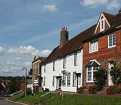
 View of High Street | |
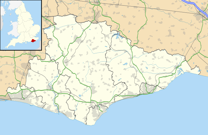
 Robertsbridge Location within East Sussex | |
| Area | 18.15 km2 (7.01 sq mi) [1] |
| Population | 2,641 (Parish-2010)[1] 2,624 (2001 census) |
| • Density | 146/km2 (380/sq mi) |
| OS grid reference | TQ737235 |
| • London | 44 miles (71 km) NW |
| Civil parish | |
| District | |
| Shire county | |
| Region | |
| Country | England |
| Sovereign state | United Kingdom |
| Post town | ROBERTSBRIDGE |
| Postcode district | TN32 |
| Dialling code | 01580 |
| Police | Sussex |
| Fire | East Sussex |
| Ambulance | South East Coast |
| UK Parliament | |
| Website | Salehurst and Robertsbridge Parish Council |
Overview
The village is thought to date back to 1176 when a Cistercian abbey was founded there by the Abbot, Robert de St Martin. When a market charter was granted in 1198 by Richard I to Robertsbridge (Pons Roberti in Latin) it was the first recorded use of the name. The abbey was dissolved in 1538; however, the town flourished, and many of the oldest existing houses in the village date from the 14th and 15th centuries,[2] including The Seven Stars Inn on High Street. At Robertsbridge is the Robertsbridge Codex (1360), a music manuscript of the 14th century. It contains the earliest surviving music written specifically for keyboard.
Robertsbridge railway station is on the main railway line from Hastings to London, and the A21 trunk road. Robertsbridge bypass opened in 1989.
Robertsbridge Community College, a specialist mathematics and computer college, is the smallest such in the county of East Sussex.[3] The local primary school is Salehurst Church of England Primary School.
Robertsbridge cultural organizations include Robertsbridge Arts Partnership (RAP], a Jazz Club and Robertsbridge Wine Club (RWC).
Sports clubs include Robertsbridge Cricket Club.[4] and formally Robertsbridge Rugby Football Club, but it disbanded in the 2008-2009 season. Robertsbridge has a bonfire society.[5] Robertsbridge is also the home of the Headquarters of Gray-Nicolls, a major brand in Cricket, and also the Headquarters of Gilbert, one of the largest brands in predominantly Rugby Union, but also Netball. Other businesses include Lordship Chairs[6] and New Spice, a notable Indian restaurant.
Robertsbridge United Reformed Church, a Grade II-listed chapel built in 1881, stands on the High Street.[7] The former Bethel Strict Baptist Chapel, built in 1842 and also listed Grade II, is nearby. [8] At Robertsbridge is the Bruderhof, a residential Anabaptist community known as Darvell, who number about 300.[9] They run a publishing house called Plough,[10] a manufacturing facility and school.[11][12][13]
Notable people
The famous cricket bat manufacturer Gray-Nicolls has its headquarters and workshop in Robertsbridge.
Demography
| Population Salehurst and Robertsbridge Parish CP | |||
|---|---|---|---|
| 2001 UK Census | Count | ||
| All people | 2624 | ||
| All males | 1271 | ||
| All females | 1353 | ||
| People aged 0–4 | 169 | ||
| People aged 5–15 | 415 | ||
| People aged 16–24 | 229 | ||
| People aged 25–44 | 684 | ||
| People aged 45–64 | 675 | ||
| People aged 65–74 | 251 | ||
| People aged 75 and over | 201 | ||
The demographics above are drawn from the National Statistics Office, 2001 Census. As data is not available for Robertsbridge in isolation, the table includes the entire parish of Salehurst and Robertsbridge.[15]
| Ethnic and Religious Breakdown for Salehurst Ward, compared by percentage | ||||
|---|---|---|---|---|
| 2001 UK Census | Salehurst Ward | Rother District | South East England | England |
| White | 98.48 | 98.11 | 95.1 | 90.92 |
| Mixed | 0.75 | 0.62 | 1.07 | 1.31 |
| Asian | 0.11 | 0.44 | 2.33 | 4.57 |
| Black | 0.25 | 0.19 | 0.71 | 2.3 |
| Chinese | 0.41 | 1.73 | 0.78 | 0.89 |
| Christian | 77.55 | 76.5 | 72.78 | 71.74 |
| Buddhist | 0.18 | 0.18 | 0.28 | 0.28 |
| Hindu | 0.07 | 0.14 | 0.56 | 1.11 |
| Jewish | 0.11 | 0.15 | 0.24 | 0.52 |
| Muslim | 0.11 | 0.64 | 1.36 | 3.1 |
| Sikh | 0.09 | 0.03 | 0.47 | 0.67 |
| Other religions | 0.33 | 0.35 | 0.36 | 0.29 |
| No religion | 13.89 | 13.91 | 16.5 | 14.59 |
| Religion not stated | 7.67 | 8.1 | 7.46 | 7.69 |
As data for the table above is not available for Robertsbridge in isolation, it is drawn from the Salehurst Ward which covers a larger area including Salehurst, Robertsbridge and Bodiam.[16][17]
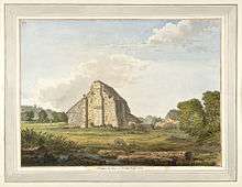
 Ruins of the Robertsbridge Abbey, 1783
 Robertsbridge station and level crossing
 The High Street
 The Ostrich public house
 Half timbered cottages in the High Street
 Cottages in Fair Lane
References
- East Sussex in Figures, East Sussex County Council Retrieved 27 October 2010
- "Robertsbridge Medieval Village". aboutrobertsbridge.org.uk.
- Robertsbridge Community College
- "Robertsbridge CC". play-cricket.com.
- Bonfire society website
- "Lordship Chairs - Beautiful Adirondack Chairs". Lordship Chairs. Retrieved 18 April 2020.
- Historic England (2011). "The United Reformed Church, High Street (east side), Robertsbridge, Salehurst, Rother, East Sussex (1221451)". National Heritage List for England. Retrieved 5 July 2011.
- Historic England (2011). "Bethel Strict Baptist Chapel, High Street (east side), Robertsbridge, Salehurst, Rother, East Sussex (1221399)". National Heritage List for England. Retrieved 11 September 2011.
- Rajani, Deepika (25 July 2019). "All you need to know about the Bruderhof community". inews.co.uk. Retrieved 31 July 2019.
- "About Us". Plough. Retrieved 9 June 2017.
- Times, The Sunday (21 July 2019). "Spectrum: an exclusive look inside the Bruderhof communes in Kent and East Sussex". ISSN 0140-0460. Retrieved 20 August 2019.
- "Darvell Bruderhof | Diggers and Dreamers". www.diggersanddreamers.org.uk. Retrieved 23 May 2017.
- "A Day With The Bruderhof". james clarke photography. Retrieved 28 June 2018.
- Hirsch, Pam. "Bodichon, Barbara Leigh Smith". Oxford Dictionary of National Biography (online ed.). Oxford University Press. doi:10.1093/ref:odnb/2755. (Subscription or UK public library membership required.)
- "Neighbourhood Statistics". Statistics.gov.uk. Retrieved 26 June 2010.
- "Neighbourhood Statistics". Statistics.gov.uk. Retrieved 26 June 2010.
- "Neighbourhood Statistics". Statistics.gov.uk. Retrieved 26 June 2010.
External links

| Wikivoyage has a travel guide for Robertsbridge. |