Mountfield, East Sussex
Mountfield is a village and civil parish in the Rother district of East Sussex, England, and three miles (5 km) north-west of Battle. It is mentioned in the Domesday Book.
| Mountfield | |
|---|---|
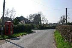 The junction of Church Road and Hoath Hill, Mountfield | |
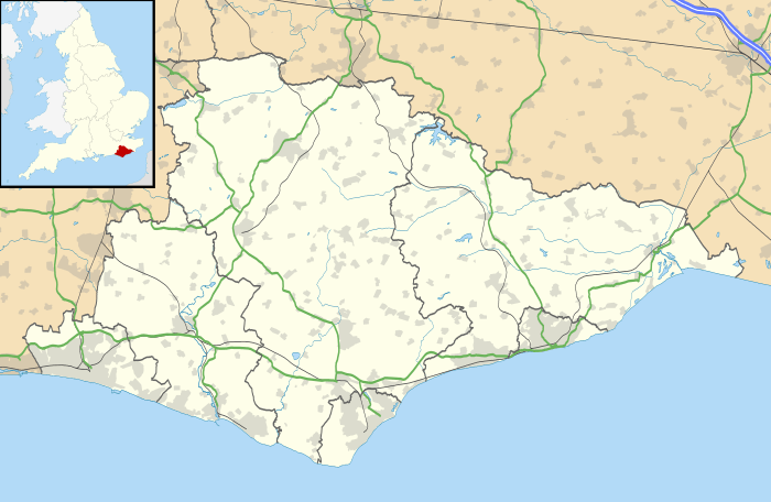 Mountfield Location within East Sussex | |
| Area | 15.3 km2 (5.9 sq mi) [1] |
| Population | 616 (Parish-2011)[2] |
| • Density | 97/sq mi (37/km2) |
| OS grid reference | TQ742203 |
| • London | 46 miles (74 km) NW |
| District | |
| Shire county | |
| Region | |
| Country | England |
| Sovereign state | United Kingdom |
| Post town | ROBERTSBRIDGE |
| Postcode district | TN32 |
| Dialling code | 01580 |
| Police | Sussex |
| Fire | East Sussex |
| Ambulance | South East Coast |
| UK Parliament | |
| Website | The Parish of Mountfield website |
The parish church is dedicated to All Saints; Mountfield and Whatlington Church of England Primary School is at the road junction in the nearby hamlet of Johns Cross by the A21 and the A2100 roads further north.
Governance
The lowest level of government is the Mountfield parish council. The parish council is responsible for local amenities including two playing fields and a children's play area. Elections are held every four years. The May 2011 election was uncontested.[3]
Rother District council provides the next level of government with services such as refuse collection, planning consent, leisure amenities and council tax collection. Mountfield is part of the Darwell Ward.
East Sussex county council is the third tier of government, providing education, libraries and highway maintenance. Mountfield falls within the Battle and Crowhurst ward.
The UK Parliament constituency for Mountfield is Bexhill and Battle.
At European level, Mountfield is represented by the South-East region, which holds ten seats in the European Parliament.
Landmarks
There are two Sites of Special Scientific Interest within the parish. River Line is a section of river noted for its geological features as it cuts through many layers from the late Jurassic and early Cretaceous periods.[4] Darwell Wood is a broadleaved woodland of biological interest. It has a number of streams flowing through it on the way to Darwell Reservoir.[5]
Two miles north-west of the village are the overgrown vestigial remains of Glottenham Castle, a twelfth-century fortified manor house, surrounded by a moat now mostly dry.
References
- "East Sussex in Figures". East Sussex County Council. Retrieved 26 April 2008.
- "Civil Parish population 2011". Archived from the original on 14 January 2016. Retrieved 7 October 2015.
- Stevens, Derek (19 March 2007). "Notice of Election" (PDF). Rother District Council. Archived from the original (pdf) on 25 February 2009. Retrieved 29 May 2008.
- "SSSI Citation — River Line" (PDF). Natural England. Retrieved 29 September 2008. Cite journal requires
|journal=(help) - "SSSI Citation — Darwell Wood" (PDF). Natural England. Retrieved 13 October 2008. Cite journal requires
|journal=(help)
External links
![]()
| Authority control |
|
|---|