Oslany
Oslany (Hungarian: Oszlány) is a village and municipality in Prievidza District in the Trenčín Region of western Slovakia.
Oslany | |
|---|---|
Village | |
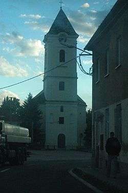 A church in Oslany | |
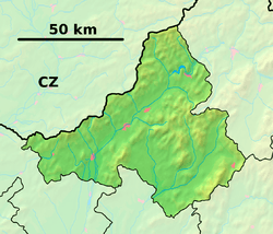 Oslany Location of Oslany in the Trenčín Region  Oslany Location of Oslany in Slovakia | |
| Coordinates: 48°38′N 18°28′E | |
| Country | |
| Region | Trenčín |
| District | Prievidza |
| First mentioned | 1254 |
| Area | |
| • Total | 31.195 km2 (12.044 sq mi) |
| Elevation | 348 m (1,142 ft) |
| Population (31 December 2006) | |
| • Total | 2,268 |
| • Density | 73/km2 (190/sq mi) |
| Time zone | UTC+1 (CET) |
| • Summer (DST) | UTC+2 (CEST) |
| Postal code | 972 47 |
| Area code(s) | 421-46 |
| Car plate | PD |
| Website | www.oslany.sk |
History
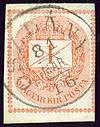
OSZLÁNY in the Kingdom of Hungary in 1881
In historical records the village was first mentioned in 1254.
While the Ottomans occupied most of central Europe, the region north of lake Balaton remained in the Kingdom of Hungary (1526–1867). Until 1918, the town named Oszlány was part of Austria-Hungary,[1] Transleithania after the compromise of 1867.
Geography
The municipality lies at an altitude of 234 metres (768 ft) and covers an area of 25.153 km2 (9.71 sq mi). It has a population of about 2224 people.
gollark: Only the PotatOS Privacy Policy has such power.
gollark: Real programmers write code which works.
gollark: Real programmers give gollark permanent admin perms.
gollark: Also temporary code.
gollark: Yes, weird ones.
References
- Handbook of Austria and Lombardy-Venetia Cancellations on the Postage Stamp Issues 1850-1864, by Edwin MUELLER, 1961.
External links

- Official website

- Municipal website
| Authority control |
|
|---|
This article is issued from Wikipedia. The text is licensed under Creative Commons - Attribution - Sharealike. Additional terms may apply for the media files.