Chvojnica, Prievidza District
Chvojnica (Hungarian: Nyitrafenyves) is a village and municipality in Prievidza District in the Trenčín Region of western Slovakia.
Chvojnica | |
|---|---|
Municipality | |
.jpg) | |
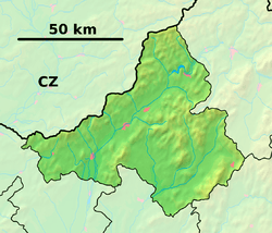 Chvojnica Location of Chvojnica in the Trenčín Region  Chvojnica Location of Chvojnica in Slovakia | |
| Coordinates: 48°52′45″N 18°33′40″E | |
| Country | |
| Region | Trenčín |
| District | Prievidza |
| First mentioned | 1614 |
| Area | |
| • Total | 9.298 km2 (3.590 sq mi) |
| Elevation | 493 m (1,617 ft) |
| Population | |
| • Total | 235 |
| • Density | 25/km2 (65/sq mi) |
| Postal code | 972 13 (pošta Nitrianske Pravno) |
| Area code(s) | 421-46 |
| Car plate | PD |
| Website | chvojnica.eu |
History
In historical records the village was first mentioned in 1614.
Geography
The municipality lies at an altitude of 493 metres and covers an area of 9.298 km². It has a population of about 235 people.
gollark: * main
gollark: It's not as if thinking about exact phrasing and stuff while you type is impossible, but for more complex tasks I think the mail delay is in thinking.
gollark: You're evidently jealous.
gollark: 1 WPM = 5 CPM.
gollark: It's not actually measured in words in practice.
Genealogical resources
The records for genealogical research are available at the state archive "Statny Archiv in Nitra, Slovakia"
- Roman Catholic church records (births/marriages/deaths): 1679-1903 (parish B)
External links

- Official website

- https://web.archive.org/web/20071217080336/http://www.statistics.sk/mosmis/eng/run.html
- Surnames of living people in Chvojnica
| Authority control |
|
|---|
This article is issued from Wikipedia. The text is licensed under Creative Commons - Attribution - Sharealike. Additional terms may apply for the media files.