National Register of Historic Places listings in central Washington, D.C.
This is a list of properties and districts listed on the National Register of Historic Places in the central area of Washington, D.C. For the purposes of this list central Washington, D. C. is defined as all of the Northwest quadrant east of Rock Creek and south of M Street and all of the Southwest quadrant. This includes the National Mall, Downtown, the Penn Quarter, the Monumental Core and most of the popular tourist sites in Washington.
- This National Park Service list is complete through NPS recent listings posted August 14, 2020.[1]
Current listings
| [2] | Name on the Register | Image | Date listed[3] | Location | Neighborhood | Description |
|---|---|---|---|---|---|---|
| 1 | 2nd Baptist Church | 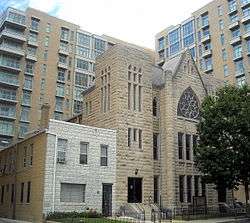 2nd Baptist Church |
June 30, 2004 (#04000625) |
816 3rd St. NW 38°54′09″N 77°00′57″W |
Mount Vernon Triangle | |
| 2 | 2000 Block of Eye Street, NW |  2000 Block of Eye Street, NW |
August 9, 1977 (#77001496) |
South side of 2000 block of Eye St., NW. 38°54′00″N 77°02′46″W |
George Washington University | Currently owned and operated by George Washington University for retail and commercial spaces. |
| 3 | Adas Israel Synagogue |  Adas Israel Synagogue |
March 24, 1969 (#69000288) |
3rd and G Sts., NW. 38°53′52″N 77°01′11″W |
Downtown East | Now The Lillian & Albert Small Jewish Museum |
| 4 | Alibi Club |  Alibi Club |
October 21, 1994 (#94001221) |
1806 Eye St., NW. 38°54′04″N 77°02′32″W |
Golden Triangle | |
| 5 | American Federation of Labor Building |  American Federation of Labor Building |
September 13, 1974 (#74002154) |
901 Massachusetts Ave., NW. 38°54′12″N 77°01′28″W |
Mount Vernon Square | |
| 6 | American Institute of Pharmacy Building |  American Institute of Pharmacy Building |
August 18, 1977 (#77001497) |
2215 Constitution Ave., NW. 38°53′34″N 77°02′59″W |
Monumental Core | |
| 7 | American Peace Society |  American Peace Society |
September 13, 1974 (#74002155) |
734 Jackson Pl., NW. 38°53′58″N 77°02′19″W |
Monumental Core | Headquarters of the American Peace Society from 1911 to 1948; in the Lafayette Square Historic District |
| 8 | American Red Cross National Headquarters | 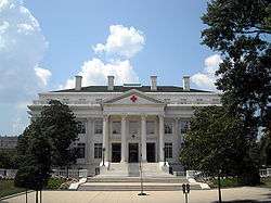 American Red Cross National Headquarters |
October 15, 1966 (#66000853) |
17th and D Sts., NW 38°53′41″N 77°02′26″W |
Monumental Core | |
| 9 | American Revolution Statuary | 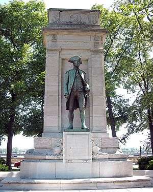 American Revolution Statuary |
July 14, 1978 (#78000256) |
Public buildings and various parks within DC 38°53′54″N 77°02′16″W |
Monumental Core | 11 statues in central DC, including G. Washington, B. Franklin, N. Hale, J.P. Jones, J. Barry, E. Burke, C. Pulaski, de Lafayette, T. Kosciuszko, von Steuben, and de Rochambeau and 3 statues in other districts |
| 10 | American Security and Trust Company Building |  American Security and Trust Company Building |
July 16, 1973 (#73002070) |
15th and Pennsylvania Ave., NW. 38°53′56″N 77°02′03″W |
Golden Triangle | |
| 11 | Elizabeth Arden Building |  Elizabeth Arden Building |
August 18, 2003 (#03000778) |
1147 Connecticut Ave. 38°54′18″N 77°02′28″W |
Golden Triangle | |
| 12 | Arlington Memorial Bridge | 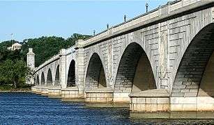 Arlington Memorial Bridge |
April 4, 1980 (#80000346) |
Spans the Potomac River 38°53′12″N 77°03′39″W |
Monumental Core | Extends into Arlington County, Virginia |
| 13 | Arts and Industries Building | 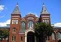 Arts and Industries Building |
November 11, 1971 (#71000994) |
900 Jefferson Dr., SW. 38°53′13″N 77°01′29″W |
Southwest Federal Center | |
| 14 | Arts Club of Washington | 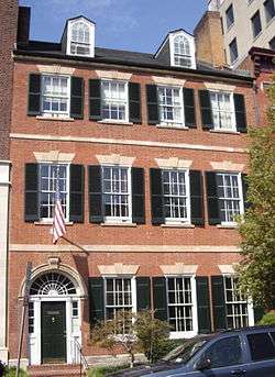 Arts Club of Washington |
March 24, 1969 (#69000289) |
2017 I St., NW. 38°54′05″N 77°02′46″W |
Golden Triangle | Cleveland Abbe, a meteorologist who became known as the father of the National Weather Service, lived in this house from 1877 to 1909. Previous occupants in the early decades of the 19th century included James Monroe and the British legation. Built ca. 1802 to 1805, this is a fine example of the Federal style of residential architecture. |
| 15 | Asbury United Methodist Church | 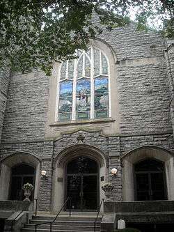 Asbury United Methodist Church |
November 1, 1986 (#86003029) |
Eleventh and K Sts. NW 38°54′08″N 77°01′39″W |
Downtown | |
| 16 | Ashburton House | 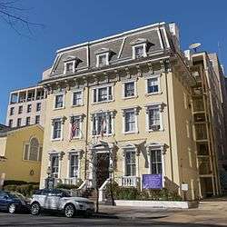 Ashburton House |
November 7, 1973 (#73002071) |
1525 H St., NW. 38°54′01″N 77°02′09″W |
Golden Triangle | |
| 17 | Auditor's Building Complex |  Auditor's Building Complex |
April 27, 1978 (#78003051) |
14th St. and Independence Ave. 38°53′10″N 77°02′01″W |
Southwest Federal Center | |
| 18 | Augusta Apartment Building |  Augusta Apartment Building |
September 9, 1994 (#94001032) |
1151 New Jersey Ave. (216 New York Ave.), NW. 38°54′19″N 77°00′52″W |
North Capitol Street | |
| 19 | Bachelor Apartment House |  Bachelor Apartment House |
December 8, 1978 (#78003052) |
1737 H St., NW. 38°54′01″N 77°02′30″W |
Golden Triangle | |
| 20 | Barr Building |  Barr Building |
January 14, 2013 (#12001165) |
910 17th St., NW 38°54′07″N 77°02′24″W |
Golden Triangle | |
| 21 | Blair House |  Blair House |
October 15, 1966 (#66000963) |
1651 Pennsylvania Ave., NW 38°53′56″N 77°02′19″W |
Monumental Core | |
| 22 | Bond Building |  Bond Building |
September 15, 1983 (#83001415) |
1404 New York Ave., NW 38°53′56″N 77°01′57″W |
Downtown | |
| 23 | Brownley Confectionery Building |  Brownley Confectionery Building |
December 1, 1994 (#94001408) |
1309 F St., NW. 38°53′51″N 77°01′50″W |
Downtown | |
| 24 | Buildings at 1000 Block of Seventh Street, and 649-651 New York Avenue NW |  Buildings at 1000 Block of Seventh Street, and 649-651 New York Avenue NW |
February 2, 1984 (#84000861) |
1005-1035 7th St., and 649-651 New York Ave. NW 38°54′12″N 77°01′19″W |
Mount Vernon Square | 649 New York Avenue, NW |
| 25 | Bulletin Building |  Bulletin Building |
November 12, 2008 (#07000422) |
717 6th St., NW 38°53′56″N 77°01′11″W |
Chinatown | |
| 26 | Capitol Hill Historic District |  Capitol Hill Historic District |
August 27, 1976 (#76002127) |
Roughly bounded by Virginia Ave., SE., S. Capitol St., F St., NE., and 14th Sts., SE. and NE.; also roughly bounded by 7th St., NE., Interstate 295, M St., SE., and 11th St., SE.; also squares 752, 753, 777, and 788 bounded by 2nd, 4th, and F Sts., NE. 38°53′13″N 76°59′51″W |
NE, SE and NW | Second and third locations represent boundary increases of July 3, 2003 and October 21, 2015 |
| 27 | Carlton Hotel |  Carlton Hotel |
June 28, 1990 (#90000911) |
923 16th St., NW. 38°54′07″N 77°02′11″W |
Golden Triangle | |
| 28 | Carnegie Endowment for International Peace |  Carnegie Endowment for International Peace |
September 13, 1974 (#74002156) |
700 Jackson Pl., NW 38°53′56″N 77°02′19″W |
Monumental Core | |
| 29 | Central National Bank |  Central National Bank |
April 27, 1995 (#95000526) |
633 Pennsylvania Ave., NW. 38°53′36″N 77°01′16″W |
Penn Quarter | |
| 30 | Central Heating Plant |  Central Heating Plant |
July 6, 2007 (#07000637) |
325 13th St., SW. 38°53′08″N 77°01′44″W |
Southwest Federal Center | |
| 31 | Central Public Library |  Central Public Library |
December 3, 1969 (#69000290) |
Mount Vernon Sq., 8th and K Sts., NW. 38°54′08″N 77°01′24″W |
Mount Vernon Square | |
| 32 | Champlain Apartment Building |  Champlain Apartment Building |
September 7, 1994 (#94001042) |
1424 K St., NW. 38°54′09″N 77°01′58″W |
Downtown | |
| 33 | Chase's Theater and Riggs Building |  Chase's Theater and Riggs Building |
September 7, 1978 (#78003053) |
1426 G St. NW. and 615-627 15th St. NW. 38°53′53″N 77°02′01″W |
Downtown | |
| 34 | Chesapeake and Potomac Telephone Company Building |  Chesapeake and Potomac Telephone Company Building |
August 5, 1988 (#88001112) |
730 Twelfth St., NW 38°53′56″N 77°01′42″W |
Downtown | |
| 35 | Chesapeake and Potomac Telephone Company, Old Main Building |  Chesapeake and Potomac Telephone Company, Old Main Building |
June 13, 1988 (#88000652) |
722 Twelfth St., NW 38°53′56″N 77°01′42″W |
Downtown | |
| 36 | Church of the Ascension |  Church of the Ascension |
January 19, 1984 (#84000863) |
1215 Massachusetts Ave. NW 38°54′18″N 77°01′43″W |
Mount Vernon Square | |
| 37 | Church of the Epiphany |  Church of the Epiphany |
September 10, 1971 (#71000996) |
1317 G St., NW. 38°53′55″N 77°01′51″W |
Downtown | |
| 38 | Civil War Fort Sites | 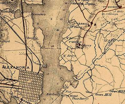 Civil War Fort Sites |
July 15, 1974 (#74000274) |
Arc of sites surrounding central Washington in Maryland, Virginia, and D.C. 38°49′33″N 77°00′56″W |
All quadrants | At the outset of the Civil War in 1861, Washington became a critical target for rebel attacks but was virtually without protection. The Union Army hastily began construction of a fortified defense line around the city, the physical remnants of which encompass these 19 earthwork forts, including Fort Greble.[4] See also National Register listings in western NW D.C., upper NW D.C., NE D.C., SE D.C., Prince George's County, Maryland, and Fairfax County, Virginia. |
| 39 | Civil War Monuments in Washington, DC |  Civil War Monuments in Washington, DC |
September 20, 1978 (#78000257) |
Various parks within the original boundaries of city 38°54′20″N 77°01′57″W |
Various | 18 statues about people and topics related to the Civil War, including 11 in central Washington, 6 in the NW quadrant, and 1 in the NE quadrant. |
| 40 | Commercial National Bank |  Commercial National Bank |
October 11, 1991 (#91001488) |
1405 G St., NW. 38°53′54″N 77°01′57″W |
Downtown | |
| 41 | Concordia German Evangelical Church and Rectory |  Concordia German Evangelical Church and Rectory |
December 14, 1978 (#78003055) |
20th and G Sts., NW. 38°53′52″N 77°02′42″W |
George Washington University | Sits directly north of the President's House of George Washington University, also sits right across the street from Oscar W. Underwood House that serves as part of the George Washington University Law School. |
| 42 | Constitution Hall | 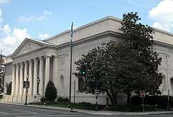 Constitution Hall |
September 16, 1985 (#85002724) |
311 Eighteenth St., NW. 38°53′35″N 77°02′30″W |
Monumental Core | |
| 43 | Corcoran Gallery of Art | 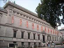 Corcoran Gallery of Art |
May 6, 1971 (#71000997) |
17th St. at New York Ave., NW. 38°53′44″N 77°02′26″W |
George Washington University | Home to the Corcoran School of the Arts and Design at George Washington University. |
| 44 | Corcoran Hall | 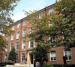 Corcoran Hall |
April 12, 1991 (#90001545) |
721 21st St., NW. 38°53′57″N 77°02′48″W |
George Washington University | Currently houses faculty offices for the George Washington University physics department |
| 45 | Cuban Friendship Urn | 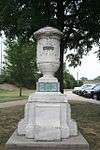 Cuban Friendship Urn |
October 11, 2007 (#07001053) |
Reservation 332, Ohio Dr., at 14th St. Bridge, SW. 38°52′43″N 77°02′18″W |
Southwest Waterfront | |
| 46 | Davidson Building |  Davidson Building |
October 4, 2016 (#16000683) |
927 15th St., NW. 38°54′08″N 77°02′00″W |
Downtown | |
| 47 | Decatur House |  Decatur House |
October 15, 1966 (#66000858) |
748 Jackson Pl., NW. 38°53′59″N 77°02′20″W |
Monumental Core | Federal Style house designed by Benjamin Henry Latrobe for naval hero Stephen Decatur across Lafayette Square from the White House. During 1827-1833 was home to successive Secretaries of State Henry Clay, Martin Van Buren, and Judah P. Benjamin. |
| 48 | Denrike Building |  Denrike Building |
August 22, 2016 (#16000542) |
1010 Vermont Ave., NW 38°54′10″N 77°02′01″W |
Downtown | |
| 49 | James C. Dent House |  James C. Dent House |
November 2, 2010 (#10000880) |
156 Q St., SW. 38°52′14″N 77°00′48″W |
Buzzard Point | |
| 50 | District Building | 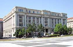 District Building |
March 16, 1972 (#72001422) |
SE corner of 14th and E Sts., NW. 38°53′41″N 77°01′54″W |
Monumental Core | |
| 51 | District of Columbia City Hall | 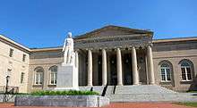 District of Columbia City Hall |
October 15, 1966 (#66000857) |
4th and E Sts., NW 38°53′43″N 77°01′04″W |
Judiciary Square | |
| 52 | District of Columbia Municipal Center and Plaza | 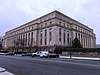 District of Columbia Municipal Center and Plaza |
July 19, 2019 (#100004189) |
300 Indiana Ave. NW (301 C St. NW) 38°53′38″N 77°01′03″W |
Judiciary Square | |
| 53 | District of Columbia Pound |  District of Columbia Pound |
September 30, 2014 (#14000798) |
820 S. Capitol St., SW., and 9 I St., SW. 38°52′46″N 77°00′34″W |
Southwest Waterfront | |
| 54 | District of Columbia Recorder of Deeds | 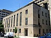 District of Columbia Recorder of Deeds |
April 14, 2020 (#100005181) |
515 D St. NW 38°53′41″N 77°01′11″W |
Judiciary Square | |
| 55 | District of Columbia War Memorial | 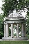 District of Columbia War Memorial |
July 11, 2014 (#14000388) |
Independence Ave. between 17th and 23rd Sts., SW. 38°53′15″N 77°02′37″W |
Monumental Core | |
| 56 | Downtown Historic District | 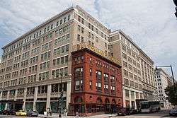 Downtown Historic District |
September 22, 2001 (#84003901) |
Roughly, Seventh St. from Pennsylvania Ave. to Mt. Vernon Sq., and F St. between Eleventh and Seventh Sts., NW 38°53′50″N 77°01′29″W |
Downtown | |
| 57 | Duncanson-Cranch House | 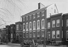 Duncanson-Cranch House |
July 26, 1973 (#73002081) |
468-470 N St., SW. 38°52′29″N 77°01′06″W |
Southwest Waterfront | |
| 58 | John J. Earley Office and Studio |  John J. Earley Office and Studio |
June 18, 2010 (#10000367) |
2131 G St., NW 38°53′55″N 77°02′53″W |
George Washington University | Part of George Washington University's Columbian College of Arts and Sciences. Currently houses studios for the Theatre and Dance Department. |
| 59 | East and West Potomac Parks |  East and West Potomac Parks |
November 30, 1973 (#73000217) |
Bounded by Constitution Ave., 17th St., Independence Ave., Washington Channel, Potomac River, and Rock Creek Park 38°52′42″N 77°02′08″W |
NW and SW | East Potomac Park and West Potomac Park |
| 60 | The Editors Building |  The Editors Building |
March 17, 2015 (#15000072) |
1729 H St., NW 38°54′01″N 77°02′28″W |
Downtown | |
| 61 | Eight Hundred Block of F St. NW |  Eight Hundred Block of F St. NW |
April 2, 1974 (#74002159) |
800-818 F St. and 527 9th St., NW. 38°53′49″N 77°01′26″W |
Penn Quarter | |
| 62 | Engine Company 16-Truck Company 3 | 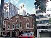 Engine Company 16-Truck Company 3 |
May 18, 2011 (#11000281) |
1018 13th St., NW 38°54′12″N 77°01′47″W |
Downtown | |
| 63 | Engine Company 23 | 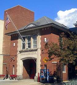 Engine Company 23 |
June 6, 2007 (#07000540) |
2119 G St., NW 38°53′52″N 77°02′54″W |
George Washington University | |
| 64 | Equitable Co-operative Building Association |  Equitable Co-operative Building Association |
December 29, 1994 (#94001515) |
915 F St., NW. 38°53′50″N 77°01′29″W |
Chinatown | |
| 65 | The Ethelhurst | 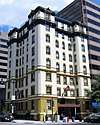 The Ethelhurst |
June 26, 2019 (#100004123) |
1025 Fifteenth St., NW 38°54′13″N 77°02′04″W |
||
| 66 | The Everglades | 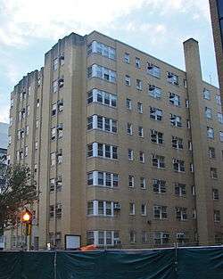 The Everglades |
June 18, 2010 (#10000368) |
2223 H St., NW 38°53′59″N 77°02′59″W |
George Washington University | Currently Fulbright Hall (residence hall) of George Washington University. |
| 67 | Executive Office Building | 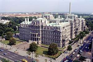 Executive Office Building |
June 4, 1969 (#69000293) |
Pennsylvania Ave. and 17th St., NW 38°53′51″N 77°02′21″W |
Monumental Core | |
| 68 | Federal Home Loan Bank Board Building |  Federal Home Loan Bank Board Building |
July 3, 2007 (#07000642) |
320 1st St., NW. 38°53′40″N 77°00′45″W |
Downtown East | |
| 69 | Federal-American National Bank |  Federal-American National Bank |
December 29, 1994 (#94001517) |
615-621 14th St., NW. 38°53′52″N 77°01′54″W |
Downtown | |
| 70 | Federal Home Loan Bank Board Building (FHLBB) |  Federal Home Loan Bank Board Building (FHLBB) |
October 11, 2016 (#16000701) |
1700 G St., NW 38°53′53″N 77°02′24″W |
Monumental Core | |
| 71 | Federal Office Building No. 6 |  Federal Office Building No. 6 |
May 8, 2017 (#100000956) |
400 Maryland Ave., SW. 38°53′12″N 77°01′08″W |
Southwest Federal Center | |
| 72 | Financial Historic District |  Financial Historic District |
October 12, 2006 (#84003900) |
15th St. from Pennsylvania Ave. to I St., NW.; also K, 14th, and G Sts., NW. 38°53′55″N 77°02′02″W |
Monumental Core, Downtown | Second set of addresses represents a boundary increase of January 12, 2017 |
| 73 | The Flagler |  The Flagler |
June 18, 2010 (#10000369) |
736 22nd St., NW 38°53′58″N 77°02′57″W |
George Washington University | |
| 74 | Fletcher Chapel | 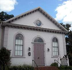 Fletcher Chapel |
August 14, 1997 (#97000834) |
401 New York Ave., NW 38°54′18″N 77°00′59″W |
Mount Vernon Square | |
| 75 | Foggy Bottom Historic District | 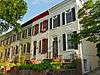 Foggy Bottom Historic District |
October 14, 1987 (#87001269) |
Bounded by New Hampshire Ave., Twenty-fourth, Twenty-sixth, H, and K Sts., NW 38°54′02″N 77°03′12″W |
Foggy Bottom | |
| 76 | Ford's Theatre National Historic Site | 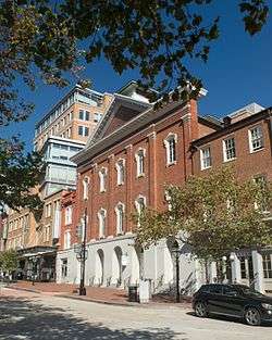 Ford's Theatre National Historic Site |
October 15, 1966 (#66000034) |
10th St., NW., between E and F Sts. 38°53′47″N 77°01′34″W |
Penn Quarter | |
| 77 | Franklin School | 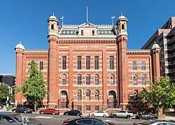 Franklin School |
April 11, 1973 (#73002085) |
13th and K Sts., NW. 38°54′08″N 77°01′47″W |
Downtown | A nineteenth-century school, site of Alexander Graham Bell's experiments with the photophone. |
| 78 | Freer Gallery of Art |  Freer Gallery of Art |
June 23, 1969 (#69000295) |
12th St. and Jefferson Dr., SW. 38°53′17″N 77°01′40″W |
Southwest Federal Center | |
| 79 | Friendship Baptist Church | 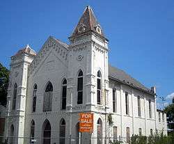 Friendship Baptist Church |
November 19, 2004 (#04001236) |
734 1st St., SW. 38°52′49″N 77°00′43″W |
Southwest Waterfront | |
| 80 | Garfinckel's Department Store | 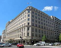 Garfinckel's Department Store |
April 4, 1995 (#95000353) |
1401 F St., NW. 38°53′51″N 77°01′56″W |
Downtown | |
| 81 | General Post Office | 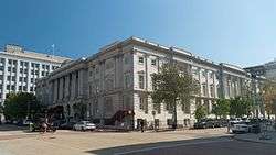 General Post Office |
March 24, 1969 (#69000311) |
E and F Sts. between 7th and 8th Sts., NW 38°53′48″N 77°01′22″W |
Penn Quarter | |
| 82 | Germuiller Row | 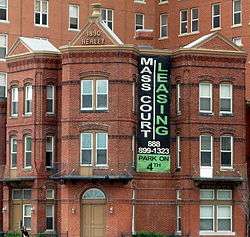 Germuiller Row |
December 1, 1994 (#94001406) |
748 3rd St. and 300-302 H St., NW. 38°53′59″N 77°00′56″W |
Chinatown | |
| 83 | Godey Lime Kilns | 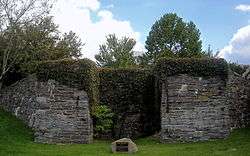 Godey Lime Kilns |
November 2, 1973 (#73000221) |
Rock Creek and Potomac Parkway at 27th and L Sts., NW. 38°54′12″N 77°03′22″W |
West End | |
| 84 | Samuel Gompers Memorial | 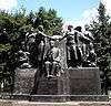 Samuel Gompers Memorial |
October 11, 2007 (#07001054) |
Massachusetts Ave. and 10th and L Sts., NW., Reservation 69 38°54′21″N 77°01′36″W |
Mount Vernon Square | |
| 85 | Ulysses S. Grant School | 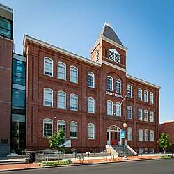 Ulysses S. Grant School |
May 22, 2007 (#07000447) |
2130 G St. NW 38°53′59″N 77°02′53″W |
George Washington University | |
| 86 | Hamilton Hotel | 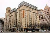 Hamilton Hotel |
April 17, 2013 (#12001194) |
1001 14th St. NW 38°54′10″N 77°01′53″W |
Downtown | |
| 87 | Harbour Square |  Harbour Square |
November 28, 2018 (#100003158) |
400-560 (even) N St., SW., and 1301-1327 (odd) 4th St., SW. 38°52′26″N 77°01′04″W |
Southwest Waterfront | |
| 88 | Harris & Ewing Photographic Studio |  Harris & Ewing Photographic Studio |
December 16, 1994 (#94001407) |
1311-1313 F St., NW. 38°53′51″N 77°01′51″W |
Downtown | |
| 89 | Harrison Apartment Building |  Harrison Apartment Building |
September 7, 1994 (#94001036) |
704 3rd St., NW. 38°53′55″N 77°00′56″W |
Chinatown | |
| 90 | W. B. Hibbs and Company Building |  W. B. Hibbs and Company Building |
March 19, 1991 (#90002150) |
725 Fifteenth St., NW. 38°53′57″N 77°02′00″W |
Downtown | |
| 91 | Hill Building |  Hill Building |
March 17, 2015 (#15000073) |
839 17th or 1636 I Sts., NW. 38°54′04″N 77°02′22″W |
Downtown | |
| 92 | Hotel Washington |  Hotel Washington |
March 30, 1995 (#95000352) |
515 15th St., NW. 38°53′49″N 77°02′01″W |
Downtown | |
| 93 | Interior Department Offices |  Interior Department Offices |
November 23, 1986 (#86003160) |
Eighteenth and F Sts. NW 38°53′48″N 77°02′35″W |
Golden Triangle | |
| 94 | Jefferson Apartment Building |  Jefferson Apartment Building |
September 7, 1994 (#94001046) |
315 H St., NW. 38°54′01″N 77°00′57″W |
Mount Vernon Triangle | |
| 95 | Thomas Jefferson Memorial | 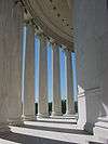 Thomas Jefferson Memorial |
October 15, 1966 (#66000029) |
S bank of the Tidal Basin 38°52′52″N 77°02′13″W |
Monumental Core | |
| 96 | Lyndon Baines Johnson Memorial Grove On The Potomac | 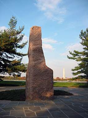 Lyndon Baines Johnson Memorial Grove On The Potomac |
December 28, 1973 (#73002097) |
Lady Byrd Johnson Park, Columbia Island 38°52′42″N 77°03′05″W |
Monumental Core | |
| 97 | The Keystone |  The Keystone |
June 18, 2010 (#10000370) |
2150 Pennsylvania Ave., NW 38°54′06″N 77°02′54″W |
George Washington University | Currently the H.B. Burns Memorial Building of George Washington University. |
| 98 | Martin Luther King Memorial Library |  Martin Luther King Memorial Library |
October 22, 2007 (#07001102) |
901 G St. NW. 38°54′02″N 77°01′29″W |
Chinatown | |
| 99 | Korean War Veterans Memorial |  Korean War Veterans Memorial |
July 27, 1995 (#01000273) |
Southeast of the Lincoln Memorial, off Independence Ave. 38°53′16″N 77°02′50″W |
Monumental Core | |
| 100 | Lafayette Building |  Lafayette Building |
September 1, 2005 (#05001205) |
811 Vermont Ave. NW 38°54′03″N 77°02′05″W |
Golden Triangle | |
| 101 | Lafayette Square Historic District |  Lafayette Square Historic District |
August 29, 1970 (#70000833) |
Roughly between 15th and 17th Sts. and H St. and State and Treasury Places, exclusive of the White House and its grounds 38°53′55″N 77°02′11″W |
Monumental Core, Golden Triangle, Downtown | |
| 102 | Julius Lansburgh Furniture Co., Inc. |  Julius Lansburgh Furniture Co., Inc. |
May 8, 1974 (#74002164) |
909 F St., NW. 38°53′51″N 77°01′29″W |
Chinatown | Also known as the Old Masonic Temple |
| 103 | Thomas Law House |  Thomas Law House |
August 14, 1973 (#73002093) |
1252 6th St., SW. 38°52′29″N 77°01′09″W |
Southwest Waterfront | |
| 104 | L'Enfant Plan of the City of Washington, District of Columbia | 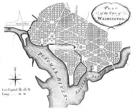 L'Enfant Plan of the City of Washington, District of Columbia |
April 24, 1997 (#97000332) |
Roughly bounded by Florida Ave. from Rock Cr., NW. to 15th St., NE., S to C St., and E to the Anacostia River 38°53′26″N 77°01′13″W |
All | |
| 105 | Lenthall Houses |  Lenthall Houses |
March 16, 1972 (#72001425) |
606–610 21St., NW 38°53′52″N 77°02′49″W |
George Washington University | Two of the oldest known houses built in the District of Columbia. Currently a part of George Washington University. |
| 106 | Edward Simon Lewis House |  Edward Simon Lewis House |
July 23, 1973 (#73002094) |
456 N St., SW. 38°52′28″N 77°01′05″W |
Southwest Waterfront | |
| 107 | Lincoln Memorial | 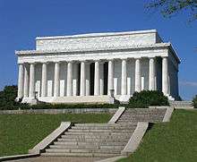 Lincoln Memorial |
October 15, 1966 (#66000030) |
West Potomac Park 38°53′21″N 77°03′00″W |
Monumental Core | |
| 108 | Lisner Auditorium |  Lisner Auditorium |
October 25, 1990 (#90001548) |
730 21st St., NW. 38°53′57″N 77°02′50″W |
George Washington University | Contains multiple auditoriums used by George Washington University. |
| 109 | Lockkeeper's House, C & O Canal Extension |  Lockkeeper's House, C & O Canal Extension |
November 30, 1973 (#73000218) |
SW corner of 17th St. and Constitution Ave., NW. 38°53′31″N 77°02′24″W |
Monumental Core | |
| 110 | Luzon Apartment Building |  Luzon Apartment Building |
September 7, 1994 (#94001035) |
2501 Pennsylvania Ave., NW. 38°54′14″N 77°03′12″W |
West End | |
| 111 | M Street High School |  M Street High School |
October 23, 1986 (#86002924) |
128 M St. NW 38°54′19″N 77°00′49″W |
North Capitol Street | |
| 112 | Gen. Robert Macfeely House |  Gen. Robert Macfeely House |
September 15, 1989 (#89001214) |
2015 I St., NW. 38°54′06″N 77°02′44″W |
Golden Triangle | |
| 113 | Masonic Temple |  Masonic Temple |
February 18, 1987 (#86002920) |
801 Thirteenth St., NW 38°54′00″N 77°01′46″W |
Downtown | |
| 114 | Mayflower Hotel |  Mayflower Hotel |
November 14, 1983 (#83003527) |
1127 Connecticut Ave. NW 38°54′16″N 77°02′23″W |
Golden Triangle | |
| 115 | McLachlen Building |  McLachlen Building |
November 6, 1986 (#86003042) |
1001 G St. NW 38°53′54″N 77°01′35″W |
Downtown | |
| 116 | Memorial Continental Hall | 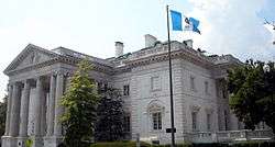 Memorial Continental Hall |
November 28, 1972 (#72001427) |
17th St., between C and D Sts., NW 38°53′37″N 77°02′25″W |
Monumental Core | |
| 117 | Metropolitan African Methodist Episcopal Church | .jpg) Metropolitan African Methodist Episcopal Church |
July 26, 1973 (#73002102) |
1518 M St., NW. 38°54′19″N 77°02′09″W |
Golden Triangle | Gothic-style church dedicated in 1886; held the funerals of Frederick Douglass and Rosa Parks; on the National Trust for Historic Preservation 2010 list of America's Most Endangered Places[5] |
| 118 | Metropolitan Club | 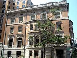 Metropolitan Club |
April 28, 1995 (#95000441) |
1700 H St., NW. 38°54′00″N 77°02′24″W |
Golden Triangle | |
| 119 | Milton Hall | 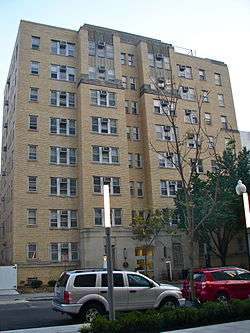 Milton Hall |
June 18, 2010 (#10000371) |
2222 I St., NW 38°54′02″N 77°02′59″W |
George Washington University | Currently is Jacqueline Bouvier Kennedy Onassis Hall at George Washington University. |
| 120 | Moran Building | 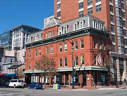 Moran Building |
September 26, 1983 (#83001413) |
501-509 G St., NW 38°53′54″N 77°01′10″W |
Chinatown | |
| 121 | Morrison and Clark Houses |  Morrison and Clark Houses |
March 19, 1991 (#90002149) |
1013-1015 L St., NW. 38°54′15″N 77°01′38″W |
Mount Vernon Square | |
| 122 | Mount Vernon Memorial Highway |  Mount Vernon Memorial Highway |
May 18, 1981 (#81000079) |
Washington St. and George Washington Memorial Parkway 38°52′38″N 77°02′56″W |
SW | Extends into Alexandria, Virginia |
| 123 | Mount Vernon Square Historic District |  Mount Vernon Square Historic District |
September 3, 1999 (#99001071) |
Roughly bounded by New York Ave., 7th St., N St., and 1st St., NW. 38°54′19″N 77°01′04″W |
Mount Vernon Square | Extends north of M Street |
| 124 | Mount Vernon Triangle Historic District |  Mount Vernon Triangle Historic District |
September 19, 2006 (#06000191) |
Roughly bounded by the 400 blocks of Massachusetts Ave., NW. and K St., NW., Prather's Alley, and 5th St., NW. 38°54′13″N 77°01′06″W |
Mount Vernon Triangle | |
| 125 | Mullett Rowhouses |  Mullett Rowhouses |
September 30, 1994 (#94001149) |
2517, 2519 and 2525 Pennsylvania Ave., NW. 38°54′15″N 77°03′16″W |
West End | |
| 126 | Munson Hall |  Munson Hall |
June 18, 2010 (#10000372) |
2212 H St., NW 38°54′02″N 77°02′58″W |
George Washington University | Currently Munson Hall of George Washington University. |
| 127 | Myrene Apartment Building |  Myrene Apartment Building |
September 9, 1994 (#94001041) |
703 6th St., NW. 38°53′55″N 77°01′11″W |
Chinatown | |
| 128 | National Academy of Sciences |  National Academy of Sciences |
March 15, 1974 (#74002168) |
2101 Constitution Ave., NW. 38°53′34″N 77°02′54″W |
Monumental Core | |
| 129 | National Archives | 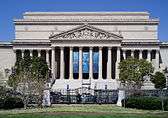 National Archives |
May 27, 1971 (#71001004) |
Constitution Ave. between 7th and 9th Sts., NW. 38°53′33″N 77°01′24″W |
Monumental Core | |
| 130 | National Bank of Washington, Washington Branch | 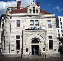 National Bank of Washington, Washington Branch |
May 8, 1974 (#74002169) |
301 7th St., NW. 38°53′37″N 77°01′16″W |
Penn Quarter | |
| 131 | National Mall | 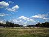 National Mall |
October 15, 1966 (#66000031) |
Between Independence and Constitution Aves. from the U.S. Capitol to the Washington Monument; also bounded by 3rd St., NW.-SW., Independence Ave., SW., Raoul Wallenberg Pl., SW., the CSX rail line, the Potomac River, and Constitution Ave., NW. 38°53′23″N 77°01′20″W |
NW and SW | Second set of addresses represents a boundary increase of December 8, 2016 |
| 132 | National Metropolitan Bank Building | 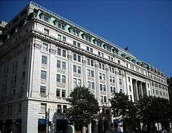 National Metropolitan Bank Building |
September 13, 1978 (#78003059) |
613 15th St., NW. 38°53′52″N 77°02′01″W |
Downtown | |
| 133 | National Portrait Gallery |  National Portrait Gallery |
October 15, 1966 (#66000902) |
F and G Sts. between 7th and 9th Sts., NW 38°53′52″N 77°01′23″W |
Chinatown | |
| 134 | National Savings and Trust Company |  National Savings and Trust Company |
March 16, 1972 (#72001428) |
New York Ave. and 15th St., NW. 38°53′57″N 77°02′01″W |
Downtown | |
| 135 | National Union Building |  National Union Building |
September 21, 1990 (#90001375) |
918 F St., NW 38°53′49″N 77°01′29″W |
Penn Quarter | |
| 136 | National War College |  National War College |
November 28, 1972 (#72001535) |
P St., within Fort Lesley J. McNair 38°51′47″N 77°01′01″W |
Buzzard Point | |
| 137 | Observatory Hill | 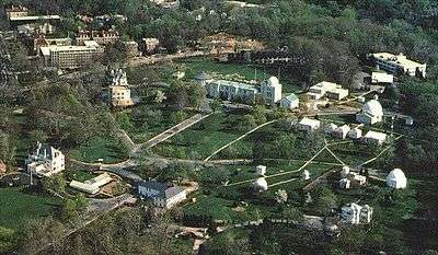 Observatory Hill |
January 12, 2017 (#100000479) |
23rd and E Sts., NW. 38°53′41″N 77°03′05″W |
Observatory Circle | |
| 138 | The Octagon | 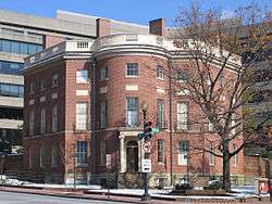 The Octagon |
October 15, 1966 (#66000863) |
1799 New York Ave., NW 38°53′46″N 77°02′30″W |
Golden Triangle | NHL: Served as the temporary Executive Mansion for Pres. James Madison after White House was burned by the British in the War of 1812 |
| 139 | Old Engine Company No. 6 |  Old Engine Company No. 6 |
September 5, 1975 (#75002052) |
438 Massachusetts Ave., NW. 38°54′01″N 77°01′03″W |
Chinatown | |
| 140 | Old Naval Observatory | .jpg) Old Naval Observatory |
October 15, 1966 (#66000864) |
23rd and E Sts., NW 38°53′42″N 77°03′07″W |
Monumental Core | |
| 141 | Old Post Office and Clock Tower | 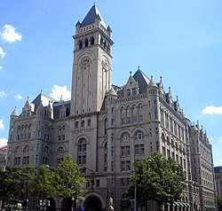 Old Post Office and Clock Tower |
April 11, 1973 (#73002105) |
Pennsylvania Ave. at 12th St., NW. 38°53′38″N 77°01′41″W |
Monumental Core | |
| 142 | Oriental Building Association No. 6 Building |  Oriental Building Association No. 6 Building |
September 10, 2004 (#04000956) |
600 F St. NW 38°53′56″N 77°01′13″W |
Penn Quarter | |
| 143 | Pan American Union |  Pan American Union |
June 4, 1969 (#69000298) |
17th St. between C St. and Constitution Ave., NW. 38°53′34″N 77°02′27″W |
Monumental Core | |
| 144 | Pennsylvania Avenue National Historic Site |  Pennsylvania Avenue National Historic Site |
October 15, 1966 (#66000865) |
Roughly bounded by Constitution Ave., F St., 3rd, and 15th Sts. NW 38°53′35″N 77°01′35″W |
Monumental Core, Downtown East, Downtown, Penn Quarter | |
| 145 | Pension Building |  Pension Building |
March 24, 1969 (#69000312) |
4th and 5th Sts. between F and G Sts., NW 38°53′51″N 77°01′05″W |
Chinatown | Now the National Building Museum |
| 146 | Peyser Building-Security Savings and Commercial Bank | 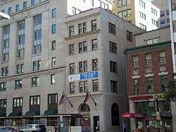 Peyser Building-Security Savings and Commercial Bank |
September 10, 2012 (#12000777) |
1518 K St., NW 38°54′08″N 77°02′08″W |
Golden Triangle | |
| 147 | PHILADELPHIA (gundelo) | 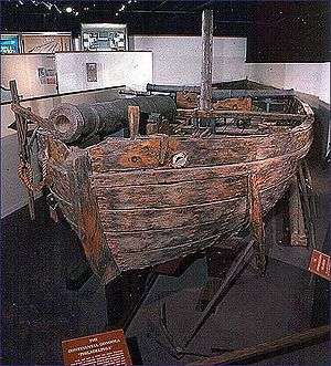 PHILADELPHIA (gundelo) |
October 15, 1966 (#66000852) |
National Museum of American History, 14th St. and Constitution Ave., NW 38°53′29″N 77°01′48″W |
Monumental Core | Only surviving American gunboat from the Revolutionary War, fought in Battle of Valcour Island |
| 148 | President's Office, George Washington University |  President's Office, George Washington University |
September 13, 1991 (#90001544) |
2003 G St., NW. and 700 20th St., NW. 38°53′54″N 77°02′43″W |
George Washington University | Part of the George Washington University School of Law. Sits on the historic University Yard with Stockton Hall and Corcoran Hall. |
| 149 | President's Park South | 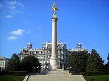 President's Park South |
May 6, 1980 (#80000347) |
Constitution Ave. 38°53′39″N 77°02′13″W |
Mounmental Core | |
| 150 | Railroad Retirement Board Building | 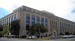 Railroad Retirement Board Building |
July 6, 2007 (#07000638) |
330 C St., SW. 38°53′08″N 77°01′00″W |
Southwest Federal Center | |
| 151 | Randall Junior High School | 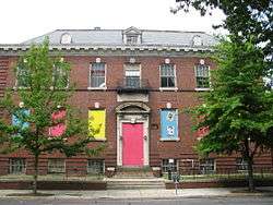 Randall Junior High School |
December 22, 2008 (#08001205) |
65 I St., SW. 38°52′45″N 77°00′39″W |
Southwest Waterfront | |
| 152 | Real Estate Trust Building-Continental Trust Building | 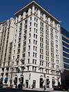 Real Estate Trust Building-Continental Trust Building |
January 20, 2015 (#14001166) |
1343 H St., NW 38°54′01″N 77°01′52″W |
Downtown | |
| 153 | Renwick Gallery | 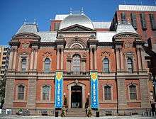 Renwick Gallery |
March 24, 1969 (#69000300) |
Northeast corner of 17th St. and Pennsylvania Ave., NW 38°53′56″N 77°02′22″W |
Monumental Core | |
| 154 | Rhodes' Tavern |  Rhodes' Tavern |
March 24, 1969 (#69000301) |
601-603 15th St. and 1431 F St., NW. 38°53′51″N 77°02′01″W |
Downtown | |
| 155 | Riggs National Bank |  Riggs National Bank |
July 16, 1973 (#73002113) |
1503-1505 Pennsylvania Ave., NW. 38°53′56″N 77°02′04″W |
Golden Triangle | |
| 156 | Riggs National Bank, Washington Loan and Trust Company Branch |  Riggs National Bank, Washington Loan and Trust Company Branch |
May 6, 1971 (#71001005) |
SW corner of 9th and F Sts., NW. 38°53′50″N 77°01′29″W |
Penn Quarter | |
| 157 | Ringgold-Carroll House |  Ringgold-Carroll House |
July 26, 1973 (#73002114) |
1801 F St., NW. 38°53′51″N 77°02′33″W |
Golden Triangle | |
| 158 | Franklin Delano Roosevelt Memorial | 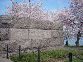 Franklin Delano Roosevelt Memorial |
May 2, 1997 (#01000271) |
Cherry Tree Walk, Tidal Basin 38°53′35″N 77°01′26″W |
Monumental Core | |
| 159 | St. Aloysius Catholic Church | 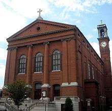 St. Aloysius Catholic Church |
July 26, 1973 (#73002116) |
N. Capitol and I Sts., NW. 38°54′05″N 77°00′36″W |
North Capitol Street | |
| 160 | Saint James Mutual Homes |  Saint James Mutual Homes |
February 23, 2016 (#16000027) |
201-217 P, 1410-1414 3rd, and 220-215-229 O Sts., SW., and 1411-1415 James Creek Parkway, SW. 38°52′21″N 77°00′49″W |
Southwest Waterfront | |
| 161 | St. John's Church | 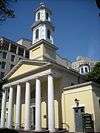 St. John's Church |
October 15, 1966 (#66000868) |
16th and H Sts., NW 38°54′01″N 77°02′11″W |
Golden Triangle | |
| 162 | St. Mary's Episcopal Church | 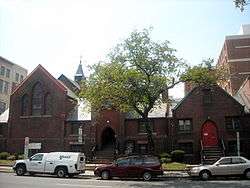 St. Mary's Episcopal Church |
April 2, 1973 (#73002118) |
730 23rd St., NW. 38°53′57″N 77°03′02″W |
George Washington University | |
| 163 | General Jose de San Martin Memorial | 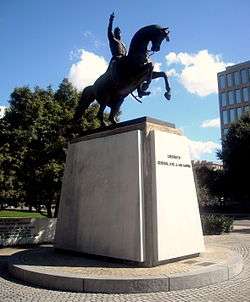 General Jose de San Martin Memorial |
October 12, 2007 (#07001059) |
Reservation 106, Virginia Ave. and 20th St., NW. 38°53′48″N 77°02′44″W |
Monumental Core | |
| 164 | B.F. Saul Building |  B.F. Saul Building |
October 4, 2016 (#16000685) |
925 15th St., NW. 38°54′07″N 77°02′00″W |
Downtown | |
| 165 | Schneider Triangle |  Schneider Triangle |
December 13, 1982 (#82001031) |
Bounded by Washington Circle, New Hampshire Ave. NW, K, 22nd, and L Sts. NW 38°54′11″N 77°02′58″W |
George Washington University | |
| 166 | Second National Bank | .jpg) Second National Bank |
December 29, 1994 (#94001516) |
1331 G St., NW. 38°53′54″N 77°01′52″W |
Downtown | |
| 167 | Smithsonian Building |  Smithsonian Building |
October 15, 1966 (#66000867) |
Jefferson Dr. at 10th St., SW. 38°53′19″N 77°01′35″W |
Southwest Federal Center | |
| 168 | Social Security Administration Building |  Social Security Administration Building |
July 6, 2007 (#07000639) |
330 Independence Ave., SW. 38°52′55″N 77°01′01″W |
Southwest Federal Center | |
| 169 | Southeast No. 9 Boundary Marker of the Original District of Columbia | _SE_9.tiff.png) Southeast No. 9 Boundary Marker of the Original District of Columbia |
November 1, 1996 (#96001242) |
0.225 mile south of the Oxon Cove Bridge and 420 feet east of Shepherd Parkway 38°48′14″N 77°01′27″W |
SW | |
| 170 | Southern Railway Building |  Southern Railway Building |
April 26, 2016 (#16000194) |
1500 K St., NW 38°54′08″N 77°02′06″W |
Downtown | |
| 171 | Steedman-Ray House |  Steedman-Ray House |
September 21, 1990 (#90001376) |
1925 F St., NW 38°53′50″N 77°02′42″W |
George Washington University | This houses the President of George Washington University. Previously, it has been used as an alumni space on the campus. |
| 172 | Thaddeus Stevens School |  Thaddeus Stevens School |
July 12, 2001 (#01000706) |
1050 Twenty-First St., NW 38°54′11″N 77°02′49″W |
Golden Triangle | |
| 173 | Stockton Hall |  Stockton Hall |
September 13, 1991 (#90001546) |
720 20th St., NW. 38°53′57″N 77°02′43″W |
George Washington University | Currently part of the George Washington University School of Law. Sits on historic University Yard with Maxwell Woodhull House, President's Office, George Washington University, and Corcoran Hall. |
| 174 | Hattie M. Strong Residence Hall |  Hattie M. Strong Residence Hall |
April 12, 1991 (#90001547) |
620 21st St., NW. 38°53′52″N 77°02′50″W |
George Washington University | Named after a donation for the construction from Hattie Strong, Hattie M. Strong Residence Hall is a women's residence hall at George Washington University. |
| 175 | Sun Building |  Sun Building |
March 27, 1985 (#85000650) |
1317 F St., NW 38°53′48″N 77°01′34″W |
Downtown | |
| 176 | Mary E. Surratt House |  Mary E. Surratt House |
August 11, 2009 (#04000118) |
604 H Street 38°53′58″N 77°01′13″W |
Chinatown | |
| 177 | William Syphax School |  William Syphax School |
July 25, 2003 (#03000672) |
1360 Half St., SW. 38°52′33″N 77°00′31″W |
Southwest Waterfront | |
| 178 | Temperance Fountain |  Temperance Fountain |
October 12, 2007 (#07001061) |
7th St. and Indiana Ave., NW. 38°53′37″N 77°01′19″W |
Penn Quarter | |
| 179 | Terminal Refrigerating and Warehouse Company |  Terminal Refrigerating and Warehouse Company |
October 15, 2014 (#14000854) |
300 D St., SW. 38°53′04″N 77°00′59″W |
Southwest Federal Center | |
| 180 | Tiber Island | Tiber Island |
January 14, 2013 (#12001166) |
401-461 N, 430-490 M, 1201-1265 4th, and 1252 6th Sts., SW. 38°52′32″N 77°01′07″W |
Southwest Waterfront | |
| 181 | Titanic Memorial | .jpg) Titanic Memorial |
October 12, 2007 (#07001060) |
Reservation 717, Waterfront Park, and Water and P Sts., SW. 38°52′38″N 77°01′16″W |
Southwest Waterfront | |
| 182 | Tower Building |  Tower Building |
September 7, 1995 (#95001084) |
1401 K St., NW. 38°54′05″N 77°01′57″W |
Downtown | |
| 183 | Town Center East |  Town Center East |
January 15, 2014 (#13001071) |
1001 and 1101 3rd St., SW. 38°52′39″N 77°00′57″W |
Southwest Waterfront | |
| 184 | Oscar W. Underwood House |  Oscar W. Underwood House |
December 8, 1976 (#76002132) |
2000 G St., NW 38°53′53″N 77°02′43″W |
George Washington University | This is the home of the Jacob Burns Law Clinics of the George Washington University Law School. |
| 185 | Union Trust Building |  Union Trust Building |
January 19, 1984 (#84000867) |
740 15th St. NW 38°54′00″N 77°02′02″W |
Golden Triangle | |
| 186 | United Brotherhood of Carpenters and Joiners-Local 132 |  United Brotherhood of Carpenters and Joiners-Local 132 |
September 17, 2003 (#03000945) |
1010 10th St. NW, 1001 K St. NW 38°54′09″N 77°01′35″W |
Downtown | |
| 187 | United Mine Workers of America Building |  United Mine Workers of America Building |
September 13, 2000 (#00001032) |
900 Fifteenth St. NW 38°54′08″N 77°02′13″W |
Golden Triangle | |
| 188 | U.S. Capitol Gatehouses and Gateposts | 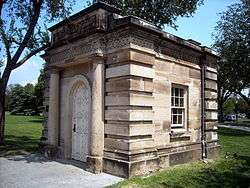 U.S. Capitol Gatehouses and Gateposts |
November 30, 1973 (#73002120) |
7th, 15th, and 17th Sts., and Constitution Ave., NW. 38°53′27″N 77°01′56″W |
Monumental Core | |
| 189 | US Chamber of Commerce Building | 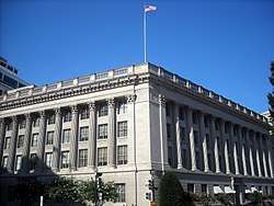 US Chamber of Commerce Building |
May 13, 1992 (#92000499) |
1615 H St., NW. 38°54′01″N 77°02′17″W |
Golden Triangle | |
| 190 | U.S. Civil Service Commission Building | 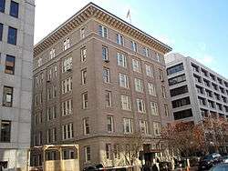 U.S. Civil Service Commission Building |
September 18, 2013 (#13000713) |
1724 F St., NW 38°53′50″N 77°02′27″W |
Golden Triangle | |
| 191 | US Courthouse-District of Columbia | 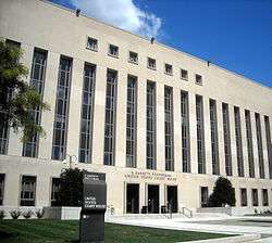 US Courthouse-District of Columbia |
July 5, 2007 (#07000640) |
333 Constitution Ave. NW 38°53′22″N 77°01′02″W |
Downtown East | |
| 192 | U.S. Court Of Military Appeals | 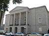 U.S. Court Of Military Appeals |
January 21, 1974 (#74002174) |
450 E St., NW. 38°53′44″N 77°01′07″W |
Downtown East | |
| 193 | U.S. Department of Agriculture Administration Building | 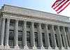 U.S. Department of Agriculture Administration Building |
January 24, 1974 (#74002175) |
12th St. and Jefferson Dr., SW. 38°53′17″N 77°01′49″W |
Southwest Federal Center | |
| 194 | U.S. Department of Agriculture Cotton Annex | 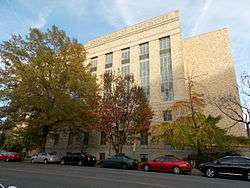 U.S. Department of Agriculture Cotton Annex |
October 5, 2015 (#15000683) |
300 12th St., SW. 38°53′08″N 77°01′40″W |
Southwest Federal Center | |
| 195 | U.S. Department of Agriculture South Building | 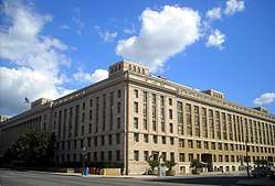 U.S. Department of Agriculture South Building |
July 5, 2007 (#07000643) |
14th St. and Independence Ave., SW. 38°53′12″N 77°01′48″W |
Southwest Federal Center | |
| 196 | U.S. Department of Housing and Urban Development |  U.S. Department of Housing and Urban Development |
August 26, 2008 (#08000824) |
451 7th St., SW. 38°53′02″N 77°01′19″W |
Southwest Federal Center | Known as "Robert C. Weaver Federal Building", it was designed by Marcel Breuer |
| 197 | US Department of the Interior Building |  US Department of the Interior Building |
November 10, 1986 (#86002898) |
Eighteenth and C Sts. NW 38°53′41″N 77°01′54″W |
Monumental Core | |
| 198 | U.S. Department of State Building | U.S. Department of State Building |
August 21, 2017 (#100001481) |
2201 C St. NW. 38°53′40″N 77°02′54″W |
Monumental Core | Known as the Harry S. Truman Building |
| 199 | U.S. Department of the Treasury |  U.S. Department of the Treasury |
November 11, 1971 (#71001007) |
1500 Pennsylvania Ave., NW 38°53′53″N 77°02′04″W |
Monumental Core | |
| 200 | US General Accounting Office Building |  US General Accounting Office Building |
September 21, 1995 (#95001086) |
441 G St., NW. 38°53′56″N 77°01′04″W |
Chinatown | |
| 201 | US Public Health Service Building | 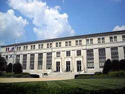 US Public Health Service Building |
July 5, 2007 (#07000641) |
1951 Constitution Ave. NW 38°53′34″N 77°02′40″W |
Monumental Core | |
| 202 | USS SEQUOIA (yacht) | _travels_down_the_Potomac_River_near_Washington_D.C.jpg) USS SEQUOIA (yacht) |
December 23, 1987 (#87002594) |
Gangplank Marina (as of 2010)[6] 38°52′32″N 77°01′21″W |
Southwest Waterfront | |
| 203 | U.S. Tax Court | U.S. Tax Court |
August 26, 2008 (#08000821) |
400 2nd St., NW. 38°53′43″N 77°00′52″W |
Downtown East | |
| 204 | Vietnam Veterans Memorial | 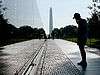 Vietnam Veterans Memorial |
November 13, 1982 (#01000285) |
West end of Constitution Gardens 38°53′27″N 77°02′50″W |
Monumental Core | |
| 205 | Virginia Interlocking Control Tower | 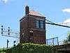 Virginia Interlocking Control Tower |
April 10, 2017 (#100000846) |
Southeastern corner of 2nd St. and Virginia Ave., SW. 38°53′01″N 77°00′49″W |
Southwest Federal Center | |
| 206 | Waggaman-Ray Commercial Row | 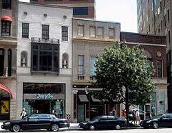 Waggaman-Ray Commercial Row |
February 24, 1995 (#95000162) |
1141, 1143, and 1145 Connecticut Ave. 38°54′15″N 77°02′28″W |
Golden Triangle | |
| 207 | George Washington University-Old West End Historic District |  George Washington University-Old West End Historic District |
January 27, 2015 (#14001207) |
Between F, I, 19th, and 23rd Sts., NW. and Virginia Ave., NW. 38°53′56″N 77°02′51″W |
George Washington University | |
| 208 | Washington Monument | 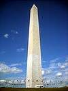 Washington Monument |
October 15, 1966 (#66000035) |
The Mall, between 14th and 17th Sts., NW. 38°53′23″N 77°02′09″W |
Monumental Core | |
| 209 | Watergate Complex | 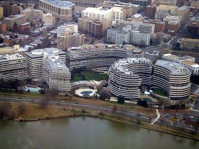 Watergate Complex |
October 12, 2005 (#05000540) |
2500, 2600, 2650, and 2600 Virginia Ave., NW, and 600 and 700 New Hampshire Ave., NW 38°53′56″N 77°03′17″W |
Foggy Bottom | |
| 210 | Westory Building |  Westory Building |
September 10, 2012 (#12000778) |
607 14th St., NW 38°53′53″N 77°01′54″W |
Downtown | |
| 211 | Margaret Wetzel House |  Margaret Wetzel House |
October 25, 1990 (#90001542) |
714 21st St., NW. 38°53′56″N 77°02′50″W |
George Washington University | Part of George Washington University for various academic programs. |
| 212 | Wheat Row |  Wheat Row |
July 23, 1973 (#73002125) |
1315, 1317, 1319, and 1321 4th St., SW. 38°52′26″N 77°01′05″W |
Southwest Waterfront | |
| 213 | Emily Wiley House |  Emily Wiley House |
May 26, 2006 (#06000192) |
902 3rd St., NW 38°54′12″N 77°00′56″W |
Mount Vernon Triangle | |
| 214 | Willard Hotel |  Willard Hotel |
February 15, 1974 (#74002177) |
1401-1409 Pennsylvania Ave., NW. 38°53′49″N 77°01′58″W |
Downtown | |
| 215 | Winder Building |  Winder Building |
March 24, 1969 (#69000303) |
604 17th St., NW. 38°53′51″N 77°02′25″W |
Golden Triangle | |
| 216 | Wire Building |  Wire Building |
January 23, 2013 (#12001195) |
1000 Vermont Ave., NW 38°54′10″N 77°02′02″W |
Downtown | |
| 217 | Maxwell Woodhull House |  Maxwell Woodhull House |
April 12, 1991 (#90001543) |
2033 G St., NW. 38°53′54″N 77°02′48″W |
George Washington University | Part of George Washington University, houses the Albert Small Washingtonia Collection. |
| 218 | Yale Steam Laundry |  Yale Steam Laundry |
March 18, 1999 (#99000332) |
437-443 New York Ave., NW. 38°54′17″N 77°01′05″W |
Mount Vernon Square |
gollark: Not to SQL injection, to XSS.
gollark: Of course, that's one box. As PHP is *quite bad*, the others won't be automatically protected, presumably, so there may be *some* vunerable boxes.
gollark: TJ09's not stupid. `<script>alert("hi")</script>` in a box won't actually run.
gollark: (that in a text input, I mean, not the SQL command line or whatever)
gollark: If it does your site is broken.
See also
| Wikimedia Commons has media related to National Register of Historic Places in Washington, D.C.. |
References
- "National Register of Historic Places: Weekly List Actions". National Park Service, United States Department of the Interior. Retrieved on August 14, 2020.
- Numbers represent an ordering by significant words. Various colorings, defined here, differentiate National Historic Landmarks and historic districts from other NRHP buildings, structures, sites or objects.
- The eight-digit number below each date is the number assigned to each location in the National Register Information System database, which can be viewed by clicking the number.
- Dillon, James (July 30, 1976), National Register of Historic Places Inventory — Nomination Form for Federal Properties: Defenses of Washington (Civil War) (PDF), archived (PDF) from the original on February 15, 2017, retrieved February 18, 2019.
- Ruane, Michael E. (May 19, 2010). "Historic D.C. church lands on most-endangered list". The Washington Post. p. B01. Retrieved May 20, 2010.
- C-Span
| Topics | |
|---|---|
| Lists by state |
|
| Lists by insular areas | |
| Lists by associated state | |
| Other areas | |
| Related | |
| |
This article is issued from Wikipedia. The text is licensed under Creative Commons - Attribution - Sharealike. Additional terms may apply for the media files.