National Register of Historic Places listings in Northeast Quadrant, Washington, D.C.
This is a list of properties and districts in the Northeast quadrant of Washington, D.C. that are listed on the National Register of Historic Places.
- This National Park Service list is complete through NPS recent listings posted August 14, 2020.[1]
Current listings
| [2] | Name on the Register | Image | Date listed[3] | Location | City or town | Description |
|---|---|---|---|---|---|---|
| 1 | American Revolution Statuary | 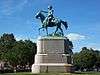 American Revolution Statuary |
July 14, 1978 (#78000256) |
Public buildings and various parks within DC 38°53′37″N 76°59′59″W |
Stanton Park | 14 statues including 11 in central DC, and the General Nathanael Greene statue in Stanton Park |
| 2 | Atlas Theater and Shops | 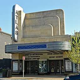 Atlas Theater and Shops |
November 10, 2010 (#10000909) |
1313-33 H Street, NE 38°53′59″N 76°59′15″W |
Near Northeast | |
| 3 | Mountjoy Bayly House | 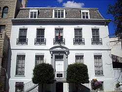 Mountjoy Bayly House |
July 20, 1973 (#73002072) |
122 Maryland Ave., NE 38°53′29″N 77°00′18″W |
Capitol Hill | |
| 4 | Brookland Bowling Alleys | 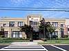 Brookland Bowling Alleys |
August 19, 2019 (#100004306) |
3726 10th St. NE. 38°56′10″N 76°59′36″W |
Brookland | |
| 5 | Brooks Mansion |  Brooks Mansion |
July 17, 1975 (#75002045) |
901 Newton St., NE. 38°55′58″N 76°59′37″W |
Brookland | |
| 6 | Ralph Bunche House |  Ralph Bunche House |
September 30, 1993 (#93001013) |
1510 Jackson St., NE. 38°55′47″N 76°59′02″W |
Brookland | |
| 7 | Bunker Hill Elementary School |  Bunker Hill Elementary School |
May 5, 2014 (#14000186) |
1401 Michigan Ave., NE 38°56′31″N 76°59′06″W |
Brookland | |
| 8 | Capitol Hill Historic District |  Capitol Hill Historic District |
August 27, 1976 (#76002127) |
Roughly bounded by Virginia Ave., SE., S. Capitol St., F St., NE., and 14th Sts., SE. and NE.; also roughly bounded by 7th St., NE., I-295, M St., SE., and 11th St., SE. 38°53′13″N 76°59′51″W |
NE, SE and NW | Second set of boundaries represents a boundary increase of July 3, 2003 |
| 9 | Chesapeake and Potomac Telephone Company Warehouse and Repair Facility |  Chesapeake and Potomac Telephone Company Warehouse and Repair Facility |
May 14, 2007 (#06001159) |
1111 N. Capitol St. NE 38°54′15″N 77°00′32″W |
NE | |
| 10 | Children's Country Home | 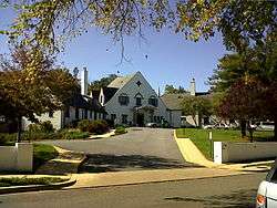 Children's Country Home |
December 9, 2003 (#03001254) |
1731 Bunker Hill Rd. NE 38°56′29″N 76°58′39″W |
Woodridge | |
| 11 | Civil War Fort Sites | _(14782675743).jpg) Civil War Fort Sites |
July 15, 1974 (#74000274) |
Arc of sites surrounding central Washington in Maryland, Virginia, and D.C. 38°56′08″N 76°59′15″W |
All quadrants | At the outset of the Civil War in 1861, Washington became a critical target for rebel attacks but was virtually without protection. The Union Army hastily began construction of a fortified defense line around the city, the physical remnants of which encompass these 19 earthwork forts, including Fort Totten, Fort Bunker Hill, Fort Lincoln, and Fort Mahan.[4] See also National Register listings in central D.C., western NW D.C., upper NW D.C., SE D.C., Prince George's County, Maryland, and Fairfax County, Virginia. |
| 12 | Civil War Monuments in Washington, DC | 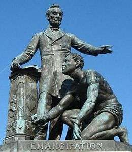 Civil War Monuments in Washington, DC |
September 20, 1978 (#78000257) |
Various parks within the original boundaries of city 38°53′23″N 76°59′25″W |
Various | 18 statues about people and topics related to the Civil War, including 1 in Lincoln Park (NE & SE quadrants), 6 in the upper NW quadrant, and 11 in central Washington. |
| 13 | Alexander Crummell School | 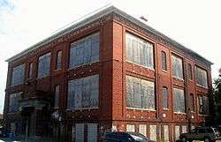 Alexander Crummell School |
July 25, 2003 (#03000671) |
Kendall and Gallaudet Sts, NE 38°54′48″N 76°59′07″W |
NE | |
| 14 | Dahlgreen Courts | 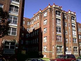 Dahlgreen Courts |
November 10, 2010 (#10000901) |
2504-2520 10th St., NE 38°55′22″N 76°59′34″W |
Brookland | Apartment Buildings in Washington, DC, MPS |
| 15 | East Capitol Street Carbarn | 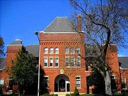 East Capitol Street Carbarn |
February 5, 1974 (#74002158) |
1400 E. Capitol St., NE. 38°53′23″N 76°59′06″W |
NE | |
| 16 | East Corner Boundary Marker of the Original District of Columbia | _East_Corner.jpg) East Corner Boundary Marker of the Original District of Columbia |
November 1, 1996 (#96001249) |
100 ft. E of jct. of Eastern and Southern Aves. 38°53′35″N 76°54′34″W |
NE and SE | See List of Boundary Markers of the Original District of Columbia |
| 17 | Emerald Street Historic District | 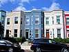 Emerald Street Historic District |
September 5, 2017 (#100001560) |
1307-1377, 1306-1368 Emerald St. NE., 517-519 13t St. NE., 518-520 14th St. NE. 38°53′48″N 76°59′13″W |
NE | |
| 18 | Engine House No. 10 | 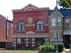 Engine House No. 10 |
November 19, 2008 (#08001063) |
1341 Maryland Ave., NE 38°53′54″N 76°59′13″W |
NE | |
| 19 | Engine Company 17 | 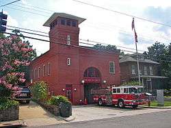 Engine Company 17 |
June 6, 2007 (#07000538) |
1227 Monroe St. NE[5] 38°55′56″N 76°59′24″W |
Brookland | |
| 20 | Engine Company 26 | 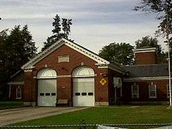 Engine Company 26 |
May 18, 2011 (#11000283) |
1340 Rhode Island Ave., NE 38°55′29″N 76°59′12″W |
Brentwood/ Brookland | Firehouses in Washington DC MPS |
| 21 | Engine Company 26, (Old) | 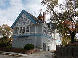 Engine Company 26, (Old) |
August 8, 2007 (#07000536) |
2715 22nd St. NE 38°55′30″N 76°58′27″W |
NE | |
| 22 | Engine Company 27 | 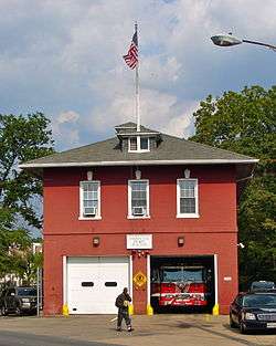 Engine Company 27 |
May 18, 2011 (#11000284) |
4201 Minnesota Ave., NE 38°54′04″N 76°56′36″W |
NE | Firehouses in Washington DC MPS |
| 23 | First Baptist Church of Deanwood | 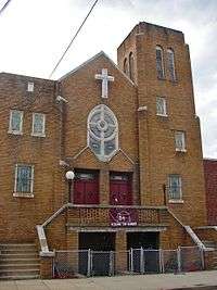 First Baptist Church of Deanwood |
July 24, 2008 (#08000720) |
1008 45th St. NE 38°54′11″N 76°56′17″W |
Deanwood | |
| 24 | Franciscan Monastery and Memorial Church of the Holy Land | 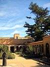 Franciscan Monastery and Memorial Church of the Holy Land |
January 17, 1992 (#91001943) |
1400 Quincy St., NE. 38°56′13″N 76°59′00″W |
Brookland | |
| 25 | Gallaudet College Historic District | 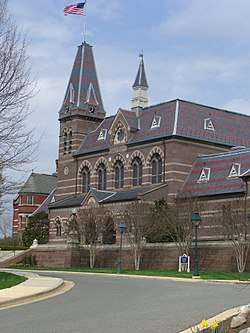 Gallaudet College Historic District |
October 15, 1966 (#66000856) |
Florida Ave. and 7th St., NE. 38°54′22″N 76°59′45″W |
NE | |
| 26 | Glenwood Cemetery | 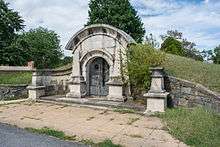 Glenwood Cemetery |
January 17, 2017 (#16000638) |
2219 Lincoln Rd., NE 38°55′18″N 77°00′20″W |
NE | |
| 27 | Glenwood Cemetery Mortuary Chapel | 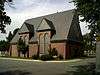 Glenwood Cemetery Mortuary Chapel |
January 9, 1989 (#88003064) |
2219 Lincoln Rd., NE 38°55′19″N 77°00′22″W |
NE | |
| 28 | Harewood Lodge | 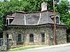 Harewood Lodge |
May 20, 2019 (#100003672) |
3600 Harewood Rd. NE. 38°55′57″N 77°00′05″W |
NE | |
| 29 | Hecht Company Warehouse | 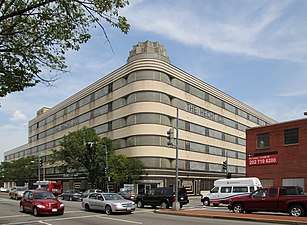 Hecht Company Warehouse |
May 25, 1994 (#94000446) |
1401 New York Ave., NE. 38°54′52″N 76°59′06″W |
NE | |
| 30 | Holy Redeemer College | 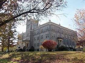 Holy Redeemer College |
May 17, 2019 (#100003958) |
3112 Seventh St. NE 38°55′44″N 76°59′48″W |
NE | |
| 31 | Kenilworth Aquatic Gardens | 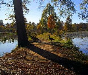 Kenilworth Aquatic Gardens |
August 25, 1978 (#78000258) |
Kenilworth Ave. and Douglas St. NE 38°54′46″N 76°56′37″W |
NE | |
| 32 | Kingman Park Historic District | 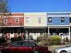 Kingman Park Historic District |
December 17, 2018 (#100002960) |
Between Rosedale & D St., Maryland Ave. NE, 19th St. & Oklahoma Ave. NE 38°53′44″N 76°58′28″W |
Kingman Park | |
| 33 | Langston Golf Course Historic District | 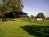 Langston Golf Course Historic District |
October 15, 1991 (#91001525) |
Roughly, Anacostia Park N of Benning Rd. NE 38°54′08″N 76°57′54″W |
NE | |
| 34 | Langston Terrace Dwellings | 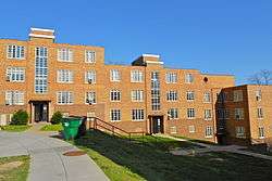 Langston Terrace Dwellings |
November 12, 1987 (#87001851) |
N from Benning Rd. to H St., NE 38°53′58″N 76°58′26″W |
Langston | |
| 35 | The Lexington | 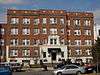 The Lexington |
January 19, 2016 (#15000978) |
1114 F St., NE 38°53′51″N 76°59′28″W |
Near Northeast | |
| 36 | Mayfair Mansions Apartments | 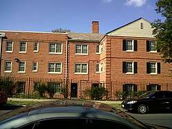 Mayfair Mansions Apartments |
November 1, 1989 (#89001735) |
3819 Jay St., NE 38°54′11″N 76°56′55″W |
Mayfair | |
| 37 | Metropolitan Apartments | 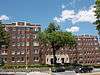 Metropolitan Apartments |
May 12, 2014 (#14000199) |
200-210 Rhode Island Ave., NE. 38°55′09″N 77°00′12″W |
Edgewood | |
| 38 | Newton Theater | 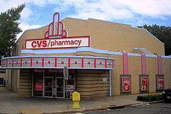 Newton Theater |
June 27, 2007 (#07000592) |
3601-3611 12th St. NE 38°56′08″N 76°59′27″W |
Brookland | |
| 39 | Northeast No. 3 Boundary Marker of the Original District of Columbia | _NE_3.jpg) Northeast No. 3 Boundary Marker of the Original District of Columbia |
November 1, 1996 (#96001256) |
144 ft. NW of jct. of Eastern Ave. and Chillum Rd. 38°57′55″N 77°00′06″W |
NE | |
| 40 | Northeast No. 4 Boundary Marker of the Original District of Columbia | _NE_4.jpg) Northeast No. 4 Boundary Marker of the Original District of Columbia |
November 1, 1996 (#96001255) |
5400 Sargent Rd. 38°57′17″N 76°59′17″W |
NE | |
| 41 | Northeast No. 5 Boundary Marker of the Original District of Columbia | _NE_5.jpg) Northeast No. 5 Boundary Marker of the Original District of Columbia |
November 1, 1996 (#96001254) |
4609 Eastern Ave. 38°56′39″N 76°58′28″W |
NE | |
| 42 | Northeast No. 6 Boundary Marker of the Original District of Columbia | _NE_6.jpg) Northeast No. 6 Boundary Marker of the Original District of Columbia |
November 1, 1996 (#96001253) |
3601 Eastern Ave. 38°56′01″N 76°57′41″W |
NE | |
| 43 | Northeast No. 7 Boundary Marker of the Original District of Columbia | _NE_7_2.jpg) Northeast No. 7 Boundary Marker of the Original District of Columbia |
November 1, 1996 (#96001252) |
Ft. Lincoln Cemetery 38°55′26″N 76°56′56″W |
NE | |
| 44 | Northeast No. 8 Boundary Marker of the Original District of Columbia | _NE_8.jpg) Northeast No. 8 Boundary Marker of the Original District of Columbia |
November 1, 1996 (#96001251) |
Kenilworth Aquatics Gardens, NW of jct. of Eastern and Kenilworth Aves. 38°54′50″N 76°56′10″W |
NE | |
| 45 | Northeast No. 9 Boundary Marker of the Original District of Columbia | _NE_9.jpg) Northeast No. 9 Boundary Marker of the Original District of Columbia |
November 1, 1996 (#96001250) |
919 Eastern Ave. 38°54′12″N 76°55′21″W |
NE | |
| 46 | Plymouth Theater | 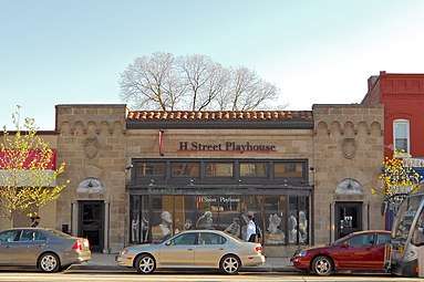 Plymouth Theater |
March 3, 2004 (#04000117) |
1365 H St., NE 38°54′07″N 76°59′11″W |
NE | |
| 47 | President's House, Gallaudet College | 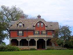 President's House, Gallaudet College |
February 15, 1974 (#74002172) |
7th St. and Florida Ave., NE. 38°54′19″N 76°59′46″W |
NE | |
| 48 | Roosevelt Apartment Building | 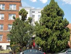 Roosevelt Apartment Building |
September 7, 1994 (#94001045) |
1116-1118 F St., NE. 38°53′50″N 76°59′27″W |
Near Northeast | |
| 49 | St. Paul's College | .JPG) St. Paul's College |
September 13, 2018 (#100002913) |
3015 4th St. NE. 38°55′41″N 76°59′56″W |
NE | |
| 50 | Sewall–Belmont House National Historic Site | 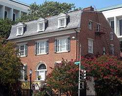 Sewall–Belmont House National Historic Site |
June 16, 1972 (#72001432) |
144 Constitution Ave., NE. 38°53′32″N 77°00′14″W |
NE | |
| 51 | Spingarn Senior High School | 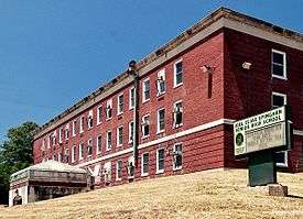 Spingarn Senior High School |
May 12, 2014 (#14000198) |
2500 Benning Rd., NE. 38°53′58″N 76°58′15″W |
Carver Langston | |
| 52 | Strand Theater |  Strand Theater |
November 25, 2008 (#08001093) |
5129-5131 Nannie Helen Burroughs Ave., NE 38°53′54″N 76°55′34″W |
NE | |
| 53 | Trades Hall of National Training School for Women and Girls | 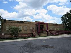 Trades Hall of National Training School for Women and Girls |
July 17, 1991 (#91002049) |
601 50th St., NE. 38°53′46″N 76°55′48″W |
NE | |
| 54 | Truck House No. 13 | 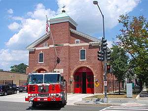 Truck House No. 13 |
June 6, 2007 (#07000535) |
1342 Florida Ave. NE 38°54′05″N 76°59′13″W |
NE | |
| 55 | U.S. National Arboretum | 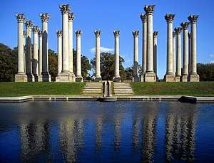 U.S. National Arboretum |
April 11, 1973 (#73002122) |
24th and R Sts., NE. 38°54′42″N 76°57′58″W |
NE | |
| 56 | U.S. Post Office Department Mail Equipment Shops | 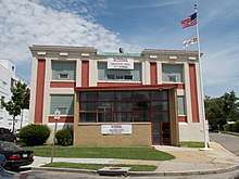 U.S. Post Office Department Mail Equipment Shops |
July 11, 2016 (#16000435) |
2135 5th St., NE 38°55′09″N 76°59′58″W |
Eckington | |
| 57 | Uline Ice Company Plant and Arena Complex | 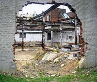 Uline Ice Company Plant and Arena Complex |
May 17, 2007 (#07000448) |
1132, 1140, and 1146 3rd St. NE 38°54′18″N 77°00′11″W |
Near Northeast | |
| 58 | Union Market Historic District | 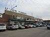 Union Market Historic District |
January 31, 2017 (#100000596) |
Between 4th and 5th Sts. NE., and Florida Ave. and Penn St., NE. 38°54′30″N 76°59′57″W |
NE | |
| 59 | Union Station | 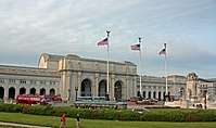 Union Station |
March 24, 1969 (#69000302) |
Intersection of Massachusetts and Louisiana Aves. and 1st St., NE. 38°53′51″N 77°00′23″W |
NE | |
| 60 | Union Station Plaza and Columbus Fountain | 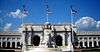 Union Station Plaza and Columbus Fountain |
April 9, 1980 (#80004523) |
1st St., Massachusetts and Louisiana Aves., NE 38°53′47″N 77°00′23″W |
NE | |
| 61 | United Brick Corporation Brick Complex | 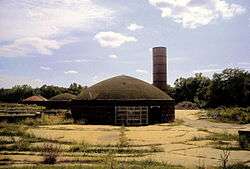 United Brick Corporation Brick Complex |
October 3, 1978 (#78003061) |
2801 New York Ave., NE. 38°54′58″N 76°58′06″W |
NE | |
| 62 | Woodward & Lothrop Service Warehouse | 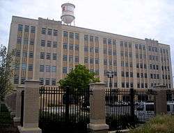 Woodward & Lothrop Service Warehouse |
February 15, 2005 (#05000046) |
131 M St. NE 38°54′25″N 77°00′17″W |
Near Northeast | |
| 63 | Young, Browne, Phelps and Spingarn Educational Campus Historic District | 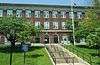 Young, Browne, Phelps and Spingarn Educational Campus Historic District |
May 3, 2016 (#15000743) |
2500 Benning Rd., NE., 704, 820, & 850 26th St., NE 38°54′00″N 76°58′15″W |
NE |
gollark: Harvesting all palaiologos messages ever and posting them on the internet retroactively...
gollark: We wanted to use RNNs or something but those are harder and we'd have to gather data and train in batches, which could be problematic privacywise.
gollark: Oh yes, it's very bad.
gollark: It's a Markov chain and it isn't very coherent.
gollark: <:insane:455119246310244362> you?!
References
- "National Register of Historic Places: Weekly List Actions". National Park Service, United States Department of the Interior. Retrieved on August 14, 2020.
- Numbers represent an ordering by significant words. Various colorings, defined here, differentiate National Historic Landmarks and historic districts from other NRHP buildings, structures, sites or objects.
- The eight-digit number below each date is the number assigned to each location in the National Register Information System database, which can be viewed by clicking the number.
- Dillon, James (July 30, 1976), National Register of Historic Places Inventory — Nomination Form for Federal Properties: Defenses of Washington (Civil War) (PDF), archived (PDF) from the original on February 15, 2017, retrieved February 18, 2019.
- District of Columbia Fire Department. "DC FEMS Fire Station Locations". Archived from the original on 2009-12-10. Retrieved 2009-12-23.
| Topics | |
|---|---|
| Lists by state |
|
| Lists by insular areas | |
| Lists by associated state | |
| Other areas | |
| Related | |
| |
This article is issued from Wikipedia. The text is licensed under Creative Commons - Attribution - Sharealike. Additional terms may apply for the media files.