National Register of Historic Places listings in the upper NW Quadrant of Washington, D.C.
This is a list of properties and districts listed on the National Register of Historic Places in the Northwest quadrant of Washington, D.C. that are both east of Rock Creek and north of M Street.
- This National Park Service list is complete through NPS recent listings posted August 14, 2020.[1]
Current listings
| [2] | Name on the Register | Image | Date listed[3] | Location | Neighborhood | Description |
|---|---|---|---|---|---|---|
| 1 | Adams Memorial | 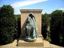 Adams Memorial |
March 16, 1972 (#72001420) |
Webster St. and Rock Creek Church Rd., NW. 38°56′50″N 77°00′39″W |
Petworth | |
| 2 | Administration Building, Carnegie Institute of Washington | 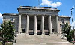 Administration Building, Carnegie Institute of Washington |
October 15, 1966 (#66000959) |
1530 P St., NW. 38°54′34″N 77°02′10″W |
Dupont Circle | |
| 3 | Alden, Babcock, Calvert Apartments |  Alden, Babcock, Calvert Apartments |
May 25, 1990 (#90000737) |
2620 13th St., NW. 38°55′27″N 77°01′49″W |
Columbia Heights | |
| 4 | American Revolution Statuary |  American Revolution Statuary |
July 14, 1978 (#78000256) |
Public buildings and various parks within DC 38°54′25″N 77°02′29″W |
Dupont Circle | 14 statues including 11 in central DC, and Doctor John Witherspoon south of Dupont Circle |
| 5 | Larz Anderson House | 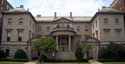 Larz Anderson House |
April 7, 1971 (#71000993) |
2118 Massachusetts Ave., NW. 38°54′39″N 77°02′53″W |
Dupont Circle | National headquarters of the Society of the Cincinnati |
| 6 | Andrew Rankin Memorial Chapel, Frederick Douglas Memorial Hall, Founders Library | 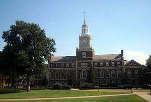 Andrew Rankin Memorial Chapel, Frederick Douglas Memorial Hall, Founders Library |
January 3, 2001 (#01000070) |
2441 and 2365 6th St. NW; and 500 Howard Place NW 38°55′21″N 77°01′13″W |
Howard University | |
| 7 | Apartment Building at 2225 N Street |  Apartment Building at 2225 N Street |
September 9, 1994 (#94001043) |
2225 N St., NW. 38°54′27″N 77°03′00″W |
Dupont Circle | |
| 8 | Apartments at 5922 13th Street, NW. |  Apartments at 5922 13th Street, NW. |
January 17, 2017 (#100000471) |
5922 13th St., NW. 38°57′45″N 77°01′47″W |
Brightwood | |
| 9 | Armed Forces Retirement Home-Washington |  Armed Forces Retirement Home-Washington |
December 5, 2007 (#07001237) |
3700 N Capitol St NW 38°56′11″N 77°00′33″W |
Park View, Petworth | |
| 10 | Armstrong Manual Training School |  Armstrong Manual Training School |
August 16, 1996 (#96000893) |
Junction of 1st and P Sts., NW 38°54′32″N 77°00′49″W |
Truxton Circle | |
| 11 | Army Medical Museum | 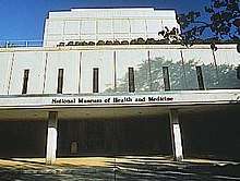 Army Medical Museum |
October 15, 1966 (#66000854) |
Armed Forces Institute of Pathology Building, Walter Reed Army Medical Center, 13th St. and Fern Pl. 38°58′41″N 77°01′47″W |
Walter Reed Army Medical Center | Original listed building has been demolished; collection is now in Maryland. |
| 12 | Francis Asbury Memorial |  Francis Asbury Memorial |
October 11, 2007 (#07001052) |
Reservation 309-B, 16th & Mt. Pleasant Sts. NW 38°55′47″N 77°02′13″W |
Mount Pleasant | |
| 13 | Banneker Recreation Center |  Banneker Recreation Center |
April 28, 1986 (#86000876) |
2500 Georgia Ave. NW 38°55′20″N 77°01′25″W |
Columbia Heights | |
| 14 | George M. Barker Company Warehouse | 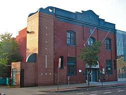 George M. Barker Company Warehouse |
August 27, 2008 (#08000820) |
1525 7th St., NW. 38°54′36″N 77°01′17″W |
Logan Circle | |
| 15 | Battleground National Cemetery | 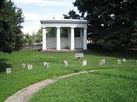 Battleground National Cemetery |
October 15, 1966 (#66000032) |
6625 Georgia Ave., NW. 38°58′14″N 77°01′37″W |
Brightwood | |
| 16 | Joseph Beale House | 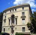 Joseph Beale House |
May 8, 1973 (#73002073) |
2301 Massachusetts Ave., NW. 38°54′46″N 77°03′05″W |
Kalorama Heights | |
| 17 | Perry Belmont House | .JPG) Perry Belmont House |
May 8, 1973 (#73002074) |
1618 New Hampshire Ave., NW. 38°54′44″N 77°02′30″W |
Dupont Circle | |
| 18 | Blagden Alley-Naylor Court Historic District | 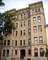 Blagden Alley-Naylor Court Historic District |
November 16, 1990 (#90001734) |
Bounded by O, 9th, M, & 10th Sts. NW. 38°54′44″N 77°01′33″W |
Logan Circle | |
| 19 | Bloomingdale Historic District |  Bloomingdale Historic District |
November 26, 2018 (#100003129) |
Bounded by Florida Ave., Channing, Bryant, North Capital & 2nd Sts. NW 38°54′59″N 77°00′41″W |
Bloomingdale | |
| 20 | Boulder Bridge and Ross Drive Bridge | 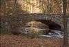 Boulder Bridge and Ross Drive Bridge |
March 20, 1980 (#80000348) |
Rock Creek Park 38°56′53″N 77°02′42″W |
Rock Creek Park | Extends to both sides of Rock Creek |
| 21 | Anthony Bowen YMCA | 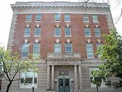 Anthony Bowen YMCA |
October 3, 1983 (#83003523) |
1816 12th St. NW 38°54′53″N 77°02′25″W |
U Street Corridor (Cardozo/Shaw) | |
| 22 | Brodhead-Bell-Morton Mansion | 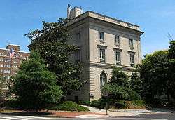 Brodhead-Bell-Morton Mansion |
October 14, 1987 (#87001769) |
1500 Rhode Island Ave., NW 38°54′27″N 77°02′06″W |
Logan Circle | |
| 23 | Blanche Kelso Bruce Elementary School |  Blanche Kelso Bruce Elementary School |
March 31, 2015 (#15000114) |
770 Kenyon St., NW. 38°55′47″N 77°01′32″W |
Park View | |
| 24 | Blanche K. Bruce House |  Blanche K. Bruce House |
May 15, 1975 (#75002046) |
909 M St., NW 38°54′21″N 77°01′29″W |
Logan Circle | |
| 25 | Buildings at 1644-1666 Park Road NW |  Buildings at 1644-1666 Park Road NW |
November 6, 1986 (#86003019) |
1644-1666 Park Rd. NW 38°55′54″N 77°02′17″W |
Mount Pleasant | |
| 26 | Lucinda Cady House |  Lucinda Cady House |
May 28, 1975 (#75002047) |
7064 Eastern Ave., NW. 38°58′40″N 77°01′07″W |
Takoma | |
| 27 | Cairo Apartment Building | 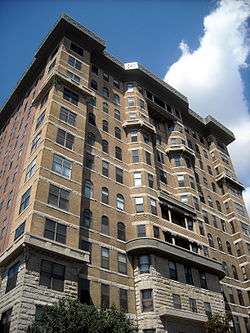 Cairo Apartment Building |
September 9, 1994 (#94001033) |
1615 Q St., NW. 38°54′41″N 77°02′16″W |
Dupont Circle | |
| 28 | Capital Traction Company Car Barn | 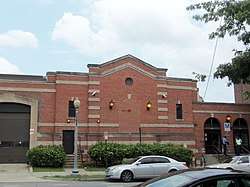 Capital Traction Company Car Barn |
May 22, 2013 (#13000290) |
4615 14th St., N.W. 38°56′50″N 77°01′56″W |
Sixteenth Street Heights | |
| 29 | Canadian Embassy | 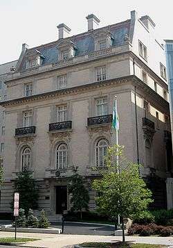 Canadian Embassy |
April 3, 1973 (#73002076) |
1746 Massachusetts Ave., NW. 38°54′29″N 77°02′26″W |
Dupont Circle | Now the Embassy of Uzbekistan; also known as the Clarence Moore House |
| 30 | Francis L. Cardozo Senior High School | 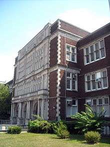 Francis L. Cardozo Senior High School |
September 30, 1993 (#93001015) |
Junction of 13th and Clifton Sts., NW. 38°55′14″N 77°01′48″W |
Columbia Heights | |
| 31 | Mary Ann Shadd Cary House |  Mary Ann Shadd Cary House |
December 8, 1976 (#76002128) |
1421 W. St., NW 38°55′10″N 77°02′08″W |
U Street Corridor (Cardozo/Shaw) | |
| 32 | Chapman Coal Company Garage and Stable |  Chapman Coal Company Garage and Stable |
October 23, 2013 (#13000845) |
57 N St., NW. 38°54′27″N 77°00′40″W |
Downtown | |
| 33 | Chilchester Arms Apartments | .jpg) Chilchester Arms Apartments |
January 24, 2017 (#100000559) |
1388 Tuckerman St., NW 38°58′02″N 77°01′59″W |
Brightwood | |
| 34 | Civil War Fort Sites |  Civil War Fort Sites |
July 15, 1974 (#74000274) |
Arc of sites surrounding central Washington in Maryland, Virginia, and D.C. 38°57′50″N 77°01′46″W |
All quadrants | At the outset of the Civil War in 1861, Washington became a critical target for rebel attacks but was virtually without protection. The Union Army hastily began construction of a fortified defense line around the city, the physical remnants of which encompass these 19 earthwork forts, including Fort Stevens and Fort Slocum.[4] See also National Register listings in central D.C., western NW D.C., NE D.C., SE D.C., Prince George's County, Maryland, and Fairfax County, Virginia. |
| 35 | Civil War Monuments in Washington, DC | .jpg) Civil War Monuments in Washington, DC |
September 20, 1978 (#78000257) |
Various parks within the original boundaries of city 38°54′26″N 77°02′12″W |
Various | 18 statues about people and topics related to the Civil War, including 11 in central Washington, 6 in the NW quadrant, and 1 in Lincoln Park (NE & SE quadrants). |
| 36 | Clifton Terrace |  Clifton Terrace |
December 26, 2001 (#01001366) |
1308,1312,1350 Clifton St. 38°55′19″N 77°01′52″W |
Columbia Heights | |
| 37 | Codman-Davis House | 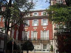 Codman-Davis House |
October 11, 1979 (#79003100) |
2145 Decatur Pl., NW 38°54′49″N 77°02′54″W |
Kalorama Heights | |
| 38 | Congressional Club | 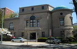 Congressional Club |
October 6, 2011 (#11000717) |
2001 New Hampshire Ave., NW 38°55′02″N 77°02′09″W |
U Street | |
| 39 | Connecticut Avenue Bridge | Connecticut Avenue Bridge |
July 3, 2003 (#03000584) |
Connecticut Ave., northwest of Rock Creek 38°55′16″N 77°03′02″W |
Kalorama Heights and Woodley Park | Extends to both sides of Rock Creek |
| 40 | Cosmos Club | 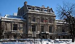 Cosmos Club |
April 3, 1973 (#73002079) |
2121 Massachusetts Ave., NW. 38°54′41″N 77°02′54″W |
Dupont Circle | Also known as the Richard H. Townsend House |
| 41 | Elliott Coues House |  Elliott Coues House |
May 15, 1975 (#75002049) |
1726 N St., NW 38°54′25″N 77°02′24″W |
Dupont Circle | |
| 42 | Dorsch's White Cross Bakery |  Dorsch's White Cross Bakery |
February 3, 2012 (#11001076) |
641 S St., NW 38°54′52″N 77°01′16″W |
U Street Corridor (Cardozo/Shaw) | |
| 43 | Dumbarton Bridge |  Dumbarton Bridge |
July 16, 1973 (#73002080) |
Q St. over Rock Creek 38°54′39″N 77°03′04″W |
Dupont Circle | |
| 44 | Dupont Circle Historic District |  Dupont Circle Historic District |
July 21, 1978 (#78003056) |
Roughly bounded by Florida and Rhode Island Aves., T, 17th, 21st, and 22nd Sts. 38°54′38″N 77°02′38″W |
Dupont Circle | |
| 45 | Eighteen Hundred Block Park Road, NW |  Eighteen Hundred Block Park Road, NW |
November 15, 1978 (#78003057) |
1801-1869 Park Rd., NW. 38°55′57″N 77°02′35″W |
Mount Pleasant | |
| 46 | Embassy Building No. 10 | 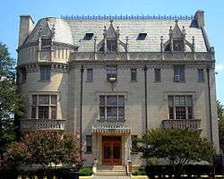 Embassy Building No. 10 |
November 6, 1986 (#86003023) |
3149 Sixteenth St. NW 38°55′52″N 77°02′11″W |
Columbia Heights | |
| 47 | Embassy Gulf Service Station |  Embassy Gulf Service Station |
September 30, 1993 (#93001014) |
2200 P St., NW. 38°54′33″N 77°02′59″W |
Dupont Circle | |
| 48 | Embassy of Mexico-MacVeagh House | 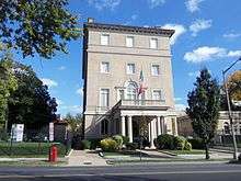 Embassy of Mexico-MacVeagh House |
February 13, 2013 (#13000001) |
2829 16th St., NW 38°55′32″N 77°02′09″W |
Columbia Heights | now the Mexican Cultural Institute |
| 49 | Emory United Methodist Church | 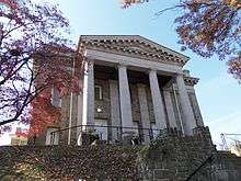 Emory United Methodist Church |
October 13, 2015 (#15000717) |
6100 Georgia Ave., NW. 38°57′51″N 77°01′41″W |
Brightwood | |
| 50 | Engine Company 12 | 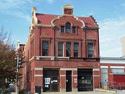 Engine Company 12 |
June 6, 2007 (#07000537) |
1626 N. Capitol St., NW 38°54′43″N 77°00′35″W |
Bloomingdale | |
| 51 | Engine Company No 21 | 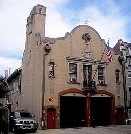 Engine Company No 21 |
June 27, 2007 (#07000594) |
1763 Lanier Place NW 38°55′34″N 77°02′31″W |
Lanier Heights | |
| 52 | Engine Company 22 | 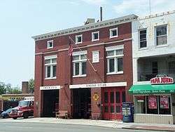 Engine Company 22 |
May 18, 2011 (#11000282) |
5760 Georgia Ave., NW 38°57′36″N 77°01′42″W |
Brightwood Park | |
| 53 | Euclid Apartments | 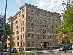 Euclid Apartments |
April 29, 2010 (#10000239) |
1740 Euclid St, NW 38°55′22″N 77°02′26″W |
Adams Morgan | |
| 54 | Evans-Tibbs House |  Evans-Tibbs House |
September 8, 1987 (#86003025) |
1910 Vermont Ave. NW 38°54′58″N 77°01′35″W |
U Street Corridor (Cardozo/Shaw) | |
| 55 | Fire Department Headquarters-Fire Alarm Headquarters |  Fire Department Headquarters-Fire Alarm Headquarters |
May 18, 2011 (#11000286) |
300 McMillan Dr., NW. 38°55′24″N 77°00′47″W |
Bloomingdale | |
| 56 | First African New Church |  First African New Church |
January 29, 2009 (#08001375) |
2105-07 10th St., NW. 38°55′06″N 77°01′33″W |
U Street Corridor (Cardozo/Shaw) | |
| 57 | First Church of Christ, Scientist |  First Church of Christ, Scientist |
January 27, 2015 (#14001206) |
1770 Euclid St., NW. 38°55′23″N 77°02′31″W |
Adams Morgan | |
| 58 | Fort View Apartments |  Fort View Apartments |
January 21, 2010 (#09001264) |
6000-6020 and 6030-6050 13th Place, N.W. 38°57′49″N 77°01′52″W |
Brightwood | |
| 59 | Fourteenth Street Historic District |  Fourteenth Street Historic District |
November 9, 1994 (#94000992) |
Roughly bounded by S, 12th, N and 15th Sts., NW. 38°54′30″N 77°01′47″W |
Logan Circle | |
| 60 | Fraser Mansion |  Fraser Mansion |
August 19, 1975 (#75002054) |
1701 20th St., NW. 38°54′46″N 77°02′42″W |
Dupont Circle | |
| 61 | Frelinghuysen University, Former Classroom Building |  Frelinghuysen University, Former Classroom Building |
November 6, 1995 (#95001228) |
1800 Vermont Ave., NW. 38°54′54″N 77°01′37″W |
U Street Corridor (Cardozo/Shaw) | |
| 62 | The Fulford |  The Fulford |
March 6, 2018 (#100002179) |
2518 17th St. NW 38°55′26″N 77°02′21″W |
Adams Morgan | |
| 63 | Fuller House |  Fuller House |
February 21, 1985 (#85000302) |
2317 Ashmead Pl., NW 38°55′08″N 77°02′53″W |
Adams Morgan | |
| 64 | Nathaniel Parker Gage School |  Nathaniel Parker Gage School |
November 19, 2008 (#08001064) |
2035 2nd St., NW. 38°55′04″N 77°00′52″W |
Bloomingdale | |
| 65 | Garden Club of America Entrance Marker at Georgia Avenue |  Garden Club of America Entrance Marker at Georgia Avenue |
April 29, 2008 (#08000347) |
Georgia Ave. at Kalmia Rd. & Alaska Ave. 38°59′02″N 77°01′36″W |
Shepherd Park | |
| 66 | General Baking Company Bakery | 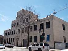 General Baking Company Bakery |
December 24, 2013 (#13000961) |
2146 Georgia Ave., NW. 38°55′06″N 77°01′19″W |
Howard University | |
| 67 | General Federation of Women's Clubs Headquarters | 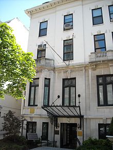 General Federation of Women's Clubs Headquarters |
December 4, 1991 (#91002057) |
1734 N St., NW. 38°54′25″N 77°02′25″W |
Dupont Circle | |
| 68 | James Cardinal Gibbons Memorial | 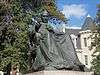 James Cardinal Gibbons Memorial |
October 11, 2007 (#07001051) |
Reservation 309-G, 16th St. & Park Rd. NW. 38°55′59″N 77°02′11″W |
Mount Pleasant | |
| 69 | Glade Apartments | 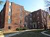 Glade Apartments |
January 31, 2017 (#100000595) |
1370-1372 Ft. Stevens Dr., NW. 38°57′50″N 77°02′00″W |
Brightwood | |
| 70 | Gladstone and Hawarden Apartment Buildings |  Gladstone and Hawarden Apartment Buildings |
September 7, 1994 (#94001034) |
1419 and 1423 R St., NW. 38°54′46″N 77°01′59″W |
Logan Circle | |
| 71 | The Glenn Arms |  The Glenn Arms |
March 6, 2018 (#100002180) |
2524 17th St. NW 38°55′26″N 77°02′21″W |
Adams Morgan | |
| 72 | Samuel Gompers House |  Samuel Gompers House |
September 23, 1974 (#74002161) |
2122 1st St., NW 38°55′02″N 77°00′46″W |
Bloomingdale | |
| 73 | Grace Evangelical Lutheran Church |  Grace Evangelical Lutheran Church |
September 18, 2013 (#13000712) |
4300 16th St., NW. 38°56′36″N 77°02′13″W |
Crestwood | |
| 74 | Grace Reformed Church, Sunday School and Parish House | .JPG) Grace Reformed Church, Sunday School and Parish House |
April 18, 1991 (#91000396) |
1405 15th St., NW. 38°54′32″N 77°02′03″W |
Logan Circle | |
| 75 | Grant Circle Historic District | 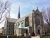 Grant Circle Historic District |
October 13, 2015 (#15000718) |
4-33 Grant Cir., NW. 38°56′35″N 77°01′09″W |
Petworth | |
| 76 | Greater U Street Historic District | Greater U Street Historic District |
December 31, 1998 (#98001557) |
Roughly bounded by New Hampshire Ave., Florida Ave, 6th St., R St., and 16th St. 38°54′59″N 77°01′45″W |
U Street | |
| 77 | Charlotte Forten Grimke House | 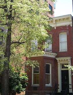 Charlotte Forten Grimke House |
May 11, 1976 (#76002129) |
1608 R St., NW. 38°54′45″N 77°02′13″W |
Dupont Circle | |
| 78 | Samuel Hahnemann Monument | 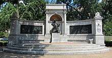 Samuel Hahnemann Monument |
October 11, 2007 (#07001055) |
Reservation 64, Massachusetts & Rhode Island Aves. at Scott Cir. NW 38°54′26″N 77°02′08″W |
Golden Triangle | |
| 79 | Hampshire Garden Apartment Buildings | 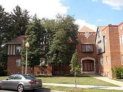 Hampshire Garden Apartment Buildings |
September 9, 1994 (#94001031) |
4912 New Hampshire Ave., 208, 222, 236 and 250 Farragut St., 4915 3rd St. and 215, 225 and 235 Emerson St., NW. 38°57′02″N 77°00′53″W |
Brightwood Park | |
| 80 | Hebrew Home for the Aged and Jewish Social Service Agency |  Hebrew Home for the Aged and Jewish Social Service Agency |
July 25, 2014 (#14000436) |
1125-1131 Spring Rd., NW. 38°56′10″N 77°01′43″W |
Petworth | |
| 81 | Christian Heurich Mansion |  Christian Heurich Mansion |
June 23, 1969 (#69000296) |
1307 New Hampshire Ave., NW. 38°54′29″N 77°02′40″W |
Golden Triangle | |
| 82 | Hilltop Manor |  Hilltop Manor |
July 26, 2007 (#07000810) |
3500 14th St., NW 38°56′05″N 77°02′00″W |
Columbia Heights | |
| 83 | Anthony Holmead Archeological Site |  Anthony Holmead Archeological Site |
April 27, 1995 (#95000527) |
1801 23rd St., NW 38°54′52″N 77°03′01″W |
Kalorama Heights | |
| 84 | Holt House |  Holt House |
April 24, 1973 (#73002090) |
Adams Mill Rd. in the National Zoological Park 38°55′31″N 77°02′50″W |
Rock Creek Park | |
| 85 | Holzbeierlein Bakery |  Holzbeierlein Bakery |
April 10, 2017 (#100000845) |
1815-1827 Wiltberger St., NW 38°54′53″N 77°01′15″W |
U Street Corridor (Cardozo/Shaw) | |
| 86 | The Homestead Apartments |  The Homestead Apartments |
February 14, 2018 (#100002111) |
812 Jefferson St. NW 38°57′18″N 77°01′29″W |
Petworth | |
| 87 | House at 2437 Fifteenth Street, NW |  House at 2437 Fifteenth Street, NW |
March 16, 1988 (#88000171) |
2437 Fifteenth St., NW 38°55′20″N 77°02′11″W |
Columbia Heights | Also known as the Old Hungarian Embassy |
| 88 | Howard Theatre |  Howard Theatre |
February 15, 1974 (#74002162) |
620 T St., NW. 38°54′55″N 77°01′17″W |
U Street Corridor (Cardozo/Shaw) | |
| 89 | Charles Evans Hughes House |  Charles Evans Hughes House |
November 28, 1972 (#72001424) |
2223 R St., NW 38°54′45″N 77°02′58″W |
Kalorama Heights | |
| 90 | Immaculate Conception Church |  Immaculate Conception Church |
September 17, 2003 (#03000946) |
1315 8th St., NW 38°54′26″N 77°01′22″W |
Logan Circle | |
| 91 | Indonesian Embassy |  Indonesian Embassy |
January 18, 1973 (#73002091) |
2020 Massachusetts Ave., NW. 38°54′36″N 77°02′47″W |
Dupont Circle | Also known as the Walsh-McLean House |
| 92 | Ingleside |  Ingleside |
January 8, 1987 (#86002936) |
1818 Newton St. NW 38°56′01″N 77°02′35″W |
Mount Pleasant | |
| 93 | Japanese Embassy | 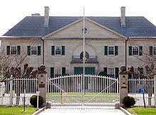 Japanese Embassy |
February 20, 1973 (#73002092) |
2520 Massachusetts Ave., NW. 38°54′54″N 77°03′23″W |
Kalorama Heights | |
| 94 | Jost-Kuhn House | 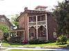 Jost-Kuhn House |
April 5, 2016 (#16000127) |
1354 Madison St. NW 38°57′30″N 77°01′58″W |
Sixteenth Street Heights | |
| 95 | Kalorama Park and Archeological District | 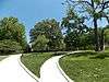 Kalorama Park and Archeological District |
April 21, 2016 (#16000193) |
1875 Columbia Rd., NW 38°55′13″N 77°02′41″W |
Kalorama Heights | House destroyed in 1937 subject of archeological investigation. Also part of Kalorama Historic District. |
| 96 | Kalorama Triangle Historic District | 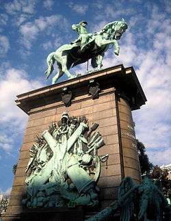 Kalorama Triangle Historic District |
May 4, 1987 (#87000627) |
Roughly bounded by Connecticut Ave., Columbia Rd., and Calvert St. 38°55′14″N 77°02′47″W |
Kalorama Heights | |
| 97 | Kelsey Temple Church of God in Christ |  Kelsey Temple Church of God in Christ |
September 18, 2017 (#16000684) |
1435-1437 Park Rd., NW. 38°55′51″N 77°02′02″W |
Columbia Heights | |
| 98 | Lafayette Apartment Building |  Lafayette Apartment Building |
September 7, 1994 (#94001044) |
1605-1607 7th St., NW. 38°54′42″N 77°01′18″W |
Logan Circle | |
| 99 | John Mercer Langston School |  John Mercer Langston School |
April 9, 2013 (#13000143) |
43 P St., NW. 38°54′35″N 77°00′38″W |
Truxton Circle | |
| 100 | LeDroit Park Historic District |  LeDroit Park Historic District |
February 25, 1974 (#74002165) |
Bounded roughly by Florida and Rhode Island Aves., 2nd and Elm Sts., Howard University 38°54′57″N 77°01′03″W |
LeDroit Park | |
| 101 | George M. Lightfoot House |  George M. Lightfoot House |
January 15, 2014 (#13001070) |
1329 Missouri Ave., NW 38°57′43″N 77°01′51″W |
Brightwood | |
| 102 | Lincoln Industrial Mission-Lincoln Memorial Congregational Church |  Lincoln Industrial Mission-Lincoln Memorial Congregational Church |
February 24, 1995 (#95000163) |
1701 11th St., NW. 38°54′47″N 77°01′36″W |
Logan Circle | |
| 103 | Lincoln Theatre |  Lincoln Theatre |
October 27, 1993 (#93001129) |
1215 U St. NW 38°55′01″N 77°01′46″W |
U Street Corridor (Cardozo/Shaw) | |
| 104 | The Lindens |  The Lindens |
June 4, 1969 (#69000297) |
2401 Kalorama Rd., NW. 38°55′06″N 77°03′13″W |
Kalorama Heights | |
| 105 | Logan Circle Historic District |  Logan Circle Historic District |
June 30, 1972 (#72001426) |
Junction of Rhode Island and Vermont Aves. 38°54′35″N 77°01′49″W |
Logan Circle | |
| 106 | Henry Wadsworth Longfellow Memorial | .jpg) Henry Wadsworth Longfellow Memorial |
October 11, 2007 (#07001056) |
Reservation 150, Connecticut Ave., M & 18th Sts. NW. 38°54′28″N 77°02′30″W |
Golden Triangle | |
| 107 | Lothrop Mansion | .JPG) Lothrop Mansion |
December 20, 1988 (#88001346) |
2001 Connecticut Ave. 38°55′01″N 77°02′48″W |
Adams Morgan | |
| 108 | Luther Place Memorial Church |  Luther Place Memorial Church |
July 16, 1973 (#73002096) |
1226 Vermont Ave., NW. (Thomas Circle) 38°54′25″N 77°01′56″W |
Logan Circle | |
| 109 | MacFarland Junior High School |  MacFarland Junior High School |
December 3, 2018 (#100003212) |
4400 Iowa Ave. NW 38°56′38″N 77°01′39″W |
Petworth | |
| 110 | Manhattan Laundry | 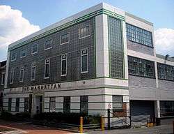 Manhattan Laundry |
November 21, 1994 (#94001327) |
1326-1346 Florida Ave., NW. 38°55′12″N 77°01′51″W |
U Street Corridor (Cardozo/Shaw) | |
| 111 | Mansion at 2401 15th St., NW | 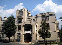 Mansion at 2401 15th St., NW |
January 28, 1991 (#90002147) |
2401 15th St., NW. 38°55′18″N 77°02′06″W |
Columbia Heights | Also known as Meridian Hall |
| 112 | Guglielmo Marconi Memorial | 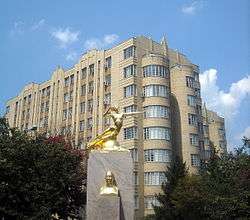 Guglielmo Marconi Memorial |
October 12, 2007 (#07001057) |
Reservation 309A, 16th & Lamont Sts. NW 38°55′56″N 77°02′13″W |
Mount Pleasant | |
| 113 | Mary McLeod Bethune Council House National Historic Site |  Mary McLeod Bethune Council House National Historic Site |
October 15, 1982 (#82005389) |
1318 Vermont Ave., NW 38°54′27″N 77°01′52″W |
Logan Circle | |
| 114 | Massachusetts Avenue Historic District | 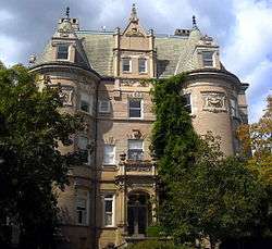 Massachusetts Avenue Historic District |
October 22, 1974 (#74002166) |
Both sides of Massachusetts Ave. between 17th St. and Observatory Circle, NW 38°54′50″N 77°03′06″W |
Dupont Circle, Kalorama Heights and Woodland-Normanstone Terrace | |
| 115 | The Maycroft |  The Maycroft |
October 17, 2012 (#12000864) |
1474 Columbia Rd., NW. 38°55′37″N 77°02′07″W |
Columbia Heights | |
| 116 | McMillan Park Reservoir Historic District | 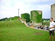 McMillan Park Reservoir Historic District |
February 20, 2013 (#13000022) |
Roughly bounded by Hobart Pl., NW, Michigan Ave., NW, 1st, 4th, Bryant & North Capitol Sts., NW 38°55′28″N 77°00′53″W |
Bloomingdale | |
| 117 | McCormick Apartments |  McCormick Apartments |
April 3, 1973 (#73002100) |
1785 Massachusetts Ave., NW 38°54′33″N 77°02′30″W |
Dupont Circle | Also known as the Andrew Mellon Building |
| 118 | Meeting House of the Friends Meeting of Washington |  Meeting House of the Friends Meeting of Washington |
September 6, 1990 (#90001294) |
2111 Florida Ave., NW. 38°54′46″N 77°02′52″W |
Kalorama Heights | |
| 119 | Meridian Hill Historic District |  Meridian Hill Historic District |
May 21, 2014 (#14000211) |
2201-2319 15th, 2400-2600 blocks 15th & 16th, 2600-3000 blocks 16th Sts., NW., 1600 blk. of Crescent Pl., NW. 38°55′16″N 77°02′10″W |
Columbia Heights | |
| 120 | Meridian Hill Park | 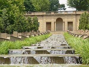 Meridian Hill Park |
October 25, 1974 (#74000273) |
Bounded by 16th, Euclid, 15th, and W Sts., NW. 38°55′16″N 77°02′10″W |
Columbia Heights | |
| 121 | Meridian House |  Meridian House |
May 8, 1973 (#73002101) |
1630 Crescent Pl., NW. 38°55′13″N 77°02′18″W |
Adams Morgan | |
| 122 | Meridian Manor |  Meridian Manor |
March 29, 2001 (#01000324) |
1424 Chapin St., NW 38°55′17″N 77°01′59″W |
Columbia Heights | |
| 123 | Meridian Mansions |  Meridian Mansions |
July 28, 1983 (#83001417) |
2400 16th St. NW 38°55′17″N 77°02′13″W |
Adams Morgan | |
| 124 | Military Road School |  Military Road School |
July 25, 2003 (#03000674) |
1375 Missouri Ave., NW 38°57′43″N 77°01′58″W |
Brightwood | |
| 125 | Miner Normal School |  Miner Normal School |
October 11, 1991 (#91001490) |
2565 Georgia Ave., NW. 38°55′24″N 77°01′21″W |
Howard University | |
| 126 | Mount Pleasant Historic District |  Mount Pleasant Historic District |
October 5, 1987 (#87001726) |
Roughly bounded by Sixteenth & Harvard Sts., Rock Creek Church Rd., & Adams Mill Rd. 38°55′53″N 77°02′22″W |
Mount Pleasant | |
| 127 | Mount Vernon Square Historic District |  Mount Vernon Square Historic District |
September 3, 1999 (#99001070) |
Roughly bounded by New York Ave., 7th St., N St., and 1st St. NW 38°54′24″N 77°01′04″W |
Mount Vernon Square | Extends to both sides of M Street |
| 128 | Mount Vernon West Historic District |  Mount Vernon West Historic District |
September 9, 1999 (#99001071) |
Roughly bounded by Rhode Island Ave., 6th St., Massachusetts Ave., and Vermont Ave. 38°54′26″N 77°01′34″W |
Mount Vernon Square | Extends to both sides of M Street |
| 129 | Northumberland Apartments |  Northumberland Apartments |
March 25, 1980 (#80004304) |
2039 New Hampshire Ave., NW 38°55′04″N 77°02′09″W |
U Street | |
| 130 | Northeast No. 2 Boundary Marker of the Original District of Columbia | _NE_2.jpg) Northeast No. 2 Boundary Marker of the Original District of Columbia |
November 1, 1996 (#96001257) |
6980 Maple Ave., NW 38°58′32″N 77°00′53″W |
Takoma | |
| 131 | O Street Market |  O Street Market |
April 28, 1995 (#95000442) |
1400 7th St., NW. 38°54′31″N 77°01′11″W |
Logan Circle | |
| 132 | Olympia Apartments |  Olympia Apartments |
June 9, 2003 (#03000534) |
1368 Euclid St. NW 38°55′25″N 77°01′54″W |
Columbia Heights | |
| 133 | General Oliver Otis Howard House |  General Oliver Otis Howard House |
February 12, 1974 (#74002163) |
607 Howard Pl. 38°55′23″N 77°01′20″W |
Howard University | |
| 134 | Thomas Nelson Page House |  Thomas Nelson Page House |
September 5, 1975 (#75002053) |
1759 R St., NW. 38°54′46″N 77°02′28″W |
Dupont Circle | |
| 135 | Park Road Courts |  Park Road Courts |
July 3, 2012 (#12000380) |
1346 Park Rd., NW 38°55′49″N 77°01′53″W |
Columbia Heights | |
| 136 | Park Tower |  Park Tower |
October 30, 1989 (#89001744) |
2440 Sixteenth St., NW. 38°55′19″N 77°02′14″W |
Adams Morgan | |
| 137 | Park View Christian Church |  Park View Christian Church |
December 29, 2014 (#14001082) |
625 Park Rd., NW. 38°55′59″N 77°01′22″W |
Park View | |
| 138 | Park View Playground and Field House |  Park View Playground and Field House |
February 24, 2014 (#14000014) |
693 Otis Pl., NW. 38°56′06″N 77°01′17″W |
Park View | |
| 139 | Park View School | Park View School |
May 1, 2013 (#13000213) |
3570 Warder Street. NW,. 38°56′04″N 77°01′16″W |
Park View | |
| 140 | Park Vista and Pine Manor Apartments |  Park Vista and Pine Manor Apartments |
October 18, 2016 (#16000725) |
5807-5825 14th St., NW. 38°57′40″N 77°02′00″W |
Brightwood | |
| 141 | W. H. Penland & Company |  W. H. Penland & Company |
December 29, 1994 (#94001510) |
1211-1219 13th St., NW. 38°54′22″N 77°01′45″W |
Logan Circle | Also known as Proctor Alley Livery Stable and Mount Vernon Stables |
| 142 | Frances Perkins House |  Frances Perkins House |
July 17, 1991 (#91002048) |
2326 California St., NW. 38°54′55″N 77°03′07″W |
Kalorama Heights | |
| 143 | Petworth Branch Library |  Petworth Branch Library |
December 3, 2018 (#100003149) |
4200 Kansas Ave. NW 38°56′32″N 77°01′34″W |
Petworth | |
| 144 | Petworth Gardens |  Petworth Gardens |
November 10, 2008 (#08001029) |
124, 126, 128, and 130 Webster St., NW. 38°56′39″N 77°00′47″W |
Petworth | |
| 145 | Duncan Phillips House |  Duncan Phillips House |
August 14, 1973 (#73002108) |
1600-1614 21st St., NW. 38°54′40″N 77°02′51″W |
Dupont Circle | |
| 146 | Pierce-Klingle Mansion |  Pierce-Klingle Mansion |
October 10, 1973 (#73000223) |
3545 Williamsburg Lane, NW 38°56′18″N 77°03′00″W |
Cleveland Park | |
| 147 | Pink Palace |  Pink Palace |
August 5, 1991 (#91000916) |
2600 16th St., NW. 38°55′23″N 77°02′13″W |
Adams Morgan | |
| 148 | The Plymouth | 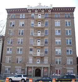 The Plymouth |
June 2, 1986 (#86001242) |
1236 Eleventh St. NW 38°54′23″N 77°01′39″W |
Logan Circle | |
| 149 | Prince Hall Masonic Temple | 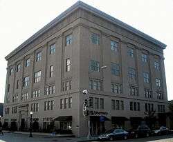 Prince Hall Masonic Temple |
September 15, 1983 (#83001418) |
1000 U St., NW 38°55′00″N 77°01′35″W |
U Street Corridor (Cardozo/Shaw) | |
| 150 | Potomac Electric Power Company Substation No. 13 |  Potomac Electric Power Company Substation No. 13 |
June 3, 2019 (#100004072) |
1001 Harvard St. NW 38°55′36″N 77°01′35″W |
Columbia Heights | |
| 151 | Potomac Electric Power Company Substation No. 25 |  Potomac Electric Power Company Substation No. 25 |
June 6, 2019 (#100004073) |
2119 Champlain St. NW 38°55′08″N 77°02′25″W |
Adams Morgan | |
| 152 | Walter Reed Army Medical Center (WRAMC) Historic District | 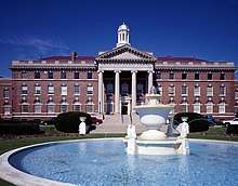 Walter Reed Army Medical Center (WRAMC) Historic District |
March 9, 2015 (#15000061) |
6900 Georgia Ave., NW 38°58′30″N 77°01′48″W |
Brightwood | |
| 153 | Zalmon Richards House | 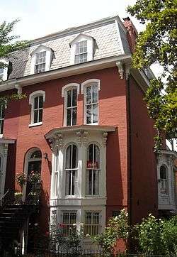 Zalmon Richards House |
October 15, 1966 (#66000866) |
1301 Corcoran St., NW 38°54′42″N 77°01′49″W |
Logan Circle | |
| 154 | Riggs-Tompkins Building | 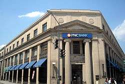 Riggs-Tompkins Building |
January 5, 1987 (#86002915) |
1403-1405 and 1413 Park Rd. NW and 3300, 3306-3316, 3328, and 3336 Fourteenth St. NW 38°55′50″N 77°01′59″W |
Columbia Heights | |
| 155 | Rock Creek and Potomac Parkway Historic District | 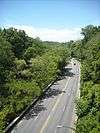 Rock Creek and Potomac Parkway Historic District |
May 4, 2005 (#05000367) |
Rock Creek and Potomac Parkway 38°54′47″N 77°03′16″W |
NW | Extends to both sides of Rock Creek |
| 156 | Rock Creek Church Yard and Cemetery | 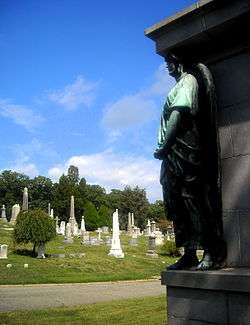 Rock Creek Church Yard and Cemetery |
August 12, 1977 (#77001498) |
Webster St. and Rock Creek Church Rd., NW. 38°56′52″N 77°00′47″W |
Fort Totten | |
| 157 | Rock Creek Park Historic District | 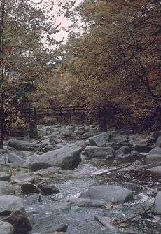 Rock Creek Park Historic District |
October 23, 1991 (#91001524) |
Roughly, Rock Creek Park from Klingle Rd. to Montgomery County line 38°57′27″N 77°02′42″W |
NW | See Rock Creek Park. Extends to both sides of Rock Creek. |
| 158 | Theodore Roosevelt Senior High School | 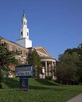 Theodore Roosevelt Senior High School |
December 3, 2018 (#100003213) |
4301 13th St. NW 38°56′37″N 77°01′47″W |
Petworth | |
| 159 | St. Luke's Episcopal Church | 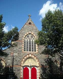 St. Luke's Episcopal Church |
May 11, 1976 (#76002131) |
15th and Church Sts., NW 38°54′36″N 77°02′07″W |
Dupont Circle | NHL - First independent black Episcopal parish in Washington |
| 160 | St. Matthew's Cathedral and Rectory | 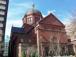 St. Matthew's Cathedral and Rectory |
January 24, 1974 (#74002173) |
1725-1739 Rhode Island Ave., NW. 38°54′22″N 77°02′24″W |
Golden Triangle | |
| 161 | St. Paul's Episcopal Church | 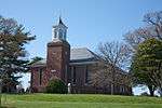 St. Paul's Episcopal Church |
March 16, 1972 (#72001433) |
Rock Creek Church Rd. and Webster St., NW. 38°56′49″N 77°00′44″W |
Fort Totten | |
| 162 | Brigadier Gen. George P. Scriven House | 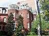 Brigadier Gen. George P. Scriven House |
August 27, 2013 (#13000620) |
1300 New Hampshire Ave., NW. 38°54′27″N 77°02′44″W |
Dupont Circle | |
| 163 | Seventh Street Savings Bank | 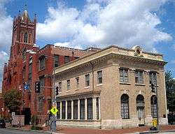 Seventh Street Savings Bank |
September 17, 2003 (#03000944) |
1300 7th St. NW 38°54′26″N 77°01′20″W |
Logan Circle | |
| 164 | Shaw Junior High School | 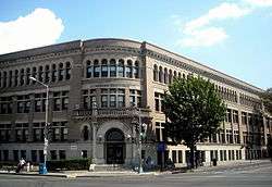 Shaw Junior High School |
December 22, 2008 (#08001206) |
7th St., and Rhode Island Ave., NW 38°54′44″N 77°01′19″W |
Logan Circle | |
| 165 | Sheridan-Kalorama Historic District | 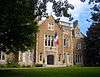 Sheridan-Kalorama Historic District |
October 30, 1989 (#89001743) |
Roughly bounded by Rock Creek Park, Connecticut Ave., NW., Florida Ave., NW., 22nd St., NW., and P St., NW. 38°54′56″N 77°03′06″W |
Kalorama Heights | |
| 166 | Billy Simpson's House of Seafood and Steaks | 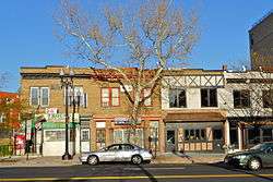 Billy Simpson's House of Seafood and Steaks |
March 17, 2009 (#09000152) |
3815 Georgia Avenue, NW 38°56′17″N 77°01′27″W |
Petworth | |
| 167 | Sixteenth Street Historic District |  Sixteenth Street Historic District |
August 25, 1978 (#78003060) |
16th St. between Scott Cir. and Florida Ave. NW 38°54′46″N 77°02′13″W |
Dupont Circle | |
| 168 | John Fox Slater Elementary School |  John Fox Slater Elementary School |
April 9, 2013 (#13000144) |
45 P St., NW. 38°54′35″N 77°00′38″W |
Truxton Circle | Documentation |
| 169 | Southern Aid Society-Dunbar Theater Building |  Southern Aid Society-Dunbar Theater Building |
November 6, 1986 (#86003071) |
1901-1903 Seventh St. NW 38°54′56″N 77°01′19″W |
U Street Corridor (Cardozo/Shaw) | |
| 170 | Spencer Carriage House and Stable |  Spencer Carriage House and Stable |
August 29, 1996 (#96000894) |
2123 Twining Crt., NW 38°54′33″N 77°02′53″W |
Dupont Circle | |
| 171 | Standard Material Company-Gyro Motor Company |  Standard Material Company-Gyro Motor Company |
September 30, 2014 (#14000799) |
770-774 Girard St. NW 38°55′33″N 77°01′30″W |
Pleasant Plains | |
| 172 | Strivers' Section Historic District |  Strivers' Section Historic District |
February 6, 1985 (#85000239) |
Roughly bounded by New Hampshire and Florida Aves., 17th and 18th Sts. along T, U, and Willard Sts. NW 38°55′00″N 77°02′26″W |
Dupont Circle | |
| 173 | Studio House |  Studio House |
April 27, 1995 (#95000528) |
2306 Massachusetts Ave., NW. 38°54′43″N 77°03′05″W |
Kalorama Heights | |
| 174 | Sulgrave Club |  Sulgrave Club |
December 5, 1972 (#72001434) |
1801 Massachusetts Ave., NW. 38°54′34″N 77°02′32″W |
Dupont Circle | Also known as Herbert Wadsworth House |
| 175 | Charles Sumner School |  Charles Sumner School |
December 20, 1979 (#79003150) |
17th and M Sts., NW 38°54′21″N 77°02′18″W |
Golden Triangle | |
| 176 | Tabard Inn | .jpg) Tabard Inn |
June 22, 2020 (#100005295) |
1737-1739-1741 N St. NW 38°54′27″N 77°02′24″W |
Dupont Circle | |
| 177 | Takoma Park Historic District |  Takoma Park Historic District |
June 30, 1983 (#83001416) |
Roughly bounded by DC/MD boundary, 7th, Piney Branch, Aspen, and Fern Sts. 38°58′31″N 77°01′11″W |
Takoma | |
| 178 | Tenth Precinct Station House |  Tenth Precinct Station House |
November 10, 1986 (#86003063) |
750 Park Rd. NW 38°55′57″N 77°01′32″W |
Park View | |
| 179 | Mary Church Terrell House | .jpg) Mary Church Terrell House |
May 15, 1975 (#75002055) |
326 T St., NW 38°54′56″N 77°01′00″W |
Le Droit Park | |
| 180 | Third Baptist Church |  Third Baptist Church |
November 26, 2008 (#08001094) |
1546 5th St., NW. 38°54′38″N 77°01′09″W |
Logan Circle | |
| 181 | Alma Thomas House |  Alma Thomas House |
July 28, 1987 (#86002923) |
1530 Fifteenth St. NW 38°54′39″N 77°02′06″W |
Dupont Circle | |
| 182 | Tivoli Theatre | 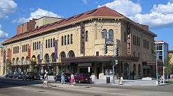 Tivoli Theatre |
April 10, 1985 (#85000716) |
3301-3325 14th St. NW 38°55′50″N 77°02′39″W |
Columbia Heights | |
| 183 | Trinity Towers | 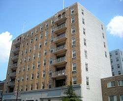 Trinity Towers |
December 26, 2001 (#01001367) |
3023 14th St., NW 38°55′41″N 77°01′57″W |
Columbia Heights | |
| 184 | Truck Company F | 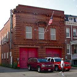 Truck Company F |
June 6, 2007 (#07000539) |
1336-1338 Park Rd. NW 38°55′49″N 77°01′54″W |
Columbia Heights | |
| 185 | True Reformer Building | 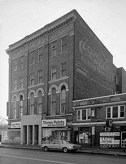 True Reformer Building |
January 9, 1989 (#88003063) |
1200 U St., NW 38°55′00″N 77°01′43″W |
U Street Corridor (Cardozo/Shaw) | |
| 186 | Tucker House and Myers House |  Tucker House and Myers House |
August 14, 1973 (#73002119) |
2310-2320 S St., NW. 38°54′50″N 77°03′07″W |
Kalorama Heights | |
| 187 | Twin Oaks Playground and Field House |  Twin Oaks Playground and Field House |
February 3, 2020 (#100004941) |
4025 14th St. NW 38°56′26″N 77°01′56″W |
Petworth | |
| 188 | U.S. Soldiers' and Airmen's Home | %2C_Washington%2C_DC.tif.jpg) U.S. Soldiers' and Airmen's Home |
February 11, 1974 (#74002176) |
Rock Creek Church Rd., NW 38°56′27″N 77°00′44″W |
Park View, Petworth | |
| 189 | United States Daughters of 1812, National Headquarters |  United States Daughters of 1812, National Headquarters |
December 12, 1997 (#97001469) |
1461 Rhode Island Ave., NW 38°54′30″N 77°02′02″W |
Logan Circle | |
| 190 | Van View |  Van View |
December 29, 2014 (#14001083) |
7714 13th St., NW. 38°59′02″N 77°01′48″W |
Shepherd Park | |
| 191 | Walsh Stable |  Walsh Stable |
November 6, 1986 (#86002932) |
1511 (rear) 22nd St. NW 38°54′36″N 77°02′54″W |
Dupont Circle | |
| 192 | Warder-Totten House |  Warder-Totten House |
April 14, 1972 (#72001437) |
2633 16th St., NW. 38°55′26″N 77°02′10″W |
Columbia Heights | |
| 193 | Wardman Flats |  Wardman Flats |
October 10, 2019 (#100004500) |
Square 519 bounded by 3rd, 4th& R Sts., & Florida Ave. NW 38°54′47″N 77°00′57″W |
||
| 194 | Wardman Row |  Wardman Row |
July 27, 1984 (#84000871) |
1416-1440 R St. NW 38°54′44″N 77°02′02″W |
Logan Circle | |
| 195 | Washington Animal Rescue League Animal Shelter |  Washington Animal Rescue League Animal Shelter |
June 22, 2020 (#1000052968) |
71 O St. NW 38°54′31″N 77°00′41″W |
Truxton Circle | |
| 196 | Washington Club |  Washington Club |
December 5, 1972 (#72001438) |
15 Dupont Circle, NW. 38°54′36″N 77°02′33″W |
Dupont Circle | Also known as Patterson House |
| 197 | Washington Heights Historic District |  Washington Heights Historic District |
September 27, 2006 (#06000875) |
Bounded by Columbia Rd., NW, 19th St. NW, 18th St. NW and Florida Ave. NW 38°55′07″N 77°02′35″W |
Adams Morgan | |
| 198 | Margaret Murray Washington School |  Margaret Murray Washington School |
November 22, 2011 (#11000843) |
27 O St., NW 38°54′31″N 77°00′37″W |
Truxton Circle | |
| 199 | Washington Railway and Electric Company Garage |  Washington Railway and Electric Company Garage |
February 5, 2014 (#13001133) |
2112 Georgia Ave., NW. 38°55′06″N 77°01′20″W |
Howard University | |
| 200 | Daniel Webster Memorial | 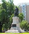 Daniel Webster Memorial |
October 12, 2007 (#07001063) |
Reservation 62, Massachusetts and Rhode Island Aves. at Scott Circle, NW. 38°54′26″N 77°02′14″W |
NW | |
| 201 | Marjorie Webster Junior College Historic District |  Marjorie Webster Junior College Historic District |
February 24, 2014 (#14000015) |
1638 & 1640 Kalmia Rd., NW., 7753 & 7775 17th St., NW. 38°59′08″N 77°02′19″W |
Colonial Village | |
| 202 | Phillis Wheatley YWCA |  Phillis Wheatley YWCA |
October 6, 1983 (#83003532) |
901 Rhode Island Ave. NW 38°54′42″N 77°01′28″W |
Logan Circle | |
| 203 | David White House |  David White House |
January 7, 1976 (#76002133) |
1459 Girard St., NW 38°55′32″N 77°02′04″W |
Columbia Heights | |
| 204 | White-Meyer House |  White-Meyer House |
January 20, 1988 (#87002293) |
1624 Crescent Pl., NW 38°55′13″N 77°02′15″W |
Adams Morgan | |
| 205 | Whitelaw Hotel |  Whitelaw Hotel |
July 14, 1993 (#93000595) |
1839 13th St. NW 38°54′55″N 77°01′45″W |
U Street Corridor (Cardozo/Shaw) | |
| 206 | Whittemore House |  Whittemore House |
July 16, 1973 (#73002126) |
1526 New Hampshire Ave., NW. 38°54′39″N 77°02′35″W |
Dupont Circle | |
| 207 | James Ormond Wilson Normal School |  James Ormond Wilson Normal School |
March 31, 2015 (#15000115) |
1100 Harvard St., NW 38°55′36″N 77°01′38″W |
Columbia Heights | |
| 208 | Woodrow Wilson House | 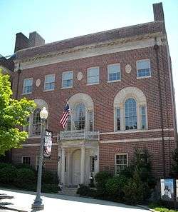 Woodrow Wilson House |
October 15, 1966 (#66000873) |
2340 S St., NW 38°54′49″N 77°03′08″W |
Kalorama Heights | |
| 209 | Windsor Lodge | 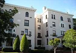 Windsor Lodge |
December 8, 1976 (#76002134) |
2139-2141 Wyoming Ave., NW 38°55′03″N 77°02′57″W |
Kalorama Heights | |
| 210 | Carter G. Woodson House | 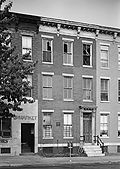 Carter G. Woodson House |
May 11, 1976 (#76002135) |
1538 9th St., NW 38°54′36″N 77°01′27″W |
Logan Circle | |
| 211 | Robert Simpson Woodward House | 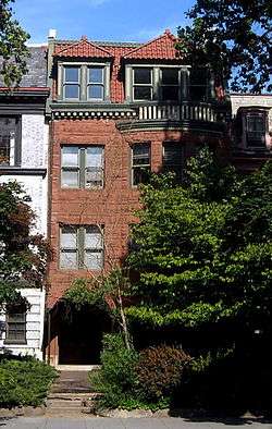 Robert Simpson Woodward House |
January 7, 1976 (#76002136) |
1513 16th St., NW 38°54′32″N 77°02′11″W |
Dupont Circle | Home of geologist Robert Simpson Woodward |
| 212 | Wyoming Apartments |  Wyoming Apartments |
September 27, 1983 (#83001414) |
2022 Columbia Rd., NW 38°55′02″N 77°02′45″W |
Adams Morgan |
gollark: "Actively harm humanity" is waaay too vague. This is a bad idea.
gollark: <@330678593904443393> Burning people because they don't agree on things is an awful idea.
gollark: <@357932279231807488> They did release the full model IIRC.
gollark: Why not run it on... your actual computer? Is there some sort of importable Pyth implementation?
gollark: I think the main issue is just in creating a process; that is *slooooow*.
See also
| Wikimedia Commons has media related to National Register of Historic Places in Washington, D.C.. |
References
- "National Register of Historic Places: Weekly List Actions". National Park Service, United States Department of the Interior. Retrieved on August 14, 2020.
- Numbers represent an ordering by significant words. Various colorings, defined here, differentiate National Historic Landmarks and historic districts from other NRHP buildings, structures, sites or objects.
- The eight-digit number below each date is the number assigned to each location in the National Register Information System database, which can be viewed by clicking the number.
- Dillon, James (July 30, 1976), National Register of Historic Places Inventory — Nomination Form for Federal Properties: Defenses of Washington (Civil War) (PDF), archived (PDF) from the original on February 15, 2017, retrieved February 18, 2019.
| Topics | |
|---|---|
| Lists by state |
|
| Lists by insular areas | |
| Lists by associated state | |
| Other areas | |
| Related | |
| |
This article is issued from Wikipedia. The text is licensed under Creative Commons - Attribution - Sharealike. Additional terms may apply for the media files.