National Register of Historic Places listings in Weakley County, Tennessee
This is a list of the National Register of Historic Places listings in Weakley County, Tennessee.
Location of Weakley County in Tennessee
This is intended to be a complete list of the properties and districts on the National Register of Historic Places in Weakley County, Tennessee, United States. Latitude and longitude coordinates are provided for many National Register properties and districts; these locations may be seen together in a map.[1]
There are 11 properties and districts listed on the National Register in the county. Another site was once listed but has been removed.
| Anderson – Bedford – Benton – Bledsoe – Blount – Bradley – Campbell – Cannon – Carroll – Carter – Cheatham – Chester – Claiborne – Clay – Cocke – Coffee – Crockett – Cumberland – Davidson – Decatur – DeKalb – Dickson – Dyer – Fayette – Fentress – Franklin – Gibson – Giles – Grainger – Greene – Grundy – Hamblen – Hamilton – Hancock – Hardeman – Hardin – Hawkins – Haywood – Henderson – Henry – Hickman – Houston – Humphreys – Jackson – Jefferson – Johnson – Knox – Lake – Lauderdale – Lawrence – Lewis – Lincoln – Loudon – Macon – Madison – Marion – Marshall – Maury – McMinn – McNairy – Meigs – Monroe – Montgomery – Moore – Morgan – Obion – Overton – Perry – Pickett – Polk – Putnam – Rhea – Roane – Robertson – Rutherford – Scott – Sequatchie – Sevier – Shelby – Smith – Stewart – Sullivan – Sumner – Tipton – Trousdale – Unicoi – Union – Van Buren – Warren – Washington – Wayne – Weakley – White – Williamson – Wilson |
- This National Park Service list is complete through NPS recent listings posted August 14, 2020.[2]
Current listings
| [3] | Name on the Register[4] | Image | Date listed[5] | Location | City or town | Description |
|---|---|---|---|---|---|---|
| 1 | Dr. Robert W. Bandy House | August 9, 1984 (#84003726) |
College St. 36°12′45″N 88°36′48″W |
Gleason | ||
| 2 | William Parker Caldwell House | 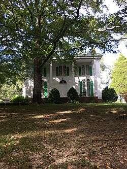 William Parker Caldwell House |
March 9, 1979 (#79002485) |
Off State Route 22 36°21′55″N 88°53′37″W |
Gardner | |
| 3 | Cary Lawn | June 18, 1992 (#92000779) |
321 Linden St. 36°17′16″N 88°42′18″W |
Dresden | ||
| 4 | First Christian Church | November 15, 2002 (#02001338) |
College St. 36°12′46″N 88°36′49″W |
Gleason | ||
| 5 | Ivandale | 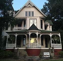 Ivandale |
March 25, 1982 (#82004067) |
115 N. McCombs St. 36°20′38″N 88°50′49″W |
Martin | |
| 6 | W.T. Lawler House | March 25, 1982 (#82004068) |
229 University St. 36°20′34″N 88°51′24″W |
Martin | ||
| 7 | Marshalldale | March 25, 1982 (#82004069) |
115 Ryan Ave. 36°20′12″N 88°50′57″W |
Martin | ||
| 8 | Capt. William Sims House | March 25, 1982 (#82004066) |
Route 2, Liberty Rd. 36°12′13″N 88°42′26″W |
Greenfield | ||
| 9 | University Street Historic District | July 5, 1996 (#96000750) |
225-248 University St. 36°20′35″N 88°51′23″W |
Martin | ||
| 10 | US Post Office | July 5, 1996 (#96000751) |
100 Main St. 36°20′37″N 88°50′21″W |
Martin | ||
| 11 | Varsity Theatre | July 16, 2010 (#10000464) |
104 Oxford St. 36°20′36″N 88°51′05″W |
Martin |
Former listings
| [3] | Name on the Register | Image | Date listed/removed | Location | City or town | Summary |
|---|---|---|---|---|---|---|
| 1 | Oakland | Listed April 22, 1982, removed March 17, 2010 (#82004065) |
State Routes 22 and 89 36°17′05″N 88°43′45″W |
Dresden |
gollark: It exists, but it can still be detected fairly easily.
gollark: I mean, technically yes, but it's hard and annoying to do.
gollark: Well, yes, but IDs aren't scarce resources and I bet people will use them in ways which would give them IDs anyway.
gollark: Idea: install spyware on all the computers you provide so your logs arem ore interesting.
gollark: I tend to just try and automate AE2 as fast as possible.
See also
| Wikimedia Commons has media related to National Register of Historic Places in Weakley County, Tennessee. |
References
- The latitude and longitude information provided in this table was derived originally from the National Register Information System, which has been found to be fairly accurate for about 99% of listings. Some locations in this table may have been corrected to current GPS standards.
- "National Register of Historic Places: Weekly List Actions". National Park Service, United States Department of the Interior. Retrieved on August 14, 2020.
- Numbers represent an ordering by significant words. Various colorings, defined here, differentiate National Historic Landmarks and historic districts from other NRHP buildings, structures, sites or objects.
- "National Register Information System". National Register of Historic Places. National Park Service. April 24, 2008.
- The eight-digit number below each date is the number assigned to each location in the National Register Information System database, which can be viewed by clicking the number.
| Topics | |
|---|---|
| Lists by state |
|
| Lists by insular areas | |
| Lists by associated state | |
| Other areas | |
| Related | |
| |
Municipalities and communities of Weakley County, Tennessee, United States | ||
|---|---|---|
| Cities | Weakley County map | |
| Towns | ||
| Unincorporated communities | ||
| Footnotes | ‡This populated place also has portions in an adjacent county or counties | |
This article is issued from Wikipedia. The text is licensed under Creative Commons - Attribution - Sharealike. Additional terms may apply for the media files.