National Register of Historic Places listings in Logan County, Arkansas
This is a list of the National Register of Historic Places listings in Logan County, Arkansas.
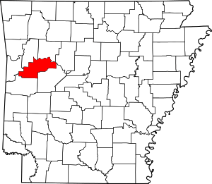
Location of Logan County in Arkansas
This is intended to be a complete list of the properties and districts on the National Register of Historic Places in Logan County, Arkansas, United States. The locations of National Register properties and districts for which the latitude and longitude coordinates are included below, may be seen in a map.[1]
There are 44 properties and districts listed on the National Register in the county. One additional listing has been removed from the Register.
- This National Park Service list is complete through NPS recent listings posted August 14, 2020.[2]
Current listings
| [3] | Name on the Register[4] | Image | Date listed[5] | Location | City or town | Description |
|---|---|---|---|---|---|---|
| 1 | American Legion Post No. 121 | 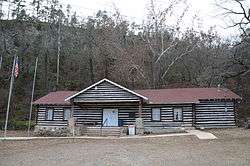 American Legion Post No. 121 |
June 20, 1995 (#95000758) |
Legion Hut Rd., off Highway 107 35°16′33″N 93°44′03″W |
Paris | |
| 2 | Anhalt Barn | 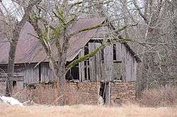 Anhalt Barn |
February 25, 1993 (#93000087) |
County Road 68 35°17′56″N 93°28′46″W |
New Blaine | |
| 3 | Arkansas Tuberculosis Sanatorium Historic District | 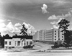 Arkansas Tuberculosis Sanatorium Historic District |
October 5, 2006 (#06000414) |
Eastern end of Highway 116 35°05′48″N 93°54′54″W |
Booneville | |
| 4 | Bank of Booneville Building | 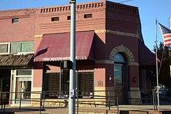 Bank of Booneville Building |
April 26, 1978 (#78000608) |
1 W. Main St. 35°08′26″N 93°55′17″W |
Booneville | |
| 5 | Booneville Commercial Historic District | 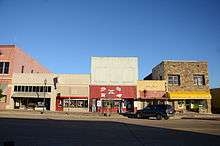 Booneville Commercial Historic District |
June 4, 2013 (#13000351) |
East side of 100 and 200 blocks of North Broadway Avenue 35°08′22″N 93°55′18″W |
Booneville | |
| 6 | Booneville Methodist Episcopal Church South | 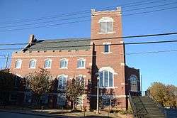 Booneville Methodist Episcopal Church South |
May 25, 2011 (#11000301) |
355 N. Broadway 35°08′28″N 93°55′20″W |
Booneville | |
| 7 | Burnett Springs |  Burnett Springs |
September 22, 1995 (#95001126) |
End of County Road 704, approximately 1 mile (1.6 km) east of Corley 35°12′58″N 93°38′34″W |
Corley | |
| 8 | Chicago, Rock Island, and Pacific Railroad Depot | February 14, 1978 (#78000607) |
Off Highway 10 35°07′47″N 93°42′34″W |
Blue Mountain | ||
| 9 | Dr. Stephen N. Chism House | 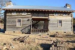 Dr. Stephen N. Chism House |
August 16, 1994 (#94000853) |
Eastern side of Highway 23, south of its junction with Highway 217 35°13′03″N 93°56′23″W |
Booneville | |
| 10 | Cove Creek Bridge | 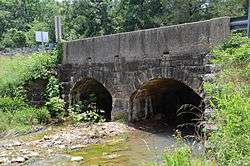 Cove Creek Bridge |
May 26, 1995 (#95000645) |
Highway 309 over Cove Creek 35°11′35″N 93°37′24″W |
Corley | |
| 11 | Cove Creek Tributary Bridge | 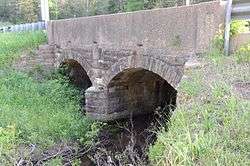 Cove Creek Tributary Bridge |
May 26, 1995 (#95000644) |
Highway 309 over a tributary of Cove Creek 35°14′31″N 93°38′22″W |
Corley | |
| 12 | Cove Lake Bathhouse | 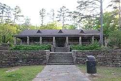 Cove Lake Bathhouse |
September 11, 1995 (#94001617) |
Forest Service Rd. 1608A in the Ozark-St. Francis National Forest 35°13′44″N 93°37′45″W |
Corley | |
| 13 | Cove Lake Spillway Dam-Bridge | 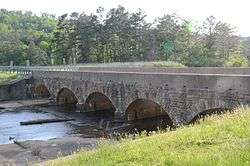 Cove Lake Spillway Dam-Bridge |
September 11, 1995 (#94001618) |
Highway 309, 9 miles (14 km) south of Paris in the Ozark-St. Francis National Forest 35°13′58″N 93°37′45″W |
Corley | |
| 14 | Elizabeth Hall | 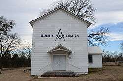 Elizabeth Hall |
May 4, 1976 (#76000428) |
Off Highway 22 35°17′03″N 93°24′32″W |
New Blaine | |
| 15 | Farmer's State Bank | 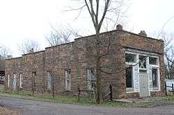 Farmer's State Bank |
July 11, 2002 (#02000757) |
100 Seallars St. 35°17′24″N 93°25′16″W |
New Blaine | |
| 16 | Farmers and Merchants Bank-Masonic Lodge | 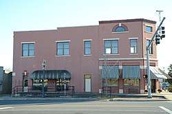 Farmers and Merchants Bank-Masonic Lodge |
November 19, 1993 (#93001257) |
288 N. Broadway 35°08′24″N 93°55′17″W |
Booneville | |
| 17 | First Christian Church | 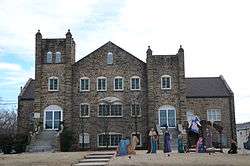 First Christian Church |
June 30, 1995 (#95000791) |
120 E. Walnut St. 35°17′29″N 93°43′41″W |
Paris | |
| 18 | John Gabriel Fort House | 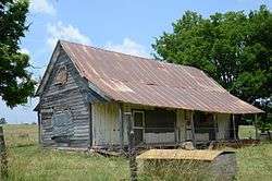 John Gabriel Fort House |
March 28, 1996 (#96000331) |
Reveille Valley Rd., southeast of Driggs 35°12′26″N 93°44′05″W |
Driggs | |
| 19 | Tolbert E. Gill House | 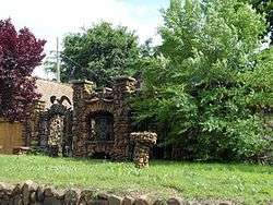 Tolbert E. Gill House |
September 30, 1993 (#93001024) |
Highway 22 west of its junction with Highway 109 35°17′31″N 93°44′00″W |
Paris | |
| 20 | Jack Creek Bathhouse | 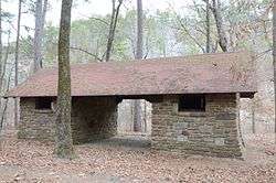 Jack Creek Bathhouse |
October 21, 1993 (#93001093) |
Forest Service Road 141, southwest of Sugar Grove, in the Ouachita National Forest 35°02′04″N 93°50′44″W |
Sugar Grove | |
| 21 | Freeborn T. Lasater House | 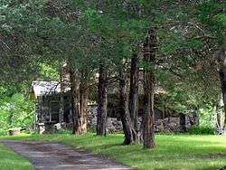 Freeborn T. Lasater House |
July 11, 2002 (#02000756) |
494 Highway 197 35°17′22″N 93°25′06″W |
New Blaine | |
| 22 | Liberty Schoolhouse | January 21, 2010 (#09001252) |
12682 Spring Lake Rd. 35°11′55″N 93°30′35″W |
Corley | ||
| 23 | Little Rock to Cantonment Gibson Road-Short Mountain Segment | 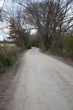 Little Rock to Cantonment Gibson Road-Short Mountain Segment |
January 24, 2008 (#07001429) |
Short Mountain Rd. between Horseshoe Mountain and Short Mountain Creek 35°18′41″N 93°44′39″W |
Paris | |
| 24 | Logan County Courthouse, Eastern District | %2C_Paris%2C_AR_002.jpg) Logan County Courthouse, Eastern District |
July 30, 1976 (#76000429) |
Courthouse Sq. 35°17′32″N 93°43′48″W |
Paris | |
| 25 | Logan County Courthouse, Southern Judicial District | 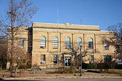 Logan County Courthouse, Southern Judicial District |
March 8, 1997 (#97000207) |
Southeastern corner of the junction of 4th and N. Broadway Sts. 35°08′28″N 93°55′17″W |
Booneville | |
| 26 | Magazine City Hall-Jail | 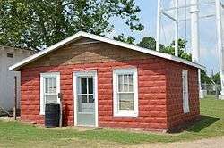 Magazine City Hall-Jail |
June 8, 1993 (#93000483) |
Northwest of the junction of Garland and Priddy Sts. 35°09′01″N 93°48′32″W |
Magazine | |
| 27 | Main Street Bridge | 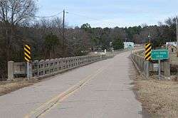 Main Street Bridge |
July 11, 2002 (#02000755) |
Sellers St. at Silver Smith Branch 35°17′19″N 93°25′13″W |
New Blaine | |
| 28 | Methodist Episcopal Church, South | 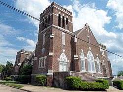 Methodist Episcopal Church, South |
June 20, 1995 (#95000757) |
205 N. Elm St. 35°17′38″N 93°43′46″W |
Paris | |
| 29 | Mount Salem Church and School | May 22, 2018 (#100002452) |
553 Mt. Salem Rd. #101 35°12′52″N 93°34′57″W |
Paris vicinity | ||
| 30 | New Blaine School | 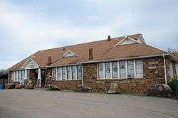 New Blaine School |
August 18, 1992 (#92001007) |
Junction of Highway 22 and Spring Rd. 35°17′06″N 93°25′17″W |
New Blaine | |
| 31 | New Liberty School | 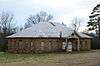 New Liberty School |
September 10, 1992 (#92001220) |
South of Highway 22 35°16′53″N 93°21′43″W |
Liberty | |
| 32 | Old Arkansas Highway 22 | 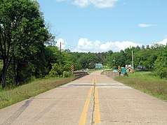 Old Arkansas Highway 22 |
September 27, 2003 (#03000950) |
Part of Highway 197, the Highway 197 Loop, and Rainwater Loop 35°17′11″N 93°25′23″W |
New Blaine | |
| 33 | Old Logan County Jail | 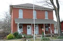 Old Logan County Jail |
November 19, 1993 (#93001254) |
204 N. Vine St. 35°17′37″N 93°43′54″W |
Paris | |
| 34 | Paris Commercial Historic District | 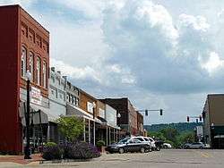 Paris Commercial Historic District |
May 12, 2009 (#09000314) |
Roughly bounded by N. Express, Short Mountain, N. 1st, E. Pine, and E. and W. Academy Sts. 35°17′31″N 93°43′48″W |
Paris | |
| 35 | Paris Post Office | 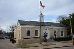 Paris Post Office |
August 14, 1998 (#98000923) |
206 N. Elm St. 35°17′39″N 93°43′47″W |
Paris | |
| 36 | Park Hill | 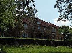 Park Hill |
January 29, 2013 (#12001233) |
400 E. Wahl St. 35°17′05″N 93°43′35″W |
Paris | |
| 37 | Petit Jean River Bridge | May 26, 1995 (#95000646) |
Highway 109 over the Petit Jean River 35°05′48″N 93°48′03″W |
Sugar Grove | ||
| 38 | Saint Anthony's Catholic Church | 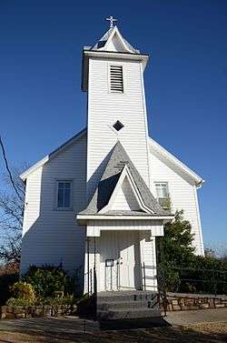 Saint Anthony's Catholic Church |
August 21, 1986 (#86001885) |
North of Highway 22 35°18′48″N 93°52′55″W |
Ratcliff | |
| 39 | Schriver House | 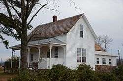 Schriver House |
September 22, 1995 (#95001125) |
Leo Ave., north of its junction with Highway 22 35°18′08″N 93°39′01″W |
Subiaco | |
| 40 | Short Mountain Creek Bridge | 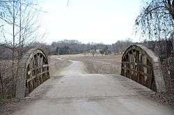 Short Mountain Creek Bridge |
September 24, 2004 (#04001039) |
County Road 64 35°18′41″N 93°44′37″W |
Paris | |
| 41 | Smith Hospital | 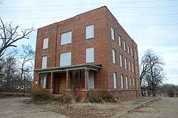 Smith Hospital |
April 11, 1994 (#94000369) |
Northern terminus of Express St. 35°17′53″N 93°43′50″W |
Paris | |
| 42 | Troy Lasater Service Station | 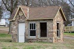 Troy Lasater Service Station |
October 4, 2002 (#02001075) |
Highway 197 Loop 35°17′20″N 93°25′11″W |
New Blaine | |
| 43 | Union Church and School | 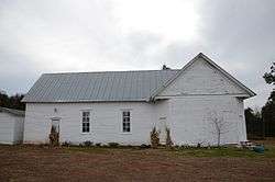 Union Church and School |
June 1, 2005 (#05000497) |
2158 Union Rd. 35°19′24″N 93°39′52″W |
Paris | Now used as the Union School Heritage Center |
| 44 | Evelyn Gill Walker House | 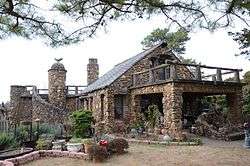 Evelyn Gill Walker House |
September 16, 1993 (#93000985) |
18 S. Spruce St. 35°17′30″N 93°44′00″W |
Paris |
Former listings
| [3] | Name on the Register | Image | Date listed | Date removed | Location | City or town | Summary |
|---|---|---|---|---|---|---|---|
| 1 | Rock Island Railroad Depot-Booneville | June 11, 1992 (#92000603) | October 18, 2002 | S of First St. and W of Broadway, at the N end of Rhyne Ave. |
Booneville |
gollark: They mostly buzz, beeping is rare.
gollark: Smoke alarms? Fridges? Random appliances? Hidden bees? Washing machines?
gollark: GTech™.
gollark: Technically, their original codebase dates to mid-2018, so 3.
gollark: Besides, it more accurately reflects the fuzzy, nondeterministic nature of networking.
See also
| Wikimedia Commons has media related to National Register of Historic Places in Logan County, Arkansas. |
References
- The latitude and longitude information provided in this table was derived originally from the National Register Information System, which has been found to be fairly accurate for about 99% of listings. Some locations in this table may have been corrected to current GPS standards.
- "National Register of Historic Places: Weekly List Actions". National Park Service, United States Department of the Interior. Retrieved on August 14, 2020.
- Numbers represent an ordering by significant words. Various colorings, defined here, differentiate National Historic Landmarks and historic districts from other NRHP buildings, structures, sites or objects.
- "National Register Information System". National Register of Historic Places. National Park Service. March 13, 2009.
- The eight-digit number below each date is the number assigned to each location in the National Register Information System database, which can be viewed by clicking the number.
| Topics | |
|---|---|
| Lists by state |
|
| Lists by insular areas | |
| Lists by associated state | |
| Other areas | |
| Related | |
| |
Municipalities and communities of Logan County, Arkansas, United States | ||
|---|---|---|
| Cities | Map of Arkansas highlighting Logan County | |
| Towns | ||
| CDP | ||
| Unincorporated communities | ||
This article is issued from Wikipedia. The text is licensed under Creative Commons - Attribution - Sharealike. Additional terms may apply for the media files.