National Register of Historic Places listings in Crawford County, Arkansas
This is a list of the National Register of Historic Places listings in Crawford County, Arkansas.
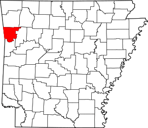
Location of Crawford County in Arkansas
This is intended to be a complete list of the properties and districts on the National Register of Historic Places in Crawford County, Arkansas, United States. The locations of National Register properties and districts for which the latitude and longitude coordinates are included below, may be seen in a map.[1]
There are 32 properties and districts listed on the National Register in the county. Another six properties were once listed but have been removed.
- This National Park Service list is complete through NPS recent listings posted August 14, 2020.[2]
Current listings
| [3] | Name on the Register[4] | Image | Date listed[5] | Location | City or town | Description |
|---|---|---|---|---|---|---|
| 1 | Dr. Charles Fox Brown House | 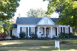 Dr. Charles Fox Brown House |
September 6, 1978 (#78000583) |
420 Drennan St. 35°25′58″N 94°21′00″W |
Van Buren | |
| 2 | Bryan House | 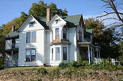 Bryan House |
January 9, 1978 (#78000584) |
105 Fayetteville St. 35°26′17″N 94°21′09″W |
Van Buren | |
| 3 | Bryant-Lasater House | 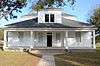 Bryant-Lasater House |
September 19, 2007 (#07000958) |
770 N. Main St. 35°30′28″N 94°03′05″W |
Mulberry | |
| 4 | Bob Burns House | 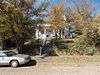 Bob Burns House |
April 30, 1976 (#76000399) |
821 Jefferson St. 35°26′09″N 94°21′02″W |
Van Buren | |
| 5 | Butterfield Overland Mail Route Lee Creek Road Segment | 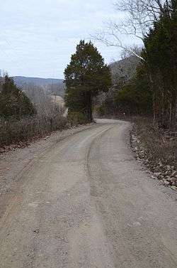 Butterfield Overland Mail Route Lee Creek Road Segment |
September 29, 2009 (#09000770) |
Lee Creek Rd., west of Highway 220 35°40′20″N 94°20′53″W |
Cedarville | |
| 6 | Butterfield Overland Mail Route Lucian Wood Road Segment | 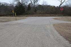 Butterfield Overland Mail Route Lucian Wood Road Segment |
September 29, 2009 (#09000771) |
Lucian Wood Rd. between the junction of Armer La. and Cedarville Rd. and Highway 220 35°34′19″N 94°21′55″W |
Cedarville | |
| 7 | Butterfield Overland Mail Route Segment | 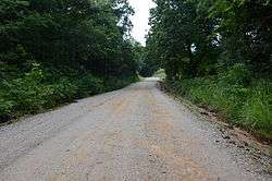 Butterfield Overland Mail Route Segment |
June 9, 2010 (#10000347) |
Bugscuffle Rd. south of Strickler and Old Cove City Rd. north of Chester 35°47′22″N 94°20′21″W |
Strickler | Segment of the Butterfield Overland Mail route; extends into Washington County |
| 8 | Cedarville School Building |  Cedarville School Building |
September 10, 1992 (#92001217) |
639 Pirates Way 35°34′20″N 94°21′59″W |
Cedarville | |
| 9 | Chester Masonic Lodge and Community Building | 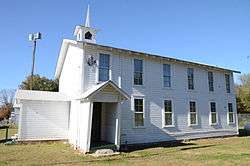 Chester Masonic Lodge and Community Building |
March 3, 2000 (#00000150) |
Junction of Front and Dickson Sts. 35°40′51″N 94°10′34″W |
Chester | |
| 10 | Clarke-Harrell-Burson House | 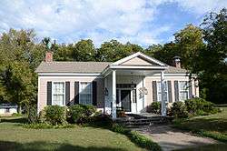 Clarke-Harrell-Burson House |
May 14, 1991 (#91000582) |
603 Parkview 35°26′53″N 94°21′14″W |
Van Buren | |
| 11 | Drennen-Scott House | 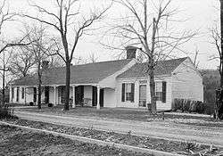 Drennen-Scott House |
September 10, 1971 (#71000123) |
Drennen Reserve, N. 3rd St. 35°26′10″N 94°21′34″W |
Van Buren | A Trail of Tears site[6] |
| 12 | Joseph Starr Dunham House | May 3, 1976 (#76000400) |
418 Broadway 35°25′59″N 94°21′06″W |
Van Buren | ||
| 13 | Fairview Cemetery | 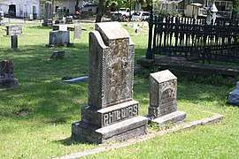 Fairview Cemetery |
June 1, 2005 (#05000489) |
Bounded by Highway 59, McKibben Ave., and Poplar St. 35°26′35″N 94°21′04″W |
Van Buren | |
| 14 | Fairview Cemetery, Confederate Section |  Fairview Cemetery, Confederate Section |
December 6, 1996 (#96001407) |
Southwest of the junction of McKibben and 10th Sts. 35°26′31″N 94°20′58″W |
Van Buren | |
| 15 | Frog Bayou Bridge | 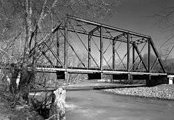 Frog Bayou Bridge |
May 26, 1995 (#95000648) |
Highway 282 over Frog Bayou 35°37′04″N 94°11′03″W |
Mountainburg | |
| 16 | High Rock Petroglyph Shelter | May 4, 1982 (#82002111) |
Address Restricted |
Rudy | ||
| 17 | Lee Creek Bridge | 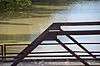 Lee Creek Bridge |
January 21, 2010 (#09001241) |
West of W. Rena Rd. over Lee Creek 35°27′53″N 94°23′21″W |
Van Buren | |
| 18 | Mount Olive United Methodist Church | 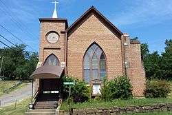 Mount Olive United Methodist Church |
July 30, 1976 (#76000401) |
Lafayette and Knox Sts. 35°26′13″N 94°21′18″W |
Van Buren | |
| 19 | Mulberry Home Economics Building | 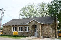 Mulberry Home Economics Building |
September 10, 1992 (#92001218) |
Behind Mulberry High School, off Alma Ave. 35°29′59″N 94°03′21″W |
Mulberry | |
| 20 | Mulberry River Bridge | 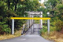 Mulberry River Bridge |
January 24, 2007 (#06001272) |
County Road 67 35°31′57″N 94°02′27″W |
Pleasant Hill | Extends into Franklin County |
| 81 | Muxen Building | May 29, 2019 (#100003986) |
22733 N. US 71 35°45′39″N 94°06′57″W |
Mountainburg | ||
| 21 | No. 12 School | 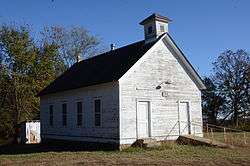 No. 12 School |
January 4, 1996 (#95001481) |
East of County Road 402, approximately 6 miles west of Chester 35°42′13″N 94°15′13″W |
Chester | |
| 22 | Old School Presbyterian Church | 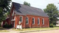 Old School Presbyterian Church |
September 23, 2009 (#09000740) |
421 Webster St. 35°26′03″N 94°21′17″W |
Van Buren | |
| 23 | Old U.S. 64-Van Buren Segment |  Old U.S. 64-Van Buren Segment |
January 21, 2010 (#09001242) |
Oak Ln. north of U.S. Route 64 35°26′38″N 94°19′41″W |
Van Buren | |
| 24 | Our Lady of the Ozarks Shrine | _-_exterior_1.jpg) Our Lady of the Ozarks Shrine |
May 29, 2019 (#100003993) |
22741 US 71 35°45′41″N 94°06′57″W |
Winslow vicinity | |
| 25 | Henry "Harry" Charles Pernot House | 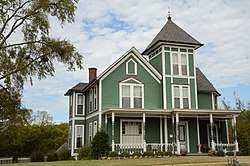 Henry "Harry" Charles Pernot House |
September 21, 2017 (#100001646) |
119 Fayetteville Rd. 35°26′20″N 94°21′09″W |
Van Buren | |
| 26 | Slack-Comstock-Marshall Farm | 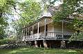 Slack-Comstock-Marshall Farm |
June 9, 1995 (#95000694) |
North of Highway 220, W. 35°35′21″N 94°27′07″W |
Uniontown | |
| 27 | Van Buren Confederate Monument | 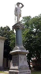 Van Buren Confederate Monument |
April 26, 1996 (#96000461) |
Courthouse Lawn at the junction of 3rd and Main Sts. 35°26′02″N 94°21′19″W |
Van Buren | |
| 28 | Van Buren Historic District | 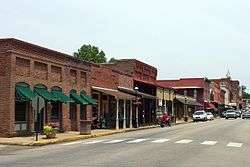 Van Buren Historic District |
April 30, 1976 (#76000402) |
Main St., bounded by Cane Hill St. and the Arkansas River 35°26′04″N 94°21′15″W |
Van Buren | |
| 29 | Van Buren Post Office | 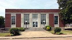 Van Buren Post Office |
August 14, 1998 (#98000918) |
22 S. 7th St. 35°26′08″N 94°20′58″W |
Van Buren | |
| 30 | Wilhauf House | 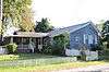 Wilhauf House |
August 27, 1974 (#74000473) |
109 N. 3rd St. 35°26′05″N 94°21′28″W |
Van Buren | |
| 31 | Col. Jacob Yoes Building | 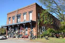 Col. Jacob Yoes Building |
June 5, 1975 (#75000380) |
Front St. 35°40′44″N 94°10′27″W |
Chester |
Former listing
| [3] | Name on the Register | Image | Date listed | Date removed | Location | City or town | Summary |
|---|---|---|---|---|---|---|---|
| 1 | Cedar Creek Bridge | May 10, 1995 (#95000649) | September 24, 2004 | AR 348 over Cedar Creek |
Rudy vicinity | ||
| 2 | Crawford County Road 32D Bridge | May 10, 1995 (#95000650) | September 24, 2004 | County Road 32D over Cove Creek |
Natural Dam vicinity | ||
| 3 | Lee Creek Bridge | 1990 (#90000504) | September 24, 2004 | AR 220 |
Cove City vicinity | ||
| 4 | Lee Creek Bridge | 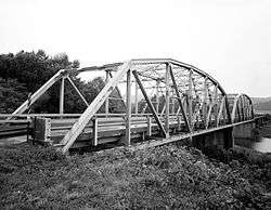 Lee Creek Bridge |
April 6, 1990 (#90000508) | January 24, 2019 | Highway 59 over Lee Creek 35°38′46″N 94°23′37″W |
Natural Dam | Demolished in 2018[7] |
| 5 | Henry Clay Mills House |  Henry Clay Mills House |
December 16, 1977 (#77000250) | January 26, 2018 | 425 N. 15th St. 35°26′30″N 94°20′33″W |
Van Buren | |
| 6 | Mountainburg High School | 1992 (#92001216) | October 19, 2001 | US 71 |
Mountainburg |
gollark: Is there an EMC value dump anywhere?
gollark: I decided to ask the esolangs server.
gollark: How can I implement at least AE2-level autocrafting, then? I really don't want to handcraft OC junk.
gollark: (though those can't be handcrafted, right?)
gollark: I think that at most it has resources made from themselves plus other stuff.
See also
| Wikimedia Commons has media related to National Register of Historic Places in Crawford County, Arkansas. |
References
- The latitude and longitude information provided in this table was derived originally from the National Register Information System, which has been found to be fairly accurate for about 99% of listings. Some locations in this table may have been corrected to current GPS standards.
- "National Register of Historic Places: Weekly List Actions". National Park Service, United States Department of the Interior. Retrieved on August 14, 2020.
- Numbers represent an ordering by significant words. Various colorings, defined here, differentiate National Historic Landmarks and historic districts from other NRHP buildings, structures, sites or objects.
- "National Register Information System". National Register of Historic Places. National Park Service. March 13, 2009.
- The eight-digit number below each date is the number assigned to each location in the National Register Information System database, which can be viewed by clicking the number.
- "Trail Of Tears National Historic Trail: National Register Research". National Park Service. Retrieved January 22, 2013.
| Topics | |
|---|---|
| Lists by state |
|
| Lists by insular areas | |
| Lists by associated state | |
| Other areas | |
| Related | |
| |
Municipalities and communities of Crawford County, Arkansas, United States | ||
|---|---|---|
| Cities | Map of Arkansas highlighting Crawford County | |
| Towns | ||
| Unincorporated communities | ||
| Ghost towns | ||
This article is issued from Wikipedia. The text is licensed under Creative Commons - Attribution - Sharealike. Additional terms may apply for the media files.