National Register of Historic Places listings in Caswell County, North Carolina
This list includes properties and districts listed on the National Register of Historic Places in Caswell County, North Carolina. Click the "Map of all coordinates" link to the right to view an online map of all properties and districts with latitude and longitude coordinates in the table below.[1]
Current listings
- This National Park Service list is complete through NPS recent listings posted August 14, 2020.[2]
| [3] | Name on the Register[4] | Image | Date listed[5] | Location | City or town | Description |
|---|---|---|---|---|---|---|
| 1 | Brown-Graves House and Brown's Store | July 15, 1974 (#74001334) |
SW of Yanceyville on NC 150 36°21′36″N 79°27′04″W |
Locust Hill | ||
| 2 | Caswell County Courthouse | 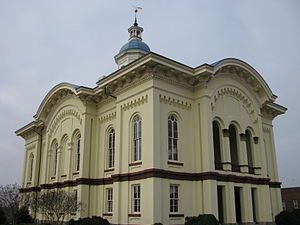 Caswell County Courthouse |
June 4, 1973 (#73001309) |
Courthouse Sq. 36°24′11″N 79°20′11″W |
Yanceyville | |
| 3 | Caswell County Training School | January 25, 2018 (#100002047) |
403 Dillard School Dr. 36°24′00″N 79°20′01″W |
Yanceyville | ||
| 4 | Garland-Buford House | 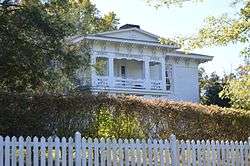 Garland-Buford House |
January 24, 1974 (#74001333) |
N of Leasburg on SR 1561 36°27′27″N 79°08′57″W |
Leasburg | |
| 5 | Graves House | 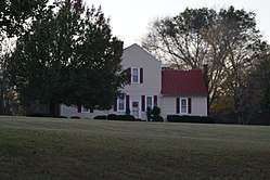 Graves House |
November 20, 1974 (#74001335) |
U.S. 158 at NC 86 36°24′15″N 79°19′20″W |
Yanceyville | |
| 6 | Griers Presbyterian Church and Cemetery | 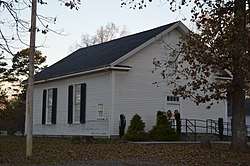 Griers Presbyterian Church and Cemetery |
December 30, 1985 (#85003187) |
SR 1710 36°20′50″N 79°13′10″W |
Frogsboro | |
| 7 | William Henry and Sarah Holderness House | December 2, 2014 (#14000982) |
3082 US 158 W. 36°23′44″N 79°23′16″W |
Yanceyville | ||
| 8 | John Johnston House | 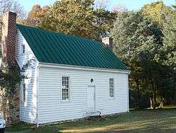 John Johnston House |
March 14, 1997 (#97000238) |
1325 NC 62, N. 36°26′08″N 79°16′59″W |
Yanceyville | |
| 9 | Longwood |  Longwood |
September 15, 1976 (#76001312) |
SW of Milton on NC 62 36°31′40″N 79°13′10″W |
Milton | |
| 10 | James Malone House | April 30, 2008 (#08000367) |
7374 US 158 36°23′39″N 79°09′27″W |
Leasburg | ||
| 11 | Melrose/Williamson House | .jpg) Melrose/Williamson House |
February 28, 1985 (#85000379) |
Off NC 62 36°25′42″N 79°17′51″W |
Yanceyville Township | |
| 12 | Milton Historic District |  Milton Historic District |
October 25, 1973 (#73001306) |
Runs along Main St. from Atlantic and Danville RR to County Line Creek 36°32′15″N 79°12′25″W |
Milton | |
| 13 | Milton State Bank |  Milton State Bank |
April 13, 1973 (#73001307) |
Main (Broad) St. 36°32′20″N 79°12′21″W |
Milton | |
| 14 | Moore House | August 28, 1973 (#73001304) |
E of Locust Hill off U.S. 158 36°22′12″N 79°25′44″W |
Locust Hill | ||
| 15 | Poteat House | .jpg) Poteat House |
October 24, 1979 (#79001688) |
N of Yanceyville on NC 62 36°25′11″N 79°18′37″W |
Yanceyville | |
| 16 | Red House Presbyterian Church | 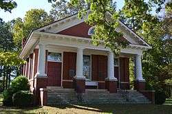 Red House Presbyterian Church |
May 1, 2007 (#07000413) |
13409 NC 119 N 36°29′15″N 79°09′46″W |
Semora | |
| 17 | Rose Hill |  Rose Hill |
October 25, 1973 (#73001305) |
On U.S. 158 at jct. with NC 150 36°22′22″N 79°25′59″W |
Locust Hill | |
| 18 | Union Tavern | .jpg) Union Tavern |
May 15, 1975 (#75001245) |
Main St. 36°32′18″N 79°12′24″W |
Milton | |
| 19 | Warren House and Warren's Store | 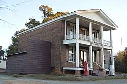 Warren House and Warren's Store |
June 19, 1973 (#73001308) |
On NC 86 36°14′56″N 79°11′24″W |
Prospect Hill | |
| 20 | Wildwood | 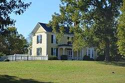 Wildwood |
October 5, 2001 (#01001076) |
5680 Stephentown Rd. 36°27′20″N 79°11′47″W |
Semora | |
| 21 | Woodside | 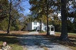 Woodside |
March 6, 1986 (#86000420) |
NC 57 36°31′33″N 79°10′58″W |
Milton | |
| 22 | Bartlett Yancey House | 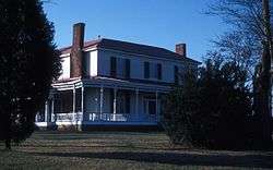 Bartlett Yancey House |
December 4, 1973 (#73001310) |
Southern side of U.S. Route 158, 0.3 miles west of the NC 1500 junction[6] 36°24′58″N 79°21′45″W |
Yanceyville | |
| 23 | Yanceyville Historic District | Yanceyville Historic District |
October 15, 1973 (#73001311) |
W. Main St., Courthouse Sq., and North Ave. to Church St. 36°24′19″N 79°20′27″W |
Yanceyville |
gollark: ++magic py import utilutil.config["autobias"]
gollark: I can dump the bias tables now, probably.
gollark: No.
gollark: You already *have* that.
gollark: It's very advanced, yes.
See also
| Wikimedia Commons has media related to National Register of Historic Places in Caswell County, North Carolina. |
References
- The latitude and longitude information provided in this table was derived originally from the National Register Information System, which has been found to be fairly accurate for about 99% of listings. Some locations in this table may have been corrected to current GPS standards.
- "National Register of Historic Places: Weekly List Actions". National Park Service, United States Department of the Interior. Retrieved on August 14, 2020.
- Numbers represent an ordering by significant words. Various colorings, defined here, differentiate National Historic Landmarks and historic districts from other NRHP buildings, structures, sites or objects.
- "National Register Information System". National Register of Historic Places. National Park Service. April 24, 2008.
- The eight-digit number below each date is the number assigned to each location in the National Register Information System database, which can be viewed by clicking the number.
- Survey and Planning Unit, North Carolina Division of Archives and History. National Register of Historic Places Inventory/Nomination: Bartlett Yancey House. National Park Service, 1973-09-13. Accessed 2016-11-03.

| Topics | |
|---|---|
| Lists by state |
|
| Lists by insular areas | |
| Lists by associated state | |
| Other areas | |
| Related | |
| |
Municipalities and communities of Caswell County, North Carolina, United States | ||
|---|---|---|
| Towns | | |
| Unincorporated communities | ||
This article is issued from Wikipedia. The text is licensed under Creative Commons - Attribution - Sharealike. Additional terms may apply for the media files.