List of road junctions in the United Kingdom: 0-A
This is part of the list of road junctions in the United Kingdom.
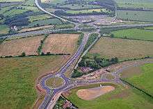
Thickthorn Interchange
Many road junctions are named after pubs. For more information regarding the derivation of pub names see pub names.
0-9
| Junction Name | Type | Location | Roads | Grid Reference | Notes |
|---|---|---|---|---|---|
| The 101 Roundabout | Roundabout | Flitwick/Ampthill | 52°01′00″N 0°30′05″W | ||
| 3m Roundabout | Roundabout | Bracknell |
|
51.418°N 0.755°W |
A
| Junction Name | Type | Location | Roads | Grid Reference | Notes |
|---|---|---|---|---|---|
| Abbey Hill Interchange | Roundabout Interchange | Wymbush, Milton Keynes | 52°02′51″N 0°48′16″W | ||
| Addlestonemoor Roundabout | Roundabout | Chertsey, Surrey |
|
TQ050657 | |
| Admiralty[1] | Roundabout Interchange | Rosyth, Scotland | 56°02′37″N 3°24′17″W | ||
| Ainley Top | Roundabout | Huddersfield, West Yorkshire | 53°40′11″N 1°49′34″W | ||
| The Air Balloon Roundabout[2] | Roundabout | Birdlip, Gloucestershire |
|
51°50′37″N 2°05′44″W | Named after the pub at the junction |
| Airman's Corner | Crossroads | Wiltshire | 51°11′09″N 1°51′38″W | ||
| Airport Roundabout | Roundabout | Weston-super-Mare, North Somerset | 51°20′41″N 2°55′55″W | ||
| Alconbury Interchange | Grade Separated Fork | Alconbury, Huntingdonshire |
|
52°22′46″N 0°15′19″W | |
| Aldgate | Gyratory | Whitechapel, LB Tower Hamlets |
|
51°30′52″N 0°04′26″W | |
| Aller Bridge | Staggered | Coldridge, Devon | B3220 | 50.8453°N 3.8402°W | |
| Aller Cross | Crossroads | Cullompton, Devon | 50.8510°N 3.3465°W | Named on fingerpost | |
| Aller Cross aka Aller Down Cross | T junction | Sandford, Devon | Sandpit Lane | 50.8280°N 3.6672°W | Both names on fingerpost |
| Allhallows Cross | T junction | Blackborough, Devon | 50.8834°N 3.2871°W | Named on fingerpost | |
| Almondsbury Interchange[3] | Four Level Stack | Almondsbury, South Gloucestershire | 51°33′09″N 2°33′08″W | ||
| Alston Cross | Crossroads | Ashburton, Devon |
|
SX776714 | |
| Amen Corner | T junction | Tooting, LB Wandsworth |
|
51°25′23″N 0°09′38″W | |
| Amwell Roundabout | Roundabout | Great Amwell, Hertfordshire | 51°47′12″N 0°00′54″W | Located at Great Amwell | |
| Amy Tree | Crossroads | St Mellion Parish, Cornwall |
|
SX364669 | also the name of the nearby Down |
| Anchor Corner | Crossroads | Holton, Somerset, Somerset |
|
ST697273 | |
| The Angel, Edmonton | Diamond Interchange | Edmonton, LB Enfield |
|
51°36′53″N 0°03′52″W | |
| Angel[4] | Crossroads | Islington, LB Islington | 51°31′55″N 0°06′22″W | Named after the Inn on the Great North Road sited at the junction | |
| Anniesland Cross | Crossroads | Anniesland, Glasgow |
|
NS546688 | |
| Animal Reception Centre Roundabout | Roundabout | Bedfont, LB Hounslow |
|
51°27′19″N 0°27′17″W | Named after the Animal Reception Centre nearby, adjacent to Heathrow Airport. |
Apex Corner[5]
|
Roundabout | Mill Hill, LB Barnet | 51°37′17″N 0°15′19″W | ||
Apleyhead Roundabout
|
Grade Separated Dumbbell Roundabout | Babworth, Nottinghamshire | SK646782 | A conversion from a roundabout to a grade separated dumbbell arrangement opened on 20 May 2008.[7] The B6420 was routed north at this time to Apleyhead. | |
| Apple Tree Roundabout | Roundabout | Yiewsley, LB Hillingdon |
|
51°31′04″N 0°27′43″W | |
| Archway | Gyratory | Upper Holloway, LB Islington | TQ294868 | ||
| Arkleston Interchange | Grade Separated Dumbbell Roundabout | Glasgow |
|
55°51′40″N 4°24′34″W | |
| Armley Gyratory | Gyratory | Leeds, West Yorkshire | 53°47′36″N 1°34′07″W | ||
| Army and Navy | Roundabout Interchange with flyover | Chelmsford, Essex |
|
51°43′38″N 0°28′54″E | Named after the pub which stood at the junction until 2007 |
| Arnold Circus | Roundabout | Shoreditch, LB Tower Hamlets |
|
51°31′34″N 0°04′29″W | |
| Ash Cross | Crossroads | Bradninch, Devon |
|
50.8350°N 3.4222°W | |
| Ash Cross | Crossroads | Stoodleigh, Mid Devon | Wormsworthy Hill | 50.9639°N 3.5500°W | Named on fingerpost |
| Ashland Roundabout | Roundabout | Ashland, Milton Keynes |
|
52°00′57″N 0°43′56″W | |
| Ashford Hospital Crossroads | Crossroads | Ashford, Surrey |
|
TQ061726 | |
| Atco Crossroads[8] | Crossroads | Eckington, Derbyshire |
|
SK434797 | Named after an erstwhile branch of the mower company |
| Auchenkilns Roundabout | Grade Separated Dumbbell Roundabout | Cumbernauld, North Lanarkshire |
|
NS742740 | Upgraded in 2005 from an at grade roundabout to a grade separated dumbbell interchange[9] |
| Avebury Roundabout | Roundabout | Central Milton Keynes |
|
52°02′04″N 0°46′06″W | |
| Awkley Interchange | Grade Separated Fork | Awkley, South Gloucestershire | 51°34′16″N 2°34′47″W | ||
| Aycliffe Interchange | Roundabout Interchange | Aycliffe, Co. Durham | 54°35′02″N 1°33′40″W |
gollark: You can use luadash.
gollark: ```rust#[macro_use] extern crate serenity;extern crate dotenv;use serenity::client::{Client, EventHandler};use serenity::framework::standard::StandardFramework;use std::env;struct Handler;impl EventHandler for Handler {}pub fn main() { dotenv::dotenv().ok(); // Load bot token from environment, let mut client = Client::new(&env::var("DISCORD_TOKEN").expect("token unavailable"), Handler) .expect("Error creating client"); client.with_framework(StandardFramework::new() .configure(|c| c.prefix("~")) .cmd("ping", ping)); if let Err(why) = client.start() { eprintln!("An error occured: {:?}", why); }}command!(ping(_context, message) { let _ = message.reply("Pong!");});```Fun with discord bots, and yes this is literally the example code.
gollark: t r a i t o r
gollark: f i b o n a c c i
gollark: ???
References
- "Motorways (1982)". Written-Answers. Historic Hansard. 8 June 1982. Retrieved 28 April 2020.
- "A417 (2001)". Written-Answers. Historic Hansard. 15 March 2001. Retrieved 28 April 2020.
- "M4 M5 Almondsbury Interchange (1971)". Written-Answers. Historic Hansard. 16 November 1971. Retrieved 28 April 2020.
- "Angel Intersection Islington (1973)". House of Commons. Historic Hansard. 23 January 1973. Retrieved 28 April 2020.
- "Apex Corner and Bignalls Corner (1960)". Written-Answers. Historic Hansard. 1 December 1960. Retrieved 28 April 2020.
- "Archived copy". Archived from the original on 10 February 2009. Retrieved 3 January 2009.CS1 maint: archived copy as title (link)
- "Archived copy". Archived from the original on 19 June 2012. Retrieved 5 October 2012.CS1 maint: archived copy as title (link)
- http://www.openstreetmap.org/browse/node/26784800
- "Auchenkilns becomes roadwork free". BBC News. 21 November 2005. Retrieved 28 April 2020.
This article is issued from Wikipedia. The text is licensed under Creative Commons - Attribution - Sharealike. Additional terms may apply for the media files.