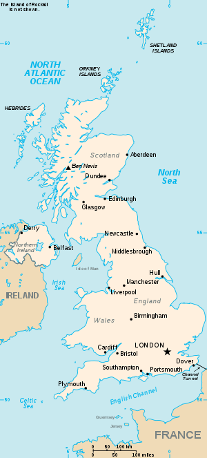
List of United Kingdom locations: X-Z

Y

Location Locality Coordinates
(links to map & photo sources)
OS grid
reference
Y Bont-Faen (Cowbridge) The Vale Of Glamorgan 51.45°N 03.45°W / 51.45; -03.45 SS9974
Y Felinheli (Port Dinorwig) Gwynedd 53.17°N 04.21°W / 53.17; -04.21 SH5267
Y Fenni (Abergavenny) Monmouthshire 51.82°N 03.03°W / 51.82; -03.03 SO2914
Y Ferwig Ceredigion 52.10°N 04.65°W / 52.10; -04.65 SN1849
Y Fflint (Flint) Flintshire 53.23°N 03.14°W / 53.23; -03.14 SJ2472
Y Ffor Gwynedd 52.91°N 04.39°W / 52.91; -04.39 SH3938
y-Ffrith Denbighshire 53.33°N 03.44°W / 53.33; -03.44 SJ0483
Y Gelli Gandryll Powys 52.07°N 03.13°W / 52.07; -03.13 SO2242
Y Gribyn Powys 52.50°N 03.59°W / 52.50; -03.59 SN9291

Ya

Location Locality Coordinates
(links to map & photo sources)
OS grid
reference
Yaddlethorpe North Lincolnshire 53.55°N 00.67°W / 53.55; -00.67 SE8807
Yafford Isle of Wight 50.62°N 01.37°W / 50.62; -01.37 SZ4481
Yafforth North Yorkshire 54.34°N 01.47°W / 54.34; -01.47 SE3494
Yair Scottish Borders 55.57°N 02.87°W / 55.57; -02.87 NT4532
Yalberton Devon 50.41°N 03.60°W / 50.41; -03.60 SX8658
Yalding Kent 51.22°N 00.43°E / 51.22; 00.43 TQ7050
Yanley North Somerset 51.41°N 02.64°W / 51.41; -02.64 ST5569
Yanworth Gloucestershire 51.81°N 01.89°W / 51.81; -01.89 SP0713
Yapham East Riding of Yorkshire 53.94°N 00.81°W / 53.94; -00.81 SE7851
Yapton West Sussex 50.81°N 00.62°W / 50.81; -00.62 SU9703
Yar Isle of Wight 50.60°N 01.26°W / 50.60; -01.26 SZ519791
Yarberry North Somerset 51.30°N 02.87°W / 51.30; -02.87 ST3957
Yarborough North East Lincolnshire 53.56°N 00.11°W / 53.56; -00.11 TA2509
Yarbridge Isle of Wight 50.67°N 01.15°W / 50.67; -01.15 SZ6086
Yarburgh Lincolnshire 53.41°N 00.03°E / 53.41; 00.03 TF3593
Yarcombe Devon 50.86°N 03.08°W / 50.86; -03.08 ST2408
Yarde Somerset 51.14°N 03.34°W / 51.14; -03.34 ST0639
Yardhurst Kent 51.13°N 00.78°E / 51.13; 00.78 TQ9541
Yardley Birmingham 52.46°N 01.82°W / 52.46; -01.82 SP1285
Yardley Gobion Northamptonshire 52.08°N 00.89°W / 52.08; -00.89 SP7644
Yardley Hastings Northamptonshire 52.19°N 00.74°W / 52.19; -00.74 SP8656
Yardley Wood Birmingham 52.41°N 01.85°W / 52.41; -01.85 SP1080
Yardro Powys 52.21°N 03.14°W / 52.21; -03.14 SO2258
Yare Norfolk 52.61°N 01.41°E / 52.61; 01.41 TG315078
Yarford Somerset 51.05°N 03.14°W / 51.05; -03.14 ST2029
Yarhampton Worcestershire 52.30°N 02.33°W / 52.30; -02.33 SO7767
Yarhampton Cross Worcestershire 52.30°N 02.33°W / 52.30; -02.33 SO7767
Yarkhill Herefordshire 52.07°N 02.58°W / 52.07; -02.58 SO6042
Yarley Somerset 51.20°N 02.71°W / 51.20; -02.71 ST5045
Yarlington Somerset 51.05°N 02.50°W / 51.05; -02.50 ST6529
Yarlside Cumbria 54.11°N 03.19°W / 54.11; -03.19 SD2269
Yarm Stockton-on-Tees 54.50°N 01.36°W / 54.50; -01.36 NZ4112
Yarmouth Isle of Wight 50.69°N 01.50°W / 50.69; -01.50 SZ3589
Yarnacott Devon 51.05°N 03.97°W / 51.05; -03.97 SS6230
Yarnbrook Wiltshire 51.28°N 02.20°W / 51.28; -02.20 ST8654
Yarnfield Staffordshire 52.88°N 02.20°W / 52.88; -02.20 SJ8632
Yarningale Common Warwickshire 52.29°N 01.72°W / 52.29; -01.72 SP1966
Yarnscombe Devon 50.98°N 04.05°W / 50.98; -04.05 SS5623
Yarnton Oxfordshire 51.80°N 01.31°W / 51.80; -01.31 SP4712
Yarpole Herefordshire 52.27°N 02.77°W / 52.27; -02.77 SO4764
Yarrow Somerset 51.21°N 02.88°W / 51.21; -02.88 ST3847
Yarrow Scottish Borders 55.53°N 03.03°W / 55.53; -03.03 NT3527
Yarrow Northumberland 55.17°N 02.45°W / 55.17; -02.45 NY7187
Yarrow Feus Scottish Borders 55.51°N 03.04°W / 55.51; -03.04 NT3425
Yarrowford Scottish Borders 55.56°N 02.95°W / 55.56; -02.95 NT4030
Yarrow Water Scottish Borders 55.54°N 02.91°W / 55.54; -02.91 NT424284
Yarsop Herefordshire 52.11°N 02.87°W / 52.11; -02.87 SO4047
Yarty Somerset 50.92°N 03.08°W / 50.92; -03.08 ST241140
Yarty Devon 50.77°N 03.01°W / 50.77; -03.01 SY282979
Yarwell Northamptonshire 52.56°N 00.43°W / 52.56; -00.43 TL0697
Yate South Gloucestershire 51.53°N 02.41°W / 51.53; -02.41 ST7182
Yateley Hampshire 51.33°N 00.83°W / 51.33; -00.83 SU8160
Yate Rocks South Gloucestershire 51.55°N 02.40°W / 51.55; -02.40 ST7284
Yatesbury Wiltshire 51.43°N 01.91°W / 51.43; -01.91 SU0671
Yattendon Berkshire 51.46°N 01.20°W / 51.46; -01.20 SU5574
Yatton Herefordshire 52.28°N 02.85°W / 52.28; -02.85 SO4266
Yatton North Somerset 51.38°N 02.83°W / 51.38; -02.83 ST4265
Yatton Keynell Wiltshire 51.48°N 02.20°W / 51.48; -02.20 ST8676
Yaverland Isle of Wight 50.66°N 01.13°W / 50.66; -01.13 SZ6185
Yawl Devon 50.74°N 02.97°W / 50.74; -02.97 SY3194
Yawthorpe Lincolnshire 53.40°N 00.66°W / 53.40; -00.66 SK8991
Yaxham Norfolk 52.65°N 00.97°E / 52.65; 00.97 TG0110
Yaxley Cambridgeshire 52.51°N 00.26°W / 52.51; -00.26 TL1892
Yaxley Suffolk 52.31°N 01.10°E / 52.31; 01.10 TM1273
Yazor Herefordshire 52.10°N 02.87°W / 52.10; -02.87 SO4046

Ye

Location Locality Coordinates
(links to map & photo sources)
OS grid
reference
Yeabridge Somerset 50.93°N 02.79°W / 50.93; -02.79 ST4415
Yeading Hillingdon 51.52°N 00.40°W / 51.52; -00.40 TQ1182
Yeadon Bradford 53.85°N 01.69°W / 53.85; -01.69 SE2040
Yealand Conyers Lancashire 54.15°N 02.76°W / 54.15; -02.76 SD5074
Yealand Redmayne Lancashire 54.16°N 02.76°W / 54.16; -02.76 SD5075
Yealand Storrs Lancashire 54.17°N 02.78°W / 54.17; -02.78 SD4976
Yealm Devon 50.41°N 03.95°W / 50.41; -03.95 SX609593
Yealmbridge Devon 50.34°N 03.98°W / 50.34; -03.98 SX5951
Yealmpton Devon 50.34°N 04.01°W / 50.34; -04.01 SX5751
Yearby Redcar and Cleveland 54.58°N 01.07°W / 54.58; -01.07 NZ6021
Yearngill Cumbria 54.78°N 03.33°W / 54.78; -03.33 NY1444
Yearsley North Yorkshire 54.15°N 01.11°W / 54.15; -01.11 SE5874
Yeaton Shropshire 52.76°N 02.84°W / 52.76; -02.84 SJ4319
Yeaveley Derbyshire 52.95°N 01.73°W / 52.95; -01.73 SK1840
Yedingham North Yorkshire 54.19°N 00.63°W / 54.19; -00.63 SE8979
Yelden Bedfordshire 52.29°N 00.52°W / 52.29; -00.52 TL0167
Yeldersley Hollies Derbyshire 52.98°N 01.67°W / 52.98; -01.67 SK2243
Yelford Oxfordshire 51.73°N 01.48°W / 51.73; -01.48 SP3604
Yell Shetland Islands 60.57°N 01.10°W / 60.57; -01.10 HU489886
Yelland Devon 51.05°N 04.15°W / 51.05; -04.15 SS4931
Yelling Cambridgeshire 52.24°N 00.15°W / 52.24; -00.15 TL2662
Yelsted Kent 51.32°N 00.61°E / 51.32; 00.61 TQ8262
Yelvertoft Northamptonshire 52.37°N 01.13°W / 52.37; -01.13 SP5975
Yelverton Devon 50.48°N 04.08°W / 50.48; -04.08 SX5267
Yelverton Norfolk 52.56°N 01.37°E / 52.56; 01.37 TG2902
Yenston Somerset 50.98°N 02.41°W / 50.98; -02.41 ST7121
Yeo Somerset 51.00°N 02.63°W / 51.00; -02.63 ST555225
Yeo Devon 50.73°N 03.88°W / 50.73; -03.88 SX673946
Yeo Dorset 50.92°N 02.55°W / 50.92; -02.55 ST609139
Yeoford Devon 50.76°N 03.73°W / 50.76; -03.73 SX7898
Yeolmbridge Cornwall 50.65°N 04.39°W / 50.65; -04.39 SX3187
Yeo Mill Devon 51.02°N 03.65°W / 51.02; -03.65 SS8426
Yeo Vale Devon 50.98°N 04.25°W / 50.98; -04.25 SS4223
Yeovil Somerset 50.94°N 02.64°W / 50.94; -02.64 ST5516
Yeovil Marsh Somerset 50.95°N 02.65°W / 50.95; -02.65 ST5418
Yeovilton Somerset 50.99°N 02.65°W / 50.99; -02.65 ST5422
Yerbeston Pembrokeshire 51.73°N 04.81°W / 51.73; -04.81 SN0608
Yesnaby Orkney Islands 59.01°N 03.36°W / 59.01; -03.36 HY2215
Yetlington Northumberland 55.37°N 01.96°W / 55.37; -01.96 NU0209
Yetminster Dorset 50.88°N 02.58°W / 50.88; -02.58 ST5910
Yett North Lanarkshire 55.80°N 03.96°W / 55.80; -03.96 NS7759
Yett Burn Northumberland 55.13°N 02.65°W / 55.13; -02.65 NY586822
Yettington Devon 50.65°N 03.34°W / 50.65; -03.34 SY0585
Yetts o' Muckhart Clackmannanshire 56.19°N 03.61°W / 56.19; -03.61 NO0001
Yew Green Warwickshire 52.30°N 01.67°W / 52.30; -01.67 SP2267
Yewhedges Kent 51.26°N 00.80°E / 51.26; 00.80 TQ9655
Yew Tree Sandwell 52.55°N 01.97°W / 52.55; -01.97 SP0295
Yew Tree Tameside 53.47°N 02.07°W / 53.47; -02.07 SJ9597
Yewtree Cross Kent 51.12°N 01.08°E / 51.12; 01.08 TR1641

Yi-Yn

Location Locality Coordinates
(links to map & photo sources)
OS grid
reference
Yieldshields South Lanarkshire 55.73°N 03.80°W / 55.73; -03.80 NS8750
Yiewsley Hillingdon 51.50°N 00.47°W / 51.50; -00.47 TQ0680
Ynus-tawelog Swansea 51.76°N 04.00°W / 51.76; -04.00 SN6209
Ynyns Deullyn Pembrokeshire 51.95°N 05.13°W / 51.95; -05.13 SM847336
Ynysboeth Rhondda, Cynon, Taff 51.65°N 03.34°W / 51.65; -03.34 ST0796
Ynysddu Caerphilly 51.62°N 03.20°W / 51.62; -03.20 ST1792
Ynysforgan Swansea 51.67°N 03.92°W / 51.67; -03.92 SS6799
Ynyshir Rhondda, Cynon, Taff 51.61°N 03.41°W / 51.61; -03.41 ST0292
Ynys-isaf Powys 51.78°N 03.75°W / 51.78; -03.75 SN7911
Ynyslas Ceredigion 52.50°N 04.06°W / 52.50; -04.06 SN6092
Ynys-Lochtyn Ceredigion 52.16°N 04.46°W / 52.16; -04.46 SN317546
Ynysmaerdy Neath Port Talbot 51.63°N 03.82°W / 51.63; -03.82 SS7495
Ynysmaerdy Rhondda, Cynon, Taff 51.54°N 03.40°W / 51.54; -03.40 ST0384
Ynysmeudwy Neath Port Talbot 51.72°N 03.84°W / 51.72; -03.84 SN7305
Ynysowen Merthyr Tydfil 51.68°N 03.34°W / 51.68; -03.34 ST0799
Ynys Tachwedd Ceredigion 52.51°N 04.06°W / 52.51; -04.06 SN6093
Ynystawe Swansea 51.68°N 03.91°W / 51.68; -03.91 SN6800
Ynyswen Powys 51.80°N 03.69°W / 51.80; -03.69 SN8313
Ynyswen Rhondda, Cynon, Taff 51.66°N 03.51°W / 51.66; -03.51 SS9597
Ynysybwl Rhondda, Cynon, Taff 51.63°N 03.37°W / 51.63; -03.37 ST0594
Ynysygwas Neath Port Talbot 51.60°N 03.76°W / 51.60; -03.76 SS7891

Yo

Location Locality Coordinates
(links to map & photo sources)
OS grid
reference
Yockenthwaite North Yorkshire 54.20°N 02.15°W / 54.20; -02.15 SD9079
Yockleton Shropshire 52.68°N 02.88°W / 52.68; -02.88 SJ4010
Yodercott Devon 50.90°N 03.32°W / 50.90; -03.32 ST0712
Yokefleet East Riding of Yorkshire 53.70°N 00.77°W / 53.70; -00.77 SE8124
Yoker City of Glasgow 55.89°N 04.38°W / 55.89; -04.38 NS5169
Yondertown Devon 50.41°N 03.98°W / 50.41; -03.98 SX5959
Yondover Dorset 50.73°N 02.72°W / 50.73; -02.72 SY4993
Yopps Green Kent 51.26°N 00.29°E / 51.26; 00.29 TQ6054
York North Yorkshire 53.95°N 01.10°W / 53.95; -01.10 SE5951
York Lancashire 53.79°N 02.45°W / 53.79; -02.45 SD7033
Yorkhill City of Glasgow 55.85°N 04.30°W / 55.85; -04.30 NS5665
Yorkletts Kent 51.32°N 00.99°E / 51.32; 00.99 TR0963
Yorkley Gloucestershire 51.75°N 02.53°W / 51.75; -02.53 SO6306
Yorkley Slade Gloucestershire 51.76°N 02.52°W / 51.76; -02.52 SO6407
York Town Hampshire 51.32°N 00.76°W / 51.32; -00.76 SU8659
Yorton Shropshire 52.80°N 02.74°W / 52.80; -02.74 SJ5023
Yorton Heath Shropshire 52.79°N 02.74°W / 52.79; -02.74 SJ5022
Yottenfews Cumbria 54.43°N 03.49°W / 54.43; -03.49 NY0305
Youlgreave Derbyshire 53.17°N 01.68°W / 53.17; -01.68 SK2164
Youlthorpe East Riding of Yorkshire 53.98°N 00.84°W / 53.98; -00.84 SE7655
Youlton North Yorkshire 54.06°N 01.25°W / 54.06; -01.25 SE4963
Youngsbury Hertfordshire 51.84°N 00.01°W / 51.84; -00.01 TL3718
Young's End Essex 51.84°N 00.51°E / 51.84; 00.51 TL7319
Young Wood Lincolnshire 53.22°N 00.30°W / 53.22; -00.30 TF1371
Yoxall Staffordshire 52.75°N 01.79°W / 52.75; -01.79 SK1418
Yoxford Suffolk 52.25°N 01.50°E / 52.25; 01.50 TM3968

Yr-Yt

Location Locality Coordinates
(links to map & photo sources)
OS grid
reference
Yr Hob Flintshire 53.11°N 03.04°W / 53.11; -03.04 SJ3058
Yr Wyddgrug Flintshire 53.15°N 03.15°W / 53.15; -03.15 SJ2363
Ysbyty Cynfyn Ceredigion 52.39°N 03.83°W / 52.39; -03.83 SN7579
Ysbyty Ifan Conwy 53.01°N 03.73°W / 53.01; -03.73 SH8448
Ysbyty Ystwyth Ceredigion 52.32°N 03.86°W / 52.32; -03.86 SN7371
Ysceifiog Flintshire 53.22°N 03.27°W / 53.22; -03.27 SJ1571
Ysgeibion Denbighshire 53.11°N 03.40°W / 53.11; -03.40 SJ0658
Yspitty Carmarthenshire 51.66°N 04.09°W / 51.66; -04.09 SS5598
Ystalyfera Neath Port Talbot 51.75°N 03.79°W / 51.75; -03.79 SN7608
Ystrad Denbighshire 53.11°N 03.52°W / 53.11; -03.52 SH981589
Ystrad Rhondda, Cynon, Taff 51.64°N 03.47°W / 51.64; -03.47 SS9895
Ystrad Aeron Ceredigion 52.18°N 04.16°W / 52.18; -04.16 SN5256
Ystradfellte Powys 51.80°N 03.56°W / 51.80; -03.56 SN9213
Ystradgynlais Powys 51.77°N 03.76°W / 51.77; -03.76 SN7810
Ystradmeurig Ceredigion 52.28°N 03.90°W / 52.28; -03.90 SN7067
Ystrad Mynach Caerphilly 51.63°N 03.24°W / 51.63; -03.24 ST1494
Ystradowen Neath Port Talbot 51.79°N 03.81°W / 51.79; -03.81 SN7512
Ystradowen The Vale Of Glamorgan 51.48°N 03.42°W / 51.48; -03.42 ST0177
Ystrad Uchaf Powys 52.62°N 03.37°W / 52.62; -03.37 SJ0704
Ystumtuen Ceredigion 52.38°N 03.86°W / 52.38; -03.86 SN7378
Ythan Aberdeenshire 57.44°N 02.28°W / 57.44; -02.28 NJ828391
Ythanbank Aberdeenshire 57.39°N 02.16°W / 57.39; -02.16 NJ9034
Ythanwells Aberdeenshire 57.43°N 02.61°W / 57.43; -02.61 NJ6338

Z

Ze

Location Locality Coordinates
(links to map & photo sources)
OS grid
reference
Zeal Monachorum Devon 50.82°N 03.81°W / 50.82; -03.81 SS7204
Zeals Wiltshire 51.07°N 02.31°W / 51.07; -02.31 ST7831
Zelah Cornwall 50.31°N 05.07°W / 50.31; -05.07 SW8151
Zennor Cornwall 50.18°N 05.57°W / 50.18; -05.57 SW4538

Zo

Location Locality Coordinates
(links to map & photo sources)
OS grid
reference
Zoar Cornwall 50.02°N 05.12°W / 50.02; -05.12 SW7619
Zone Point Cornwall 50.14°N 05.00°W / 50.14; -05.00 SW851314
Zouch Nottinghamshire 52.80°N 01.25°W / 52.80; -01.25 SK5023
gollark: I'm glad you're making sure to violate norms in socially approved ways which signify you as "out there" or something.
gollark: > if you can convince them that their suffering benefits other people, then they'll happily submit to itI am not convinced that this is actually true of people, given any instance of "selfishness" etc. ever.
gollark: Yes, you can only make something optimize effectively for good if you can define what that is rigorously, and people haven't yet and wouldn't agree on it.
gollark: Ignore them, they are clearly the government.
gollark: It might be fun to come up with a unified, consistent and of course completely disconnected from reality theory/system for how all the random free energy and crystal things work together.
This article is issued from Wikipedia. The text is licensed under Creative Commons - Attribution - Sharealike. Additional terms may apply for the media files.