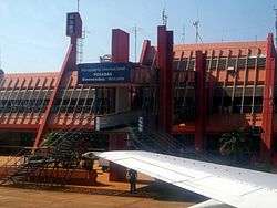
Libertador General José de San Martín Airport
Libertador General José de San Martín Airport (Spanish: Aeropuerto de Posadas "Libertador General San Martín") (IATA: PSS, ICAO: SARP) is located 7.5 km (4.7 mi) southwest of the center of Posadas, a city in the Misiones Province of Argentina. The airport covers an area of 329 hectares (813 acres) and is operated by Aeropuertos Argentina 2000[2][3]
Libertador General José de San Martín Airport Aeropuerto de Posadas "Libertador General San Martín" | |||||||||||
|---|---|---|---|---|---|---|---|---|---|---|---|
 | |||||||||||
| Summary | |||||||||||
| Airport type | Public | ||||||||||
| Operator | Aeropuertos Argentina 2000 | ||||||||||
| Serves | Posadas, Argentina | ||||||||||
| Elevation AMSL | 430 ft / 131 m | ||||||||||
| Coordinates | 27°23′10″S 55°58′14″W | ||||||||||
| Map | |||||||||||
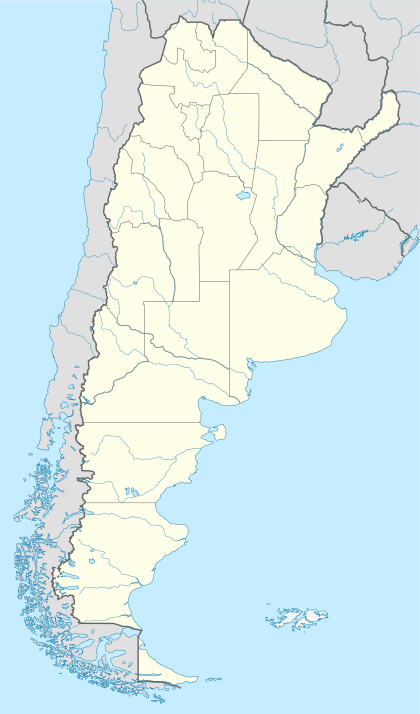 PSS Location of airport in Argentina | |||||||||||
| Runways | |||||||||||
| |||||||||||
| Statistics (2017) | |||||||||||
| |||||||||||
It has a 6,500 square metres (70,000 sq ft) terminal, 67,740 m² of runways, and parking spaces for 100 vehicles. The Posadas VOR-DME (Ident: POS) is located on the field.[7]
Airlines and destinations
| Airlines | Destinations |
|---|---|
| Aerolíneas Argentinas | Buenos Aires–Aeroparque |
| Aerolíneas Argentinas Operated by Austral Líneas Aéreas | Buenos Aires–Aeroparque, Córdoba |
| Flybondi | Buenos Aires–El Palomar[8] |
Statistics
| Passengers | Change from previous year | Aircraft operations | Change from previous year | Cargo (metric tons) | Change from previous year | |
|---|---|---|---|---|---|---|
| 2001 | 128,000 | - | 2,666 | - | - | - |
| 2002 | 93,000 | 1,684 | - | - | ||
| 2003 | 101,787 | 1,297 | - | - | ||
| 2004 | 122,000 | 1,484 | - | - | ||
| 2005 | 113,000 | 1,482 | 564 | |||
| 2006 | 108,000 | 1,334 | 455 | |||
| 2007 | 65,019 | 863 | 313 | |||
| 2008 | 62,000 | 742 | 210 | |||
| 2009 | 114,000 | 1,325 | 345 | |||
| 2010 | 97,000 | 1,494 | 379 | |||
| 2011 | 93,000 | 1,319 | - | - | ||
| 2012 | 96,000 | 1,361 | - | - | ||
| 2013 | 111,000 | 1,431 | - | - | ||
| 2014 | 129,000 | 1,529 | - | - | ||
| 2015 | 175,000 | 1,948 | - | - | ||
| 2016 | 174,000 | 1,964 | - | - | ||
| 2017 | 209,000 | 2,190 | - | - | ||
| Source: Airports Council International. World Airport Traffic Statistics (Years 2005-2010) | ||||||
Accidents and incidents
On June 12, 1988, Austral Líneas Aéreas Flight 46 undershot the runway, resulting in 22 deaths.[9]
gollark: So the initial simple minimax thing didn't work well because it couldn't search deep trees because combinatorial explosion.
gollark: Which I guess would come under "more computing resources". But anyway.
gollark: Anyway, I *did* have an idea to make the AI work better without substantially more computing resources or accursed neural network™ things.
gollark: I don't know, consideration is your problem.
gollark: Well, I would actually need more money than that to get more GPU compute.
See also


- Transport in Argentina
- List of airports in Argentina
References
- Airport Council International 2010 World Airport Traffic Report
- "SARP - Posadas / Libertador Gral. D. José de San Martín" (PDF). Archived from the original (PDF) on 2011-05-31. at AIP Argentina (in Spanish)
- Aeropuerto de Posadas "Libertador General San Martín" at Organismo Regulador del Sistema Nacional de Aeropuertos (ORSNA) (in Spanish)
- Airport information for SARP at World Aero Data. Data current as of October 2006.Source: DAFIF.
- Airport information for Libertador General José de San Martín Airport at Great Circle Mapper.
- "Libertador General José de San Martín Airport". Google Maps. Google. Retrieved 8 May 2019.
- "Posadas VOR". Our Airports. Retrieved 8 May 2019.
- Flybondi begin service to Posadas from April 2018
- Ranter, Harro. "ASN Aircraft accident McDonnell Douglas DC-9-81 (MD-81) N1003G Posadas Airport, MI (PSS)". aviation-safety.net. Aviation Safety Network. Retrieved 2020-06-10.
External links
- OpenStreetMap - Posadas Airport
- Posadas, PSS at Aeropuertos Argentina 2000 (official web site)
- Current weather for SARP at NOAA/NWS
- Accident history for PSS at Aviation Safety Network
This article is issued from Wikipedia. The text is licensed under Creative Commons - Attribution - Sharealike. Additional terms may apply for the media files.