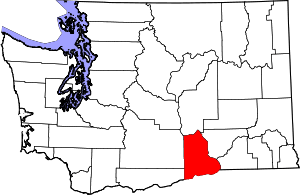
Kennewick, Washington
Kennewick (/ˈkɛnəwɪk/) is a city in Benton County in the U.S. state of Washington. It is located along the southwest bank of the Columbia River, just southeast of the confluence of the Columbia and Yakima rivers and across from the confluence of the Columbia and Snake rivers. It is the most populous of the three cities collectively referred to as the Tri-Cities (the others being Pasco and Richland). The population was 73,917 at the 2010 census. The Census Bureau estimates the city's population at 84,347 as of July 1, 2019.[7][8]
Kennewick, Washington | |
|---|---|
| City of Kennewick | |
.jpg) An aerial view of Kennewick taken from above the Columbia River near the Blue Bridge. | |
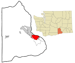 Location of Kennewick, Washington | |
 Kennewick, Washington Location in the United States | |
| Coordinates: 46°12′13″N 119°9′33″W | |
| Country | United States |
| State | Washington |
| County | Benton |
| Government | |
| • Type | Council–manager |
| • Mayor | Don Britain[1] |
| • City manager | Marie Mosley[2] |
| Area | |
| • City | 28.84 sq mi (74.70 km2) |
| • Land | 27.45 sq mi (71.09 km2) |
| • Water | 1.39 sq mi (3.61 km2) |
| Elevation | 407 ft (124 m) |
| Population | |
| • City | 73,917 |
| • Estimate (2019)[5] | 84,347 |
| • Rank | US: 411st WA: 14th |
| • Density | 3,072.86/sq mi (1,186.42/km2) |
| • Urban | 232,954 (US: 171st) |
| • Metro | 296,224 (US: 164th) |
| • CSA | 357,146 (US: 103rd) |
| • Tri-Cities | 215,024 |
| Time zone | UTC−8 (Pacific (PST)) |
| • Summer (DST) | UTC−7 (PDT) |
| ZIP Codes | 99336–99338 |
| Area code(s) | 509 |
| FIPS code | 53-35275 |
| GNIS feature ID | 1512347[6] |
| Website | www.go2kennewick.com |
The discovery of Kennewick Man along the banks of the Columbia River provides evidence of Native Americans' settlement of the area for at least 9,000 years.[9] American settlers began moving into the region in the late 19th century as transportation infrastructure was built to connect Kennewick to other settlements along the Columbia River. The construction of the Hanford Site at Richland accelerated the city's growth in the 1940s as workers from around the country came to participate in the Manhattan Project. While Hanford and Pacific Northwest National Laboratory continue to be major sources of employment,[10] the city's economy has diversified over time and now hosts offices for Amazon and Lamb Weston.[11][12]
History
Native peoples
Native Americans populated the area around modern-day Kennewick for millennia before being discovered and settled by European descendants. These inhabitants consisted of people from the Umatilla, Wanapum, Nez Perce, and Yakama tribes. Kennewick's low elevation helped to moderate winter temperatures. On top of this, the riverside location made salmon and other river fish easily accessible. By the 19th century, people lived in and between two major camps in the area. These were located near present-day Sacajawea State Park in Pasco and Columbia Point in Richland. Lewis and Clark noted that there were many people living in the area when they passed through in 1805 and 1806.[13] The map produced following their journey marks two significant villages in the area - Wollawollah and Selloatpallah. These had approximate populations of 2,600 and 3,000 respectively.[14]
There are conflicting stories on how Kennewick gained its name, but these narratives attribute it to the Native Americans living in the area. Some reports claim that the name comes from a native word meaning "grassy place".[15] It has also been called "winter paradise," mostly because of the mild winters in the area. In the past, Kennewick has also been known by other names. The area was known as Tehe from 1886 to 1891, and this name appears on early letters sent to the area with the city listed as Tehe, Washington.[16] Other reports claim that the city's name is derived from how locals pronounced the name Chenoythe, who was a member of the Hudson's Bay Company.[17]
Settlement and early 20th century
.jpeg)
The Umatilla and Yakama tribes ceded the land Kennewick sits on at the Walla Walla Council in 1855.[18] Ranchers began working with cattle and horses in the area as early as the 1860s, but in general settlement was slow due to the arid climate. Ainsworth became the first non-Native settlement in the area—where U.S. Route 12 now crosses the Snake River between Pasco and Burbank. Some Ainsworth residents would commute to what is now Kennewick via small boats for work. All that remains of Ainsworth is a marker placed by the Washington State Department of Transportation near the site.[19]
During the 1880s, steamboats and railroads connected what would become known as Kennewick to the other settlements along the Columbia River.[13] Until the construction of a railroad bridge, rail freight from Minneapolis to Tacoma had to cross the Columbia River via ferry.[20] In 1887, a temporary railroad bridge was constructed by the Northern Pacific Railroad connecting Kennewick and Pasco. That bridge could not endure the winter ice on the Columbia and was partially swept away in the first winter. A new, more permanent bridge was built in its place in 1888. It was around this time that a town plan was first laid out, centered around the needs of the railroad. A school was constructed using donated funds, but this burned soon after it was finished. This initial boom only lasted briefly, as most of the people who came to Kennewick left after the bridge was finished.[17]
In the 1890s, the Northern Pacific Irrigation Company installed pumps and ditches to bring water for agriculture into the Kennewick Highlands. Once there was a reliable water source, orchards and vineyards were planted all over the Kennewick area. Strawberries were another successful crop.[21] The turn of the century saw the creation of the city's first newspaper, the Columbia Courier. Kennewick was officially incorporated on February 5, 1904. and the name of the newspaper changed to the Kennewick Courier in 1905 to reflect this change.[22] In the following decade, an unsuccessful bid attempted to move the seat of Benton County from Prosser to Kennewick. There have been other unsuccessful attempts to make this move throughout the city's history, most recently in 2010.[23][24]
In 1915, the opening of the Celilo Canal connected Kennewick to the Pacific Ocean via the Columbia River. City residents hoped to capitalize on this new infrastructure by forming the Port of Kennewick, making the city an inland seaport. Freight and passenger ship traffic began that same year. The port also developed rail facilities in the area.[25] Transportation in the region further improved with the construction of the Pasco-Kennewick Bridge in 1922, which is locally known as the Green Bridge. This bridge connected the two cities by vehicle traffic for the first time.[26][27] Kennewick and Pasco both experienced decent growth and became informally known as the Twin Cities throughout the Columbia Basin because of their juxtaposition across the river from each other.
Like many other agricultural communities, the Great Depression had an impact in Kennewick. Despite lowered prices for crops grown in the region, the city continued to experience growth, gaining another 400 people during the 1930s. Growth was aided by federal projects that improved the Columbia River. Downstream, Bonneville Dam at Cascade Locks, Oregon allowed larger barges to reach Kennewick. Grand Coulee Dam, located upstream of Kennewick, fostered irrigation across the Columbia Basin north of Pasco, sending more raw material through Kennewick.[13]
Hanford boom
Kennewick and the greater Tri-Cities area experienced significant changes during World War II. In 1943, the United States opened the Hanford nuclear site in and north of Richland. Its purpose originally was to help produce nuclear weaponry, which the US was trying to develop. People came from across the United States to work at Hanford, who were unaware of what they were actually producing. They were only told that their work would help the war effort.[28] The federal government constructed housing in Richland, but many employees of that site then commuted from Kennewick. The plutonium refined at the Hanford Site was used in the Fat Man bomb, which was dropped in Nagasaki in 1945 in the decisive final blow of the war. As the Hanford Site's purpose has evolved, there has continually been a tremendous influence from the site on the workforce and economy of Kennewick.[29][10] Due to activity at the Hanford Site, the 1950 census recorded major population growth in the Tri-Cities, with Richland overtaking to become the largest city in the region. From 1940 to 1950, the population of Richland grew from 247 residents to 21,793 residents, while Pasco gained from 3,913 to 10,114, and Kennewick increased from 1,918 to 10,085.[30]
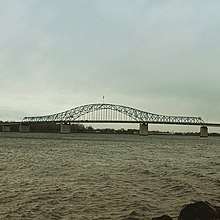
An effort to build a new bridge began in 1949 and was funded in 1951. Traffic between Kennewick and Pasco, largely due to commuters heading to and from the Hanford Site in Richland and McNary Dam, which was under construction near Umatilla, Oregon. The two-lane Green Bridge was the only one for automobiles across the Columbia River in the Tri-Cities at the time, and the 10,000 cars crossing it daily had created traffic problems. A new four-lane divided highway bridge, dubbed the Blue Bridge, opened in 1954 less than 2 miles (3.2 km) upstream from the Green Bridge.[31] The Cable Bridge opened between Kennewick and Pasco in 1978 and was built to replace the Green Bridge. However, demolishing the Green Bridge proved to be controversial. Those seeking to preserve the bridge for historical reasons were able to stall the demolition, but it was eventually torn down in 1990.[32]
Racial discrimination against African Americans was common in Kennewick before the civil rights movement. The city had been a sundown town, which required African Americans to be out of the city after nightfall. The only place they could live in the Tri-Cities at the time was east Pasco. Even during the day, African Americans would experience harassment by the general public and police. In 1963, the Washington State Board Against Discrimination indicted Kennewick for its sundown town policy.[33][34]
The 1980 eruption of Mount St. Helens caused several inches of volcanic ash to fall on Kennewick. Higher accumulations were recorded in Yakima and Ritzville, but the ash plume was thick enough to trigger street lamps to turn on at noon. Cars that didn't have external filters stopped functioning during the eruption, and it took several months to completely clean all the ash.[35][36] Kennewick and surrounding areas have been dusted by smaller eruptions of Mount St. Helens since.[37]
The 1980s also brought the two most serious attempts to merge Kennewick with the other cities in the Tri-Cities, both of which failed. This resulted from an economic down turn in the area caused by the cancellation of two proposed nuclear power plants on the Hanford Site. The first proposal was to consolidate all three cities (Kennewick, Pasco, and Richland) into one, while the second only included Kennewick and Richland. Support for both of these attempts was strong in Richland, but voters in Kennewick and Pasco were not on board.[38]
1990 to present
The Toyota Center was used as a venue for ice hockey and figure skating during the 1990 Goodwill Games.[39] This international sporting competition was similar to the Olympic Games, but significantly smaller in scale. Most of the events were held in the host city, Seattle, but were also staged in other areas of the state, including Tacoma and Spokane.[40]
In 1996, an ancient human skeleton was found on a bank of the Columbia River. Known as Kennewick Man, the remains are notable for their age (some 9,300 years). Ownership of the bones has been a matter of controversy with Native American tribes in the Inland Northwest claiming the bones to be from an ancestor of theirs and wanting them to be reburied. After a court litigation, a group of researchers were allowed to study the remains and perform various tests and analyses. They published their results in a book in 2014. A 2015 genetic analysis confirmed the ancient skeleton's ancestry to the Native Americans of the area (some observers contended that the remains were of European origin). The genetic analysis has notably contributed to knowledge about the peopling of the Americas.[41]
Kennewick fared better than most of the state during the Great Recession, primarily due to consistent job growth in the metro area during that time. This was largely driven by the Hanford Site, which only had one significant period of layoffs which briefly caused economic uncertainty. Home sales experienced a small decline from 2007 to 2009, but rebounded in 2010.[42][43] Since the recession, Kennewick has expanded greatly. While growth has been experienced throughout the city, new development has been strongest in the Southridge area along U.S. Route 395 (US 395) and in the west part of the city thanks to their access to major roads and the ample available in those areas when development started.[44]
Geography
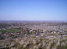
Kennewick is located in Eastern Washington along the south side of the Columbia River and is one of three cities in the Tri-Cities. The other two cities are Richland, which is upstream of Kennewick on the same side of the river, and Pasco, which is across the river. The elevation within the city rises from the river to a line of ridges on the south side of town that are a result of the same anticline that created Badger Mountain and Rattlesnake Mountain.[45] Beyond that line of ridges, the city slopes up toward the Horse Heaven Hills.[46] According to the United States Census Bureau, the city has a total area of 28.36 square miles (73.45 km2), of which, 26.93 square miles (69.75 km2) is land and 1.43 square miles (3.70 km2) is water.[47] The former community of Vista is now a neighborhood fully contained within Kennewick.
The city overlies basalt laid down by the Columbia River Basalt Group, which was a type of volcanic eruption known as a flood basalt. This erupted from fissures that were geographically spread throughout eastern Washington, eastern Oregon, and far western Idaho. Most of the lava erupted between 17 and 14 million years ago, with smaller eruptions lasting as late as 6 million years ago.[48][49] The nearest eruptive vent to Kennewick from this period is near Ice Harbor Dam along the Snake River upstream of Burbank and Pasco. While outcroppings from the basalt flows can be seen throughout Kennewick, they are mostly buried by sediments.[50]
The first major sediment deposit following the eruptions is the Ringold Formation, which was placed by the Columbia River between 8 and 3 million years ago. Further deposition came as a result of the Missoula Floods.[45] At the end of the last glacial maximum, an ice dam blocked the Clark Fork River in Montana. The pressure from the resulting lake would periodically build to the point that the dam would fail, sending massive amounts of water cascading to the Pacific Ocean.[51] The flood's movement was impeded by the Horse Heaven Hills, creating a temporary lake known as Lake Lewis. This abrupt halt in flow allowed the floodwater to drop a significant amount of sediment before passing through Wallula Gap toward Hermiston. During the largest floods, the water's surface reached 1,250 feet (380 m) above sea level. This completely covered all of the land within Kennewick's city limits.[52]
Earthquakes are a hazard in Kennewick, though not to the same extent or frequency as areas west of the Cascade Range like the Puget Sound Region. The entire Pacific Northwest is threatened with subduction zone earthquakes that can exceed magnitudes of 9 on the moment magnitude scale. The last of these earthquakes, which could be compared to the 2011 Tōhoku earthquake in Japan, occurred in 1700.[53] Should the next earthquake occur, damage is expected to be minimal in and around Kennewick, but destruction west of the Cascades could have a major impact of the economy of inland areas. These subduction zone earthquakes will be centered on the boundary between the North American Plate and the Juan de Fuca Plate, which is located offshore.[54] Fault lines closer to Kennewick also produce earthquakes. While these are weaker, they can still cause damage. One such earthquake, named the 1936 State Line earthquake, occurred near Walla Walla with damage extending as far away as Prosser.[55]
Climate
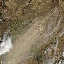
Kennewick has a semi-arid climate (Köppen BSk), that closely borders on a desert climate (Köppen BWk) due to its position east of the Cascade Mountains.[56] The Cascades create an effective rain shadow, causing Kennewick to receive a fraction of the precipitation that cities west of the mountains like Portland and Seattle get annually, with values being more similar to that of Phoenix, Arizona. The mountains also insulate Kennewick from the moderating effects of the Pacific Ocean, allowing the city to experience more extreme temperatures.[57][58]
Before McNary Dam was built on the Columbia River downstream of Kennewick, the river would periodically flood. The worst of these floods happened in 1948 and caused one death and $50 million ($533.6 million in 2019) worth of damage.[59] The government responded by building the McNary Levee System to protect lower parts of town.[60] Floods like this were the result of melting snow, and were most extreme when a heavy snowpack developed in the mountains over winter followed by a strong regional heatwave. The flood threat from the Columbia has significantly decreased since dams were built.[61] Zintel Canyon Dam located near the Southridge Sports and Events Complex was built to protect parts of the city from a 100-year flood. While the creek that flows through Zintel Canyon typically runs dry, summer thunderstorms in the Horse Heaven Hills can generate destructive flash floods.[62]
Laying at the bottom of a basin, temperature inversions can develop, creating dense fog and low clouds in Kennewick. This is particularly common in the winter and can last for several days. Inversions form during periods of high pressure. High pressure combining with the low angle of the sun in winter brings stability in the atmosphere, allowing denser cold air to sink to the floor of the Columbia Basin. Pollutants will also become trapped, lowering the air quality. When fog develops during an inversion, it will often limit diurnal temperature changes to just a few degrees. Temperatures in areas above the inversion will often be warmer despite being at a higher elevation.[63] These inversions cause a major decrease in the amount of sunshine Kennewick receives annually.[64] If a weather system drops precipitation but isn't strong enough to clear the inversion, freezing rain or sleet can fall in Kennewick.[65]
The average annual wind speed in Kennewick is 8 miles per hour (13 km/h), but strong winds are a common occurrence in Kennewick and can sometimes cause damage.[66] Wind and the arid nature of the region can cause dust storms. These events can happen any time of the year but is most common in the spring and fall months when farms in the region have high amounts of exposed soil.[67] Chinook winds can also be experienced during the winter. These are formed when moisture gets removed from air moving across the Cascade Mountains, allowing the air to warm significantly as it descends into the Yakima Valley and Columbia Basin. Many of the high temperature records set during the winter months result from Chinook events.[68][69]
Summer brings extreme heat and low humidity, which are ideal conditions for wildfires in undeveloped areas adjacent to town. One such fire in 2018 started along Interstate 82 south of Kennewick and burned 5,000 acres (2,000 ha), destroying five homes on the edge of Kennewick.[70] While rare, severe thunderstorms can also cause damage in Kennewick. Severe storms can produce damaging wind, hail, lightning, and weak tornadoes. No tornadoes were recorded in Kennewick between 1962 and 2011, but one did touch down in 2016.[71][72]
| Climate data for Kennewick, Washington | |||||||||||||
|---|---|---|---|---|---|---|---|---|---|---|---|---|---|
| Month | Jan | Feb | Mar | Apr | May | Jun | Jul | Aug | Sep | Oct | Nov | Dec | Year |
| Record high °F (°C) | 69 (21) |
74 (23) |
82 (28) |
91 (33) |
104 (40) |
107 (42) |
108 (42) |
110 (43) |
100 (38) |
89 (32) |
79 (26) |
68 (20) |
110 (43) |
| Average high °F (°C) | 40.1 (4.5) |
48.4 (9.1) |
58.0 (14.4) |
66.8 (19.3) |
75.3 (24.1) |
82.9 (28.3) |
90.6 (32.6) |
88.8 (31.6) |
79.5 (26.4) |
65.5 (18.6) |
50.2 (10.1) |
41.5 (5.3) |
65.6 (18.7) |
| Average low °F (°C) | 27.0 (−2.8) |
30.8 (−0.7) |
35.4 (1.9) |
41.2 (5.1) |
48.3 (9.1) |
54.8 (12.7) |
59.7 (15.4) |
58.9 (14.9) |
50.6 (10.3) |
41.1 (5.1) |
34.4 (1.3) |
29.1 (−1.6) |
42.6 (5.9) |
| Record low °F (°C) | −19 (−28) |
−23 (−31) |
10 (−12) |
22 (−6) |
30 (−1) |
38 (3) |
42 (6) |
41 (5) |
30 (−1) |
17 (−8) |
−8 (−22) |
−7 (−22) |
−23 (−31) |
| Average precipitation inches (mm) | 1.10 (28) |
0.73 (19) |
0.65 (17) |
0.50 (13) |
0.59 (15) |
0.48 (12) |
0.22 (5.6) |
0.28 (7.1) |
0.31 (7.9) |
0.59 (15) |
0.99 (25) |
1.13 (29) |
7.57 (193.6) |
| Average snowfall inches (cm) | 3.6 (9.1) |
0.8 (2.0) |
0.1 (0.25) |
0 (0) |
0 (0) |
0 (0) |
0 (0) |
0 (0) |
0 (0) |
0 (0) |
0.2 (0.51) |
1.7 (4.3) |
6.4 (16.16) |
| Source: Western Regional Climate Center (1948–2005)[73] | |||||||||||||
Demographics
| Historical population | |||
|---|---|---|---|
| Census | Pop. | %± | |
| 1900 | 183 | — | |
| 1910 | 1,219 | 566.1% | |
| 1920 | 1,684 | 38.1% | |
| 1930 | 1,519 | −9.8% | |
| 1940 | 1,918 | 26.3% | |
| 1950 | 10,106 | 426.9% | |
| 1960 | 14,244 | 40.9% | |
| 1970 | 15,212 | 6.8% | |
| 1980 | 34,397 | 126.1% | |
| 1990 | 42,155 | 22.6% | |
| 2000 | 54,693 | 29.7% | |
| 2010 | 73,917 | 35.1% | |
| Est. 2019 | 84,347 | [5] | 14.1% |
| Population History[74] | |||
2010 census
As of the 2010 census, there were 73,917 people, 27,266 households, and 18,528 families residing in the city. The population density was 2,744.8 inhabitants per square mile (1,059.8/km2). There were 28,507 housing units at an average density of 1,058.6 per square mile (408.7/km2). The racial makeup of the city was 78.5% White, 1.7% African American, 0.8% Native American, 2.4% Asian, 0.2% Pacific Islander, 12.1% from other races, and 4.3% from two or more races. Hispanic or Latino of any race were 24.2% of the population.[4]
Of the 27,266 households, 37.9% had children under the age of 18 living with them, 49.3% were married couples living together, 13.0% had a female householder with no husband present, 5.7% had a male householder with no wife present, and 32.0% were non-families. 25.7% of all households were made up of single individuals and 8.8% had someone living alone who was 65 years of age or older. The average household size was 2.67 and the average family size was 3.22.[4]
The median age in the city was 32.6 years. 28.2% of residents were under the age of 18; 10.3% were between the ages of 18 and 24; 26.8% were from 25 to 44; 23.8% were from 45 to 64; and 10.9% were 65 years of age or older. The gender makeup of the city was 49.9% male and 50.1% female.[4]
2000 census
As of the 2000 census, there were 54,693 people, 20,786 households, and 14,176 families residing in the city. The population density was 2,384.9 people per square mile (920.9/km2). There were 22,043 housing units at an average density of 961.2 per square mile (371.2/km2). The racial makeup of the city was 82.9% White, 1.1% Black or African American, 0.9% Native American, 2.1% Asian, 0.1% Pacific Islander, 9.4% from other races, and 3.4% from two or more races. 15.5% of the population was Hispanic or Latino of any race. 18.2% were of German, 9.6% English, 8.5% Irish and 8.5% American ancestry. 84.6% spoke English and 12.5% Spanish as their first language.[76]
There were 20,786 households, out of which 37.6% had children under the age of 18 living with them, 51.5% were married couples living together, 12.2% had a female householder with no husband present, and 31.8% were non-families. 26.1% of all households were made up of individuals, and 8.6% had someone living alone who was 65 years of age or older. The average household size was 2.6 and the average family size was 3.15.[76]
In the city, the population was spread out, with 29.6% under the age of 18, 10.3% from 18 to 24, 29.3% from 25 to 44, 20.6% from 45 to 64, and 10.2% who were 65 years of age or older. The median age was 32 years. For every 100 females, there were 98.3 males. For every 100 females age 18 and over, there were 94.3 males.[76]
The median income for a household in the city was $41,213, and the median income for a family was $50,011. Males had a median income of $41,589 versus $26,022 for females. The per capita income for the city was $20,152. About 9.7% of families and 12.9% of the population were below the poverty line, including 18.8% of those under age 18 and 8.7% of those age 65 or over.[76]
Economy
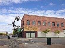
Kennewick's economy is closely tied to the rest of the Tri-Cities and is heavily influenced by the Hanford Site and the national laboratory. The agriculture and healthcare industries also employ many residents.[77] It has developed to become the retail hub of the Tri-Cities and hosts the only mall in the area—Columbia Center Mall.[13] As such, Kennewick draws in shoppers from a significant portion of southeast Washington and northeast Oregon.[78] Aside from the commercial area around the mall, the other significant retail districts include the historic downtown area and the newly developed Southridge district.[79][80]
Many agricultural commodities are grown near Kennewick, and many of these pass through the city to be processed and/or transported to other markets for consumption. Boise, Idaho-based Lamb Weston, a division of ConAgra Foods, has corporate offices in Kennewick and Tyson Foods does processing in town.[77] Volcanic ash is mixed in with the rich soil of the region, creating ideal growing conditions for numerous crops.[81] Irrigation enhanced the region through further diversification of agricultural products coming from the Columbia Basin to include vineyards and a variety of vegetables and tree fruit. In higher elevations, like much of the Horse Heaven Hills, there is no access to irrigation water, limiting agricultural activities in that area to ranching and growing wheat.[13][82][83]
The region is experiencing consistent job growth, which is creating a large population boom. Home prices have increased by about 10% annually in Kennewick for the past several years, with slower increases having occurred before 2016.[78] Despite this growth, unemployment remained above both the national and state averages in 2020.[84] Recently, industrial growth in Hermiston and at the Port of Morrow in Boardman has led to an increase in the number of Kennewick residents who commute to those areas for work.[85] This is further enhanced by a housing shortage in northeast Oregon.[86][87]
Culture
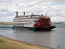
Kennewick hosts a number of events throughout the year, many of which are held outdoors in public parks during the warm season.[88] The largest weekend event in town is the Tri-Cities Water Follies, which fill the weekend of the HAPO Gold Cup, a hydroplane race taking place every July in the Columbia River just upstream of the Blue Bridge.[89] Activities in Kennewick that weekend include the races itself as well as an airshow. There are other events throughout the Tri-Cities during Water Follies, such as Art in the Park, a craft show at Howard Amon Park in Richland.[90][91] Over 70,000 people attend events related to Water Follies each year.[92]
Benton and Franklin Counties combine together to host a single fair at the end of each summer at the fairgrounds off SR 397 in east Kennewick. Like many other county fairs across the United States, the fair has livestock exhibitions, retail, carnival rides, and concerts.[93] Also on site during the fair is a rodeo named the Horse Heaven Round-Up.[94]
Tourism
The arid climate and warm temperatures during the summer draw people to Kennewick from around the Pacific Northwest. Many summertime visitors engage in boating and other water related activities in the Columbia, Snake, and Yakima rivers.[95] The city and port district work together to further develop tourism throughout the city. This includes recent improvements to Clover Island, which has a hotel, lighthouse, and the Ice Harbor Brewing Company.[96][97][98] Adjacent to Clover Island is historic downtown, which has many antique and clothing shops. As of 2020, work is ongoing to develop the former Vista Field area in the west side of town into a mixed-use development that will include shopping.[99]
Kennewick lies near the center of Washington's wine country, which stretches from the Yakima Valley through the Columbia Basin and Horse Heaven Hills east to the Walla Walla Valley. There are several American Viticultural Areas near town. Wine tasting is a major part of the Tri-Cities tourism economy, with over 300 wineries and wine bars rooms in the area.[100] The city actively markets this to bring in visitors.[101] Cruises travel up the Columbia from Portland with a stop in the Tri-Cities to tour wineries in the area.[102]
Sports
| Club | Sport | League | Venue (capacity) | Founded | Titles | Record Attendance |
|---|---|---|---|---|---|---|
| Tri-City Americans | Hockey | WHL | Toyota Center (5,694) | 1988 | 0 | 6,053 |
| Tri-Cities Fire | Indoor American football | AWFC | Toyota Center (6,000) | 2019 | 0 | - |

Kennewick hosts two professional sports teams, the Tri-City Americans of the Western Hockey League and Tri-Cities Fire of the American West Football Conference. Both teams play at the Toyota Center.[103][104] The other professional sports team in the Tri-Cities, the Tri-City Dust Devils (a farm team of the San Diego Padres) plays at Gesa Stadium in Pasco.[105]
The Tri-City Americans were one of the original teams in the Western Hockey League, starting in Calgary, Alberta in 1966. The team moved a couple times before coming to the Tri-Cities in 1988, most recently being in a suburb of Vancouver, British Columbia. The team's move to the Tri-Cities made them the first professional hockey team to play in the area and was the catalyst for constructing the Toyota Center.[106] The Americans have won the US Division four times, but have not yet won a Western Conference final.[107]
The Tri-Cities Fire are an indoor football team playing in a league with three other teams. The team was founded in 2019, bringing indoor football back to the Toyota Center after the Tri-City Fever went dormant in 2016.[108][109] The Fire finished their first season with an 0-12 record, the worst in the league.[110] The Fever won one National Indoor Football League championship in 2005, beating the Rome Renegades. They went to the Indoor Football League championship game in 2011 and 2012, losing to Sioux Falls Storm both years.[111]
While Kennewick does not currently host a professional baseball team, they have a long history of doing so in the past. Professional minor league teams have played in Kennewick starting as early as 1950 with the Tri-City Braves. Other teams included the Tri-City Atoms, the Tri-City A's, the Tri-City Triplets, and the Tri-City Ports. All of these played at Sanders-Jacobs Field, which has since been demolished.[112] The city presently hosts the Atomic City Rollergirls, an amateur roller derby team.[113] Washington State University occasionally plays basketball at the Toyota Center.[114]
Media
The only daily newspaper published in the Tri-Cities, the Tri-City Herald, is based in downtown Kennewick.[115] The Tri-Cities Journal of Business is a monthly print publication that is also located in Kennewick and also has a significant online presence. The Journal of Business also publishes the Senior Times, whose target demographic is Tri-Citians who are 60 years or older.[116][117] The city hosts Tú Decides, a bilingual weekly news publication that is both in print and online. Tú Decides is available in both Spanish and English.[118] Richland based Tumbleweird is an alternative newspaper published monthly that covers the Tri-Cities.[119]
Kennewick and the Tri-Cities share a television market with Yakima. Because of this, the local affiliates of major national networks are closely linked to the affiliates in Yakima. The studios of the Tri-Cities affiliates of NBC, ABC, and Fox are located in Kennewick. These are KNDU, KVEW, and KFFX respectively.[120][121][122] The CBS affiliate, KEPR is in Pasco.[123] KFFX does not produce any local programming, instead it acquires its news from KNDU and its parent station—KHQ in Spokane. Unlike the television market, the Tri-Cities and Yakima have separate radio markets. Sixteen radio stations are licensed in Kennewick by the FCC with others in nearby cities. There are several religious non-commercial radio stations with coverage in Kennewick. The school district operates a student-run station out of Tri-Tech.[124] NPR member stations Northwest Public Radio and Oregon Public Broadcasting also serve Kennewick.[125][126]
Parks and recreation
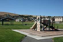
Kennewick's low precipitation values and mild-to-warm weather provide opportunities for outdoor recreation throughout much of the year. The city's Parks and Recreation Department operates 27 parks plus other facilities for the public to use. Many parks have shelters that can be reserved for events, with most of them offering playgrounds.[127] There are three athletic complexes throughout the city as well.[128] The Parks and Recreation Department also maintains several hiking and bike trails in the city, including the portion of the Sacagawea Heritage Trail that passes through Kennewick.[129]
The largest park in the city's system is Columbia Park, which is a riverfront area to the north of SR 240 from the Richland/Kennewick city line in the west to the Blue Bridge in the east. There are several boat launches here offering access to the Columbia River. Kayaking and canoeing is another popular water activity. The Sacagawea Heritage Trail, a bike path connecting all three of the Tri-Cities, passes through the entire length of the park. The most developed portion of the park is the east end, which has a veterans memorial, golf course, fishing pond, and a large playground.[130] Columbia Park hosts the HAPO Gold Cup, an annual hydroplane race.[131] The part of Richland adjacent to the park is Columbia Park West. Combined, the two form 450 acres (180 ha) of contiguous public recreation land along the river.[132][133]
In the early 2010s, the city built the 52 acres (21 ha) Southridge Sports and Events Complex in the quickly growing south end of town along US 395.[134] This property is primarily used for scheduled sporting events, such as baseball, basketball, and volleyball. That said, it also has recreational facilities that don't need to be reserved, such as a playground and open fields.[135] Kennewick was able to secure a piece of the World Trade Center from the Port Authority of New York and New Jersey, which is located in the southeast corner of the complex as a memorial to the victims of the September 11 attacks in 2001.[136] The complex was considered complete when the historic carousel that the city restored was opened on the site.[137]
Government
Kennewick is a code city that operates under the council–manager form of government. The city council has seven members, four of which are elected at-large while three are elected by the city's three electoral wards.[138] The mayor is selected by the councilmembers. Kennewick's City Manager serves under the direction of the City Council, and administers and coordinates the delivery of municipal services.[139]
The City of Kennewick is a full-service city, providing police, fire prevention and suppression, emergency medical response, water and sewer, parks, public works, planning and zoning, street maintenance, code enforcement, and general administrative services to residents. The city also operations a regional convention center.[140] According to the City's 2018 audited financial report, the cities total annual expenses are $96.6 million, of which $24.2 million is funded by Sales Tax, $13.1 million by Utility Tax and $13.0 million by Property Tax.[140]:6
The citizens of Kennewick are represented in the Washington Senate by Sharon Brown in District 8, and Maureen Walsh in District 16, and in the Washington House of Representatives by Brad Klippert and Matt Boehnke in District 8, and Bill Jenkin and Skyler Rude in District 16.[141] At the national level, Kennewick and the rest of the Tri-Cities are part of the 4th congressional district, has been represented by Republican Dan Newhouse since 2015.[142][143]
Education
Out of the city's residents who are 25 years or older, 88% hold a high school diploma (or equivalent) with 24% holding a bachelor's degree or better. These rates are higher than Pasco, but lower than Richland.[144] Kennewick does not have any post-secondary institutions, but is located near Columbia Basin College in Pasco or Washington State University Tri-Cities in Richland.[145][146]
Public schools located in the city are part of the Kennewick School District (KSD). The Kennewick School District has 17 elementary schools, five middle schools, three high schools serving over 18,000 students.[147] A vocational school is operated by KSD—with funding also coming from other local school districts—named the Tri-Tech Skills Center. Vocational programs at Tri-Tech include firefighting, radio broadcasting, and auto body technology.[148] Similarly, KSD contributes funding to Delta High School in Pasco, which is a STEM-focused school drawing students from around the Tri-Cities. KSD also operates Neil F. Lampson Stadium, located at Kennewick High School, which is used to host football and soccer games for the three high schools in town as well as for special events.[149] Lampson Stadium has a capacity of 6,800 people.[150]
There are five private schools for educating children in Kennewick. Many of these are run by Christian churches, including St. Joseph's Catholic School and Bethlehem Lutheran School.[151][152]
Infrastructure
Transportation
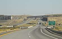
The nearest commercial airport to Kennewick is the Tri-Cities Airport in Pasco, with flights to several major international airports in the western part of the country. The busiest route is between Pasco and Seattle–Tacoma.[153] Pasco also has the station for both Amtrak's Empire Builder and Greyhound Lines.[154][155] The Port of Kennewick formerly operated Vista Field near the Toyota Center as a general aviation airport, but it closed at the end of 2013. The port plans to turn the land into a mixed-use development.[156]
Interstate 82 bypasses Kennewick to the south, connecting to Seattle via Interstate 90 and both Portland and Salt Lake City via Interstate 84. US 395 passes through town from south to north connecting to Spokane, also via Interstate 90. State Route 240 and State Route 397 also pass through Kennewick, but these mostly serve local traffic. SR 240 connects the Hanford Site to Richland and also travels across the Columbia River on the Blue Bridge to Pasco. SR 397 connects both Interstate 82 and Interstate 182 in Pasco (via the Cable Bridge) to Finley, providing a direct route for freight to go to a chemical plant there.[157]
Public transportation in Kennewick is provided by Ben Franklin Transit, which runs several bus routes that provide intra-city service as well as connections to Pasco and Richland. There are two transit centers in Kennewick: the Three Rivers Transit Center near the Toyota Center and the Dayton Transfer Point downtown.[158] The transit authority also operates a dial-a-ride service for disabled persons.[159]
Utilities
Water and sewer services are provided by the city, with electricity coming from Benton Public Utility District. Natural gas comes from Cascade Natural Gas. Kennewick contracts with Waste Management for garbage and recycling collection. Many people use irrigation water sourced from nearby rivers to water their lawns. This system is separate from the water provided by the city. Most of Kennewick is part of the Kennewick Irrigation District, with parts of the east side of town being under the Columbia Irrigation District.[160]
Nearly 80% of Kennewick's energy is hydroelectric, with another 10% coming from nuclear. Altogether, less than 5% of the city's electricity is sourced from fossil fuels.[161]
Health care
The only hospital in Kennewick is Trios, located in the Southridge area. Trios is a rebranding of Kennewick General Hospital, and still operates the original hospital near downtown. Trios also operates clinics and urgent care facilities throughout the Tri-Cities.[162] The main Trios Hospital has 111 beds for treating patients. Having many clinics around the Tri-Cities, Kadlec Regional Medical Center in Richland is another major health care player in Kennewick. Kadlec has 270 beds to treat patients.[163]
Trios is a Level III trauma center and is the only hospital in the Tri-Cities that is a designated as a pediatric trauma center.[164] Kadlec is a Level II trauma center and often receives victims from car accidents.[165] Patients needing further care are often transported to Harborview Medical Center in Seattle, which is the only Level I trauma center in the Pacific Northwest.[166] Children with significant medical needs are often treated at Seattle Children's. Seattle Children's operates a clinic in Richland.[167]
Notable people
- Adelle August, actress and 1952 Miss Washington USA[168]
- Stu Barnes, former Tri-City Americans and NHL player, now an assistant coach with the Dallas Stars[169]
- Jeremy Bonderman, Major League Baseball pitcher, Detroit Tigers[170]
- Adam Carriker, defensive end for the Washington Redskins of the National Football League and graduate of Kennewick High School[171]
- Rick Emerson, former radio personality[172]
- Janet Krupin, actress, singer, writer, and producer[173]
- Olaf Kolzig, former Tri-City Americans and NHL goaltender, Washington Capitals[174]
- Damon Lusk, NASCAR driver[175]
- Ray Mansfield, National Football League player, center, Pittsburgh Steelers[176]
- Michael McShane, United States Judge for the District of Oregon[177]
- Leilani Mitchell, Professional basketball player[178]
- Scot Pollard, retired NBA player[179]
- Mike Reilly, NFL quarterback, Pittsburgh Steelers, Green Bay Packers, St. Louis Rams, CFL quarterback, Edmonton Eskimos[180]
- Russ Swan, Major League Baseball pitcher, San Francisco Giants, Seattle Mariners, Cleveland Indians[181]
- Shawn O'Malley, Major League Baseball outfielder, Seattle Mariners[182]
See also

References
- "City Council". City of Kennewick. Retrieved January 18, 2020.
- "City Manager". City of Kennewick. Retrieved January 18, 2020.
- "2019 U.S. Gazetteer Files". United States Census Bureau. Retrieved August 7, 2020.
- "U.S. Census website". United States Census Bureau. Retrieved December 19, 2012.
- "Population and Housing Unit Estimates". United States Census Bureau. May 24, 2020. Retrieved May 27, 2020.
- "US Board on Geographic Names". United States Geological Survey. October 25, 2007. Retrieved January 31, 2008.
- "Population Estimates". United States Census Bureau. Retrieved May 29, 2018.
- "Annual Estimates of the Resident Population: April 1, 2010 to July 1, 2018 - United States -- Metropolitan and Micropolitan Statistical Area; and for Puerto Rico". United States Census Bureau. Retrieved December 28, 2019.
- Stafford, Thomas W. (2014). "Chronology of the Kennewick Man skeleton (chapter 5)". In Douglas W. Owsley; Richard L. Jantz (eds.). Kennewick Man, The Scientific Investigation of an Ancient American Skeleton. Texas A&M University Press. ISBN 978-1-62349-200-7.
- "In strange twist, Hanford cleanup creates latest boom". Seattle Post-Intelligencer.
- "Amazon looking to fill 100 jobs at Kennewick job fair". Tri-City Herald. May 10, 2016. Retrieved December 28, 2019.
- "Lamb Weston Opens Expanded Operations in Richland, WA". Lamb Weston. October 16, 2017. Retrieved December 28, 2019.
- Kershner, Jim (March 2, 2008). "Kennewick — Thumbnail History". HistoryLink. Retrieved December 28, 2019.
- Lewis, Samuel; Clark, William (1814). A map of Lewis and Clark's track across the western portion of North America, from the Mississippi to the Pacific Ocean : by order of the executive of the United States in 1804, 5 & 6 (Map). 1:4,400,000. Longman, Hurst, Rees, Orme & Brown. Retrieved April 21, 2020.
- Majors, Harry M. (1975). Exploring Washington. Van Winkle Publishing Co. p. 134. ISBN 978-0-918664-00-6.
- Hagey, Jason (January 12, 1997). "Tehe And Yakitat All But Lost In History Of Benton County". The Seattle Times. Retrieved April 21, 2020.
- Read, R. E. (February 19, 1950). "Brief history of Kennewick up to 1909". Tri-City Herald. Retrieved December 28, 2019.
- Hanford Reach of the Columbia River. National Park Service. 1992.
- "Roadside Markers of Washington". Explore Washington. Retrieved December 30, 2019.
- "First trains cross the Northern Pacific Railroad bridge spanning the Columbia River between Pasco and Kennewick on December 3, 1887.", History Link; Retrieved November 16, 2009.
- Gibson, Elizabeth. "Benton County – Thumbnail History". HistoryLink.org. March 29, 2004. Retrieved February 28, 2010.
- "About The Kennewick courier. (Kennewick, Wash.) 1905-1914". Library of Congress. Retrieved December 30, 2019.
- Gibson, Elizabeth. "Voters fail to move Benton County seat from Prosser following rivalry with Benton City and Kennewick on November 5, 1912." HistoryLink.org. May 29, 2006. Retrieved February 28, 2010.
- Trumbo, John (September 22, 2010). "Benton County seat move debated with editors". Tri-City Herald. Retrieved December 30, 2019.
- "History". Port of Kennewick. Retrieved December 30, 2019.
- Dorpat, Paul; Sherrard, Jean (2007). Washington Then & Now. Big Earth Publishing. p. 106. ISBN 1-56579-547-4.
- Kershner, Jim (May 1, 2008). "Pasco — Thumbnail History". HistoryLink. Retrieved December 30, 2019.
- "Hanford History". United States Department of Energy. Retrieved December 30, 2019.
- Cary, Annette (October 6, 2013). "Early Hanford workers remember dust, security". Tri-City Herald. Retrieved December 30, 2019.
- Fussell, E. B. (July 23, 1950). "King, Pierce Account For More Than Half Of State's Census Gain". The Seattle Times. p. 38.
- Miller, Roland (July 30, 1954). "New Columbia River Bridge Linking Tri-Cities Opened". Walla Walla Union-Bulletin. p. 1.
- Jackson, Donald C.; McCullough, David G. (1988). Great American Bridges and Dams. John Wiley & Sons. pp. 68–70. ISBN 0-471-14385-5.
- Rigert, Joe (July 9, 1963). "Charge Kennewick as 'sundown town'". Port Angeles Evening News. Port Angeles, Washington. Associated Press. p. 1 – via Newspapers.com.
A state civil rights board indicated Tuesday Kennewick has virtually barred its gates to Negroes and gained a reputation as a 'sundown town' where Negroes must leave after dark.
- Pihl, Kristi (February 14, 2011). "Black Tri-Citians reflect on struggles, progress". Tri-City Herald. Retrieved December 30, 2019.
- "The Northwest Remembers Vivid Images After Mount St. Helens Erupted". KNDU-TV. May 18, 2015. Retrieved December 30, 2019.
- "6 inches of Mt. St. Helens ash fell on Lind, WA; half as much on closer cities". KNDU-TV. May 15, 2017. Retrieved December 30, 2019.
- "Volcano's ash burp dusts Tri-Cities". Tri-City Herald. February 15, 1991. Retrieved December 30, 2019.
- Geranlos, Nicholas (May 23, 1988). "Tri-Cities may become Bi-Cities; Pasco would get boot". The Spokesman-Review.
- Swenson, John (July 25, 1990). "Tri-Cities welcomes Goodwill Games while Soviets fume". United Press International. Retrieved December 12, 2018.
- Wilma, David (February 25, 2004). "Ted Turner's Goodwill Games open in Seattle on July 20, 1990". HistoryLink. Retrieved December 12, 2018.
- Morelle, Rebecca (June 18, 2015). "DNA reignites Kennewick Man debate". BBC News. Retrieved December 30, 2019.
- "COMPREHENSIVE HOUSING MARKET ANALYSIS - Kennewick-Richland, WA" (PDF). United States Department of Housing and Urban Development. October 1, 2018. Retrieved December 30, 2019.
- "Experts say region poised for continued growth". Tri-Cities Business News. 2018. Retrieved December 30, 2019.
- "Together we are one Kennewick". City of Kennewick. 2017. Retrieved December 30, 2019.
- Schuster, J. Eric; Gulick, Charles W.; Reidel, Stephen P.; Fecht, Karl R.; Zurenko, Stephanie (1997). Geologic Map of Washington - Southeast Quadrant (PDF) (Map). Washington State Department of Natural Resources. Retrieved December 31, 2019.
- Kennewick, WA (Map). 1:24,000. United States Geological Survey. 2017.
- "US Gazetteer files 2010". United States Census Bureau. Archived from the original on July 2, 2012. Retrieved December 19, 2012.
- Carson, Robert J.; Pogue, Kevin R. (1996), Flood Basalts and Glacier Floods: Roadside Geology of Parts of Walla Walla, Franklin, and Columbia Counties, Washington, Washington State Department of Natural Resources (Washington Division of Geology and Earth Resources Information Circular 90), p. 2
- Reidel, Stephen P. (January 2005), "A Lava Flow without a Source: The Cohasset Flow and Its Compositional Members", Journal of Geology, 113 (1): 1–21, Bibcode:2005JG....113....1R, doi:10.1086/425966
- "Washington Geologic Information Portal". Washington State Department of Natural Resources. Retrieved December 31, 2019.
- Clague, John J.; Barendregt, Rene; Enkin, Randolph J.; Foit, Franklin F., Jr. (March 2003). "Paleomagnetic and tephra evidence for tens of Missoula floods in southern Washington". Geology. The Geological Society of America. 31 (3): 247–250. Bibcode:2003Geo....31..247C. doi:10.1130/0091-7613(2003)031<0247:PATEFT>2.0.CO;2.
- Bjornstad, Bruce (2006). On the Trail of the Ice Age Floods: A Geological Guide to the Mid-Columbia Basin. Keokee Books; San Point, Idaho. ISBN 978-1-879628-27-4.
- National Geophysical Data Center / World Data Service (NGDC/WDS) (1972), Significant Earthquake Database (Data Set), National Geophysical Data Center, NOAA, doi:10.7289/V5TD9V7K
- Cascadia Subduction Zone Earthquakes (PDF) (Report). Cascade Region Earthquake Workgroup. 2013. p. 17. Retrieved December 31, 2019.
- "WA/OR - United States earthquakes, 1936". Seattle, Washington: Pacific Northwest Seismic Network. Retrieved February 26, 2018.
- "Kennewick, Washington Köppen Climate Classification". Weatherbase. Retrieved December 31, 2019.
- Christiansen, Corey. "WET VS. DRY - SHEDDING SOME LIGHT ON THE PACIFIC NORTHWEST RAIN SHADOW". The Weather Prediction. Retrieved December 31, 2019.
- Mass, Cliff (2008). The Weather of the Pacific Northwest. University of Washington. pp. 13–18. ISBN 978-0-295-98847-4.
- "US Inflation Calculator". Retrieved December 31, 2019.
- Gibson, Elizabeth (March 31, 2008). "Flood inundates Kennewick and Richland on May 31, 1948". HistoryLink. Retrieved December 31, 2019.
- Mass (2008), p. 30-32
- McShane, Dan (November 28, 2012). "Zintel Canyon Dam". Reading the Washington Landscape. Retrieved February 2, 2018.
- Mass (2008), p. 223-229
- Ingalls, Mark (April 25, 2018). "Does the Tri-Cities really get 300 days of sunshine a year?". WeatherTogether. Retrieved December 31, 2019.
- Mass (2008), p. 74
- "Wind gusts hit 70 mph in Tri-Cities". KEPR-TV. December 17, 2012. Retrieved December 31, 2019.
- Mass (2008), p. 180-184
- Burt, Christopher (2004). Extreme Weather. W. W. Norton & Company. p. 251. ISBN 0-393-32658-6.
- "Climate and Weather of Tri-Cities, Washington". Retrieved December 31, 2019.
- Probert, Cameron (August 12, 2018). "Devastating Tri-City wildfire destroys 5 homes, damages 3 more". Tri-City Herald. Retrieved December 31, 2019.
- "Tornado Environment Browser". Storm Prediction Center. Retrieved December 30, 2019.
- "Storm causes floods and produced a small tornado in Tri-Cities". KNDU-TV. May 23, 2016. Retrieved December 31, 2019.
- "Period of Record Monthly Climate Summary: Kennewick, Washington (454154)". Western Regional Climate Center. Retrieved August 1, 2020.
- Moffatt, Riley. Population History of Western U.S. Cities & Towns, 1850-1990. Lanham: Scarecrow, 1996, 331.
- United States Census Bureau. "Census of Population and Housing". Retrieved September 19, 2013.
- "Census 2000, Summary File 3: Kennewick city, WA (35275)" (PDF). United States Census Bureau. September 17, 2002. pp. 1, 9, 56. Retrieved April 21, 2020 – via Washington State Office of Financial Management.
- "Major Employers". City of Kennewick. Retrieved January 2, 2020.
- "Kennewick, WA". Forbes. Retrieved January 2, 2020.
- "Shopping". Tri-Cities Visitor and Convention Bureau. Retrieved January 2, 2020.
- "Southridge". City of Kennewick. Retrieved January 2, 2020.
- Rasmussen, Jack J. (1971). SOIL SURVEY OF BENTON COUNTY AREA, WASHINGTON (PDF) (Report). United States Department of Agriculture. Retrieved January 2, 2020.
- "An Introduction to Kennewick". Retrieved January 2, 2020.
- "Washington CropMAP - Benton". Purdue University. Retrieved April 23, 2020.
- "Kennewick-Richland, Washington Unemployment". Department of Numbers. Retrieved January 2, 2020.
- Morrow County/Umatilla County Transit Development Strategy (PDF) (Report). Oregon Department of Transportation. 2018. pp. 19, 51. Retrieved January 2, 2020.
- McDowell, Jade (March 18, 2016). "Housing market still tight in Hermiston". East Oregonian. Retrieved January 2, 2020.
- McCullen, Kevin (June 27, 2010). "Booming Boardman has jobs but lacks housing". Tri-City Herald. Retrieved January 2, 2020.
- "Recreation Community Events". City of Kennewick. Retrieved January 23, 2020.
- "Sports Tri-Cities". Tri-Cities Visitor and Convention Bureau. Retrieved April 21, 2020.
- "Home". Water Follies. Retrieved January 23, 2020.
- "Art in the Park 2020, a craft show in Richland, Washington". Retrieved January 23, 2020.
- "Water Follies attendance numbers are in". KNDU-TV. August 1, 2011. Retrieved January 23, 2020.
- "Food Finder Map" (PDF). Benton Franklin Fair and Rodeo. 2019. Retrieved January 23, 2020.
- "Horse Heaven Round-Up Rodeo". Benton Franklin Fair and Rodeo. Retrieved January 23, 2020.
- "Sports Tri-Cities". Tri-Cities Visitor and Convention Bureau. Retrieved January 23, 2020.
- "Waterfront Kennewick Hotel". Retrieved February 21, 2016.
- Joshi, Pratik (January 7, 2010). "Kennewick's Clover Island lighthouse gets its lid". Wenatchee World. Retrieved January 23, 2020.
- "Ice Harbor Brewery". Retrieved January 23, 2020.
- "Vista Field". Port of Kennewick. Retrieved January 23, 2020.
- "2020 Guide to Tri-Cities Wineries". Retrieved January 23, 2020.
- "Washington Wine Tours". Tri-Cities Visitor and Convention Bureau. Retrieved January 23, 2020.
- "Columbia River Cruises & Snake River Cruises". Retrieved January 23, 2020.
- "WHL Network". =Western Hockey League. Retrieved January 23, 2020.
- "Home". American West Football Conference. Retrieved January 23, 2020.
- "Tickets". Minor League Baseball. Retrieved January 23, 2020.
- Fowler, Annie (September 21, 2012). "Tri-City Americans celebrate 25 years". Tri-City Herald. Retrieved January 23, 2020.
- "Tri-City Americans hockey team statistics and history". hockeydb.com. Retrieved April 21, 2020.
- "Indoor football league considers new Tri-City team". Tri-City Herald. December 15, 2018.
- "IFL Issues Statement on Tri-Cities Fever" (Press release). Indoor Football League. June 30, 2016. Retrieved July 1, 2016 – via OurSports Central.
- "AWFC Stats". American West Football Conference. Retrieved January 23, 2020.
- "Defense, Coleman lead Fever to Indoor Bowl V win" (Press release). National Indoor Football League. July 31, 2005. Retrieved September 30, 2015 – via OurSports Central.
- "Jacobs Sanders Field". Retrieved January 23, 2020.
- "Atomic City Rollergirls". Flat Track Stats. Retrieved January 23, 2020.
- "WSU Men's Basketball vs Montana State". Toyota Center. December 9, 2018. Retrieved January 23, 2020.
- "About Us". Tri-City Herald. Retrieved January 3, 2020.
- "Subscribe to the Tri-Cities Journal of Business". Tri-Cities Journal of Business. Retrieved January 3, 2020.
- "Senior Times". Tri-Cities Journal of Business. Retrieved January 3, 2020.
- "Tú Decides Media". Retrieved January 3, 2020.
- "Tumbleweird". Mediox. Retrieved January 3, 2020.
- "nbcrightnow.com". KNDU. Retrieved January 18, 2020.
- "About - YakTriNews". Retrieved January 18, 2020.
- "FOX 11 and 41 Tri-Cities - Yakima". Retrieved January 18, 2020.
- "Pasco Contact". Retrieved January 18, 2020.
- "Radio Stations in Kennewick, Washington". Radio Locator. Retrieved January 18, 2020.
- "About Us". Northwest Public Radio. Retrieved January 18, 2020.
- "KRBM-FM Radio Station Coverage Map". Radio Locator. Retrieved January 18, 2020.
- "Parks & Facilities". City of Kennewick. Retrieved January 19, 2020.
- "Athletic Complexes". City of Kennewick. Retrieved January 19, 2020.
- "Trails & Bike Paths". City of Kennewick. Retrieved January 19, 2020.
- "Columbia Park Golf Tri-Plex". Retrieved January 19, 2020.
- "Tri-City Water Follies" (PDF). 2017. Retrieved January 19, 2020.
- City of Kennewick page. Columbia Park Archived December 10, 2008, at the Wayback Machine Retrieved January 6, 2009.
- "Public Facilities". City of Richland. Retrieved May 28, 2018.
- "Play Southridge, WA". City of Kennewick. Retrieved September 23, 2018.
- "Play Southridge - Facilities". City of Kennewick. Retrieved September 24, 2018.
- Trumbo, John (September 8, 2011). "Kennewick to unveil memorial of 9/11 attacks on Sunday". Tri-City Herald. Retrieved September 23, 2018.
- "Story of the Carousel". Gesa Carousel of Dreams. Retrieved September 23, 2018.
- "Council Election by Wards or Districts". Municipal Research and Services Center. Retrieved January 19, 2020.
- "City Council". City of Kennewick. Retrieved May 11, 2020.
- "Comprehensive Annual Financial Report of the City of Kennewick, Washington, Year Ended December 31, 2018". City of Kennewick. June 28, 2019. p. 49. Retrieved January 11, 2020.
- "House of Representatives Members, Districts, and Counties". Washington State Legislature. Retrieved January 11, 2020.
- Washington State Legislative & Congressional District Map (PDF) (Map). Washington State Redistricting Commission. February 7, 2012. Tri-Cities Area inset. Retrieved May 4, 2020.
- "Newhouse wins seat in 4th District". The Spokesman-Review. November 8, 2014. Retrieved May 4, 2020.
- "Kennewick, WA Education data". Town Charts. Retrieved January 23, 2020.
- "Columbia Basin College". Columbia Basin College. Retrieved April 21, 2020.
- "About WSU Tri-Cities". Washington State University. Retrieved April 21, 2020.
- "Miseducation - Kennewick School District". ProPublica. Retrieved January 23, 2020.
- "Home Page". Kennewick School District. Retrieved January 23, 2020.
- FAQ - Kennewick High School Football
- "Eastern Washington high school stadium guide". Tri-City Herald. August 31, 2012.
- "About". St. Joseph's Catholic School. Retrieved April 21, 2020.
- Probert, Cameron (April 20, 2020). "Tri-Cities private schools 1st to tackle virtual classrooms during the shutdown". MSN News. Retrieved April 21, 2020.
- "RITA - BTS - Transtats". transtats.bts.gov. Retrieved January 17, 2020.
- "Pasco (PSC)". Amtrak. Retrieved January 18, 2020.
- "Pasco WA Bus Station". Greyhound Lines. Retrieved January 18, 2020.
- Culverwell, Wendy (April 19, 2018). "Are you ready for a woonerf at Kennewick's Vista Field?". Tri-City Herald. Retrieved August 7, 2018.
- 2014-2015 Washington State Highway Map with Shaded Relief (PDF) (Map). Washington State Department of Transportation. 2014. Retrieved January 18, 2020.
- "BFT System Map" (PDF). Ben Franklin Transit. August 2019. Retrieved January 18, 2020.
- "Dial-A-Ride - Services". Ben Franklin Transit. Retrieved January 18, 2020.
- "Utility Information". City of Kennewick. Retrieved January 23, 2020.
- "Energy Fuel Mix". Benton Public Utility District. 2018. Retrieved January 23, 2020.
- "Kennewick General Hospital changes name to Trios Health". KEPR-TV. October 8, 2013. Retrieved January 23, 2020.
- "Find Your Local Trauma Center". American Trauma Society. Retrieved January 23, 2020.
- "Emergency Services". Trios Hospital. Retrieved January 23, 2020.
- "Accreditations". Kadlec Regional Medical Center. Retrieved January 23, 2020.
- "Trauma Care". UW Medicine. Retrieved January 23, 2020.
- "Seattle Children's Tri-Cities Clinic". Seattle Children's. Retrieved January 23, 2020.
- "Adelle August - The Private Life and times of Adelle August". Retrieved December 29, 2019.
- "Tri-City Americans @ WHL - 1988-1989 Stats". Retrieved December 29, 2019.
- Watson, Pernell (June 21, 2001). "Oakland A's Draft High School Junior". www.daileypress.com. Daily Press Media Group. Retrieved December 12, 2016.
- "Adam Carriker". Huskers.com. Archived May 12, 2009, at WebCite Retrieved February 14, 2016.
- Turnquist, Kristi (January 21, 2012). "After 25 years in radio, Rick Emerson is all talked out". The Oregonian. Retrieved January 21, 2012.
- O'Neal, Dori. "Kennewick grad, Broadway star returns to Tri-Cities". Tri-City Herald. Archived from the original on December 3, 2013. Retrieved September 9, 2014.
- "Olaf 'Godzilla' Kolzig". Retrieved December 29, 2019.
- "Michigan: Damon Lusk preview". Motorsport. June 12, 2007. Retrieved December 29, 2019.
- "1997 Inductees". Washington Sports Hall of Fame. Retrieved December 29, 2019.
- "Gay marriage: Openly gay judge, Michael McShane, in spotlight overseeing Oregon case". The Oregonian. April 17, 2014.
- Columnist, Gordon Monson Tribune. "Monson: Utah's Mitchell has transcended turmoil". Retrieved August 2, 2016.
- Pollard, Scot. "All about Scot". PlanetPollard.com. Retrieved May 22, 2011.
- Booth, Tim (August 24, 2008). "Central gave Reilly opportunity to blossom". The Spokesman-Review. Retrieved November 23, 2018.
- "Former M's pitcher Swan dies". SWX. May 2, 2006. Retrieved December 29, 2019.
- Brennan, Dustin (August 6, 2016). "Seattle Mariners shortstop Shawn O'Malley still scrappy after all these years". Tri-City Herald. Retrieved December 29, 2019.
External links
| Wikimedia Commons has media related to Kennewick, Washington. |
| Wikivoyage has a travel guide for Kennewick. |
