Japan National Route 37
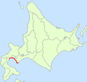
National Route 37 (国道37号, Kokudō sanjūnana-gō) is a national highway connecting Oshamanbe and Muroran in Hokkaidō, Japan.
| ||||
|---|---|---|---|---|
| 国道37号 | ||||
 | ||||
| Route information | ||||
| Length | 81.1 km[1] (50.4 mi) | |||
| Highway system | ||||
| National highways of Japan Expressways of Japan
| ||||

Route data
- Length: 81.1 km (50.4 mi)
- Origin: Oshamanbe, Hokkaido (originates at junction with Route 5)
- Terminus: Muroran, Hokkaido (ends at junction with Route 36)
- Major cities: Date
History
- 1952-12-04 - First Class National Highway 37 (from Oshamanbe to Muroran)
- 1965-04-01 - General National Highway 37 (from Oshamanbe to Muroran)
Overlapping sections
- From the origin to Toyako Town (Irie intersection): Route 230
Municipalities passed through
Intersects with
- Oshima Subprefecture
- Route 5; at the origin, in Oshamanbe Town
- Shiribeshi Subprefecture
- Iburi Subprefecture
- Route 230; at Toyako Town
- Route 453; at Date City
- Route 36; at the terminus, in Muroran City
Bypass
- Iburi Subprefecture
- Hakuchō Shindō (Hakuchō Bridge); at Muroran City
gollark: You saying that does rather undermine what you were saying a few minutes ago.
gollark: I'm sure *you'd* like to think so.
gollark: But if you can't really understand the underlying evidence yourself, which is *really hard*, and you don't trust the "establishment" for whatever reason, you can't really do much else.
gollark: Okay.
gollark: I don't think anywhere near most people are actually equipped to judge how good evidence for something is in this kind of domain.
References
- "一般国道の路線別、都道府県別道路現況" [Road statistics by General National Highway route and prefecture] (PDF) (in Japanese). Ministry of Land, Infrastructure, Transport and Tourism. Retrieved 19 February 2020.
| Wikimedia Commons has media related to Route 37 (Japan). |
This article is issued from Wikipedia. The text is licensed under Creative Commons - Attribution - Sharealike. Additional terms may apply for the media files.