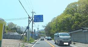
Japan National Route 165
National Route 165 (国道165号, Kokudō hyakuroku-jūgo-gō) is a national highway connecting Kita-ku in the city of Osaka, Osaka Prefecture, and the city of Tsu, Mie Prefecture, Japan.[2]
| ||||
|---|---|---|---|---|
| 国道165号 | ||||
 | ||||
| Route information | ||||
| Length | 126.5 km[1] (78.6 mi) | |||
| Existed | 18 May 1953–present | |||
| Major junctions | ||||
| West end | ||||
| East end | ||||
| Highway system | ||||
| National highways of Japan Expressways of Japan
| ||||

Route description
- Length: 126.5 km
- Origin: Kita-ku, Osaka, Osaka Prefecture (originates at the terminus of Routes 2, 25, and 176)
- Terminus: Tsu, Mie Prefecture
gollark: Not really. Regular people can buy stocks. Probably only large companies are doing HFT, though.
gollark: Apparently finance might be an application for it, since fibre optics are somewhat significantly slower than light, and the satellites' laser/microwave links wouldn't be, and the minor latency advantage would provide an edge in high frequency trading.
gollark: Wokerer: modulate some kind of neutrino generation thing, and have a detector on the other end, so you can just send signals straight through the earth.
gollark: Really? That would be better, then.
gollark: I do wonder how well they're actually going to work in practice, though. I heard that each satellite could handle 6Gbps or so of traffic, and there are maybe 500 of them, which means if they roll it out to 100 000 people they'll get an amazing 4MB/s each.
References
- "一般国道の路線別、都道府県別道路現況" [Road statistics by General National Highway route and prefecture] (PDF) (in Japanese). Ministry of Land, Infrastructure, Transport and Tourism. Retrieved 19 February 2020.
- 一般国道165号 (in Japanese). Kinki Regional Development Bureau, Ministry of Land, Infrastructure, Transport and Tourism. Retrieved 2010-11-29.
| Wikimedia Commons has media related to Route 165 (Japan). |
This article is issued from Wikipedia. The text is licensed under Creative Commons - Attribution - Sharealike. Additional terms may apply for the media files.