German Township, Bartholomew County, Indiana
German Township is one of twelve townships in Bartholomew County, Indiana, United States. As of the 2010 census, its population was 7,093 and it contained 2,920 housing units.[1]
German Township | |
|---|---|
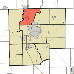 Location in Bartholomew County | |
| Coordinates: 39°18′10″N 85°59′20″W | |
| Country | United States |
| State | Indiana |
| County | Bartholomew |
| Government | |
| • Type | Indiana township |
| Area | |
| • Total | 31.33 sq mi (81.1 km2) |
| • Land | 31.23 sq mi (80.9 km2) |
| • Water | 0.1 sq mi (0.3 km2) 0.32% |
| Elevation | 646 ft (197 m) |
| Population (2010) | |
| • Total | 7,093 |
| • Density | 227.1/sq mi (87.7/km2) |
| ZIP codes | 46124, 47201, 47203, 47280 |
| GNIS feature ID | 0453325 |
History
The James Marr House and Farm and Pugh Ford Bridge are listed on the National Register of Historic Places.[2]
Geography
According to the 2010 census, the township has a total area of 31.33 square miles (81.1 km2), of which 31.23 square miles (80.9 km2) (or 99.68%) is land and 0.1 square miles (0.26 km2) (or 0.32%) is water.[1] Camp Atterbury borders the township to the west.
Cities, towns, villages
- Columbus (north edge)
- Edinburgh (south quarter)
- Taylorsville
Unincorporated towns
(This list is based on USGS data and may include former settlements.)
Adjacent townships
- Jackson Township, Shelby County (northeast)
- Washington Township, Shelby County (northeast)
- Flat Rock Township (east)
- Columbus Township (south)
- Blue River Township, Johnson County (northwest)
Cemeteries
The township contains these three cemeteries: Steenbarger, Tannehill and Treadway.
Major highways


School districts
- Bartholomew County School Corporation
Political districts
- Indiana's 6th congressional district
- State House District 59
- State Senate District 41
gollark: Because you can discuss things without liking them?
gollark: There's no technical reason they should only last 8ish years.
gollark: Primarily batteries, and kind of screens if you're prone to dropping them a lot like me. Also charging ports.
gollark: Some parts tend to degrade over time, and I'd definitely want those to be swappable.
gollark: I at least want hardware I can actually replace/upgrade parts in.
References
- United States Census Bureau 2007 TIGER/Line Shapefiles
- United States Board on Geographic Names (GNIS)
- United States National Atlas
- "Population, Housing Units, Area, and Density: 2010 - County -- County Subdivision and Place -- 2010 Census Summary File 1". United States Census. Retrieved 2013-05-10.
- "National Register Information System". National Register of Historic Places. National Park Service. July 9, 2010.
External links
Municipalities and communities of Bartholomew County, Indiana, United States | ||
|---|---|---|
| City | Map of Indiana highlighting Bartholomew County | |
| Towns | ||
| Townships | ||
| CDP | ||
| Other unincorporated communities |
| |
| Ghost town | ||
| Footnotes | ‡This populated place also has portions in an adjacent county or counties | |
This article is issued from Wikipedia. The text is licensed under Creative Commons - Attribution - Sharealike. Additional terms may apply for the media files.