Flat Rock Township, Bartholomew County, Indiana
Flat Rock Township is one of twelve townships in Bartholomew County, Indiana, United States. As of the 2010 census, its population was 1,574 and it contained 653 housing units.[1]
Flat Rock Township | |
|---|---|
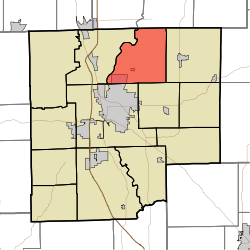 Location in Bartholomew County | |
| Coordinates: 39°17′49″N 85°51′07″W | |
| Country | United States |
| State | Indiana |
| County | Bartholomew |
| Government | |
| • Type | Indiana township |
| Area | |
| • Total | 31.09 sq mi (80.5 km2) |
| • Land | 31.09 sq mi (80.5 km2) |
| • Water | 0 sq mi (0 km2) 0% |
| Elevation | 676 ft (206 m) |
| Population (2010) | |
| • Total | 1,574 |
| • Density | 50.6/sq mi (19.5/km2) |
| ZIP codes | 47203, 47226, 47234, 47246 |
| GNIS feature ID | 0453296 |
History
The James Marr House and Farm and Pugh Ford Bridge are listed on the National Register of Historic Places.[2]
Geography
According to the 2010 census, the township has a total area of 31.09 square miles (80.5 km2), all land.[1]
Unincorporated towns
(This list is based on USGS data and may include former settlements.)
Adjacent townships
- Washington Township, Shelby County (northeast)
- Haw Creek Township (east)
- Clay Township (southeast)
- Columbus Township (southwest)
- German Township (west)
- Jackson Township, Shelby County (northwest)
Cemeteries
The township contains these four cemeteries: Flat Rock, Liberty, Sidney Branch and Spaugh.
Airports and landing strips
- Columbus Bakalar Municipal Airport
School districts
- Flat Rock-Hawcreek School Corporation
Political districts
- Indiana's 6th congressional district
- State House District 57
- State Senate District 41
gollark: You set `recipes[stringRecipeType][result.name] = {}` in every iteration of the loop.
gollark: Well, the problem is simple.
gollark: So `result2` (you can declare that in the loop by the way, and arguably should) will sometimes be nil.
gollark: There's not necessarily something in every slot.
gollark: no.
References
- United States Census Bureau 2007 TIGER/Line Shapefiles
- United States Board on Geographic Names (GNIS)
- United States National Atlas
- "Population, Housing Units, Area, and Density: 2010 - County -- County Subdivision and Place -- 2010 Census Summary File 1". United States Census. Archived from the original on 2020-02-12. Retrieved 2013-05-10.
- "National Register Information System". National Register of Historic Places. National Park Service. July 9, 2010.
External links
Municipalities and communities of Bartholomew County, Indiana, United States | ||
|---|---|---|
| City | Map of Indiana highlighting Bartholomew County | |
| Towns | ||
| Townships | ||
| CDP | ||
| Other unincorporated communities |
| |
| Ghost town | ||
| Footnotes | ‡This populated place also has portions in an adjacent county or counties | |
This article is issued from Wikipedia. The text is licensed under Creative Commons - Attribution - Sharealike. Additional terms may apply for the media files.