Jackson Township, Shelby County, Indiana
Jackson Township is one of fourteen townships in Shelby County, Indiana. As of the 2010 census, its population was 1,844 and it contained 738 housing units.[3]
Jackson Township | |
|---|---|
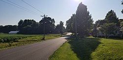 Mt. Auburn Indiana is near the center of Jackson Township | |
 | |
| Coordinates: 39°23′50″N 85°53′56″W | |
| Country | United States |
| State | Indiana |
| County | Shelby |
| Government | |
| • Type | Indiana township |
| Area | |
| • Total | 34.27 sq mi (88.8 km2) |
| • Land | 34.08 sq mi (88.3 km2) |
| • Water | 0.18 sq mi (0.5 km2) |
| Elevation | 781 ft (238 m) |
| Population (2010) | |
| • Total | 1,844 |
| • Density | 54.1/sq mi (20.9/km2) |
| FIPS code | 18-37404[2] |
| GNIS feature ID | 453466 |
History

St. George Lutheran Church, January 2011.
Jackson Township was established in 1840.[4]
St. George Lutheran Church was listed on the National Register of Historic Places in 1984.[5]
Geography
According to the 2010 census, the township has a total area of 34.27 square miles (88.8 km2), of which 34.08 square miles (88.3 km2) (or 99.45%) is land and 0.18 square miles (0.47 km2) (or 0.53%) is water.[3]
Cities and towns
- Edinburgh (partial)
Unincorporated towns
gollark: Nope, still installs `luabitop` and does the `bit.c:79:2: error: #error "Unknown number type, check LUA_NUMBER_* in luaconf.h"` thing.
gollark: Installing Lapis off LuaRocks seems to bring in an old version of `pgmoon` which requires `luabitop` which doesn't work beyond 5.2, is there a way to make LuaRocks pull directly off the git repository or something?
gollark: Huh. This does *also* look asynchronous. I guess I can probably deal with it being mildly less efficient, I don't need massive throughput.
gollark: I'm mostly just looking at options right now, wasn't aware there was a non-OpenResty way to use Lapis.
gollark: There seem to be some Lua SQLite3 bindings, but I worry that those would ruin performance because of not fitting into the non-blocking-IO thing.
References
- "US Board on Geographic Names". United States Geological Survey. 2007-10-25. Retrieved 2008-01-31.
- "U.S. Census website". United States Census Bureau. Retrieved 2008-01-31.
- "Population, Housing Units, Area, and Density: 2010 - County -- County Subdivision and Place -- 2010 Census Summary File 1". United States Census. Archived from the original on 2020-02-12. Retrieved 2013-05-10.
- History of Shelby County, Indiana: From the Earliest Time to the Present, with Biographical Sketches, Notes, Etc. Brant & Fuller. 1887. p. 277.
- "National Register Information System". National Register of Historic Places. National Park Service. July 9, 2010.
External links
Municipalities and communities of Shelby County, Indiana, United States | ||
|---|---|---|
| City | Map of Indiana highlighting Shelby County | |
| Towns | ||
| Townships | ||
| CDP | ||
| Other unincorporated communities |
| |
| Footnotes | ‡This populated place also has portions in an adjacent county or counties | |
This article is issued from Wikipedia. The text is licensed under Creative Commons - Attribution - Sharealike. Additional terms may apply for the media files.