Rosstown, Indiana
Rosstown is an unincorporated community in Wayne Township, Bartholomew County, in the U.S. state of Indiana.[3]
Rosstown, Indiana | |
|---|---|
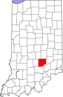
 Bartholomew County's location in Indiana | |
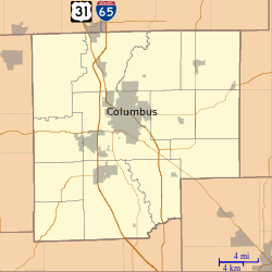
 Rosstown Location in Bartholomew County | |
| Coordinates: 39°06′33″N 85°55′46″W | |
| Country | United States |
| State | Indiana |
| County | Bartholomew |
| Township | Wayne |
| Elevation | 630 ft (190 m) |
| Time zone | UTC-5 (Eastern (EST)) |
| • Summer (DST) | UTC-4 (EDT) |
| ZIP code | 47201 |
| FIPS code | 18-66132[2] |
| GNIS feature ID | 442328 |
Geography
Rosstown is located at 39°06′33″N 85°55′46″W.
gollark: Although all the tooling and CPUs are optimized for the C model, so good luck changing anything ever.
gollark: You could do that, but you might as well use a sane, nonC language.
gollark: Yes.
gollark: No idea, perhaps something where the majority of data is immutable or something like that, with hardware GC.
gollark: A functional language would probably allow things to be mapped to SIMD instructions neatly as you generally do explicit high-level operations like map on immutable data.
References
- "US Board on Geographic Names". United States Geological Survey. 2007-10-25. Retrieved 2008-01-31.
- "U.S. Census website". United States Census Bureau. Retrieved 2008-01-31.
- "Rosstown, Indiana". Geographic Names Information System. United States Geological Survey. Retrieved February 22, 2020.
This article is issued from Wikipedia. The text is licensed under Creative Commons - Attribution - Sharealike. Additional terms may apply for the media files.