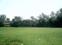
Fatikchhari Upazila
Fatikchhari (Bengali: ফটিকছড়ি) is an Upazila of Chittagong District in the Division of Chittagong, Bangladesh.[1]
Fatickchhari ফটিকছড়ি | |
|---|---|
Upazila | |
| Fatikchhari | |
 Fatickchhari Location in Bangladesh | |
| Coordinates: 22.6840°N 91.7893°E | |
| Country | |
| Division | Chittagong Division |
| District | Chittagong District |
| Area | |
| • Total | 773.13 km2 (298.51 sq mi) |
| Population (2011) | |
| • Total | 441,863 |
| • Density | 570/km2 (1,500/sq mi) |
| Time zone | UTC+6 (BST) |
| Website | www |
Geography
It is one of the largest upazilas of Bangladesh. It is a fertile valley between the Sitakunda Hills and the Hills of the Chittagong Hill Tracts. These two hill ranges become one at the northernmost point of the upazila and they widen apart as they proceed southwards. There is no particular geographical place in the upazila called Fatikchhari, rather the entire upazila takes its name from one small all-season rivulet known as Fatikchhari Khal that originates in the Sitakund Hills on the West and enters the Upazila at Bhujpur Union before joining the River Halda, the longest river in Fatikchhari Upazila that runs through the upazila along almost its entire length. Dhurung is its second longest river. There are some small rivers (khals) originating from the hills both on the eastern and western flanks, all being tributaries of the Halda flowing southwards to the sea. Among them are Gazaria, Fatikchhari, Baramasia, Mandakini, Balukhali etc. In between the two hill ranges, Fatikchhari consists of flat farmland annually affected by flash floods caused by heavy rainfall in the hilly catchment areas and the water being drained by several small rivers and the Halda.
It is surrounded by Tripura (India) to the north, Hathazari and Kawkhali Upazila (Rangamati District) to the south, Ramgarh, Manikchhari, Lakshmichhari, and Raozan Upazilas on the east, Mirsharai and Sitakunda Upazilas on the west.
Demographics
According to the 1991 Bangladesh census, Fatikchhari had a population of 388,013, in 65,861 households. Males constituted 50.1% of the population, and females 49.9%. The population aged 18 or over was 182,250. Fatikchhari had an average literacy rate of 32% (7+ years), against the national average of 32.4% literate.[2]
The population is a mix of Bengali Muslims and Hindus, Buddhists (all bearing the title Barua); Tripura, Chakma, Mogh (these tribal groups are gradually retreating into the CHTs and are becoming rare in the upazila); and Manipuri and Uria (mainly tea garden workers).
Economy
17 of Bangladesh's 163 tea gardens are in Fatikchhari Upazila.[3]
- Aasia Tea Garden
- Andharmanik Tea Garden
- Baramasia Tea Garden
- Dantmara Tea Garden
- Elahi-Noor Tea Garden
- Haldavalley Tea Garden
- Laiyacherra Tea Garden
- Karnafuli Tea Garden
- Maa Jaan Tea Garden
- Mohammad Nagar Tea Garden
- Naseha Tea Garden
- Neptune Tea Garden
- New Dantmara Tea Garden
- Oodaleah Tea Garden
- Panchabati Tea Garden
- Ramgarh Tea Garden
- Rangapani Tea Garden
Administration
Bibir Hat is the Administrative center of the Fatikchhari Upazila. The old Fatikchhari Thana is divided into two Thanas (Police Stations) with Bhujpur created as a new thana in 2008 with its seat near Kazirhat. Fatikchhari has two (2) Municipality and 17 Unions/Wards, 102 Mauzas/Mahallas, and 199 villages. The unions are:
Under Fatickchari Thana
- Fatikchhari municipality
- Nazirhat municipality
- Abdullapur union
- Baktapur union
- Dharmapur union
- Jafotnagar union
- Kanchan Nagar union
- Lelang union
- Nanupur union
- Paindong union
- Roshangiri union
- Samitirhat union
- sundarpur union
- Khiram Union
Under Bhujpur Thana
- Harualchhari union
- Baganbazar union
- Dantmara union
- Narayanhat union
- Bhujpur union
- Suabil union
Education

According to Banglapedia, Fatickchari Coronation Model High School, founded in 1912; Maizbhander Ahmadia High School; Haidchakia High School, founded in 1926; Nanpur Abu Sobahan High School, founded in 1942; and Dhurung Khulshi Lion's High School, founded in 1943, are notable secondary school and Zamidar Abdul Bari Chowdhury (Abc) School [1] There are five colleges in the upazila. They include Fatikchhari Degree College, founded in 1970.[4] Another Primary School Found 1926 Anwar Ali Primary School And Now It Government Primary School Registered. Its Haji Anwar Ali Sowdagor Bari Familiar Haji Anwar Ali Sowdagor Family Inferior.
The madrasa education system includes two fazil madrasas and one kamil madrasa.[5]
See also
- Fatikchhari
- Upazilas of Bangladesh
- Districts of Bangladesh
- Divisions of Bangladesh
References
- Rubel, Tilak Barua (2012). "Fatikchhari Upazila". In Islam, Sirajul; Jamal, Ahmed A. (eds.). Banglapedia: National Encyclopedia of Bangladesh (Second ed.). Asiatic Society of Bangladesh.
- "Population Census Wing, BBS". Archived from the original on 2005-03-27. Retrieved November 10, 2006.
- "Bangladesh Tea Board". Teaboard.gov.bd. Archived from the original on 2012-06-03. Retrieved 2012-08-28.
- "Colleges in Chittagong". Bangladesh.jantareview.com. Retrieved 2012-08-28.
- "List of Institutions". Ministry of Education. Retrieved July 15, 2014.
