Daganbhuiyan Upazila
Dagonbhuiyan (Bengali: দাগনভূইয়া) is an Upazila of Feni District[1] in the Division of Chittagong, Bangladesh.
Dagonbhuiyan দাগনভূইয়া | |
|---|---|
Upazila | |
 Dagonbhuiyan Location in Bangladesh | |
| Coordinates: 22°56.3′N 91°18.3′E | |
| Country | |
| Division | Chittagong Division |
| District | Feni District |
| Area | |
| • Total | 165.84 km2 (64.03 sq mi) |
| Population (auto) | |
| • Total | 204,975 |
| • Density | 1,236/km2 (3,200/sq mi) |
| Time zone | UTC+6 (BST) |
| Website | Official Map of Dagonbhuiyan |
Geography
Dagonbhuiyan is located at 22.9375°N 91.3042°E. It has 34750 households and a total area of 165.84 km².
Demographics
According to the 1991 Bangladesh census, Dagonbhuiyan had a population of 204, 975. Males constituted 49.4% of the population, and females 50.6%. The population aged 18 or over was 95, 809. Dagonbhuiyan had an average literacy rate of 70% (7+ years), against the national average of 32.4%.[2]
Administration
Dagonbhuiyan has 8 Union Parishad. The Union Parishads are:
- Daganbhuiyan Union Parishad
- Jaylashkar Union Parishad
- Matubhuiyan Union Parishad
- Purba Chandrapur Union Parishad
- Rajapur Union Parishad
- Ramnagar Union Parishad
- Sindurpur Union Parishad
- Yakubpur Union Parishad
gollark: I'm not sure why quintopia thought they were impersonating me.
gollark: The spec says it "should [...] return the result of evaluating the expression."
gollark: Technically, it doesn't say those things.
gollark: Bot tokens contain information? Fascinating.
gollark: Yet```hello=====* alpha* beta"#;```
See also
- Upazilas of Bangladesh
- Districts of Bangladesh
- Divisions of Bangladesh
References
- Mohiuddin Hossain Mohin (2012), "Daganbhuiyan Upazila", in Sirajul Islam; Ahmed A. Jamal (eds.), Banglapedia: National Encyclopedia of Bangladesh (Second ed.), Asiatic Society of Bangladesh
- "Population Census Wing, BBS". Archived from the original on 2005-03-27. Retrieved November 10, 2006.
| Upazila/Thana: | ||
|---|---|---|
Capital: Chattogram | ||
| Bandarban District | 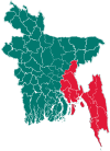 | |
| Brahmanbaria District | ||
| Chandpur District | ||
| Chattogram District | ||
| Cumilla District |
| |
| Cox's Bazar District | ||
| Feni District | ||
| Khagrachari District |
| |
| Lakshmipur District | ||
| Noakhali District | ||
| Rangamati District | ||
This article is issued from Wikipedia. The text is licensed under Creative Commons - Attribution - Sharealike. Additional terms may apply for the media files.