Brahmanpara Upazila
Brahmanpara (Bengali: ব্রাহ্মণপাড়া) is an Upazila of Comilla District in the Division of Chittagong, Bangladesh.[1]
Brahmanpara ব্রাহ্মণপাড়া | |
|---|---|
Upazila | |
 Brahmanpara Location in Bangladesh | |
| Coordinates: 23°37′N 91°6.5′E | |
| Country | |
| Division | Chittagong Division |
| District | Comilla District |
| Area | |
| • Total | 128.9 km2 (49.8 sq mi) |
| Population (1991) | |
| • Total | 161,906 |
| • Density | 1,300/km2 (3,300/sq mi) |
| Time zone | UTC+6 (BST) |
| Website | Official Map of Brahmanpara |
Geography
It has a total area of 128.9 km².
Demographics
According to the 1991 Bangladesh census, Brahmanpara It had a population of 161,906 living in 26,493 households. Males constituted 50.98% of the population and females 49.02%. The population of 18 and older was 72,500. Brahmanpara had an average literacy rate of 32.6% (7+ years), against the national average of 32.4%.[2]
Administration
Brahmanpara has 8 Unions/Wards, 54 Mauzas/Mahallas and 90 villages.
The incumbent MP in this Thana is Abdul Matin Khasru, the former Law, Justice and parliamentary minister. The Upazila chairman is Jahangir Khan Chowdhury.
gollark: Have you tried using Urn`?`
gollark: Hmm, you are right.
gollark: It should be a nil check operator.
gollark: no.
gollark: Yes, indeed.
See also
- Upazilas of Bangladesh
- Districts of Bangladesh
- Divisions of Bangladesh
References
- Sattar, Md Abdus (2012). "Brahmanpara Upazila". In Islam, Sirajul; Jamal, Ahmed A. (eds.). Banglapedia: National Encyclopedia of Bangladesh (Second ed.). Asiatic Society of Bangladesh.
- "Population Census Wing, BBS". Archived from the original on 2005-03-27. Retrieved November 10, 2006.
Cumilla District | ||
|---|---|---|
| Upazila/Thana: |
| |
Capital: Chattogram | ||
| Bandarban District | 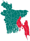 | |
| Brahmanbaria District | ||
| Chandpur District | ||
| Chattogram District | ||
| Cumilla District |
| |
| Cox's Bazar District | ||
| Feni District | ||
| Khagrachari District |
| |
| Lakshmipur District | ||
| Noakhali District | ||
| Rangamati District | ||
This article is issued from Wikipedia. The text is licensed under Creative Commons - Attribution - Sharealike. Additional terms may apply for the media files.