Erukkanchery
Erukkanchery or Erukkancheri (Tamil: எருக்கஞ்சேரி), is a neighbourhood and a developed residential area in North Chennai, a metropolitan city in Tamil Nadu, India. The Grand Northern Trunk Road passes through the neighbourhood as Erukkanchery High Road in Erukkanchery and Vyasarpadi.
Erukkanchery எருக்கஞ்சேரி Erukkancheri | |
|---|---|
Neighbourhood | |
 Erukkanchery  Erukkanchery  Erukkanchery | |
| Coordinates: 13.123675°N 80.248275°E / 13.123675; 80.248275 | |
| Country | |
| State | |
| District | Chennai |
| Metro | Chennai |
| Elevation | 7 m (23 ft) |
| Languages | |
| • Official | Tamil |
| Time zone | UTC+5:30 (IST) |
| PIN | 600118 |
| Telephone code | 044 |
| Planning agency | CMDA |
| City | Chennai |
| Lok Sabha constituency | North Chennai |
| Vidhan Sabha constituency | Perambur |
| Civic agency | Greater Chennai Corporation |
Location
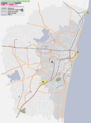
Erukkanchery is located near Kodungaiyur, Moolakadai, Madhavaram, Vyasarpadi and Perambur. It is well connected by bus transport. It is very close to Moolakadai Junction. The nearest railway station of Erukkanchery is Perambur Railway Station which is 3 km away.[1]
Directions From Erukkanchery | ||||||||||
|---|---|---|---|---|---|---|---|---|---|---|
| ||||||||||
gollark: There's no reason you couldn't make the AI do that optimisation too.
gollark: Hi. Your profile picture is quite cool.
gollark: Or that.
gollark: The worst it could just do is react with <:shame:577871393862057996>s again.
gollark: Bots are not generally capable of applying mystical curses of some sort. Yet.
References
- "Erukkancheri Locality Map, Chennai". Retrieved 25 July 2016.
Neighbourhoods of Chennai | |
|---|---|
|
Areas of Chennai | |
|---|---|
| North |
|
| West |
|
| Central |
|
| South |
|
| State symbols |
|  |
|---|---|---|
| Governance |
| |
| Topics | ||
| Major cities | ||
| Districts |
| |
| Lists | ||
This article is issued from Wikipedia. The text is licensed under Creative Commons - Attribution - Sharealike. Additional terms may apply for the media files.