Les Hauts-de-Chée
Les Hauts-de-Chée is a commune in the Meuse department in Grand Est in north-eastern France.
Les Hauts-de-Chée | |
|---|---|
 The town hall in Les Hauts-de-Chée | |
 Coat of arms | |
Location of Les Hauts-de-Chée 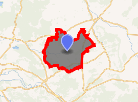
| |
 Les Hauts-de-Chée  Les Hauts-de-Chée | |
| Coordinates: 48°52′05″N 5°10′03″E | |
| Country | France |
| Region | Grand Est |
| Department | Meuse |
| Arrondissement | Bar-le-Duc |
| Canton | Revigny-sur-Ornain |
| Intercommunality | Communauté de communes de Triaucourt Vaubecourt |
| Government | |
| • Mayor (2008–2014) | Reine Varinot |
| Area 1 | 50.17 km2 (19.37 sq mi) |
| Population (2017-01-01)[1] | 728 |
| • Density | 15/km2 (38/sq mi) |
| Time zone | UTC+01:00 (CET) |
| • Summer (DST) | UTC+02:00 (CEST) |
| INSEE/Postal code | 55123 /55000 |
| Elevation | 184–301 m (604–988 ft) (avg. 213 m or 699 ft) |
| 1 French Land Register data, which excludes lakes, ponds, glaciers > 1 km2 (0.386 sq mi or 247 acres) and river estuaries. | |
The former towns of Génicourt-sous-Condé, Hargeville-sur-Chée, Louppy-sur-Chée (Loppy-le-Petit) and Les Marats (Marat-la-Grande, Marat-la-Petite) were joined to Condé-en-Barrois on 20 June 1972, which subsequently changed its name to Les Hauts-de-Chée on 1 July 1972.
Geography
The river Chée rises in the eastern part of the commune, then flows westward through the middle of the commune, crossing through several villages and hamlets.
gollark: I think due to implementational apioids the best they can do is to store 2 pages of compressed RAM within 1 page of actual RAM.
gollark: Zswap as a cache for ondisk swap.
gollark: They store compressed RAM content in RAM.
gollark: You *should* probably just do that last thing.
gollark: Nikola Tesla had excellent foresight.
See also
References
- "Populations légales 2017". INSEE. Retrieved 6 January 2020.
| Wikimedia Commons has media related to Les Hauts-de-Chée. |
| Authority control |
|
|---|
This article is issued from Wikipedia. The text is licensed under Creative Commons - Attribution - Sharealike. Additional terms may apply for the media files.