Chaparrito, Texas
Chaparrito is a census-designated place (CDP) in Starr County, Texas, United States. It is a new CDP formed from part of the former La Casita-Garciasville CDP prior to the 2010 census with a population of 114.[1]
Chaparrito, Texas | |
|---|---|
| Coordinates: 26°20′27″N 98°44′7″W | |
| Country | United States |
| State | Texas |
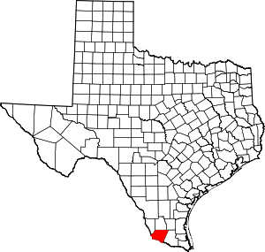
| County | Starr |
| Area | |
| • Total | 0.1 sq mi (0.3 km2) |
| • Land | 0.1 sq mi (0.3 km2) |
| • Water | 0.0 sq mi (0 km2) |
| Population (2010) | |
| • Total | 114 |
| • Density | 1,100/sq mi (440/km2) |
| Time zone | UTC-6 (Central (CST)) |
| • Summer (DST) | UTC-5 (CDT) |
| Zip Code | 78582 |
Geography
Chaparrito is located at 26°20′27″N 98°44′7″W (26.340817, -98.735352).[2]
gollark: The region I live in is generally somewhat worse off because [REDACTED FOR PERSONAL INFORMATION PROTECTION].
gollark: That is not between countries, and only vaguely.
gollark: Differences in what?
gollark: > if you dont go to university and i do, i am going to annoy you by not shutting up about higher math and you will get annoyed.Hmm, that is a reasonable point, although I may do a non-maths subject?
gollark: Vaguely relatedly, I'm not sure if it would be more sensible to go to university, or not go to university.
References
- "Population and Housing Unit Counts, 2010 Census of Population and Housing" (PDF). Texas: 2010.
- "Chaparrito, Texas :: Boundary Map of Chaparrito, Texas". Archived from the original on 2016-12-21. Retrieved 2016-12-21.
This article is issued from Wikipedia. The text is licensed under Creative Commons - Attribution - Sharealike. Additional terms may apply for the media files.