Campo Verde, Texas
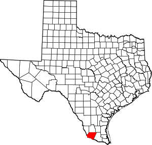
Campo Verde is a census-designated place (CDP) in Starr County, Texas, United States. It is a new CDP formed from part of the La Rosita CDP prior to the 2010 census with a population of 132.[1]
Campo Verde, Texas | |
|---|---|
| Coordinates: 26°23′30″N 98°54′50″W | |
| Country | United States |
| State | Texas |
| County | Starr |
| Population (2010) | |
| • Total | 132 |
| Time zone | UTC-6 (Central (CST)) |
| • Summer (DST) | UTC-5 (CDT) |
| Zip Code | 78582 |
| FIPS code | 48-12226 |
Geography
Campo Verde is located at 26°23′30″N 98°54′50″W (26.391630, -98.913980).[2]
gollark: http://runtimejs.org/Apparently this exists?!
gollark: Don't worry.
gollark: No, it's visible to *you*, but to everyone else it's just asterisks or [REDACTED] or something.
gollark: Does that work for passwords too?
gollark: I can pretend it's AutoBotRobot and just run them on the same token. Unless it requires outdated discord.py.
References
- "Population and Housing Unit Counts, 2010 Census of Population and Housing" (PDF). Texas: 2010.
- "Campo Verde, Texas :: Boundary Map of Campo Verde, Texas". Archived from the original on 2018-09-29. Retrieved 2016-12-21.
This article is issued from Wikipedia. The text is licensed under Creative Commons - Attribution - Sharealike. Additional terms may apply for the media files.