B and E, Texas
B and E is a census-designated place (CDP) in Starr County, Texas, United States. It is a new CDP formed from part of the La Puerta CDP prior to the 2010 census with a population of 518.[1]
B and E, Texas | |
|---|---|
| Coordinates: 26°21′24″N 98°45′13″W | |
| Country | United States |
| State | Texas |
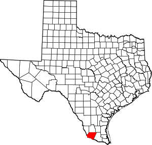
| County | Starr |
| Area | |
| • Total | 0.1 sq mi (0.3 km2) |
| • Land | 0.1 sq mi (0.3 km2) |
| • Water | 0.0 sq mi (0 km2) |
| Population (2010) | |
| • Total | 518 |
| • Density | 5,200/sq mi (2,000/km2) |
| Time zone | UTC-6 (Central (CST)) |
| • Summer (DST) | UTC-5 (CDT) |
| Zip Code | 78582 |
| FIPS code | 48-05520 |
Geography
B and E is located at 26°21′24″N 98°45′13″W (26.356531, -98.753675).[2]
gollark: You should definitely implement an entirely binding legal system within your game.
gollark: Ideas: Apiochorahazards, which make countries for favourable legal arrangements, and apionomohazards, which manipulate the law to make attacking them illegal and such.
gollark: Possibly doable.
gollark: Doable.
gollark: Don't make it trained, but do make it persist state across replays.
References
- "Population and Housing Unit Counts, 2010 Census of Population and Housing" (PDF). Texas: 2010.
- "B and E, Texas :: Boundary Map of B and E, Texas". maptechnica.com. Archived from the original on 2016-12-21. Retrieved 2016-12-21.
| Authority control |
|
|---|
This article is issued from Wikipedia. The text is licensed under Creative Commons - Attribution - Sharealike. Additional terms may apply for the media files.