Carway, Alberta
Carway is a hamlet in southern Alberta, Canada within Cardston County.[1] It is a port of entry into the U.S. state of Montana opposite of Port of Piegan.[2] Just on the other side of the border is the Blackfeet Indian Reservation in Glacier County, Montana.

Carway
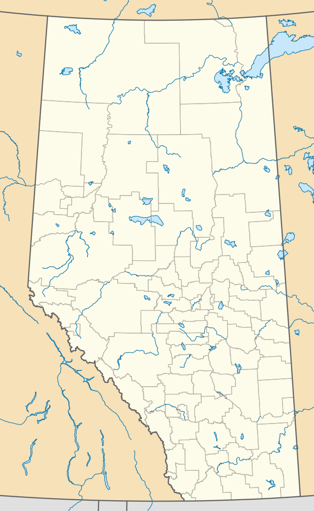
Location of Carway, Alberta
Located approximately 23 km (14 mi) south of Cardston. Carway is on the southernmost point of Highway 2, which becomes U.S. Route 89 in Montana.
The hamlet was named by William Roberts, the first officer in charge of the station, by combining Cardston and highway.[3]
Climate
Carway has a humid continental climate (Dfb) with mild, rainy summers and cold, snowy winters with annual snowfall averaging 250.4 cm (98.6 in).
| Climate data for Carway, Alberta | |||||||||||||
|---|---|---|---|---|---|---|---|---|---|---|---|---|---|
| Month | Jan | Feb | Mar | Apr | May | Jun | Jul | Aug | Sep | Oct | Nov | Dec | Year |
| Record high °C (°F) | 16.7 (62.1) |
19.0 (66.2) |
24.4 (75.9) |
29.4 (84.9) |
30.0 (86.0) |
32.8 (91.0) |
38.0 (100.4) |
36.1 (97.0) |
35.0 (95.0) |
30.0 (86.0) |
24.4 (75.9) |
17.8 (64.0) |
38.0 (100.4) |
| Average high °C (°F) | 0.8 (33.4) |
1.0 (33.8) |
4.8 (40.6) |
9.9 (49.8) |
15.0 (59.0) |
18.8 (65.8) |
23.6 (74.5) |
23.5 (74.3) |
17.8 (64.0) |
11.5 (52.7) |
4.0 (39.2) |
0.3 (32.5) |
10.9 (51.6) |
| Daily mean °C (°F) | −5.0 (23.0) |
−4.7 (23.5) |
−0.9 (30.4) |
3.9 (39.0) |
8.5 (47.3) |
12.3 (54.1) |
15.9 (60.6) |
15.5 (59.9) |
10.7 (51.3) |
5.2 (41.4) |
−1.5 (29.3) |
−5.2 (22.6) |
4.6 (40.3) |
| Average low °C (°F) | −10.9 (12.4) |
−10.6 (12.9) |
−6.6 (20.1) |
−2.2 (28.0) |
2.0 (35.6) |
5.7 (42.3) |
8.1 (46.6) |
7.5 (45.5) |
3.5 (38.3) |
−1.1 (30.0) |
−7.0 (19.4) |
−10.6 (12.9) |
−1.8 (28.8) |
| Record low °C (°F) | −43.3 (−45.9) |
−39.4 (−38.9) |
−36.1 (−33.0) |
−26.7 (−16.1) |
−14.4 (6.1) |
−4.4 (24.1) |
−3.0 (26.6) |
−7.0 (19.4) |
−15.6 (3.9) |
−26.7 (−16.1) |
−34.0 (−29.2) |
−43.9 (−47.0) |
−43.9 (−47.0) |
| Average precipitation mm (inches) | 25.4 (1.00) |
28.6 (1.13) |
45.9 (1.81) |
53.1 (2.09) |
78.5 (3.09) |
92.9 (3.66) |
39.9 (1.57) |
44.0 (1.73) |
51.2 (2.02) |
29.0 (1.14) |
33.9 (1.33) |
27.8 (1.09) |
550.2 (21.66) |
| Average rainfall mm (inches) | 0.0 (0.0) |
0.0 (0.0) |
0.5 (0.02) |
12.1 (0.48) |
59.0 (2.32) |
91.6 (3.61) |
39.9 (1.57) |
42.9 (1.69) |
45.2 (1.78) |
7.2 (0.28) |
0.9 (0.04) |
0.5 (0.02) |
229.8 (9.05) |
| Average snowfall cm (inches) | 25.4 (10.0) |
28.6 (11.3) |
45.4 (17.9) |
40.9 (16.1) |
19.5 (7.7) |
1.3 (0.5) |
0.0 (0.0) |
1.2 (0.5) |
6.0 (2.4) |
21.8 (8.6) |
32.9 (13.0) |
27.4 (10.8) |
250.4 (98.6) |
| Source: Environment Canada[4] | |||||||||||||
gollark: Windows is pretty much that.
gollark: The interweb dictionary thing defines "spyware" as "programs that surreptitiously monitor and report the actions of a computer user".
gollark: Why not?
gollark: But that *doesn't make it good*, and definitely doesn't make it *non-spyware*.
gollark: Popular? Objective fact. Created before? Maybe, I guess.
See also
- Piegan–Carway Border Crossing
- List of communities in Alberta
- List of hamlets in Alberta
- List of geographic names derived from portmanteaus
References
- Alberta Municipal Affairs (April 1, 2010). "Specialized and Rural Municipalities and Their Communities" (PDF). Archived from the original (PDF) on February 29, 2012. Retrieved June 21, 2010.
- Your Official Road Map of Alberta (Map). Alberta Tourism, Parks and Recreation. 2014.
- Marden, Ernest G.; Marden, Austin (2010). Community Place Names of Alberta. Lulu.com. p. 67. ISBN 189747217X.
- "Canadian Climate Normals 1981-2010 Station Data - Carway". Environment and Climate Change Canada. Retrieved August 10, 2020.
This article is issued from Wikipedia. The text is licensed under Creative Commons - Attribution - Sharealike. Additional terms may apply for the media files.