Brown Township, Montgomery County, Indiana
Brown Township is one of eleven townships in Montgomery County, Indiana, United States. As of the 2010 census, its population was 1,719 and it contained 739 housing units.[2]
Brown Township | |
|---|---|
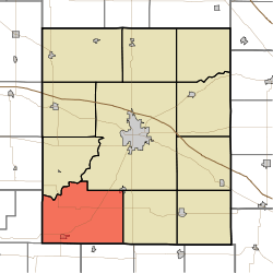 Location in Montgomery County | |
| Coordinates: 39°54′34″N 87°00′23″W | |
| Country | |
| State | |
| County | Montgomery |
| Government | |
| • Type | Indiana township |
| Area | |
| • Total | 54.22 sq mi (140.4 km2) |
| • Land | 53.75 sq mi (139.2 km2) |
| • Water | 0.47 sq mi (1.2 km2) 0.87% |
| Elevation | 801 ft (244 m) |
| Population (2010) | |
| • Total | 1,719 |
| • Density | 32/sq mi (12/km2) |
| Time zone | UTC-5 (Eastern (EST)) |
| • Summer (DST) | UTC-4 (EDT) |
| ZIP codes | 47933, 47954, 47965, 47989 |
| Area code(s) | 765 |
| GNIS feature ID | 453139 |
Geography
According to the 2010 census, the township has a total area of 54.22 square miles (140.4 km2), of which 53.75 square miles (139.2 km2) (or 99.13%) is land and 0.47 square miles (1.2 km2) (or 0.87%) is water.[2]
Cities, towns, villages
- New Market (southwest corner)
- Waveland
Unincorporated towns
- Browns Valley at 39.9031°N 86.991954°W
- Sycamore Ford at 39.958377°N 87.046676°W
(This list is based on USGS data and may include former settlements.)
Cemeteries
The township contains these eight cemeteries: Indian Creek, Indian Creek Hill, Jones, Lydick, Maple Ridge, Old Hickory, Old Union and Wasson.
Major highways
Airports and landing strips
- Shades State Park Airport
Landmarks
- Lake Waveland Park
- Shades State Park (southeast three-quarters)
Education
- South Montgomery Community School Corporation
Brown Township is served by the Waveland-Brown Township Public Library.[3]
Political districts
- Indiana's 4th congressional district
- State House District 28
- State Senate District 23
gollark: It seems fine, honestly.
gollark: ©§§ reasons?
gollark: Idea: initiate emergency deployment of apiobees against the parser.
gollark: Support commas, apioform.
gollark: It should allow commas.
References
- "Brown Township, Montgomery County, Indiana". Geographic Names Information System. United States Geological Survey. Retrieved 2009-09-27.
- United States Census Bureau 2008 TIGER/Line Shapefiles
- IndianaMap
- "US Board on Geographic Names". United States Geological Survey. October 25, 2007. Retrieved 2017-05-09.
- "Population, Housing Units, Area, and Density: 2010 - County -- County Subdivision and Place -- 2010 Census Summary File 1". United States Census. Archived from the original on 2020-02-12. Retrieved 2013-05-10.
- "Indiana public library directory" (PDF). Indiana State Library. Retrieved 10 March 2018.
External links
- Indiana Township Association
- United Township Association of Indiana
- City-Data.com page for Brown Township
Places adjacent to Brown Township, Montgomery County, Indiana | |
|---|---|
Municipalities and communities of Montgomery County, Indiana, United States | ||
|---|---|---|
| City | Map of Indiana highlighting Montgomery County | |
| Towns | ||
| Townships | ||
| CDP | ||
| Other unincorporated communities | ||
| Footnotes | ‡This populated place also has portions in an adjacent county or counties | |
This article is issued from Wikipedia. The text is licensed under Creative Commons - Attribution - Sharealike. Additional terms may apply for the media files.