Log Cabin Crossroads, Indiana
Log Cabin Crossroads is an unincorporated community in Walnut Township, Montgomery County, in the U.S. state of Indiana.[2]
Log Cabin Crossroads | |
|---|---|
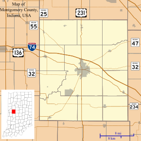
 Log Cabin Crossroads Location in Montgomery County | |
| Coordinates: 40°01′31″N 86°42′01″W | |
| Country | United States |
| State | Indiana |
| County | Montgomery |
| Township | Walnut |
| Elevation | 883 ft (269 m) |
| Time zone | UTC-5 (Eastern (EST)) |
| • Summer (DST) | UTC-4 (EDT) |
| ZIP code | 47933 |
| Area code(s) | 765 |
| GNIS feature ID | 438220 |
Geography
Log Cabin Crossroads is located at 40°01′31″N 86°42′01″W.
gollark: And require solutions to use stdio.
gollark: Just steal the TIO API code from AutoBotRobot.
gollark: Not if you specify the language!
gollark: https://www.assemblyscript.org/
gollark: This does in fact exist.
References
- "US Board on Geographic Names". United States Geological Survey. October 25, 2007. Retrieved 2016-11-17.
- "Log Cabin Crossroads, Indiana". Geographic Names Information System. United States Geological Survey. Retrieved 2017-06-18.
This article is issued from Wikipedia. The text is licensed under Creative Commons - Attribution - Sharealike. Additional terms may apply for the media files.