Franklin Township, Montgomery County, Indiana
Franklin Township is one of eleven townships in Montgomery County, Indiana, United States. As of the 2010 census, its population was 1,915 and it contained 801 housing units.[2]
Franklin Township | |
|---|---|
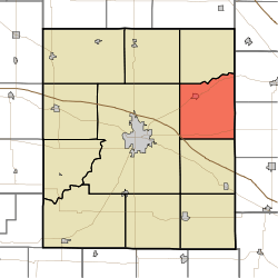 Location in Montgomery County | |
| Coordinates: 40°05′23″N 86°45′02″W | |
| Country | |
| State | |
| County | Montgomery |
| Government | |
| • Type | Indiana township |
| Area | |
| • Total | 38.93 sq mi (100.8 km2) |
| • Land | 38.93 sq mi (100.8 km2) |
| • Water | 0 sq mi (0 km2) 0% |
| Elevation | 846 ft (258 m) |
| Population (2010) | |
| • Total | 1,915 |
| • Density | 49.2/sq mi (19.0/km2) |
| Time zone | UTC-5 (Eastern (EST)) |
| • Summer (DST) | UTC-4 (EDT) |
| ZIP codes | 46071, 47933, 47940 |
| Area code(s) | 765 |
| GNIS feature ID | 453309 |
Franklin Township was established in 1831.[3]
History
Darlington Covered Bridge was listed on the National Register of Historic Places in 1990.[4]
Geography
According to the 2010 census, the township has a total area of 38.93 square miles (100.8 km2), all land.[2]
Cities, towns, villages
Unincorporated towns
(This list is based on USGS data and may include former settlements.)
Cemeteries
The township contains Greenlawn Cemetery.
Major highways
School districts
- North Montgomery Community School Corporation
Political districts
- Indiana's 4th congressional district
- State House District 28
- State Senate District 23
gollark: Why I didn't write several of the entries:#1: looks ugly#2: I am physically incapable of typing bad words#3: bad identifier names, 🐝 it#4: I can imitate myself better than that#5: don't know what `calloc` does#6: includes tests and use of vaguely FP-like constructs, and I do not do testing#7: global variables are wrong#9: not heavy enough for osmarks internet radio™#10: also looks ugly, reminds me of accursed heavpoot code#11: fixed-sized array is quite <:icosidodecahedron:726025762590949426>al#12: object orientation, kind of simple
gollark: Unless you were metahyperbluffoiding.
gollark: True, actually.
gollark: You would not, due to lyric bad.
gollark: I said exactly, and also it only has to be a multiple of 50.
References
- "Franklin Township, Montgomery County, Indiana". Geographic Names Information System. United States Geological Survey. Retrieved 2009-09-27.
- United States Census Bureau 2008 TIGER/Line Shapefiles
- IndianaMap
- "US Board on Geographic Names". United States Geological Survey. October 25, 2007. Retrieved 2017-05-09.
- "Population, Housing Units, Area, and Density: 2010 - County -- County Subdivision and Place -- 2010 Census Summary File 1". United States Census. Archived from the original on 2020-02-12. Retrieved 2013-05-10.
- Beckwith, Hiram Williams; Kennedy, P. S. (1881). History of Montgomery County, Together with Historic Notes on the Wabash Valley. H. H. Hill and N. Iddings. pp. 521.
- "National Register Information System". National Register of Historic Places. National Park Service. July 9, 2010.
External links
- Indiana Township Association
- United Township Association of Indiana
- City-Data.com page for Franklin Township
Places adjacent to Franklin Township, Montgomery County, Indiana | |
|---|---|
Municipalities and communities of Montgomery County, Indiana, United States | ||
|---|---|---|
| City | Map of Indiana highlighting Montgomery County | |
| Towns | ||
| Townships | ||
| CDP | ||
| Other unincorporated communities | ||
| Footnotes | ‡This populated place also has portions in an adjacent county or counties | |
This article is issued from Wikipedia. The text is licensed under Creative Commons - Attribution - Sharealike. Additional terms may apply for the media files.