Fiskville, Indiana
Fiskville is an unincorporated community in Union Township, Montgomery County, in the U.S. state of Indiana.[2]
Fiskville, Indiana | |
|---|---|
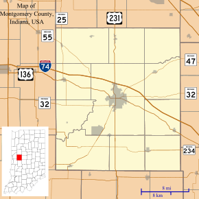 Fiskville Location in Montgomery County | |
| Coordinates: 40°02′55″N 86°53′41″W | |
| Country | United States |
| State | Indiana |
| County | Montgomery |
| Township | Union |
| Elevation | 748 ft (228 m) |
| Time zone | UTC-5 (Eastern (EST)) |
| • Summer (DST) | UTC-4 (EDT) |
| ZIP code | 47933 |
| Area code(s) | 765 |
| GNIS feature ID | 434535 |
It is located within the city limits of Crawfordsville.
Geography
Fiskville is located at 40°02′55″N 86°53′41″W.
gollark: It's not obfuscated enough for stuff like the potatOS magic DRM blob and [REDACTED].
gollark: I should use that stuff for obfuscation.
gollark: Now make clones of them and have a board of directors.
gollark: AMD would probably *never* go for ARM except for a few special-purpose things like they did a while ago, because half the value they bring is that they have x86 support.
gollark: Ah yes, like `On Error Resume Next`, no accursedness I'm sure.
References
- "US Board on Geographic Names". United States Geological Survey. October 25, 2007. Retrieved 2016-11-17.
- "Fiskville, Indiana". Geographic Names Information System. United States Geological Survey. Retrieved 2017-06-17.
Municipalities and communities of Montgomery County, Indiana, United States | ||
|---|---|---|
| City | Map of Indiana highlighting Montgomery County | |
| Towns | ||
| Townships | ||
| CDP | ||
| Other unincorporated communities | ||
| Footnotes | ‡This populated place also has portions in an adjacent county or counties | |
This article is issued from Wikipedia. The text is licensed under Creative Commons - Attribution - Sharealike. Additional terms may apply for the media files.