Darlington Woods, Indiana
Darlington Woods is an unincorporated community in Franklin Township, Montgomery County, in the U.S. state of Indiana.[2]
Darlington Woods, Indiana | |
|---|---|
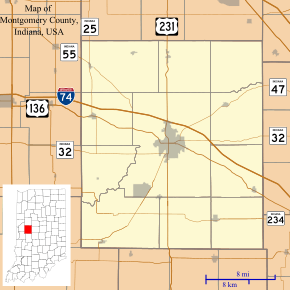 Darlington Woods Location in Montgomery County | |
| Coordinates: 40°07′11″N 86°48′19″W | |
| Country | United States |
| State | Indiana |
| County | Montgomery |
| Township | Franklin |
| Elevation | 784 ft (239 m) |
| Time zone | UTC-5 (Eastern (EST)) |
| • Summer (DST) | UTC-4 (EDT) |
| ZIP code | 47933 |
| Area code(s) | 765 |
| GNIS feature ID | 433319 |
History
Darlington Woods was a popular hunting spot for residents of the town of Darlington. Deer, pheasant, quail, rabbit, etc. are all plentiful in the area. The Darlington Covered Bridge resides on the southern edge of the wood and was built in 1868.
Geography
Darlington Woods is located at 40°07′11″N 86°48′19″W, encompassing an area east of CR 400 East, south of CR 570 North, south to CR 400 North and CR 700 East.
gollark: Yeees, probably.
gollark: What do you mean `how many reds do you need for 7 eggs?`?
gollark: Also, hi.
gollark: Hmm... two reds... probably not worth it for a CB xeno, unless values dropped.
gollark: AEONS DO THAT.
References
- "US Board on Geographic Names". United States Geological Survey. 2007-10-25. Retrieved 2008-01-31.
- "Darlington Woods, Indiana". Geographic Names Information System. United States Geological Survey. Retrieved July 17, 2017.
Municipalities and communities of Montgomery County, Indiana, United States | ||
|---|---|---|
| City | Map of Indiana highlighting Montgomery County | |
| Towns | ||
| Townships | ||
| CDP | ||
| Other unincorporated communities | ||
| Footnotes | ‡This populated place also has portions in an adjacent county or counties | |
This article is issued from Wikipedia. The text is licensed under Creative Commons - Attribution - Sharealike. Additional terms may apply for the media files.