Berowra Valley National Park
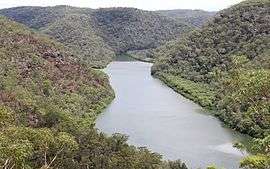
The Berowra Valley National Park is a protected national park that is located in northern Sydney, New South Wales, Australia. The 3,884-hectare (9,600-acre) national park is situated approximately 20 kilometres (12 mi) north-west of the Sydney central business district. Located within the Sydney Basin, the park is part of the dissected Hornsby Plateau which is dominated by Hawkesbury Sandstone and predominately covers the catchment area of Berowra Creek.
| Berowra Valley National Park New South Wales | |
|---|---|
IUCN category II (national park) | |
 Berowra Creek | |
 Berowra Valley National Park | |
| Nearest town or city | Berowra |
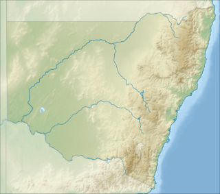
| Coordinates | 33°40′54″S 151°06′04″E |
| Established | September 2012[1] |
| Area | 38.84 km2 (15.0 sq mi)[1] |
| Managing authorities | NSW National Parks & Wildlife Service |
| Website | Berowra Valley National Park |
| See also | Protected areas of New South Wales |
A contiguous stretch of parkland, from south to north, its southern boundary is defined by Boundary Road, Pennant Hills; its south–eastern boundary defined by the western limits of Hornsby; its north–eastern boundary defined by the Pacific Motorway; its northern boundary defined by Berowra Waters; and its western boundary defined by a series of creek and gullies as the park extends into Galston Gorge and further south.
A 25-kilometre (16 mi) stretch of the Great North Walk is located within the national park.
Etymology
In the local indigenous language the word Berowra means a "place of many winds".[2]
History
Part of the park originally formed as a the Elouera Bushland Natural Park which was reserved in 1964 and consisted of 640 hectares (1,600 acres). Additional lands were acquired and the park was gazetted as Reserve No. 100092 for public recreation and the study and preservation of native flora and fauna in 1987. This gazettal was in response to increasing community concern over the development of bushland areas in the Hornsby Shire. The park then came to be known as Berowra Valley Bushland Park. Further land additions were made to the park, which was gazetted as Berowra Valley Regional Park on 27 March 1998,[3] and was gazetted as a national park in September 2012.
On 27 January 2013 a man was found alive in the park after spending 9 weeks being lost. He survived one of Australia's worst heatwaves during which daytime temperatures reached more than 45 degrees, surviving on water and food he had brought with him.[4]
References
- "Berowra Valley National Park: Park management". Office of Environment & Heritage. Government of New South Wales. Retrieved 11 October 2014.
- "Berowra Valley Regional Park". Geographical Names Register (GNR) of NSW. Geographical Names Board of New South Wales. Retrieved 11 October 2014.

- "Berowra Valley Regional Park: Plan of management" (PDF). NSW National Parks & Wildlife Service (PDF). Government of New South Wales. 27 April 2005. ISBN 1-74122-058-0. Retrieved 11 October 2014.
- "How Matt survived a nine-week nightmare ', Herald Post (Australia), January 28, 2013.
External links
- "Berowra Valley National Park". NSW National Parks & Wildlife Service. Government of New South Wales. Archived from the original on 17 October 2014. Retrieved 11 October 2014.
- Berowra Valley National Park (Map). NSW National Parks & Wildlife Service, Government of New South Wales. Archived from the original on 17 October 2014. Retrieved 11 October 2014.
- "Berowra Valley Regional Park: Plan of management" (PDF). NSW National Parks & Wildlife Service (PDF). Government of New South Wales. 27 April 2005. ISBN 1-74122-058-0.
- "Berowra Valley National Park". Office of Environment & Heritage. Government of New South Wales.