Galston Gorge
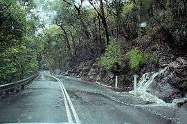
Galston Gorge is a valley located in the Berowra Valley Regional Park in Sydney, Australia. It separates Galston from Hornsby Heights, and is intersected by Galston Road and the heritage-listed Tunks Creek bridge at the foot of the valley.[1] Adjacent to Tunks Creek bridge, there is a second concrete bridge that crosses Berowra Creek.[2] The gorge itself contains many walking tracks, waterfalls and a variety of Australian flora, and is a popular spot for hikers, cyclists and rock climbers.
| Galston Gorge | |
|---|---|
 | |
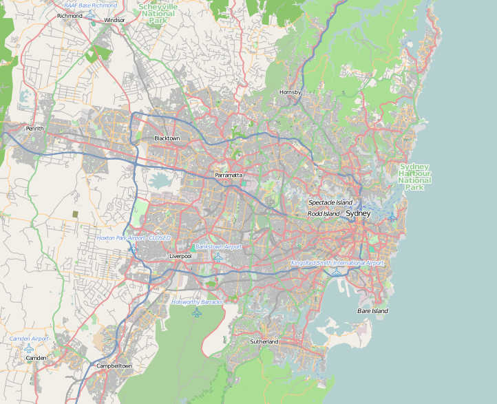
 Galston Gorge Location in greater Sydney | |
| Geology | |
| Type | Gorge |
| Geography | |
| Location | Galston, Sydney, New South Wales, Australia |
| Coordinates | 33°39′55″S 151°04′46″E |
| Rivers | Tunks Creek |
Description
Galston Gorge is a scenic valley containing dense bushland with numerous natural features such as waterfalls and streams accessible by established walking tracks. At the foot of the valley, the Tunks Creek Bridge crosses Tunks Creek. The bridge was constructed in 1893 as a McDonald timber truss one-way road bridge,[3] and became heritage listed in 2000 under the 1977 Heritage Act.[1] The second bridge, the Steel Military Bridge, is a Warren truss bridge that crosses Berowra Creek.[4] It was installed in 1965 to provide fire-fighting vehicles with access between Hornsby and Dural.[4] There is also a small car park located near the base of the Gorge which contains three designated car spots and the Galston Gorge track head that allows access to sections of the Great North Walk.[2]
Galston Road allows direct access between Galston and Hornsby Heights, and is the only road that extends through the entirety of Galston Gorge. Via the Gorge, travelling from Galston to Hornsby Heights takes approximately 20 to 25 minutes. Alternatively, detouring around the Gorge via Boundary Road takes approximately 40 to 45 minutes, and can increase significantly during peak hour times. From Tunks Creek Bridge to Hornsby Heights, the narrow road stretches approximately three kilometres with an average incline of 5%, and contains six tight hairpin corners.[5] Of the five initial hairpin turns, the most gentle are the first and last, while the three in between are notoriously steep.[6] Light vehicles or vehicle combinations greater than 11 m in length are unlikely to successfully navigate the road conditions,[7] and heavy vehicles over 7.5 m in length are prohibited.[8] The road contains a guard rail along the Berowra Creek side of the road to enhance its safety.[6]
The Gorge is also accessed on foot and via bike. The Galston Gorge East[5] and Galston Gorge West[9] climbs are both routes which are commonly taken by cyclists. The Benowie Walking Track, the Tunks Trail and the Ulolo Trail are suitable bushwalking trails that run through the Gorge. The most significant of these is the Benowie Walking Track, which forms part of the Great North Walk that extends from Sydney Cove to Newcastle[10].[4] It is 25 km in length through Berowra Valley National Park and can be accessed via six separate locations, generating a variety of different walks.[4] The track is suitable for overnight walks, as the Galston Gorge Campsite is located along the Benowie Walking Track. Although, this campground does not provide any water or facilities for campers.[2] Features such as the Gulley Creek Falls, a small creek crossing, are also seen along the Benowie Walking Track.[11] The Heritage Bridges Walk is an established bush-walk which begins at the constructed wetlands in Clarinda Street, Hornsby, and follows predominantly fire trails with views of the two bridges before ending at the bottom of Galston Gorge.[4]
Local Flora and Fauna
Galston Gorge is also home to many native birds, mammals and reptiles. Approaching Berowra Creek, rainforest vegetation becomes dominant. Stands of Grey Myrtle Backhousia myrtifolia, ferns and water gums can be found in this area.[4] Possums and other nocturnal marsupials also reveal themselves at night, so commuters must take extra care when driving at night due to low visibility and the tight hairpin corners. Along the Benowie Walking Track, commonly found flora includes Sydney Blue Gum, Blackbutt, She Oak, Sydney Peppermint and Smooth-barked Apple mixed with Coachwood, Blackwattle and Pittosporum.[4] Commonly seen birds include honeyeaters, fantails, parrots, and various species of waterbirds such as the Pied Cormorant, White Faced Heron and Dusky Moorhen.[4] More rarely, Satin Bowerbirds and Lyrebirds may also be seen.[4]
Before 2000, a population of feral chickens lived in the bushland. This population was boosted by local residents, who would leave chickens from their semi-rural properties on the Galston side of the gorge at the bottom of the valley.[12] Steps were taken by Hornsby Shire Council to eradicate this population, however the chickens seem to have bounced back and can often be seen wandering around the parking spaces at the base of the gorge.
Traffic Regulations
There are regular occurrences of traffic incidents in Galston Gorge, most commonly caused by large trucks becoming stuck at hair-pin bends, or on Tunks Creek Bridge. As of May 2018, over 100 over-length trucks have caused traffic blockages in Galston Gorge.[8] The installation of new signage and a camera based detection system which utilises infrared technology incurs a AUD$2,270 fine to any heavy vehicle over 7.5 metres that attempts to enter Galston Gorge.[7][13] A roundabout was installed on the Galston side of the Gorge to give heavy vehicles a chance to turn around and avoid heavy fines.
Despite these laws, oversized trucks continue to travel through the valley. In February 2016, the new infrared scanning system alerted to an oversize truck, recorded by NSW Roads and Maritime Services as 15.2 metres long.[14] During the vehicles removal, two additional over-sized trucks were stopped, escorted from Galston Gorge, and later fined.[14] In June 2018, a truck crashed into Tunks Creek Bridge, damaging the heritage site and spilling diesel on the surrounding area.[15]
References
- "Bridge over Tunks (Pearces) Creek | NSW Environment & Heritage". www.environment.nsw.gov.au. Retrieved 2019-04-22.
- "Bushwalking on the Thornleigh to Galston Gorge hiking trail". Retrieved 2008-12-05.
- "Bridge over Tunks (Pearces) Creek | NSW Environment & Heritage". 141.243.8.146. Retrieved 2019-04-22.
- "Bushwalking in Hornsby" (PDF). Retrieved 2019-04-22.
- "Guide to cycling Galston Gorge East". B Grade Cyclist. 2018-05-03. Retrieved 2019-04-22.
- "Galston Gorge Road". www.dangerousroads.org. Retrieved 2019-04-22.
- Roads and Maritime Services, N. S. W. "Improvements on Galston Road, Hornsby Heights to Galston". Roads and Maritime Services. Retrieved 2019-03-28.
- Roads and Maritime Services, N. S. W. "Heavy vehicle safety at Galston Gorge". Roads and Maritime Services. Retrieved 2019-03-28.
- "Guide to cycling Galston Gorge West". B Grade Cyclist. 2018-08-09. Retrieved 2019-04-22.
- "Great North walk - Berowra Valley National Park". NSW National Parks. Retrieved 2020-01-31.
- "Galston Gorge to Berowra Station walking track". www.wildwalks.com. Retrieved 2019-04-22.
- sliang (2008-11-01). "Galston Gorge". Road Rider Magazine. Retrieved 2019-04-22.
- "'Over Dimension' cameras switched on at Galston Gorge". OwnerDriver.com.au. Retrieved 2019-03-28.
- "Galston Gorge trucks fined". www.dailytelegraph.com.au. 2016-02-12. Retrieved 2019-03-28.
- "UPDATE | Truckie fined over Galston Gorge chaos". 2GB. 2018-06-08. Retrieved 2019-03-28.