Beedon
Beedon is a village and civil parish about 6½ miles (10.4 km) north of Newbury in West Berkshire, England. The village has outlying farmhouses and is otherwise clustered west of the A34 road.
| Beedon | |
|---|---|
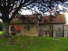 Saint Nicholas Church | |
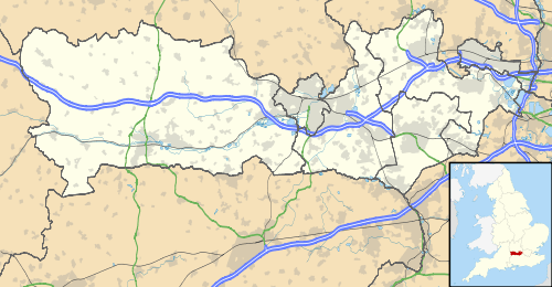 Beedon Location within Berkshire | |
| Area | 8.05 km2 (3.11 sq mi) |
| Population | 459 (2011 census)[1] |
| • Density | 57/km2 (150/sq mi) |
| OS grid reference | SU4878 |
| Civil parish |
|
| Unitary authority | |
| Ceremonial county | |
| Region | |
| Country | England |
| Sovereign state | United Kingdom |
| Post town | Newbury |
| Postcode district | RG20 |
| Dialling code | 01635 |
| Police | Thames Valley |
| Fire | Royal Berkshire |
| Ambulance | South Central |
| UK Parliament | |
Manor house
Beedon manor house was built early in the 18th century.[2]
Church
The Church of England parish church of Saint Nicholas was built in about 1220.[3]
Transport
From 18 February 2013, Beedon is served by Newbury and District bus services 6 and 6A from Newbury.[4]
Geography
Beedon has a site of Special Scientific Interest (SSSI) just to the north east of the village, called Ashridge Wood.[5]
Demography
| Output area | Homes owned outright | Owned with a loan | Socially rented | Privately rented | Other | km² roads | km² water | km² domestic gardens | Usual residents | km² |
|---|---|---|---|---|---|---|---|---|---|---|
| Civil parish | 51 | 47 | 48 | 33 | 4 | 0.07 | 0.0007 | 0.1 | 459 | 8.05 |
Military
There was a RAF decoy airfield opened to the west of the town during WWII. and its role was to deflect the bombing of real airfields. It was parented by nearby RAF Station Harwell, in Oxfordshire, England.
See also
- List of civil parishes in Berkshire
References
- Key Statistics: Dwellings; Quick Statistics: Population Density; Physical Environment: Land Use Survey 2005
- Pevsner, Nikolaus (1966). The Buildings of England: Berkshire. Harmondsworth: Penguin Books. p. 85.
- Page, William; Ditchfield, P.H., eds. (1924). Victoria County History: A History of the County of Berkshire, Volume 4. pp. 40–43.
- "Archived copy" (PDF). Archived from the original (PDF) on 19 August 2013. Retrieved 11 March 2013.CS1 maint: archived copy as title (link)
- "Magic Map Application". Magic.defra.gov.uk. Retrieved 19 March 2017.
External links
![]()