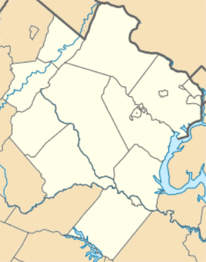
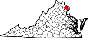
Woodlawn, Fairfax County, Virginia
Woodlawn is a census-designated place in Fairfax County, Virginia, United States. The population as of the 2010 census was 20,804.[1] It was carved out of the Mount Vernon CDP beginning with the 2010 census, from the west it goes from Fort Belvoir to Little Hunting Creek stretching along U.S. Route 1 on the south and Huntley Meadows Park on the north. Historic Woodlawn Plantation occupies the southwest corner. Fairfax County Park Authority operates neighborhood parks in the area.
Woodlawn, Fairfax County, Virginia | |
|---|---|
 Apartment complex in Woodlawn, typical of those found locally in the Route 1 corridor | |
 Woodlawn  Woodlawn  Woodlawn | |
| Coordinates: 38°43′59″N 77°6′54″W | |
| Country | United States |
| State | Virginia |
| County | Fairfax |
| Area | |
| • Total | 2.31 sq mi (5.98 km2) |
| • Land | 2.30 sq mi (5.95 km2) |
| • Water | 0.01 sq mi (0.03 km2) |
| Elevation | 30 ft (9 m) |
| Population (2010) | |
| • Total | 20,804 |
| • Density | 9,051/sq mi (3,494.8/km2) |
| Time zone | UTC−5 (Eastern (EST)) |
| • Summer (DST) | UTC−4 (EDT) |
| ZIP code | 22309 |
| FIPS code | 51-87430 |
| GNIS feature ID | 2584939 |
Education
Fairfax County Public Schools operates Woodlawn and Mount Vernon Woods Elementary Schools within the area.
References
- "Geographic Identifiers: 2010 Demographic Profile Data (G001): Woodlawn CDP (Fairfax County), Virginia". U.S. Census Bureau, American Factfinder. Retrieved October 18, 2016.
This article is issued from Wikipedia. The text is licensed under Creative Commons - Attribution - Sharealike. Additional terms may apply for the media files.