Windham County, Vermont
Windham County is a county located in the U.S. state of Vermont. As of the 2010 census, the population was 44,513.[2] The shire town (county seat) is Newfane,[3] and the largest municipality is the town of Brattleboro.
Windham County | |
|---|---|
 Windham County courthouse in Newfane | |
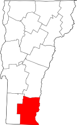 Location within the U.S. state of Vermont | |
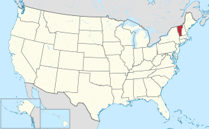 Vermont's location within the U.S. | |
| Coordinates: 42°59′55″N 72°40′07″W | |
| Country | |
| State | |
| Founded | 1781 |
| Named for | Windham, Vermont, which was named for Windham, Connecticut[1] |
| Shire Town | Newfane |
| Largest town | Brattleboro |
| Area | |
| • Total | 798 sq mi (2,070 km2) |
| • Land | 785 sq mi (2,030 km2) |
| • Water | 13 sq mi (30 km2) 1.6%% |
| Population (2010) | |
| • Total | 44,513 |
| • Estimate (2019) | 42,222 |
| • Density | 56/sq mi (22/km2) |
| Time zone | UTC−5 (Eastern) |
| • Summer (DST) | UTC−4 (EDT) |
| Congressional district | At-large |
History
Fort Bridgman, Vernon, was burned in 1755, a casualty of the French and Indian War.[4] The Court of Common Pleas (established 1768) of the County of Cumberland (established July 3, 1766) of the Province of New York was moved to the town of Westminster in 1772. On July 4, 1776 the Province of New York became an independent state.
On January 15, 1777 Vermont declared its independence from New York, and functioned as an independent republic until statehood in 1791. Cumberland County (N.Y.) and Gloucester County (N.Y.) were extinguished when Vermont declared its independence from New York; Albany County (N.Y.) and Charlotte County (now Washington County, N.Y.) were eliminated from Vermont.[5]
Unity County was formed March 17, 1778, the eastern of the two original Vermont Republic counties.[6] Unity County was renamed Cumberland County on March 21, 1778.[7] Cumberland County and Bennington County (the eastern original county) exchanged land, adjusting their early border.[8] On February 16, 1781 Rutland County was created from Bennington County, and Orange, Windham and Windsor Counties were created from Cumberland County.[9] Some authors assume Cumberland County was renamed Windham County in 1781. Several original sources indicate Cumberland County was dissolved rather than renamed.[10] This was probably to make a clean legal break from any connection with Cumberland County, New York, as some authors indicate the Cumberland County, Vermont Republic, records remained in Windham County. Newfane became the Shire Town of Windham County before 1812.
Geography
According to the U.S. Census Bureau, the county has a total area of 798 square miles (2,070 km2), of which 785 square miles (2,030 km2) is land and 13 square miles (34 km2) (1.6%) is water.[11] It is the third-largest county in Vermont by land area.
Adjacent counties
- Windsor County - north
- Sullivan County, New Hampshire - northeast
- Cheshire County, New Hampshire - east
- Franklin County, Massachusetts - south
- Bennington County - west
Reservoirs
- Ball Mountain Lake
- Harriman Reservoir (also sometimes called Lake Whitingham or Whitingham Reservoir)
- Townshend Lake
National protected areas
Demographics
| Historical population | |||
|---|---|---|---|
| Census | Pop. | %± | |
| 1790 | 17,572 | — | |
| 1800 | 23,581 | 34.2% | |
| 1810 | 26,760 | 13.5% | |
| 1820 | 28,457 | 6.3% | |
| 1830 | 28,748 | 1.0% | |
| 1840 | 27,442 | −4.5% | |
| 1850 | 29,062 | 5.9% | |
| 1860 | 26,982 | −7.2% | |
| 1870 | 26,036 | −3.5% | |
| 1880 | 26,763 | 2.8% | |
| 1890 | 26,547 | −0.8% | |
| 1900 | 26,660 | 0.4% | |
| 1910 | 26,932 | 1.0% | |
| 1920 | 26,373 | −2.1% | |
| 1930 | 26,015 | −1.4% | |
| 1940 | 27,850 | 7.1% | |
| 1950 | 28,749 | 3.2% | |
| 1960 | 29,776 | 3.6% | |
| 1970 | 33,074 | 11.1% | |
| 1980 | 36,933 | 11.7% | |
| 1990 | 41,588 | 12.6% | |
| 2000 | 44,216 | 6.3% | |
| 2010 | 44,513 | 0.7% | |
| Est. 2019 | 42,222 | [12] | −5.1% |
| U.S. Decennial Census[13] 1790–1960[14] 1900–1990[15] 1990–2000[16] 2010–2018[2] | |||
2000 census
As of the census[17] of 2000, 44,216 people, 18,375 households, and 11,447 families resided in the county. The population density was 56 people per square mile (22/km²). There were 27,039 housing units at an average density of 34 per square mile (13/km²). The county's racial makeup was 96.72% White, 0.50% Black or African American, 0.22% Native American, 0.79% Asian, 0.04% Pacific Islander, 0.32% from other races, and 1.42% from two or more races. 1.11% of the population were Hispanic or Latino of any race. 18.1% were of English, 13.3% Irish, 9.5% French, 8.9% American, 7.7% German, 6.0% Italian and 5.0% French Canadian ancestry. 95.9% spoke English, 1.3% Spanish and 1.2% French as their first language.
There were 18,375 households, of which 29.90% had children under the age of 18 living with them, 49.20% were married couples living together, 9.60% had a female householder with no husband present, and 37.70% were non-families. 29.70% of all households were made up of individuals and 10.20% had someone living alone who was 65 years of age or older. The average household size was 2.35 and the average family size was 2.91.
In the county, the population was spread out with 23.50% under the age of 18, 7.10% from 18 to 24, 28.10% from 25 to 44, 27.20% from 45 to 64, and 14.00% who were 65 years of age or older. The median age was 40 years. For every 100 females there were 95.00 males. For every 100 females age 18 and over, there were 91.80 males.
The county's median household income was $38,204, and the median family income was $46,989. Males had a median income of $31,094 versus $24,650 for females. The county's per capita income was $20,533. About 6.10% of families and 9.40% of the population were below the poverty line, including 12.00% of those under age 18 and 7.90% of those age 65 or over.
2010 census
As of the 2010 United States Census, 44,513 people, 19,290 households, and 11,453 families resided in the county.[18] The population density was 56.7 inhabitants per square mile (21.9/km2). There were 29,735 housing units at an average density of 37.9 per square mile (14.6/km2).[19] The county's racial makeup was 95.3% white, 1.0% Asian, 0.9% black or African American, 0.3% American Indian, 0.5% from other races, and 2.0% from two or more races. Those of Hispanic or Latino origin made up 1.8% of the population.[18] The largest ancestry groups were:


.svg.png)
.svg.png)

.svg.png)
Of the 19,290 households, 26.2% had children under the age of 18 living with them, 44.8% were married couples living together, 10.1% had a female householder with no husband present, 40.6% were non-families, and 31.8% of all households were made up of individuals. The average household size was 2.23 and the average family size was 2.79. The median age was 44.9 years.[18]
The county's median household income was $46,714 and the median family income was $58,814. Males had a median income of $40,872 versus $33,278 for females. The county's per capita income was $27,247. About 6.3% of families and 11.1% of the population were below the poverty line, including 13.3% of those under age 18 and 7.7% of those age 65 or over.[20]
Politics and government
In 1828, Windham County was won by National Republican Party candidate John Quincy Adams and by Henry Clay in 1832.
From William Henry Harrison in 1836 to Winfield Scott in 1852, the county would vote the Whig Party candidates.
From John C. Frémont in 1856 to Richard Nixon in 1960, the Republican Party would have a 104 year winning streak within Windham County.
In 1964, the county was won by Democratic Party incumbent President Lyndon B. Johnson, who became not only the first Democratic presidential candidate to win the county, but to win the state of Vermont entirely.
Following the Democrats victory in 1964, the county went back to voting for Republican candidates for another 16 year winning streak starting with Richard Nixon in 1968 and ending with Ronald Reagan in 1984, who became the last Republican presidential candidate to win the county, winning it with 54% of the vote to 45% for Walter Mondale.[21]
In 1988 the county was won by Michael Dukakis and has been won by Democratic candidates ever since.
By some accounts, Windham County is now considered the 'bluest' county in the 'bluest' state in the USA. It was Vermont's bluest county in the 2000, 2004, 2008 and 2012 U.S. Presidential elections. Then-Vice President Al Gore won the county by an 18.4% margin over then-Texas Governor George W. Bush, with 53% of the vote to Bush's 34%. In 2004, John Kerry carried the county by a 35.2% margin over President Bush, with Kerry carrying the state by 20.1% over Bush.[22] In 2008, Barack Obama won Windham by 48.1% margin over John McCain, with Obama winning by 37% over McCain statewide.[23] In 2012, Obama won Windham County by a 48.7% margin over Mitt Romney.[24]
In 2006, four towns in Windham County, Dummerston, Marlboro, Newfane, and Stratton, had their citizens pass resolutions supporting the proposed impeachment of President George W. Bush.[25]
| Year | Republican | Democratic | Third parties |
|---|---|---|---|
| 2016 | 24.1% 5,454 | 63.4% 14,340 | 12.6% 2,840 |
| 2012 | 24.4% 5,347 | 73.1% 16,026 | 2.6% 564 |
| 2008 | 24.9% 5,997 | 73.0% 17,585 | 2.1% 499 |
| 2004 | 31.2% 7,280 | 66.4% 15,489 | 2.4% 547 |
| 2000 | 34.2% 7,358 | 52.7% 11,319 | 13.1% 2,814 |
| 1996 | 27.8% 5,261 | 55.1% 10,426 | 17.1% 3,228 |
| 1992 | 27.2% 5,816 | 53.3% 11,414 | 19.5% 4,181 |
| 1988 | 46.0% 8,572 | 52.8% 9,839 | 1.3% 242 |
| 1984 | 54.1% 9,880 | 44.9% 8,206 | 1.1% 193 |
| 1980 | 42.6% 7,062 | 35.1% 5,830 | 22.3% 3,706 |
| 1976 | 52.1% 7,928 | 44.6% 6,794 | 3.4% 510 |
| 1972 | 60.0% 9,062 | 39.2% 5,925 | 0.8% 113 |
| 1968 | 54.4% 6,916 | 42.1% 5,353 | 3.6% 452 |
| 1964 | 33.3% 4,180 | 66.7% 8,371 | 0.0% 4 |
| 1960 | 67.7% 9,128 | 32.3% 4,358 | |
| 1956 | 80.0% 9,979 | 19.8% 2,474 | 0.2% 22 |
| 1952 | 77.6% 9,774 | 22.2% 2,790 | 0.3% 31 |
| 1948 | 70.5% 7,148 | 27.3% 2,770 | 2.2% 222 |
| 1944 | 66.5% 6,708 | 33.5% 3,376 | 0.1% 5 |
| 1940 | 63.0% 7,031 | 36.8% 4,101 | 0.2% 27 |
| 1936 | 66.4% 7,369 | 33.3% 3,699 | 0.2% 27 |
| 1932 | 66.0% 7,347 | 32.9% 3,659 | 1.1% 123 |
| 1928 | 77.7% 8,410 | 22.2% 2,398 | 0.2% 16 |
| 1924 | 83.2% 7,638 | 11.9% 1,091 | 4.9% 454 |
| 1920 | 80.4% 5,551 | 18.9% 1,302 | 0.8% 55 |
| 1916 | 65.5% 3,375 | 33.0% 1,698 | 1.6% 80 |
| 1912 | 38.3% 2,143 | 23.7% 1,327 | 38.1% 2,132 |
| 1908 | 78.6% 3,738 | 19.0% 906 | 2.4% 114 |
| 1904 | 78.6% 3,735 | 17.0% 809 | 4.4% 208 |
| 1900 | 79.0% 3,948 | 20.3% 1,014 | 0.7% 34 |
| 1896 | 84.1% 4,829 | 11.7% 670 | 4.2% 240 |
| 1892 | 69.5% 3,656 | 28.5% 1,496 | 2.0% 107 |
| 1888 | 69.8% 4,344 | 24.4% 1,518 | 5.9% 366 |
| 1884 | 67.1% 3,788 | 30.2% 1,703 | 2.7% 152 |
| 1880 | 76.4% 4,637 | 23.5% 1,426 | 0.2% 9 |
County law enforcement
The Windham County Sheriff's Department is one source of law enforcement in this county especially in areas with no local police departments. Where no coverage exists, the Vermont State Police are the de facto law enforcement agency.
Transportation
Roads and highways
Windham County is crossed by:
|
Bus
Local bus service, particularly in and around Brattleboro and Bellows Falls, is provided by Connecticut River Transit's "The Current". The Current includes the entire Brattleboro BeeLine bus system, composed of the Red, Blue and White Lines, which also go to West Brattleboro and Hinsdale, New Hampshire. The Deerfield Valley Transit Association's fare-free MOOver serves mostly the southwestern portion of the county, especially the town of Wilmington and nearby ski areas. The MOOver also has bus connections to Bennington (in a partnership with the Green Mountain Express) to the west and Brattleboro, connecting to other local and intercity buses in both towns.
The national intercity bus service Greyhound serves Windham County with stops in Brattleboro and Bellows Falls daily.
Rail
Amtrak, the national intercity rail network, operates its Vermonter, running daily from St. Albans, Vermont to Washington, DC through Bellows Falls and Brattleboro with one daily northbound and southbound stop.
Communities
Towns
In Vermont, towns are contiguous named places, subdivisions of counties, where there is permanent, year-round human population. They are usually formally incorporated, governing themselves in open town meetings (with very few exceptions), and their usual elected administrative body is called a selectboard. Though Brattleboro is by far the most populous town in the county, the historic "shire town" (county seat) is Newfane, and Windham County Superior Court is still there, as are the offices of the County Sheriff and the County Clerk.
- Athens
- Brattleboro
- Brookline
- Dover
- Dummerston
- Grafton
- Guilford
- Halifax
- Jamaica
- Londonderry
- Marlboro
- Newfane (shire town)
- Putney
- Rockingham
- Somerset
- Stratton
- Townshend
- Vernon
- Wardsboro
- Westminster
- Whitingham
- Wilmington
- Windham
Villages
Villages are named places and sometimes formal census divisions, but may or may not be incorporated separately within a town's borders.
Census-designated places
- Brattleboro
- North Westminster
- Putney
- West Brattleboro
- Wilmington
Other villages
- Algiers
- Bellows Falls
- Cambridgeport
- Dover
- Dummerston Center
- East Dover
- East Dummerston
- East Jamaica
- Halifax Center
- Harmonyville
- Houghtonville
- Jacksonville
- Newfane
- Rawsonville
- Saxtons River
- South Londonderry
- South Newfane
- South Wardsboro
- South Windham
- Wardsboro Center
- West Dover
- West Dummerston
- West Halifax
- West Townshend
- West Wardsboro
- Westminster
- Westminster Station
- Westminster West
- Williamsville
See also
References
- Aiken, Charles Curry; Kane, Joseph Nathan (May 21, 2013). "The American Counties: Origins of County Names, Dates of Creation, Area, and Population Data, 1950-2010". Rowman & Littlefield – via Google Books.
- "State & County QuickFacts". United States Census Bureau. Retrieved December 30, 2013.
- "Find a County". National Association of Counties. Retrieved June 7, 2011.
- Archived February 19, 2012, at the Wayback Machine
- Slade, 70-73; Van Zandt, 64; Williamson, C., 82-84, map facing 95, 100-102, 112-113.
- Vermont State Papers, 12:43-44.
- Vermont State Papers, 3:13.
- Vermont State Papers, 12:43-44
- Vermont State Papers, 13:5-6
- "Vermont: Individual County Chronologies". Vermont Atlas of Historical County Boundaries. The Newberry Library. 2008. Retrieved June 30, 2015.
- "2010 Census Gazetteer Files". United States Census Bureau. August 22, 2012. Retrieved June 29, 2015.
- "Population and Housing Unit Estimates". Retrieved June 10, 2019.
- "U.S. Decennial Census". United States Census Bureau. Retrieved June 29, 2015.
- "Historical Census Browser". University of Virginia Library. Retrieved June 29, 2015.
- Forstall, Richard L., ed. (March 27, 1995). "Population of Counties by Decennial Census: 1900 to 1990". United States Census Bureau. Retrieved June 29, 2015.
- "Census 2000 PHC-T-4. Ranking Tables for Counties: 1990 and 2000" (PDF). United States Census Bureau. April 2, 2001. Retrieved June 29, 2015.
- "U.S. Census website". United States Census Bureau. Retrieved May 14, 2011.
- "DP-1 Profile of General Population and Housing Characteristics: 2010 Demographic Profile Data". United States Census Bureau. Archived from the original on February 13, 2020. Retrieved January 20, 2016.
- "Population, Housing Units, Area, and Density: 2010 - County". United States Census Bureau. Archived from the original on February 13, 2020. Retrieved January 20, 2016.
- "DP03 SELECTED ECONOMIC CHARACTERISTICS – 2006-2010 American Community Survey 5-Year Estimates". United States Census Bureau. Archived from the original on February 13, 2020. Retrieved January 20, 2016.
- "1984 Presidential General Election Results - Vermont".
- "2004 Presidential General Election Results - Vermont". uselectionatlas.org. Retrieved 10 April 2018.
- Leip, David. "Dave Leip's Atlas of U.S. Presidential Elections". www.uselectionatlas.org. Retrieved 10 April 2018.
- "2012 Presidential General Election Results - Vermont".
- Four Vermont Towns Vote to Impeach Bush Associated Press. Published on 2006-03-08. Retrieved on 2008-09-20.
- Leip, David. "Dave Leip's Atlas of U.S. Presidential Elections". uselectionatlas.org. Retrieved 10 April 2018.
External links
- The Windham Regional Commission
- Windham County Sheriff's Department
- The Mount Snow Valley Chamber of Commerce
- The Historical Society of Windham County
- Windham County history and genealogy
Places adjacent to Windham County, Vermont | |
|---|---|
Municipalities and communities of Windham County, Vermont, United States | ||
|---|---|---|
Shire town: Newfane | ||
| Towns | Map of Vermont highlighting Windham County | |
| Villages | ||
| CDPs |
| |
| Other communities | ||
| Footnotes | ‡ Disincorporated | |
Montpelier (capital) | ||
| Regions | ||
| Counties | ||
| Cities | ||
| Towns (pop. >5000) | ||
| Festivals | ||
| Topics |
| |
| Society |
| |
| Authority control |
|
|---|