Addison County, Vermont
Addison County is a county located in the U.S. state of Vermont. As of the 2010 census, the population was 36,821.[1] Its shire town (county seat) is the town of Middlebury.[2]
Addison County | |
|---|---|
 Addison County courthouse in Middlebury | |
 Location within the U.S. state of Vermont | |
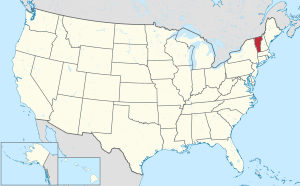 Vermont's location within the U.S. | |
| Coordinates: 44°01′58″N 73°10′05″W | |
| Country | |
| State | |
| Founded | 1785 |
| Shire Town | Middlebury |
| Largest town | Middlebury |
| Area | |
| • Total | 808 sq mi (2,090 km2) |
| • Land | 766 sq mi (1,980 km2) |
| • Water | 41 sq mi (110 km2) 5.1%% |
| Population (2010) | |
| • Total | 36,821 |
| • Estimate (2019) | 36,777 |
| • Density | 46/sq mi (18/km2) |
| Time zone | UTC−5 (Eastern) |
| • Summer (DST) | UTC−4 (EDT) |
| Congressional district | At-large |
| Website | www |
History
Iroquois settled in the county before European arrived in 1609. French settlers in Crown Point, New York extended their settlements across Lake Champlain. A few individuals or families came up the lake from Canada and established themselves at Chimney Point in 1730. In 1731, Fort Frederic was erected at Cross Point. In 1759, General Amherst occupied Cross Point and British settlers came in. The Battle of Bennington in Bennington, fought on August 16, 1777, brought a turning point for the American independence against British.
Addison County was established by act of the Legislature October 18, 1785,[3] during the period of Vermont Republic. In 1791, Vermont joined the federal union after the original thirteen colonies. The main product of the county was wheat. In the 1820s farmers began to raise sheep. The Champlain Canal was opened on 1823, making it possible for ships to navigate from the Hudson River. In 1840, the county produced more wool than any other county in the United States.[3]
When Vermont was admitted into the Union in 1791, there were 9,267 people living in Addison County. By 1830, the population had grown to 26,503 people.
In 2008, the federal government declared the county a disaster area after severe storms and flooding June 14–17.[4]
Geography

.jpg)
According to the U.S. Census Bureau, the county has a total area of 808 square miles (2,090 km2), of which 766 square miles (1,980 km2) is land and 41 square miles (110 km2) (5.1%) is water.[5] It is the third-largest county in Vermont by total area.
The county of Addison is situated on the west line of Vermont state and nearly in the center north and south; between 43° 50′ and 44° 10′ north latitude. The primary stream of the county is Otter Creek, which runs through the county from the south to the north.
Adjacent counties
- Chittenden County - north
- Washington County - northeast
- Orange County - east
- Windsor County - southeast
- Rutland County - south
- Washington County, New York - southwest
- Essex County, New York - west
National protected area
Demographics
| Historical population | |||
|---|---|---|---|
| Census | Pop. | %± | |
| 1790 | 6,420 | — | |
| 1800 | 13,417 | 109.0% | |
| 1810 | 19,998 | 49.0% | |
| 1820 | 20,469 | 2.4% | |
| 1830 | 24,940 | 21.8% | |
| 1840 | 23,583 | −5.4% | |
| 1850 | 26,549 | 12.6% | |
| 1860 | 24,010 | −9.6% | |
| 1870 | 23,484 | −2.2% | |
| 1880 | 24,173 | 2.9% | |
| 1890 | 22,277 | −7.8% | |
| 1900 | 21,912 | −1.6% | |
| 1910 | 20,010 | −8.7% | |
| 1920 | 18,666 | −6.7% | |
| 1930 | 17,952 | −3.8% | |
| 1940 | 17,944 | 0.0% | |
| 1950 | 19,442 | 8.3% | |
| 1960 | 20,076 | 3.3% | |
| 1970 | 24,266 | 20.9% | |
| 1980 | 29,406 | 21.2% | |
| 1990 | 32,953 | 12.1% | |
| 2000 | 35,974 | 9.2% | |
| 2010 | 36,821 | 2.4% | |
| Est. 2019 | 36,777 | [6] | −0.1% |
| U.S. Decennial Census[7] 1790–1960[8] 1900–1990[9] 1990–2000[10] 2010–2018[1] | |||
2000 census
At the 2000 census,[11] there were 35,974 people, 13,068 households and 9,108 families living in the county. The population density was 47 per square mile (18/km2). There were 15,312 housing units at an average density of 20 per square mile (8/km2). The racial makeup of the county was 96.86% White, 0.54% Black or African American, 0.26% Native American, 0.73% Asian, 0.03% Pacific Islander, 0.29% from other races, and 1.29% from two or more races. 1.10% of the population were Hispanic or Latino of any race. 15.5% were of English, 12.7% American, 12.0% French, 10.8% French Canadian, 10.8% Irish and 6.7% German ancestry. 96.0% spoke English, 1.8% French and 1.2% Spanish as their first language.
There were 13,068 households of which 34.40% had children under the age of 18 living with them, 57.40% were married couples living together, 8.30% had a female householder with no husband present, and 30.30% were non-families. 23.40% of all households were made up of individuals and 8.90% had someone living alone who was 65 years of age or older. The average household size was 2.55 and the average family size was 3.02.
Age distribution was 24.90% under the age of 18, 12.50% from 18 to 24, 26.90% from 25 to 44, 24.30% from 45 to 64, and 11.30% who were 65 years of age or older. The median age was 36 years. For every 100 females there were 97.70 males. For every 100 females age 18 and over, there were 95.40 males.
The median household income was $43,142, and the median family income was $49,351. Males had a median income of $31,836 versus $24,416 for females. The per capita income for the county was $19,539. About 5.10% of families and 8.60% of the population were below the poverty line, including 9.10% of those under age 18 and 8.00% of those age 65 or over.
For historical populations since 1900, see Historical U.S. Census totals for Addison County, Vermont
2010 census
As of the 2010 United States Census, there were 36,821 people, 14,084 households, and 9,340 families living in the county.[12] The population density was 48.0 inhabitants per square mile (18.5/km2). There were 16,760 housing units at an average density of 21.9 per square mile (8.5/km2).[13] The racial makeup of the county was 95.3% white, 1.4% Asian, 0.8% black or African American, 0.2% American Indian, 0.5% from other races, and 1.7% from two or more races. Those of Hispanic or Latino origin made up 1.9% of the population.[12] In terms of ancestry, 18.1% were English, 17.2% were Irish, 12.0% were German, 7.5% were American, 7.2% were French Canadian, 5.9% were Italian, and 5.3% were Scottish.[14]
Of the 14,084 households, 29.5% had children under the age of 18 living with them, 53.3% were married couples living together, 8.6% had a female householder with no husband present, 33.7% were non-families, and 25.5% of all households were made up of individuals. The average household size was 2.41 and the average family size was 2.88. The median age was 41.3 years.[12]
The median income for a household in the county was $55,800 and the median income for a family was $67,721. Males had a median income of $43,643 versus $34,486 for females. The per capita income for the county was $26,599. About 5.7% of families and 11.3% of the population were below the poverty line, including 11.4% of those under age 18 and 5.8% of those age 65 or over.[15]
Politics
In 1828, the county voted for National Republican Party candidate John Quincy Adams.
In 1832, the county voted for Anti-Masonic Party candidate William Wirt.
From William Henry Harrison in 1836 to Winfield Scott in 1852, the state would vote the Whig Party candidates.
From John C. Frémont in 1856 to Richard Nixon in 1960, the Republican Party would have a 104-year winning streak in the county.
In 1964, the county was won by Democratic Party incumbent President Lyndon B. Johnson, who became not only the first Democratic presidential candidate to win the county, but to win the state of Vermont entirely.
Following the Democrats victory in 1964, the county went back to voting for Republican candidates for another 16 year winning streak starting with Richard Nixon in 1968 and ending with Ronald Reagan in 1984, who became the last Republican presidential candidate to win the county.
In 1988 the county was won by Michael Dukakis and has been won by Democratic candidates ever since.
| Year | Republican | Democratic | Third parties |
|---|---|---|---|
| 2016 | 27.8% 5,297 | 59.0% 11,219 | 13.2% 2,515 |
| 2012 | 29.1% 5,203 | 68.4% 12,257 | 2.5% 450 |
| 2008 | 29.5% 5,667 | 68.6% 13,202 | 1.9% 369 |
| 2004 | 38.1% 7,077 | 60.0% 11,147 | 1.9% 355 |
| 2000 | 39.9% 6,953 | 51.3% 8,936 | 8.8% 1,538 |
| 1996 | 31.1% 4,798 | 52.8% 8,164 | 16.1% 2,491 |
| 1992 | 29.6% 5,034 | 47.5% 8,092 | 22.9% 3,900 |
| 1988 | 49.1% 6,773 | 49.2% 6,791 | 1.7% 233 |
| 1984 | 58.3% 7,589 | 40.7% 5,299 | 1.1% 137 |
| 1980 | 44.9% 5,216 | 37.4% 4,351 | 17.7% 2,063 |
| 1976 | 56.5% 5,726 | 41.1% 4,164 | 2.4% 241 |
| 1972 | 66.0% 6,467 | 33.3% 3,262 | 0.7% 71 |
| 1968 | 60.8% 5,006 | 35.4% 2,914 | 3.7% 308 |
| 1964 | 42.4% 3,500 | 57.6% 4,758 | |
| 1960 | 65.0% 5,520 | 35.0% 2,969 | |
| 1956 | 78.2% 5,990 | 21.8% 1,668 | |
| 1952 | 78.2% 6,057 | 21.5% 1,667 | 0.3% 24 |
| 1948 | 70.7% 4,148 | 27.5% 1,615 | 1.8% 106 |
| 1944 | 66.3% 4,097 | 33.6% 2,079 | 0.1% 8 |
| 1940 | 63.2% 4,500 | 36.4% 2,593 | 0.4% 25 |
| 1936 | 65.9% 5,161 | 33.8% 2,646 | 0.3% 24 |
| 1932 | 62.8% 5,295 | 36.0% 3,031 | 1.2% 102 |
| 1928 | 72.1% 5,247 | 27.5% 2,003 | 0.4% 28 |
| 1924 | 87.7% 4,927 | 9.9% 557 | 2.4% 135 |
| 1920 | 88.9% 4,515 | 9.9% 503 | 1.2% 59 |
| 1916 | 74.7% 2,765 | 23.6% 874 | 1.7% 64 |
| 1912 | 45.3% 1,835 | 15.3% 621 | 39.3% 1,591 |
| 1908 | 84.4% 2,986 | 12.6% 444 | 3.0% 107 |
| 1904 | 87.2% 3,146 | 10.1% 366 | 2.7% 96 |
| 1900 | 86.4% 3,286 | 12.3% 467 | 1.3% 50 |
| 1896 | 89.2% 4,314 | 8.4% 404 | 2.5% 120 |
| 1892 | 80.7% 3,146 | 15.9% 621 | 3.3% 130 |
| 1888 | 82.8% 4,036 | 12.7% 618 | 4.6% 222 |
| 1884 | 81.2% 4,878 | 14.0% 600 | 4.8% 204 |
| 1880 | 85.7% 3,842 | 13.1% 585 | 1.2% 55 |
Education
Addison County has the following high schools:
- Vergennes Union High School in Vergennes
- Mt. Abe Union High School in Bristol
- Middlebury Union High School in Middlebury
- Middlebury Union Middle School in Middlebury
Addison County is also home to two institutions of higher learning, Middlebury College and the Community College of Vermont, both located in Middlebury[17]
Transportation
Air
The Middlebury State Airport serves private aviation for Addison County. Commercial airlines are available to the north at Burlington International Airport in Chittenden County, and to the south at Rutland Southern Vermont Regional Airport in Rutland County.
Public Transportation
Public bus service in Addison County is operated by Addison County Transit Resources (ACTR). There is extensive bus service around Middlebury with connections to Vergennes, New Haven and Bristol, seasonal service to Middlebury Snow Bowl, as well as commuter buses to Burlington and Rutland operated in conjunction with Green Mountain Transit and the Marble Valley Regional Transit District, respectively.[18]
Although the majority of rides are provided through the Shuttle Bus System, ACTR also operates a Dial-A-Ride System. This system enhances ACTR's ability to provide comprehensive transportation alternatives for all Addison County residents.[19]
The Dial-A-Ride System includes programs that focus on specialized populations including elders, persons with disabilities, low-income families and individuals, as well as the visually impaired. Those eligible for Medicaid, Reach Up, are aged 60+ or with a disability may be eligible for free transportation. Nearly 40 Volunteer Drivers work with ACTR to provide these rides. Additional information about ACTR's transportation services are available at www.actr-vt.org.[20]
In 2021 or 2022 Amtrak is set to bring the Ethan Allen Express, for Burlington to New York City service through the county, making a stop at Middlebury.[21] This would mark the first time intercity train service operated through the county since the Rutland Railroad discontinued the Green Mountain Flyer and the Mount Royal.[22]
Major highways


Communities
City
Towns
Census-designated places
- Bristol
- East Middlebury
- Middlebury
Other unincorporated communities
See also
References
- "State & County QuickFacts". United States Census Bureau. Archived from the original on June 6, 2011. Retrieved December 30, 2013.
- "Find a County". National Association of Counties. Archived from the original on May 31, 2011. Retrieved June 7, 2011.
- Samuel Swift (1859). History of Addison county. A. H. Coperland.
- Sutkoski, Matt (August 1, 2008). Summer has been wet one for the ages. Burlington Free Press.
- "2010 Census Gazetteer Files". United States Census Bureau. August 22, 2012. Retrieved June 28, 2015.
- "Population and Housing Unit Estimates". Retrieved June 14, 2019.
- "U.S. Decennial Census". United States Census Bureau. Retrieved June 28, 2015.
- "Historical Census Browser". University of Virginia Library. Retrieved June 28, 2015.
- Forstall, Richard L., ed. (March 27, 1995). "Population of Counties by Decennial Census: 1900 to 1990". United States Census Bureau. Retrieved June 28, 2015.
- "Census 2000 PHC-T-4. Ranking Tables for Counties: 1990 and 2000" (PDF). United States Census Bureau. April 2, 2001. Retrieved June 28, 2015.
- "U.S. Census website". United States Census Bureau. Retrieved May 14, 2011.
- "DP-1 Profile of General Population and Housing Characteristics: 2010 Demographic Profile Data". United States Census Bureau. Archived from the original on February 13, 2020. Retrieved January 20, 2016.
- "Population, Housing Units, Area, and Density: 2010 - County". United States Census Bureau. Archived from the original on February 13, 2020. Retrieved January 20, 2016.
- "DP02 SELECTED SOCIAL CHARACTERISTICS IN THE UNITED STATES – 2006-2010 American Community Survey 5-Year Estimates". United States Census Bureau. Archived from the original on February 13, 2020. Retrieved January 20, 2016.
- "DP03 SELECTED ECONOMIC CHARACTERISTICS – 2006-2010 American Community Survey 5-Year Estimates". United States Census Bureau. Archived from the original on February 13, 2020. Retrieved January 20, 2016.
- Leip, David. "Dave Leip's Atlas of U.S. Presidential Elections". uselectionatlas.org. Retrieved June 8, 2018.
- Education in Addison County, Vermont. Addisoncounty.com. Retrieved on April 12, 2014.
- ACTR Bus Schedules & Maps, Addison County Transit Resources, Dec. 1, 2017.
- ACTR Dial-A-Ride, Addison County Transit Resources, Dec. 1, 2017.
- ACTR Bus Schedules & Maps brochure
- Flowers, John (2018-04-30). "Middlebury begins search for passenger rail platform". Addison County Independent.
- Lindsell, Robert M. (2000). The Rail Lines of Northern New England. Branch Line Press. pp. 35–46, 175. ISBN 0942147065.
External links
- Addison County Chamber of Commerce
- National Register of Historic Places listing for Addison Co., Vermont
- History of Addison County - Edited by H. P. Smith. D. Mason & Co., Publishers. 1886. Hosted by the Middlebury College Library.
Places adjacent to Addison County, Vermont | |
|---|---|
Municipalities and communities of Addison County, Vermont, United States | ||
|---|---|---|
Shire town: Middlebury | ||
| City | Map of Vermont highlighting Addison County | |
| Towns | ||
| CDPs | ||
| Other communities | ||
Montpelier (capital) | ||
| Regions | ||
| Counties | ||
| Cities | ||
| Towns (pop. >5000) | ||
| Festivals | ||
| Topics |
| |
| Society |
| |
| Authority control |
|
|---|