Chittenden County, Vermont
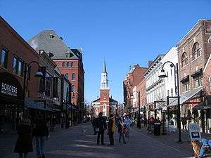
Chittenden County (/ˈtʃɪtəndən/) is the most populous county in the U.S. state of Vermont. As of the 2010 census, the population was 156,545.[1] The county's population estimate for 2019 was 163,774. The county seat is Vermont's most populous municipality, the city of Burlington. The county has over a quarter of Vermont's population and more than twice the population of Vermont's second most populous county, Rutland. The county also has more than twice the population density of Vermont's second most dense county, Washington. The county is named for Vermont's first governor and one of the framers of its constitution as an independent republic and later U.S. state, Thomas Chittenden.
Chittenden County | |
|---|---|
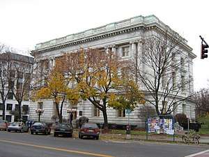 Chittenden County Superior Court in Burlington | |
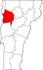 Location within the U.S. state of Vermont | |
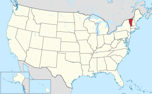 Vermont's location within the U.S. | |
| Coordinates: 44°28′32″N 73°07′38″W | |
| Country | |
| State | |
| Founded | October 22, 1787 |
| Shire Town | Burlington |
| Largest city | Burlington |
| Area | |
| • Total | 619 sq mi (1,600 km2) |
| • Land | 537 sq mi (1,390 km2) |
| • Water | 83 sq mi (210 km2) 13%% |
| Population (2010) | |
| • Total | 156,545 |
| • Estimate (2019) | 163,774 |
| • Density | 250/sq mi (98/km2) |
| Time zone | UTC−5 (Eastern) |
| • Summer (DST) | UTC−4 (EDT) |
| Congressional district | At-large |
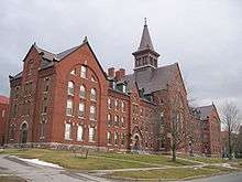
The county has most of Vermont's fastest growing municipalities. It is one of the three counties that comprise the Burlington metropolitan area, along with the counties of Franklin and Grand Isle to the north and northwest, respectively. The University of Vermont (UVM), Vermont's largest university, is located in the county, as well as its affiliated hospital, the UVM Medical Center (which is Vermont's largest hospital and collectively forms the largest employer in the state along with the university). Vermont's largest private employer (GlobalFoundries) and largest airport (Burlington International Airport) are in the localities of Essex Junction and South Burlington, respectively.
The Vermont Army National Guard is based at Camp Johnson in the town of Colchester. The Vermont Air National Guard is based at the Burlington Air National Guard Base on the grounds of the Burlington International Airport in South Burlington.
Geography
According to the U.S. Census Bureau, the county has a total area of 619 square miles (1,600 km2), of which 537 square miles (1,390 km2) is land and 83 square miles (210 km2) (13%) is water.[2] It is the third-smallest county in Vermont by area.
Originally, Chittenden County contained parts of other counties. It included all of today's Franklin, Grand Isle, and Lamoille counties, and parts of today's Orleans, Washington, and Addison counties.[3]
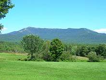
The town of Underhill in Chittenden County is home to the highest summit within the state, Mount Mansfield, which has a peak elevation of 4,393 feet (1,339 m) above sea level.
Adjacent counties
- Addison County – south
- Clinton County, New York – northwest
- Essex County, New York – west
- Franklin County – north
- Grand Isle County – northwest
- Lamoille County – northeast
- Washington County – southeast
Demographics
| Historical population | |||
|---|---|---|---|
| Census | Pop. | %± | |
| 1790 | 7,287 | — | |
| 1800 | 12,778 | 75.4% | |
| 1810 | 18,120 | 41.8% | |
| 1820 | 16,955 | −6.4% | |
| 1830 | 21,765 | 28.4% | |
| 1840 | 22,977 | 5.6% | |
| 1850 | 29,036 | 26.4% | |
| 1860 | 28,171 | −3.0% | |
| 1870 | 36,480 | 29.5% | |
| 1880 | 32,792 | −10.1% | |
| 1890 | 35,389 | 7.9% | |
| 1900 | 39,600 | 11.9% | |
| 1910 | 42,447 | 7.2% | |
| 1920 | 43,708 | 3.0% | |
| 1930 | 47,471 | 8.6% | |
| 1940 | 52,098 | 9.7% | |
| 1950 | 62,570 | 20.1% | |
| 1960 | 74,425 | 18.9% | |
| 1970 | 99,131 | 33.2% | |
| 1980 | 115,534 | 16.5% | |
| 1990 | 131,761 | 14.0% | |
| 2000 | 146,571 | 11.2% | |
| 2010 | 156,545 | 6.8% | |
| Est. 2019 | 163,774 | [4] | 4.6% |
| U.S. Decennial Census[5] 1790–1960[6] 1900–1990[7] 1990–2000[8] 2010–2018[1] | |||
2018 U.S. census estimates
In 2018, there were 164,572 people, and 67,271 households. There were 67,271 households of which 36.23% had children under age 18 living with them, 52.9% were married couples living together, 7.70% had a female householder with no husband present, and 37.70% were non-families. 24.31% of all households were made up of individuals and 6.72% had someone living alone who was age 65 or older. Average household size was 2.67 and average family size was 3.13.
In 2014, the county was 91.7% White, 2.4% Black or African American, 0.3% Native American and Alaska Native, 3.5% Asian, 0.01% Native Hawaiian and Other Pacific Islander and 2.1% Two or more races. Hispanic or Latino of any race made up 2.2% of the population.
In the county, age distribution was as follows: 18.7% under the age of 18, 15.23% from 18 to 24, 32.05% from 25 to 44, 20.82% from 45 to 64, and 13.2% who were 65 years of age or older. The median age was 34 years. For every 100 females, there were 94.06 males. For every 100 females age 18 and over, there were 92.30 males.
In 2007, census department estimates that Chittenden had the youngest average age in the state, 37.5. This compares with the actual census in 2000 of 34.2 years.[9]
In 2008, about 29% of the population lives alone. 59% of households consist of families. 38% of men and 35% of women, age 15 or older, have never married. 6% of the population were born in a foreign country, 8% of residents speak a language other than English at home.
From 2000 to 2008, residents left Chittenden in high numbers for places outside Vermont. Still, population increased slightly, in part due to immigration from foreign countries.[10]
2010 census
As of the 2010 United States Census, there were 156,545 people, 61,827 households, and 36,582 families residing in the county.[11] The population density was 291.7 inhabitants per square mile (112.6/km2). There were 65,722 housing units at an average density of 122.5 per square mile (47.3/km2).[12]
Of the 61,827 households, 28.8% had children under the age of 18 living with them, 46.4% were married couples living together, 9.1% had a female householder with no husband present, 40.8% were non-families, and 27.7% of all households were made up of individuals. The average household size was 2.37 and the average family size was 2.92. The median age was 36.2 years.[11]
The median income for a household in the county was $59,878 and the median income for a family was $78,283. Males had a median income of $49,991 versus $39,213 for females. The per capita income for the county was $31,095. About 6.6% of families and 10.8% of the population were below the poverty line, including 11.8% of those under age 18 and 6.8% of those age 65 or over.[13]
Government
As in all Vermont counties, there is a small executive function which is mostly consolidated at the state level. There is a county sheriff and county sheriff's department. The elected sheriff is Kevin McLaughlin.[14] Remaining county government is judicial. There are no "county taxes."
In 2007, median property taxes in the county were $3,809, placing it 265th out of 1,817 counties in the nation with populations over 20,000. This was the highest in Vermont.[15]
Judicial
The elected state's attorney is Sarah George.[16]
Elections
In 1828, Chittenden County voted for National Republican Party candidate John Quincy Adams and in 1832 voted for Henry Clay.
From William Henry Harrison in 1836 to Winfield Scott in 1852, the county would vote the Whig Party candidates.
From John C. Frémont in 1856 to Calvin Coolidge in 1924, the Republican Party would have a 68 year winning streak in the county.
In 1928, Chittenden County was won by Democratic Party Al Smith, making him the first Democratic candidate to carry the county. The county would also vote for Franklin D. Roosevelt in all four of his presidential runs from 1932 to 1944. During that time, Chittenden County, along with Franklin and Grand Isle counties would become Democratic enclaves in an otherwise Republican-voting Vermont. The county would also be won by Harry S. Truman in 1948.
Dwight D. Eisenhower was able to win back Chittenden County for the Republicans during the 1952 and 1956 elections.
The county would go to Democratic candidates John F. Kennedy in 1960, Lyndon B. Johnson in 1964 and Hubert H. Humphrey in 1968.
Incumbent President Richard Nixon would carry the county in 1972, as would Gerald Ford in 1976.
In 1980, Jimmy Carter would narrowly win the county.
In 1984, Ronald Reagan would become the last Republican presidential candidate to win Chittenden County.
Since Michael Dukakis won the county in 1988, it has been won by Democratic candidates and, along with Windham County, has been considered one of the bluest counties in the state of Vermont.
| Year | Republican | Democratic | Third parties |
|---|---|---|---|
| 2016 | 22.3% 18,601 | 65.7% 54,814 | 12.0% 10,001 |
| 2012 | 28.0% 21,571 | 69.6% 53,626 | 2.4% 1,883 |
| 2008 | 26.7% 22,237 | 71.4% 59,611 | 1.9% 1,592 |
| 2004 | 34.0% 26,422 | 63.5% 49,369 | 2.5% 1,905 |
| 2000 | 36.3% 26,105 | 54.4% 39,156 | 9.4% 6,756 |
| 1996 | 29.8% 19,020 | 56.8% 36,299 | 13.4% 8,541 |
| 1992 | 27.2% 19,093 | 50.4% 35,314 | 22.4% 15,714 |
| 1988 | 47.8% 27,380 | 50.9% 29,185 | 1.4% 781 |
| 1984 | 54.1% 30,217 | 44.5% 24,830 | 1.4% 798 |
| 1980 | 39.0% 18,310 | 40.4% 18,967 | 20.6% 9,666 |
| 1976 | 53.2% 22,013 | 43.5% 17,992 | 3.3% 1,351 |
| 1972 | 58.1% 23,063 | 40.7% 16,163 | 1.2% 477 |
| 1968 | 45.3% 14,621 | 50.9% 16,420 | 3.8% 1,209 |
| 1964 | 29.3% 9,050 | 70.7% 21,817 | |
| 1960 | 43.5% 13,072 | 56.5% 16,959 | |
| 1956 | 57.4% 14,108 | 42.6% 10,474 | |
| 1952 | 57.9% 13,533 | 41.7% 9,746 | 0.5% 106 |
| 1948 | 48.0% 8,509 | 50.2% 8,903 | 1.8% 327 |
| 1944 | 41.1% 7,513 | 59.0% 10,788 | |
| 1940 | 41.6% 7,926 | 58.1% 11,069 | 0.4% 66 |
| 1936 | 41.3% 7,757 | 58.4% 10,962 | 0.3% 56 |
| 1932 | 43.9% 7,208 | 55.4% 9,104 | 0.8% 123 |
| 1928 | 47.3% 8,156 | 52.5% 9,052 | 0.2% 27 |
| 1924 | 71.0% 8,008 | 23.6% 2,658 | 5.5% 620 |
| 1920 | 66.4% 7,215 | 32.8% 3,564 | 0.8% 86 |
| 1916 | 56.9% 3,786 | 41.6% 2,772 | 1.5% 102 |
| 1912 | 36.8% 2,368 | 35.2% 2,266 | 28.0% 1,801 |
| 1908 | 68.3% 3,806 | 29.6% 1,650 | 2.1% 117 |
| 1904 | 70.6% 3,848 | 26.3% 1,432 | 3.1% 170 |
| 1900 | 67.3% 3,907 | 31.4% 1,822 | 1.4% 80 |
| 1896 | 75.3% 4,743 | 22.5% 1,416 | 2.3% 143 |
| 1892 | 62.6% 3,418 | 35.7% 1,952 | 1.7% 92 |
| 1888 | 65.6% 4,149 | 30.7% 1,940 | 3.8% 237 |
| 1884 | 64.6% 3,629 | 33.4% 1,875 | 2.1% 116 |
| 1880 | 64.9% 3,902 | 33.6% 2,020 | 1.6% 94 |
Economy
Personal income
According to the U.S. Census, the median household income for the years 2007 and 2011 was $62,260. The per capita income for the same period was $32,533.[18]
As of the 2010 U.S. Census, the median income for a household in the county was $63,989, and the median income for a family was $59,460. Males had a median income of $38,541 versus $27,853 for females. The per capita income for the county was $33,281. About 4.90% of families and 8.80% of the population were below the poverty line, including 8.00% of those under age 18 and 8.20% of those age 65 or over.[19]
Industry

Essex Junction is home to GlobalFoundries' Burlington Design Center and 200 mm wafer fabrication plant. GlobalFoundries is the largest private employer in the state of Vermont, with approximately 3,000 employees.[20]
Burton Snowboards employs 500 people with a payroll of $28 million in 2008.[21]
Retailing
One measure of economic activity is retail sales. In 2007, Chittenden led the state with 29% of sales, as measured by sales tax reports. This amounted to US$1.52 billion.[22] Four local cities stood among the top five areas in the state: 1- Williston, 2-South Burlington, 4-Colchester, and 5-Burlington.
Real estate
In 2008, a vacancy rate for office space reached 11%, and was called "historic."[23]
Education
There are several school districts within the county, including Burlington, Winooski and Chittenden East.[24] Teachers salaries in 2007–8 varied from lows of $33,000 to $38,000 annually. Top salaries ranged from $66,000 to $79,000. Teachers pay from 10–20% of their health premiums with many contracts at 12%.[25]
Higher education
Chittenden County is home to the University of Vermont and Champlain College, which are located in the city of Burlington. Saint Michael's College, the Vermont Center of Southern New Hampshire University, and a branch campus of Albany College of Pharmacy and Health Sciences (Vermont's first pharmacy school) are in the town of Colchester. A branch of the Community College of Vermont is located in Winooski and a satellite campus of Vermont Technical College is in Williston.
Personal health and safety
In the first national survey by Robert Wood Johnson and the University of Wisconsin in 2010, Vermont ranked the highest in the country for health outcomes. The top county in Vermont was Chittenden.[26]
Infrastructure
Consistent with the rest of New England and other counties in the state of Vermont, the county has little formal county government. There are a few agencies that serve county-wide. One is the Chittenden County Solid Waste District.
Solid waste
In 2008, the Solid Waste District announced that it would charge trash haulers $17/ton for recyclables. Formerly it was paying $7/ton. The global economy has reduced the demand for recycled materials.[27]
Roads
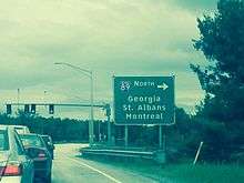
Interstate 89 crosses Chittenden County initially from east to west, then makes a northward turn in South Burlington to run north along the Lake Champlain shoreline. The full trajectory is generally from southeast to northwest. There are seven interchanges within the county. Four of the interchanges provide direct access to U.S. Route 2, which parallels the interstate throughout most of the county. U.S. Route 7, the county's main north-south surface route, is also directly accessible from two interchanges.
The Chittenden County Metropolitan Planning Organization measures traffic, analyzes road conditions, and allocates federal and state funds accordingly.[28]
Athletics
There is a private, amateur Champlain Valley Swim League with nine members, mostly from Chittenden.[29]
Communities
Cities
- Burlington (shire town / county seat)
- South Burlington
- Winooski
Towns
Villages
Census-designated places
- Hinesburg
- Milton
- Richmond
- Shelburne
Unincorporated communities
In Vermont, gores and grants are unincorporated portions of a county which are not part of any town and have limited self-government (if any, as many are uninhabited).
See also
References
- "State & County QuickFacts". United States Census Bureau. Archived from the original on July 8, 2011. Retrieved December 30, 2013.
- "2010 Census Gazetteer Files". United States Census Bureau. August 22, 2012. Retrieved June 28, 2015.
- Archived October 24, 2012, at the Wayback Machine
- "Population and Housing Unit Estimates". Retrieved May 21, 2019.
- "U.S. Decennial Census". United States Census Bureau. Retrieved June 28, 2015.
- "Historical Census Browser". University of Virginia Library. Retrieved June 28, 2015.
- Forstall, Richard L., ed. (March 27, 1995). "Population of Counties by Decennial Census: 1900 to 1990". United States Census Bureau. Retrieved June 28, 2015.
- "Census 2000 PHC-T-4. Ranking Tables for Counties: 1990 and 2000" (PDF). United States Census Bureau. April 2, 2001. Retrieved June 28, 2015.
- Sutkowski, Matt (August 7, 2008). Census: State older, a little more diverse. Burlington Free Press.
- Sutkowski, Matt (July 2, 2009). CENSUS: Vermont grows slowly. Burlington Free Press.
- "DP-1 Profile of General Population and Housing Characteristics: 2010 Demographic Profile Data". United States Census Bureau. Archived from the original on February 13, 2020. Retrieved January 20, 2016.
- "Population, Housing Units, Area, and Density: 2010 - County". United States Census Bureau. Archived from the original on 2020-02-13. Retrieved 2016-01-20.
- "DP03 SELECTED ECONOMIC CHARACTERISTICS – 2006-2010 American Community Survey 5-Year Estimates". United States Census Bureau. Archived from the original on February 13, 2020. Retrieved January 20, 2016.
- "Chittenden County Sheriff's Office".
- McLean, Dan (December 17, 2008). Property tax bills among highest. Burlington Free Press.
- Leip, David. "Dave Leip's Atlas of U.S. Presidential Elections". uselectionatlas.org. Retrieved 2018-06-08.
- "State & County QuickFacts". U.S. Census Bureau. Archived from the original on 8 July 2011. Retrieved 17 March 2013.
- "U.S. Census website". United States Census Bureau. Retrieved 2008-01-31.
- by VTDigger.org. Retrieved 2015-07-14.
- Carpenter, Jake Burton (November 30, 2008). Letter to the Editor (My Turn): Protests do no credit to Vermont. Burlington Free Press.
- McLean, Dan (July 13, 2008). Retail Sales By The Numbers. Burlington Free Press.
- McLean, Don (December 11, 2008). Vacant office space hits record high. Burlington Free Press.
- Richmond, Huntingdon, Undeerhill, Bolton and Jericho
- Walsh, Molly (August 24, 2008). Teachers unions working on contracts. Burlington Free Press.
- "County Health Rankings: National Comparisons". Robert Wood Johnson and the University of Wisconsin. 2010. Archived from the original on 2010-02-20.
- Burlington Free Press, Waste district raises recycling fees, Page, Candace, November 12, 2008
- Shamy, Ed (16 August 2007). "Watch backside when entering this intersection". Burlington Free Press. Burlington, Vermont. pp. 1B.
- Wells, Alison (26 July 2009). "Tight duel in the pool". Burlington Free Press. Burlington, Vermont. pp. 1C.
External links
| Wikivoyage has a travel guide for Chittenden County. |
- Chittenden County Sheriff's Office
- National Register of Historic Places listing for Chittenden Co., Vermont
- Lake Champlain Regional Chamber of Commerce Business and tourism information.
Places adjacent to Chittenden County, Vermont | ||||||||||
|---|---|---|---|---|---|---|---|---|---|---|
| ||||||||||
Municipalities and communities of Chittenden County, Vermont, United States | ||
|---|---|---|
Shire town: Burlington | ||
| Cities | Map of Vermont highlighting Chittenden County | |
| Towns | ||
| Villages | ||
| CDPs |
| |
| Unincorporated communities | ||
Montpelier (capital) | ||
| Regions | ||
| Counties | ||
| Cities | ||
| Towns (pop. >5000) | ||
| Festivals | ||
| Topics |
| |
| Society |
| |
| Authority control |
|
|---|