List of cities in Vermont
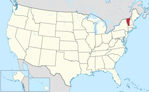
Vermont is a state located in the New England region of the northeastern United States. The state of Vermont has 255 municipalities. Of these, nine (listed below) are incorporated as cities and are independent of any surrounding towns. For example, the city of Barre is independent of the town of Barre.
Six of Vermont's 14 counties have at least one city within their borders. Five cities serve as the county seats for their respective counties and are indicated below with an asterisk (*).
Aggregates and averages
Population
According to the 2010 census, 115,085 people, or 18.39% of the state's population, resided in Vermont's cities.

| City | County | 2010 Population | Rank (Population) | Area in sq mi (km²)[1] | Rank (Area) | Incorporated | Median Household Income (1999) | Rank (Income) | Mayor |
|---|---|---|---|---|---|---|---|---|---|
| Burlington[2]* | Chittenden | 42,417 | 1 | 15.49 sq mi (40.1 km2) | 2 | 1864 | $33,070 | 6 | Miro Weinberger (D) |
| South Burlington[3] | Chittenden | 17,904 | 2 | 29.58 sq mi (76.6 km2) | 1 | 1971 | $51,566 | 1 | N/A |
| Rutland[4]* | Rutland | 16,495 | 3 | 7.68 sq mi (19.9 km2) | 4 | 1892 | $30,478 | 8 | David Allaire (R) |
| Barre[5] | Washington | 9,052 | 4 | 3.98 sq mi (10.3 km2) | 6 | 1895 | $30,393 | 9 | Lucas Herring (I) |
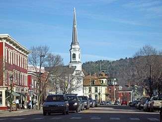
| Montpelier[6]* | Washington | 7,855 | 5 | 10.25 sq mi (26.5 km2) | 3 | 1895 | $37,513 | 3 | Anne Watson (I) |
| Winooski[7] | Chittenden | 7,267 | 6 | 1.51 sq mi (3.9 km2) | 9 | 1921 | $30,592 | 7 | Kristine Lott (I) |
| St. Albans[8]* | Franklin | 6,918 | 7 | 2.03 sq mi (5.3 km2) | 8 | 1902 | $37,221 | 4 | Elizabeth Gamache (D) |
| Newport[9]* | Orleans | 4,589 | 8 | 7.63 sq mi (19.8 km2) | 5 | 1917 | $34,922 | 5 | Paul Monette (I) |
| Vergennes[10] | Addison | 2,588 | 9 | 2.51 sq mi (6.5 km2) | 7 | 1788 | $37,763 | 2 | Jeff Fritz [11] |
Personal income
The average median household income of the cities was $35,946, 25.90% less than the state average ($48,508). Only one city, South Burlington, exceeds the state's average household income.
Area
The total area of Vermont's cities is 80.2 sq mi (208 km2), or 0.8% of the state's total area.
See also
References
- "Population and Housing Unit Counts" (PDF). U.S. Census Bureau. December 11, 2012. Retrieved July 7, 2017.
- "Burlington city, Vermont – Fact Sheet". American FactFinder. U.S. Census Bureau. Archived from the original on 2011-06-07. Retrieved 2009-01-07.
- "South Burlington city, Vermont – Fact Sheet". American FactFinder. U.S. Census Bureau. Archived from the original on 2011-06-07. Retrieved 2009-01-07.
- "Rutland city, Vermont – Fact Sheet". American FactFinder. U.S. Census Bureau. Archived from the original on 2011-06-07. Retrieved 2009-01-07.
- "Barre city, Vermont – Fact Sheet". American FactFinder. U.S. Census Bureau. Archived from the original on 2011-06-07. Retrieved 2009-01-07.
- "Montpelier city, Vermont – Fact Sheet". American FactFinder. U.S. Census Bureau. Archived from the original on 2011-06-07. Retrieved 2009-01-07.
- "Winooski city, Vermont – Fact Sheet". American FactFinder. U.S. Census Bureau. Archived from the original on 2011-06-07. Retrieved 2009-01-07.
- "Saint Albans city, Vermont – Fact Sheet". American FactFinder. U.S. Census Bureau. Archived from the original on 2011-06-07. Retrieved 2009-01-07.
- "Newport city, Vermont – Fact Sheet". American FactFinder. U.S. Census Bureau. Archived from the original on 2011-06-07. Retrieved 2009-01-07.
- "Vergennes city, Vermont – Fact Sheet". American FactFinder. U.S. Census Bureau. Archived from the original on 2011-06-07. Retrieved 2009-01-07.
- http://vergennes.org/government/city-council/
Montpelier (capital) | ||
| Regions | ||
| Counties | ||
| Cities | ||
| Towns (pop. >5000) | ||
| Festivals | ||
| Topics |
| |
| Society |
| |