Vian, Oklahoma
Vian is a town in Sequoyah County, Oklahoma, United States. It is part of the Fort Smith, Arkansas-Oklahoma Metropolitan Statistical Area. The population was 1,466 at the 2010 census, a 7.6 percent gain from 1,362 at the 2000 census.[5] It was named for Big Vian and Little Vian Creeks. Nearby tourist attractions include Lake Tenkiller, Lake Robert S. Kerr and Sequoyah National Wildlife Refuge.[6]
Vian, Oklahoma | |
|---|---|
 Vian Town Hall | |
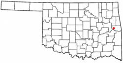 Location of Vian, Oklahoma | |
| Coordinates: 35°29′52″N 94°58′15″W | |
| Country | United States |
| State | Oklahoma |
| County | Sequoyah |
| Government | |
| • Mayor | Dennis Fletcher |
| Area | |
| • Total | 1.38 sq mi (3.56 km2) |
| • Land | 1.33 sq mi (3.45 km2) |
| • Water | 0.04 sq mi (0.11 km2) |
| Elevation | 541 ft (165 m) |
| Population (2010) | |
| • Total | 1,466 |
| • Estimate (2019)[2] | 1,367 |
| • Density | 1,026.28/sq mi (396.34/km2) |
| Time zone | UTC-6 (Central (CST)) |
| • Summer (DST) | UTC-5 (CDT) |
| ZIP code | 74962 |
| Area code(s) | 539/918 |
| FIPS code | 40-77250[3] |
| GNIS feature ID | 1099250[4] |
History
Vian began as a trading post where the primary goods were meat-related, between Big Vian and Little Vian Creeks in the Cherokee Nation. When a post office was established in 1886, the first postmaster, Mahala Thompson, wanted to name the town Round Mountain, but the name was already in use and was thus rejected. The post office was therefore named Vian for the two creeks, which get their name from the French word for meat. After the St. Louis, Iron Mountain and Southern Railway laid tracks through the town in 1888, it became an important shipping point for cotton produced in the surrounding farmland. Before Vian was incorporated and shown on maps as a town in 1903, the Vian Town Hall was founded in 1902, as seen on the plaque in the photo. It was the original county seat of Sequoyah County before it was moved to Sallisaw.[6]
Originally, Vian was a more bustling town than what it is today. A theater and many other venues existed there. Its downfall was seen most keenly when the county seat was moved.
In 2013, one of Vian's oldest buildings burned to the ground due to a fire in a neighboring café.[6]
Geography
Vian is located at 35°29′52″N 94°58′15″W (35.497910, -94.970841).[7] It is 11 miles (18 km) west of Sallisaw.[6]
According to the United States Census Bureau, the town has a total area of 0.8 square miles (2.1 km2), all land.
Demographics
| Historical population | |||
|---|---|---|---|
| Census | Pop. | %± | |
| 1900 | 296 | — | |
| 1910 | 794 | 168.2% | |
| 1920 | 1,176 | 48.1% | |
| 1930 | 900 | −23.5% | |
| 1940 | 941 | 4.6% | |
| 1950 | 927 | −1.5% | |
| 1960 | 930 | 0.3% | |
| 1970 | 1,131 | 21.6% | |
| 1980 | 1,521 | 34.5% | |
| 1990 | 1,414 | −7.0% | |
| 2000 | 1,362 | −3.7% | |
| 2010 | 1,466 | 7.6% | |
| Est. 2019 | 1,367 | [2] | −6.8% |
| U.S. Decennial Census[8] | |||
As of the census of 2000, there were 1,362 people, 503 households, and 339 families residing in the town.[3] The population density was 1,702.3 people per square mile (657.3/km²). There were 558 housing units at an average density of 697.4 per square mile (269.3/km²). The racial makeup of the town was 51.54% White, 6.98% African American, 26.51% Native American, 0.07% Asian, 0.22% from other races, and 14.68% from two or more races. Hispanic or Latino of any race were 2.13% of the population.
There were 503 households out of which 35.4% had children under the age of 18 living with them, 44.3% were married couples living together, 17.9% had a female householder with no husband present, and 32.6% were non-families. 30.2% of all households were made up of individuals and 14.9% had someone living alone who was 65 years of age or older. The average household size was 2.49 and the average family size was 3.10.
In the town, the population was spread out with 28.6% under the age of 18, 7.2% from 18 to 24, 25.5% from 25 to 44, 19.9% from 45 to 64, and 18.9% who were 65 years of age or older. The median age was 36 years. For every 100 females, there were 83.1 males. For every 100 females age 18 and over, there were 76.9 males.
The median income for a household in the town was $18,264, and the median income for a family was $24,167. Males had a median income of $26,731 versus $16,806 for females. The per capita income for the town was $10,471. About 28.2% of families and 35.6% of the population were below the poverty line, including 42.2% of those under age 18 and 33.5% of those age 65 or over.
Notable residents
- Franklin Gritts - Cherokee painter
- Captain Frederick F. Henry, United States Army (Deceased), Korean War Medal of Honor recipient
- Kenyatta Wright - NFL linebacker Buffalo Bills, New York Jets
- Richard Jordan - NFL linebacker Kansas City Chiefs, Detroit Lions
- Heath Wright and Greg Cook - Two of the founding members of the band Ricochet
- Bobby Ussery - Hall of Fame Jockey
- Howard Dean Bowles - Christian, Father and Businessman. Philanthropist and family man. Beloved Grandfather and proud Okie.
References
- "2019 U.S. Gazetteer Files". United States Census Bureau. Retrieved July 28, 2020.
- "Population and Housing Unit Estimates". United States Census Bureau. May 24, 2020. Retrieved May 27, 2020.
- "U.S. Census website". United States Census Bureau. Retrieved 2008-01-31.
- "US Board on Geographic Names". United States Geological Survey. 2007-10-25. Retrieved 2008-01-31.
- CensusViewer: Population of the City of Vian, Oklahoma
- Larry O'Dell, "Vian." Encyclopedia of Oklahoma History and Culture. Accessed May 26, 2012.]
- "US Gazetteer files: 2010, 2000, and 1990". United States Census Bureau. 2011-02-12. Retrieved 2011-04-23.
- "Census of Population and Housing". Census.gov. Retrieved June 4, 2015.
Municipalities and communities of Sequoyah County, Oklahoma, United States | ||
|---|---|---|
| City | 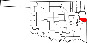 Sequoyah County map | |
| Towns | ||
| CDPs | ||
| Unincorporated communities | ||
| Indian reservation | ||
| Footnotes | ‡This populated place also has portions in an adjacent county or counties | |