Smithfield, Queensland
Smithfield is a suburb of Cairns in the Cairns Region, Queensland, Australia.[2] At the 2016 census the suburb recorded a population of 5,303.[1]
| Smithfield Cairns, Queensland | |||||||||||||||
|---|---|---|---|---|---|---|---|---|---|---|---|---|---|---|---|
 Looking west along Stanton Road, 2018 | |||||||||||||||
 Smithfield | |||||||||||||||
| Coordinates | 16°49′53″S 145°41′27″E | ||||||||||||||
| Population | 5,303 (2016 census)[1] | ||||||||||||||
| Established | 1876 | ||||||||||||||
| Postcode(s) | 4878 | ||||||||||||||
| Location | 15 km (9 mi) N of Cairns | ||||||||||||||
| LGA(s) | Cairns Region | ||||||||||||||
| State electorate(s) | Barron River | ||||||||||||||
| Federal Division(s) | Leichhardt | ||||||||||||||
| |||||||||||||||
Geography

Smithfield is about 15 kilometres (9.3 mi) to the north of Cairns City, Queensland, Australia. The Captain Cook Highway passes through Smithfield and the Kuranda Range Road (the first section of the Kennedy Highway) branches from the Captain Cook Highway at Smithfield.[3]
In the suburb's south is the lower station of the Skyrail Rainforest Cableway.
History
Irukandji (also known as Yirrgay, Yurrgay, Yirrgandji, Djabuganjdji and Yirgay) is a language of Far North Queensland, particularly the area around the Kuranda Range and Lower Barron River. The Irukandji language region includes the landscape within Cairns Regional Council.[4]
Smithfield was first established in 1876, and was a rival for dominance of the area to Cairns at that time. It was named in honour of prospector and explorer, William "Bill" Smith, who had a camp at this place.[5] On Boxing Day 1877, Bill Smith added further notoriety to the town named after him by murdering a man and then shooting himself in the main street.[6] After a devastating flooding of the Barron River on which the settlement was situated during a cyclone, the original site was abandoned.
It is now a suburb of Cairns, and is the business and trade centre of the Cairns 'Northern Beaches'.
Smithfield State School closed in 1964.[7]
Smithfield State High School opened on 24 January 1983.[7]
Smithfield library opened in 1998 and underwent a major refurbishment in 2008.[8]
At the 2011 census the suburb recorded a population of 3,707.[9]
Amenities
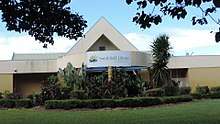
Cairns Regional Council operates a library at 70 Cheviot Street.[10]
The Smithfield branch of the Queensland Country Women's Association meets at the CWA Hall on Kamerunga Road, Caravonica (16.8514°S 145.6955°E). It is between the Caravonica State School and the Australian Armour and Artillery Museum.[11]
References
- Australian Bureau of Statistics (27 June 2017). "Smithfield (SSC)". 2016 Census QuickStats. Retrieved 5 March 2018.

- "Smithfield - suburb (entry 49788)". Queensland Place Names. Queensland Government. Retrieved 26 June 2017.
- "Queensland Globe". State of Queensland. Retrieved 3 March 2018.
-

- "The New Township, Barron River. Trinity Bay". The Brisbane Courier. XXXI (2, 995). Queensland, Australia. 25 December 1876. p. 3. Retrieved 14 September 2018 – via National Library of Australia.
- "The Murder and Suicide at Smithfield". The Queenslander. XII (126). Queensland, Australia. 12 January 1878. p. 34. Retrieved 14 September 2018 – via National Library of Australia.
- "Opening and closing dates of Queensland Schools". Queensland Government. Retrieved 18 April 2019.
- "Public Libraries Statistical Bulletin 2016-17" (PDF). Public Libraries Connect. State Library of Queensland. November 2017. p. 12. Archived (PDF) from the original on 30 January 2018. Retrieved 19 January 2018.
- Australian Bureau of Statistics (31 October 2012). "Smithfield (State Suburb)". 2011 Census QuickStats. Retrieved 6 September 2014.
- "Smithfield Library". Public Libraries Connect. State Library of Queensland. 25 March 2015. Archived from the original on 19 January 2018. Retrieved 19 January 2018.
- "Branch Locations". Queensland Country Women's Association. Retrieved 26 December 2018.
External links
| Wikimedia Commons has media related to Smithfield, Queensland. |