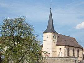
Sainte-Hélène, Vosges
Sainte-Hélène is a commune in the Vosges department in Grand Est in northeastern France.
Sainte-Hélène | |
|---|---|
 Saint-Georges | |
Location of Sainte-Hélène 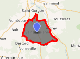
| |
 Sainte-Hélène 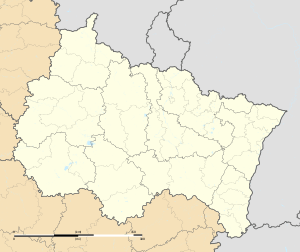 Sainte-Hélène | |
| Coordinates: 48°17′28″N 6°39′26″E | |
| Country | France |
| Region | Grand Est |
| Department | Vosges |
| Arrondissement | Épinal |
| Canton | Bruyères |
| Intercommunality | CC Région de Rambervillers |
| Government | |
| • Mayor (2014–2020) | Jocelyne Viriat |
| Area 1 | 17.05 km2 (6.58 sq mi) |
| Population (2017-01-01)[1] | 466 |
| • Density | 27/km2 (71/sq mi) |
| Time zone | UTC+01:00 (CET) |
| • Summer (DST) | UTC+02:00 (CEST) |
| INSEE/Postal code | 88418 /88700 |
| Elevation | 300–389 m (984–1,276 ft) (avg. 316 m or 1,037 ft) |
| 1 French Land Register data, which excludes lakes, ponds, glaciers > 1 km2 (0.386 sq mi or 247 acres) and river estuaries. | |
Geography
The village lies in the middle of the commune, on the right bank of the Arentèle, a tributary of the Mortagne, which forms most of the commune's eastern border.
See also
References
- "Populations légales 2017". INSEE. Retrieved 6 January 2020.
| Wikimedia Commons has media related to Sainte-Hélène (Vosges). |
| Authority control |
|
|---|
This article is issued from Wikipedia. The text is licensed under Creative Commons - Attribution - Sharealike. Additional terms may apply for the media files.