Les Poulières
Les Poulières is a commune in the Vosges department in Grand Est in northeastern France.
Les Poulières | |
|---|---|
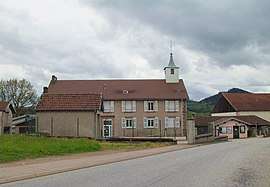 The town hall in Les Poulières | |
Location of Les Poulières 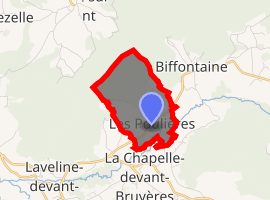
| |
 Les Poulières 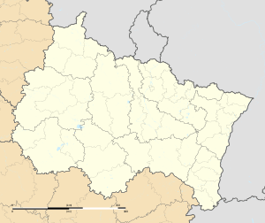 Les Poulières | |
| Coordinates: 48°11′54″N 6°47′30″E | |
| Country | France |
| Region | Grand Est |
| Department | Vosges |
| Arrondissement | Saint-Dié-des-Vosges |
| Canton | Bruyères |
| Intercommunality | CA Saint-Dié-des-Vosges |
| Government | |
| • Mayor (2008–2014) | Sébastien Fritz |
| Area 1 | 2.98 km2 (1.15 sq mi) |
| Population (2017-01-01)[1] | 241 |
| • Density | 81/km2 (210/sq mi) |
| Time zone | UTC+01:00 (CET) |
| • Summer (DST) | UTC+02:00 (CEST) |
| INSEE/Postal code | 88356 /88660 |
| Elevation | 451–663 m (1,480–2,175 ft) (avg. 456 m or 1,496 ft) |
| 1 French Land Register data, which excludes lakes, ponds, glaciers > 1 km2 (0.386 sq mi or 247 acres) and river estuaries. | |
Inhabitants are called Polérois.
Geography
The commune is positioned between Épinal to the west and Saint-Dié to the north-east, in the valley of the Neuné, a tributary of the Vologne River. Neighbouring communes are Biffontaine and La Chapelle-devant-Bruyères. Les Poulières is at the confluence of several roads, but roads here are small and twisting, thanks to the topography, on the western fringes of the Vosges Mountains.
See also
References
- "Populations légales 2017". INSEE. Retrieved 6 January 2020.
| Wikimedia Commons has media related to Les Poulières. |
This article is issued from Wikipedia. The text is licensed under Creative Commons - Attribution - Sharealike. Additional terms may apply for the media files.