Pierrepont-sur-l'Arentèle
Pierrepont-sur-l'Arentèle is a commune in the Vosges department in Grand Est in northeastern France.
Pierrepont-sur-l'Arentèle | |
|---|---|
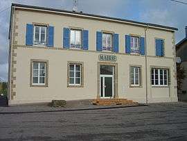 The town hall in Pierrepont-sur-l'Arentèle | |
Location of Pierrepont-sur-l'Arentèle 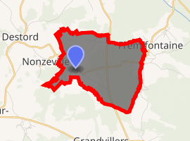
| |
 Pierrepont-sur-l'Arentèle  Pierrepont-sur-l'Arentèle | |
| Coordinates: 48°15′51″N 6°38′58″E | |
| Country | France |
| Region | Grand Est |
| Department | Vosges |
| Arrondissement | Épinal |
| Canton | Bruyères |
| Intercommunality | CC Bruyères - Vallons des Vosges |
| Government | |
| • Mayor (2008–2014) | Claude Husson |
| Area 1 | 6.23 km2 (2.41 sq mi) |
| Population (2017-01-01)[1] | 136 |
| • Density | 22/km2 (57/sq mi) |
| Time zone | UTC+01:00 (CET) |
| • Summer (DST) | UTC+02:00 (CEST) |
| INSEE/Postal code | 88348 /88600 |
| Elevation | 322–380 m (1,056–1,247 ft) (avg. 340 m or 1,120 ft) |
| 1 French Land Register data, which excludes lakes, ponds, glaciers > 1 km2 (0.386 sq mi or 247 acres) and river estuaries. | |
Inhabitants are called Pierrepontais.
Geography
The village is positioned on a minor road in the wooded countryside between Épinal and Saint-Dié. As the name indicates, the commune is crossed by the Arentèle River, which rises at the foot of the Avison Massif in the commune of Bruyères, some 12 kilometres (7 mi) through the forest to the southeast.
History
In the 7hh century C.E., Saint Dié turned up on the banks of the Arentèle and started to build a monastery. The territory was already inhabited, however; the villagers greeted the new arrivals with hostility, chasing them away in an easterly direction towards present-day Saint-Dié-des-Vosges, where the itinerant saint and his retinue founded that town.
See also
References
- "Populations légales 2017". INSEE. Retrieved 6 January 2020.
| Wikimedia Commons has media related to Pierrepont-sur-l'Arentèle. |
| Authority control |
|
|---|