New Bloomfield, Missouri
New Bloomfield is a city in Callaway County, Missouri, United States. The population was 669 at the 2010 census.[6] It is part of the Jefferson City Metropolitan Statistical Area.
New Bloomfield, Missouri | |
|---|---|
 Location of New Bloomfield, Missouri | |
| Coordinates: 38°43′13″N 92°05′29″W[1] | |
| Country | United States |
| State | Missouri |
| County | Callaway |
| Area | |
| • Total | 1.57 sq mi (4.07 km2) |
| • Land | 1.54 sq mi (4.00 km2) |
| • Water | 0.03 sq mi (0.07 km2) |
| Elevation | 866 ft (264 m) |
| Population | |
| • Total | 669 |
| • Estimate (2019)[4] | 673 |
| • Density | 435.60/sq mi (168.17/km2) |
| Time zone | UTC-6 (Central (CST)) |
| • Summer (DST) | UTC-5 (CDT) |
| ZIP code | 65063 |
| Area code(s) | 573 |
| FIPS code | 29-51680[5] |
| GNIS feature ID | 0751281[1] |
| Website | City website |
History
In 1827, a 'Round Prairie Post Office' was opened near the southern border of a much larger historic Round Prairie Township (subdivided to create what became Guthrie Township only later, around 1890).[7][8]
In 1836, a historic town of 'Bloomfield', next to or containing the Round Prairie Post Office, was surveyed. (This was near what is now the settlement of Guthrie, which was not officially laid out until 1872, which from 1874 to 1954 had a separate Guthrie Post Office, and was within the boundaries of Round Prairie Township prior to the creation of Guthrie Township around 1890).[7]
In 1841 the Round Prairie Post Office was shut down and moved about 1/2 mile southward, clearly into Cedar Township, and was renamed 'New Bloomfield Post Office', around which today's town of New Bloomfield formed.[9][10] Details of relevant township boundary changes are given in the article on Round Prairie Township.
Geography
New Bloomfield is located along U.S. Route 54. Town Creek flows past the east side of the city and Hillers Creek is about two miles to the east.[11]
According to the United States Census Bureau, the city has a total area of 1.56 square miles (4.04 km2), of which 1.53 square miles (3.96 km2) is land and 0.03 square miles (0.08 km2) is water.[12]
Demographics
| Historical population | |||
|---|---|---|---|
| Census | Pop. | %± | |
| 1960 | 359 | — | |
| 1970 | 427 | 18.9% | |
| 1980 | 519 | 21.5% | |
| 1990 | 480 | −7.5% | |
| 2000 | 599 | 24.8% | |
| 2010 | 669 | 11.7% | |
| Est. 2019 | 673 | [4] | 0.6% |
| U.S. Decennial Census[13] | |||
2010 census
As of the census[3] of 2010, there were 669 people, 256 households, and 173 families living in the city. The population density was 437.3 inhabitants per square mile (168.8/km2). There were 283 housing units at an average density of 185.0 per square mile (71.4/km2). The racial makeup of the city was 94.2% White, 1.0% African American, 0.9% Native American, 0.6% Asian, 0.7% from other races, and 2.5% from two or more races. Hispanic or Latino of any race were 1.2% of the population.
There were 256 households, of which 37.9% had children under the age of 18 living with them, 52.0% were married couples living together, 12.5% had a female householder with no husband present, 3.1% had a male householder with no wife present, and 32.4% were non-families. 26.2% of all households were made up of individuals, and 9.8% had someone living alone who was 65 years of age or older. The average household size was 2.61 and the average family size was 3.15.
The median age in the city was 34.2 years. 27.4% of residents were under the age of 18; 8.3% were between the ages of 18 and 24; 30.5% were from 25 to 44; 24.5% were from 45 to 64; and 9.3% were 65 years of age or older. The gender makeup of the city was 49.0% male and 51.0% female.
2000 census
As of the census[5] in 2000, there were 599 people, 237 households, and 158 families living in the city. The population density was 1,261.3 people per square mile (492.1/km2). There were 253 housing units at an average density of 532.8 per square mile (207.8/km2). The racial makeup of the city was 96.49% White, 0.50% African American, 0.83% Native American, 0.33% Asian, and 1.84% from two or more races. Hispanic or Latino of any race were 0.83% of the population.
There were 237 households, out of which 41.4% had children under the age of 18 living with them, 50.6% were married couples living together, 15.2% had a female householder with no husband present, and 33.3% were non-families. 31.2% of all households were made up of individuals, and 16.0% had someone living alone who was 65 years of age or older. The average household size was 2.53 and the average family size was 3.20.
In the city the population was spread out, with 30.7% under the age of 18, 6.2% from 18 to 24, 34.6% from 25 to 44, 17.0% from 45 to 64, and 11.5% who were 65 years of age or older. The median age was 33 years. For every 100 females, there were 78.3 males. For every 100 females age 18 and over, there were 79.7 males.
The median income for a household in the city was $32,969, and the median income for a family was $41,023. Males had a median income of $25,556 versus $23,125 for females. The per capita income for the city was $15,180. About 6.5% of families and 9.1% of the population were below the poverty line, including 13.1% of those under age 18 and 13.0% of those age 65 or over.
References
- U.S. Geological Survey Geographic Names Information System: New Bloomfield, Missouri
- "2019 U.S. Gazetteer Files". United States Census Bureau. Retrieved July 26, 2020.
- "U.S. Census website". United States Census Bureau. Retrieved 2012-07-08.
- "Population and Housing Unit Estimates". United States Census Bureau. May 24, 2020. Retrieved May 27, 2020.
- "U.S. Census website". United States Census Bureau. Retrieved 2008-01-31.
- "Race, Hispanic or Latino, Age, and Housing Occupancy: 2010 Census Redistricting Data (Public Law 94-171) Summary File (QT-PL), New Bloomfield city, Missouri". United States Census Bureau. Retrieved October 28, 2011.
- Kingdom of Callaway Historical Society "A History of Callaway County, Missouri" Fulton MO: Kingdom of Callaway Historical Society (1984).
- Kingdom of Callaway Historical Society: "Combined Atlases of Callaway County Missouri 1876-1897-1919". Mt Vernon IN: Windmill Publications (1994).
- "Callaway County Place Names, 1928–1945 (archived)". The State Historical Society of Missouri. Archived from the original on 24 June 2016. Retrieved 7 September 2016.CS1 maint: BOT: original-url status unknown (link)
- "Post Offices". Jim Forte Postal History. Retrieved 7 September 2016.
- New Bloomfield, MO, 7.5 Minute Topographic Quadrangle, USGS, 1969 (1982 rev.)
- "US Gazetteer files 2010". United States Census Bureau. Archived from the original on 2012-01-25. Retrieved 2012-07-08.
- "Census of Population and Housing". Census.gov. Retrieved June 4, 2015.
External links
- New Bloomfield City Website
- New Bloomfield Area Historical Society
- New Bloomfield School
- Historic maps of New Bloomfield in the Sanborn Maps of Missouri Collection at the University of Missouri
Municipalities and communities of Callaway County, Missouri, United States | ||
|---|---|---|
| Cities | 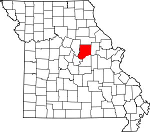 Map of Missouri highlighting Callaway County | |
| Village | ||
| Townships | ||
| Unincorporated communities | ||
| Ghost towns | ||
| Footnotes | ‡This populated place also has portions in an adjacent county or counties | |