Auxvasse Township, Callaway County, Missouri
Auxvasse Township is one of eighteen townships in Callaway County, Missouri, USA. As of the 2010 census, its population was 1,000.[3]
Auxvasse Township today | |
|---|---|
 | |
| Coordinates: 38°45′37″N 091°45′10″W | |
| Country | United States |
| State | Missouri |
| County | Callaway |
| Area | |
| • Total | 90.89 sq mi (235.4 km2) |
| • Land | 89.2 sq mi (231.02 km2) |
| • Water | 1.69 sq mi (4.38 km2) 1.86% |
| Elevation | 810 ft (247 m) |
| Population (2010) | |
| • Total | 1,000 |
| • Density | 11/sq mi (4.2/km2) |
| FIPS code | 29-02656[2] |
| GNIS feature ID | 0766370 |
History
Historical references to Auxvasse Township are complicated by the fact that, at the time of its founding on February 12, 1821, the Township was nearly 4 times larger than it is now, and included all of eastern Callaway County. The township as well as the city of Auxvasse are both named after Auxvasse Creek,[4] but today's city of Auxvasse was never within the borders of Auxvasse Township at any time, although near its northwest border in the early 1800s. Auxvasse Township was reduced substantially and to its current size in 1826,[5] by the creation of (then larger) Nine Mile Prairie Township to its north, while what became the city of Auxvasse is located about 15 miles to the north-northwest of Auxvasse Township, and about 3 miles from Callaway County's northern border with Audrain County.
Geography
Auxvasse Township today (as of 2018) covers an area of 90.89 square miles (235.4 km2) and, although containing no incorporated settlements, does contain the unincorporated settlements of Portland, Readsville, and Reform, as well as eastern Steedman along its border with St Aubert Township. The historic town of Heilburn bordered Portland. Auxvasse Township contains nine cemeteries: Atterberry, Garrett, Holiness, Lawrence, Liberty, Old Salem, Oliver, Saint Patricks and Washington—and the streams of Eagle Creek, Little Tavern Creek, Logan Camp Branch, Logan Creek, Means Branch, Meyers Branch, Mollie Dozier Chute, Mud Creek and Tavern Creek.
The Missouri River forms its southern border, while to its west is St Aubert Township (incl Mokane), to its northwest is East Fulton Township (incl Fulton), to its north is Nine Mile Prairie Township (incl Williamsburg), and to its east is Montgomery County. Do not confuse today's Auxvasse Township with city of Auxvasse, Missouri in Jackson Township, about 15 to 20 miles to the north-northwest.
References
- "US Board on Geographic Names". United States Geological Survey. 2007-10-25. Retrieved 2008-01-31.
- "U.S. Census website". United States Census Bureau. Retrieved 2008-01-31.
- "Race, Hispanic or Latino, Age, and Housing Occupancy: 2010 Census Redistricting Data (Public Law 94-171) Summary File (QT-PL), Auxvasse township, Callaway County, Missouri". United States Census Bureau. Retrieved October 31, 2011.
- "Callaway County Place Names, 1928–1945 (archived)". The State Historical Society of Missouri. Archived from the original on 24 June 2016. Retrieved 7 September 2016.CS1 maint: BOT: original-url status unknown (link)
- Earngey, Bill (1995). Missouri Roadsides: The Traveler's Companion. University of Missouri Press. p. 11.
- USGS Geographic Names Information System (GNIS)
- Missouri State Library. "History of Callaway County". (St Louis, National Historical Company, 1884).
- Callaway County Place Names 1928-1945: https://web.archive.org/web/20160624071020/http://shsmo.org/manuscripts/ramsay/ramsay_callaway.html
External links
Municipalities and communities of Callaway County, Missouri, United States | ||
|---|---|---|
| Cities | 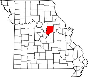 Map of Missouri highlighting Callaway County | |
| Village | ||
| Townships | ||
| Unincorporated communities | ||
| Ghost towns | ||
| Footnotes | ‡This populated place also has portions in an adjacent county or counties | |